All Activity
- Past hour
-
Ginx?
-
Yeah Tigger tried to put on the jinx, but maybe the jinxer will become the jinxee.
-

Winter 2025-26 Short Range Discussion
Powerball replied to SchaumburgStormer's topic in Lakes/Ohio Valley
I'll be sure to troll bump when it happens on 1/18 or 1/25. FTP *AND* FBJ.gif.5d5d8ae471aad0bb83cca25853e1a724.gif)
-
Vortex Dude...please post here more often, nice contributions!
-

Pittsburgh/Western PA WINTER ‘25/‘26
RitualOfTheTrout replied to Burghblizz's topic in Upstate New York/Pennsylvania
Looks like I might catch the southern tip of that line. Its about to blow through now. -

Pittsburgh/Western PA WINTER ‘25/‘26
colonel717 replied to Burghblizz's topic in Upstate New York/Pennsylvania
Short but got near whiteout.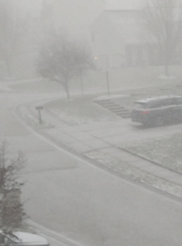
-
Finished with 1.7” of rain
-
The whole thread was started in jest.
-
I checked the 00Z Euro out a short while ago after catching up in the medium range thread, just to see what people meant. Holy F**ing Shit, Batman!! That is like PD2 times 2 there! I am sure that's a wild extreme solution, but damn wouldn't it be nice to have something like that work out? Classic overrunning, almost non-stop, into a cold dome of high pressure. I wouldn't expect that level of a solution in reality, but hopefully it's a good sign for something good around that time frame. I believe the GFS and perhaps the CMC also hinted at that time period as well?
-
Move to the southeast if you want to call an advisory level threat a major snowstorm. By New England standards - this isn’t even a storm at this stage. It’s weather in January.
-
Y’all know Mike Witcher right? (Assuming he’s not on here lol) I’m in a little discord group with him and some other weather folks. So I’ll be able to bring his thoughts here on the bigger events. The group is a little more severe weather but there’s some snow talk. .
-
Dampen out that southern swinging energy or curl it in sooner and I think we have a solid event here. if southern stream remains strong and separated from the northern ULL than we cloudy skies here with maybe some light snows.
-
Back to snow and cold finally today, and the pattern change is here. Wednesday night and into Thursday looks very interesting. We typically do pretty good with the ULL's here in WNC, but if we could get some Gulf interaction like the 0z GFS showed it could turn into a lot more. I am interested to see what the model have to say over the next 36 hours.
-
i'm just across the river and iirc the bands just refused to cross.....about 6 inches here what a disappointment compared to areas south and east.
-
But what do the snow map probabilities show?
-
Nice snow shower in progress here .
-
A bit over an 1”, nice event and much needed rain.
-

January 2026 Medium/Long Range Discussion
Scarlet Pimpernel replied to snowfan's topic in Mid Atlantic
Yup, that was "Commutageddon"...Jan. 26, 2011. I believe that was the one we also called the "PSU Hoffman Storm" in this forum! There was some snow early in the morning, then a lull with drizzle. As the ULL came by later in the afternoon, we got heavy sleet (more like chunks of ice falling, it really hurt when it hit your face!) which fairly quickly turned to heavy, wet snow that pasted everything. I got 8" snow in about 5 hours. Power went out for a lot of people in that storm with downed power lines and tree limbs. -

E PA/NJ/DE Winter 2025-26 Obs/Discussion
MGorse replied to LVblizzard's topic in Philadelphia Region
A total of 1.04 inches of rain. -

Central PA Winter 25/26 Discussion and Obs
paweather replied to MAG5035's topic in Upstate New York/Pennsylvania
Looks like a chase again -
Ur always full of good news lol
-
The 25th seems to have some long distance legs
-
Latest euro run reminds me of that commute disaster about 15 years ago. We got 5" of wet snow in a few hours. That's for the Thursday Friday thing.
-
Whats the point? This is a weather forum and we are talking about a possible upcoming storm. Maybe change the thread to Possible Snowstorm
-
GSP with nice AFD this morning for those interested https://forecast.weather.gov/product.php?site=NWS&issuedby=GSP&product=AFD&format=ci&version=1&glossary=1&highlight=off