All Activity
- Past hour
-
The heat and humidity are coming. Not only will be it big heat and humidity but it will be long-duration. Only short breaks will be when shortwaves rotate through bringing severe weather. People can try to poo-poo or downplay but that doesn't change the reality of what is coming. My recommendation is get your window units and central air units checked to ensure they are operating at max capacity. Get those thick green curtains for the windows to block out sunlight from entering the house. Create a schedule where you are doing all your outdoor stuff either early morning or late afternoon/early evening. Anyone not prepared will regret. There will be so many chairs, couches, etc. stuck to bottoms it will be visible from the space station.
-
Hope the Inuit people installed.
-
Just law of averages, eventually this rut is going to break, however, if I’m a betting man, this coming winter isn’t going to be the one that’s going to do it
-
https://x.com/contentwxguy/status/1799133425951187396?s=46&t=dhcbvkjmRcyBVQtDxJ3lRg
-
Sure it wasn't Dick Trickle that has you tired?
-
Forecast low tonight at Deep Creek is 49, I can't wait. Beautiful day tomorrow on tap.
-
Ah Shetley, haven't seen him around in a while. Hopefully he finally got some rain. The western half of NC has definitely been moister the last 3 months. That said I had a decent 0.81" yesterday up to 1.26" for the week (and month).
- Today
-

2024-2025 La Nina
40/70 Benchmark replied to George001's topic in Weather Forecasting and Discussion
I agree we are in a "rut" period akin to the 80's, only adjusted warmer due to CC....it's also a different type of "rut", since that was a +PDO period....often those winters were done in by a lack of high latitude blocking, but this period has been marked by an extra tropical Pacific regime so hostile that it has largely negated any episodes of blocking, which has become easier to do given the warmer climate. -
Operational runs are backing off the implications they carried yesterday. We'll have to see.
-
Yeah ... I distinctly recall, that was the version of the GFS that was particularly awful in handling boundary layer thermodynamics. Folks might remember that 37/30 during 3" of QPF Nor'easter earlier that March. That storm ended up 33/33 cat paws... but because the 37/30 looked so egregious... many thought ( including self ) that there was a chance that was setting us up for a blue monster. But instead it just kept raining at 33 ... 34. Very frustrating event for late winter enthusiasm. We did eventually get a blue bomb later that month but ...anyway... later in the Summer, that ridge with 606 DM non-hydrostats was putting out those 110s over eastern Mass, in the GFS runs, and as you say, we corrected the DPs up to reality, and that sucked the temps down. One thing about that ridge event/heat ...96/75 -like, there was no and/or only very weakly coherent SW heat mass release. I've always maintained that we might have been robbed our 'Pacific NW' notoriety but the fact that we had to home grow heat and not get the table set gave us towering heights with room to spare..
-

Central Pa. Summer 2024
Itstrainingtime replied to mahantango#1's topic in Upstate New York/Pennsylvania
Sunny and 80 at 12:45pm. The MLB thread has exhausted me. -
Late nooners: 80 and gusty - winds up to 22 mph and increasing
-

Spring/Summer '24 Banter and Complaint Thread
Chicago Storm replied to IWXwx's topic in Lakes/Ohio Valley
The FAR would be way too high if that were to be done. -
Hopefully the heat comes. The pawpaws and figs need some growing degree days.
-
Your Bartles and Jaymes wine coolers will need to be very frosty.
-
That did end up hot and oppressive, but we got there with 98/75 instead of 110/50.
-
Before my time, but it seems like we are into the throws of a 1979-1993 type of rut with bad winters. Only difference between now and then is that 13+ year period was actually cold, just had way below average snow. This one is an all out torch with way below average snow
-
I’m still trying to keep the beer cold from 2018.
-
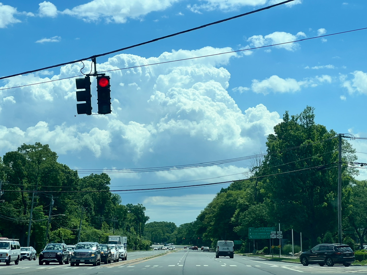
In Hauppauge, looks like something’s trying to pop out east.

-
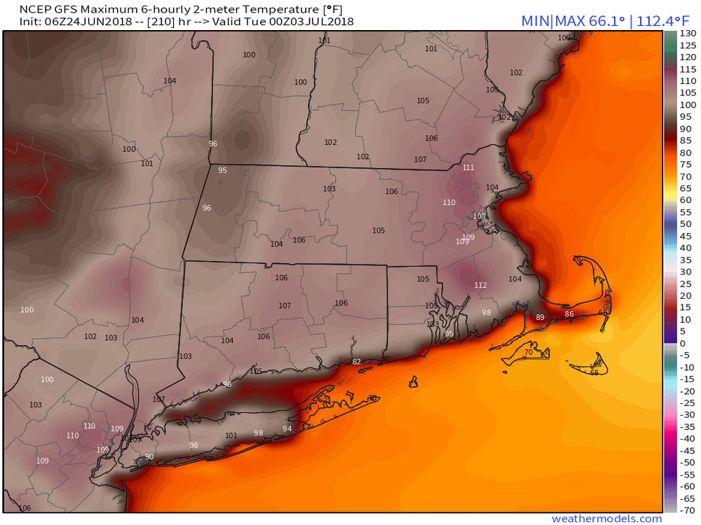
Hottest place on this map also the most northern location. Over the top heat.
-
It is pretty comfortable leading up to that period though....No complaints
-
My nose is in the shop
-
Pro like you shouldn't need any stupid radar. You have a nose for ozone.
-
This site is a great resource for historical tornado tracks by state: https://data.newsleader.com/tornado-archive/maryland/ I've spent way too much time on that site. Obviously a low sample size, but it does seem like a lot of the longer track tornadoes in that area are more west -> east based.
- 973 replies
-
- 1
-

-
- severe
- thunderstorms
- (and 5 more)