All Activity
- Past hour
-
Cracked 40 for first time since January 23
-
Count me in for the euro op look. This stretch has been great for lake ice but not snow. The big bay on Sebago is making legit ice for the first time in over a decade. Now lets relax the temps and get some snow where it wants to snow in peak climo, NNE
-
Glutton for punishment I guess. Didn’t think we’d see you in here either But you’re already in the thread… and you had to look for it since it’s not pinned
-
31 for a high and a little melting on deck and along driveway edges. Still a solid 6 depth out there in the yard. So many piles of dog poo to clean up
-
More snow on the 3k NAM for RDU than it had on the Saturday morning run for the past storm…
-

E PA/NJ/DE Winter 2025-26 Obs/Discussion
Birds~69 replied to LVblizzard's topic in Philadelphia Region
Looks like I won't go above freezing. Hit 32F then dropped back to 31F and holding... -
relaxing from an extreme cold period and just going back to closer to normal for a few days before the next shorter extreme cold period beginning later this week. After that is anyone's guess IMO
-

February 2026 OBS & Discussion
Intensewind002 replied to Stormlover74's topic in New York City Metro
I was 9 years old at the time of this storm. I definitely cried lol -
a WRAL Weather Alert Day!? That could be anything from tornados to locusts to partly cloudy.
-
And they are already getting brutalized in the comments.
-
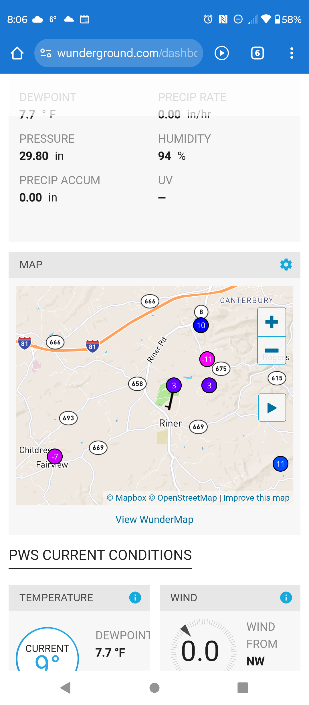
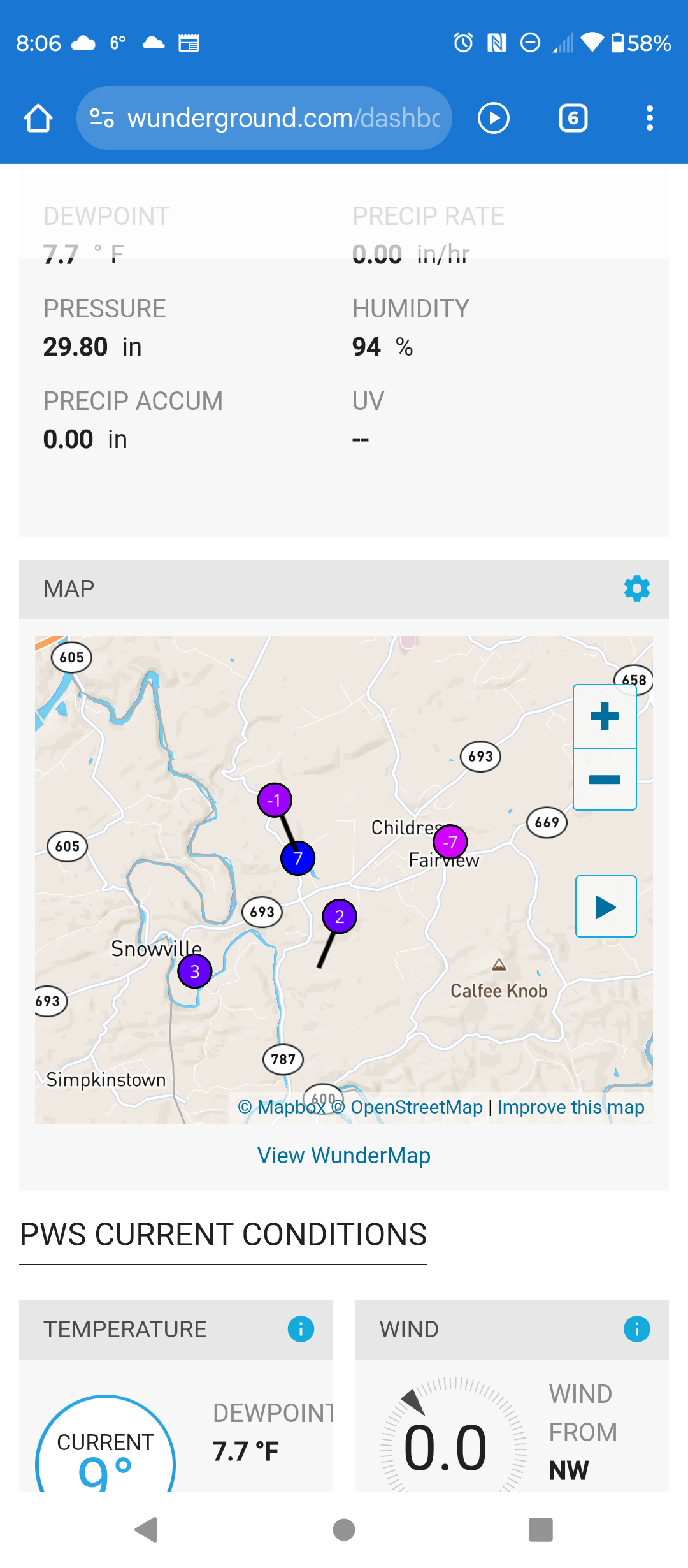
 Crazy temp variations in some deeper valleys up here.


-

2025-2026 ENSO
donsutherland1 replied to 40/70 Benchmark's topic in Weather Forecasting and Discussion
Yes, they're definitely a step back (continuing the trend from recent days). I actually prefer the daily data, as one can better evaluate what's happening than if one had to make guesses over 3- and 4-day intervals. -
It is amazing. People who start talking about fall on August 2nd would be chewed up and spit out of here. Then again this winter has already been longer than the past several . It is absolutely wild how on February 2nd, people see a relaxation in the pattern and immediately it is time for spring.
-
LOL here's what they went with: More snow possible Wednesday. It will be a WRAL Weather Alert Day https://www.wral.com/weather/forecast-raleigh-durham-fayetteville/
-

Fall/Winter Banter - Football, Basketball, Snowball?
Jed33 replied to John1122's topic in Tennessee Valley
Oh my! As cold as the temps were I bet that’s making for some bad ice problems! On one hand it wiped out a lot of snow but on the other hand since it’s been below freezing all day I imagine it’s created more problems. Ice mud! -

Pittsburgh/Western PA WINTER ‘25/‘26
TheClimateChanger replied to Burghblizz's topic in Upstate New York/Pennsylvania
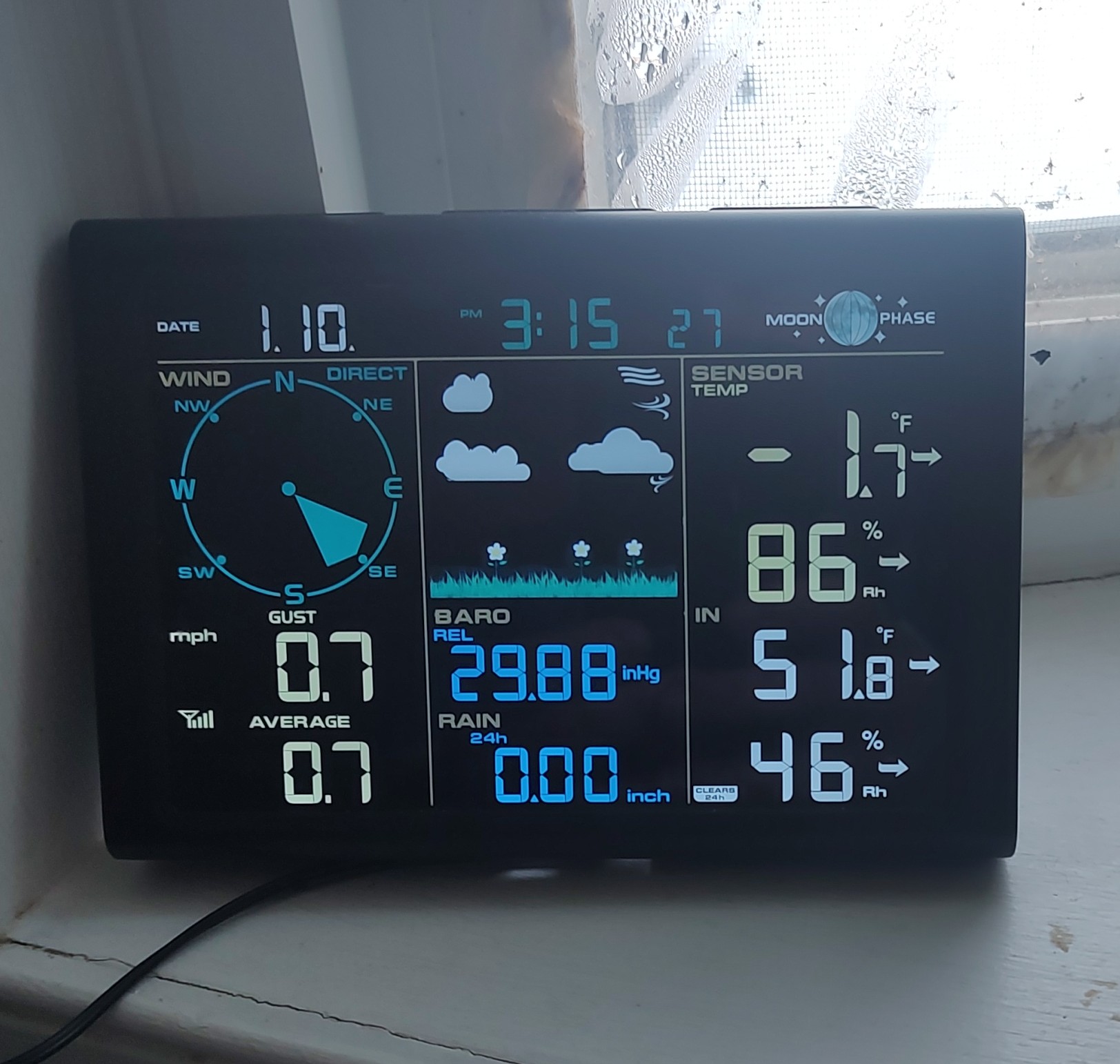
An impressive 43.2F diurnal range there so far. Can definitely see the effects of that higher sun angle, even with the snow cover. From -14.8F -> 28.4F. -
Tell 'em what you want 'em to hear... The next headline on WRAL... "Surprise mid-week storm could produce more snow than last weekend's historic storm for some"
-

WxUSAF's weak ass frontal passage thing.
SomeguyfromTakomaPark replied to dailylurker's topic in Mid Atlantic
Never bet on low qpf east west systems to make it over the mountains. Just be pleasantly surprised if it does. -

Possible coastal storm centered on Feb 1 2026.
CoastalWx replied to Typhoon Tip's topic in New England
Yeah I know it. Thing scooted east. 4.2? Wow. They probably have one of the deepest packs in SNE now. -

February 2026 Medium/ Long Range Discussion: Buckle Up!
mitchnick replied to Weather Will's topic in Mid Atlantic
2 week ensemble forecasts are as reliable and certain as 2 day Nam forecasts. -
18z 3K NAM looks good for a light event.
-

E PA/NJ/DE Winter 2025-26 Obs/Discussion
RedSky replied to LVblizzard's topic in Philadelphia Region
30F high -
Euro snow hole
-
Air is very dry so melting is limited but the sun doing its work too.
-
This is what you call a bad day. https://x.com/i/status/2017986769208152519 https://x.com/i/status/2018358294356635855