All Activity
- Past hour
-
-

Central PA Spring 2026 Discussion/Obs Thread
canderson replied to Voyager's topic in Upstate New York/Pennsylvania
Gorgeous day today. 76 here now. I have to load on for a major conference tmrw and am going to sweat like a pig. -
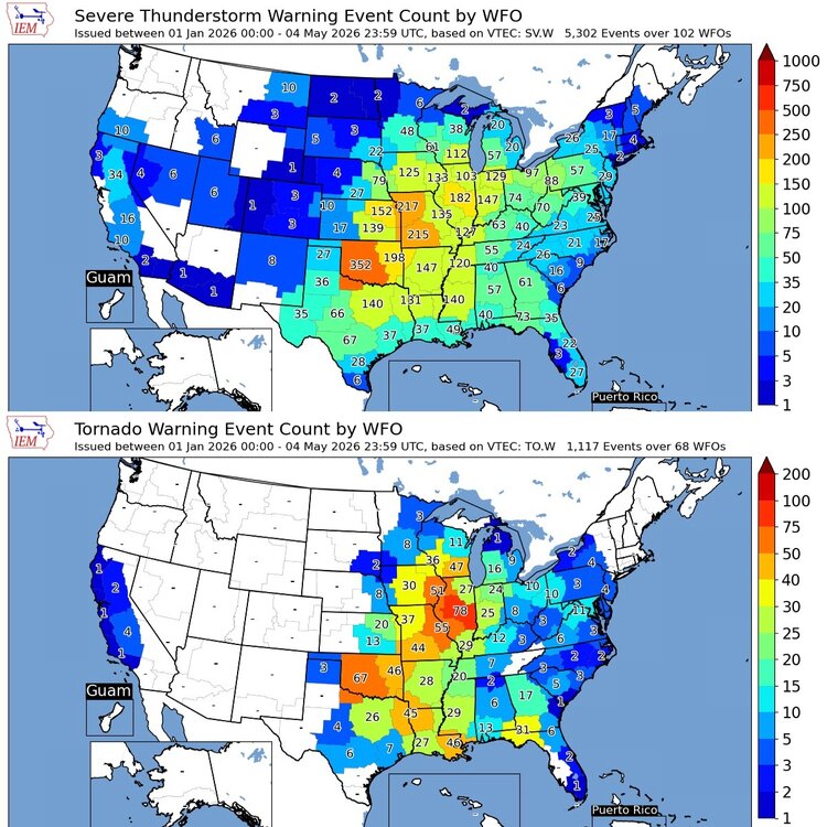
Found this on FB. No tornado warnings in 2026 through the first of May from MRX. That's gotta be a rare occurrence.
-
18z gfs backed off a bit but honestly we'll take anything. Sent from my SM-G998U using Tapatalk

-
What is "truth"? And did you really mean to phrase that as a question.
-
Looks like there will be multiple chances of rain in the next 10 days. Been awhile since we have seen a forecast like that.
-
Low of 45, high of 76. Dew points in the 50's made for another great May day.
-

2026-2027 Strong/Super El Nino
mitchnick replied to Stormchaserchuck1's topic in Weather Forecasting and Discussion
Don't know if anyone noticed, but since start of May FWIW, the Cfs2, which had been pretty AN for the winter, has backed down on the warmth quite a bit. Notwithstanding the usual long range Cfs2 caveats, it is, at least, a bit of a nod to the Cansips even if it still has a way to go. Here's a link to the latest 5H and surface temps starting at December. If you compare December and January to late April runs, you'll see what I mean. February's forecast just started showing up on May 1. https://www.tropicaltidbits.com/analysis/models/?model=cfs-mon®ion=us&pkg=z500a&runtime=2026050406&fh=7 https://www.tropicaltidbits.com/analysis/models/?model=cfs-mon®ion=us&pkg=T2ma&runtime=2026050406&fh=7 -
Think this is the first time I've seen a WSW in May. URGENT - WINTER WEATHER MESSAGE National Weather Service Denver CO 116 PM MDT Mon May 4 2026 COZ038>041-050800- /O.CON.KBOU.WS.A.0003.260506T0200Z-260506T2100Z/ Larimer County Below 6000 Feet/Northwest Weld County-Boulder And Jefferson Counties Below 6000 Feet/West Broomfield County-North Douglas County Below 6000 Feet/Denver/West Adams and Arapahoe Counties/East Broomfield County-Elbert/Central and East Douglas Counties Above 6000 Feet- Including the cities of Golden, Elbert, Highlands Ranch, Brighton, City of Denver, Longmont, Kiowa, Fort Collins, Denver International Airport, Larkspur, Lakewood, Littleton, Fondis, Parker, Arvada, Loveland, Nunn, Boulder, Hereford, Aurora, and Castle Rock 116 PM MDT Mon May 4 2026 ...WINTER STORM WATCH REMAINS IN EFFECT FROM TUESDAY EVENING THROUGH WEDNESDAY AFTERNOON... * WHAT...Heavy snow possible. Total snow accumulations between 3 and 8 inches possible, heaviest on colder surfaces and west of I-25. * WHERE...Fort Collins, Boulder and the western suburbs of Denver, Denver, and Castle Rock. * WHEN...From Tuesday evening through Wednesday afternoon. Heaviest Tuesday night into Wednesday morning. * IMPACTS...Heavy wet snow will accumulate on tree branches and powerlines, possibly causing them to break and lead to power outages. Despite lesser accumulations on roadways, slick and hazardous conditions are still possible for the Wednesday morning commute.
-
Quite a bit of thunder out of these tiny high-based cells. See-through fall streaks of rain beneath high-based updrafts, and quite a bit of lightning. Getting some 40mph gusts beneath one right now, but rain is pretty wimpy.
-
This wind lol
-
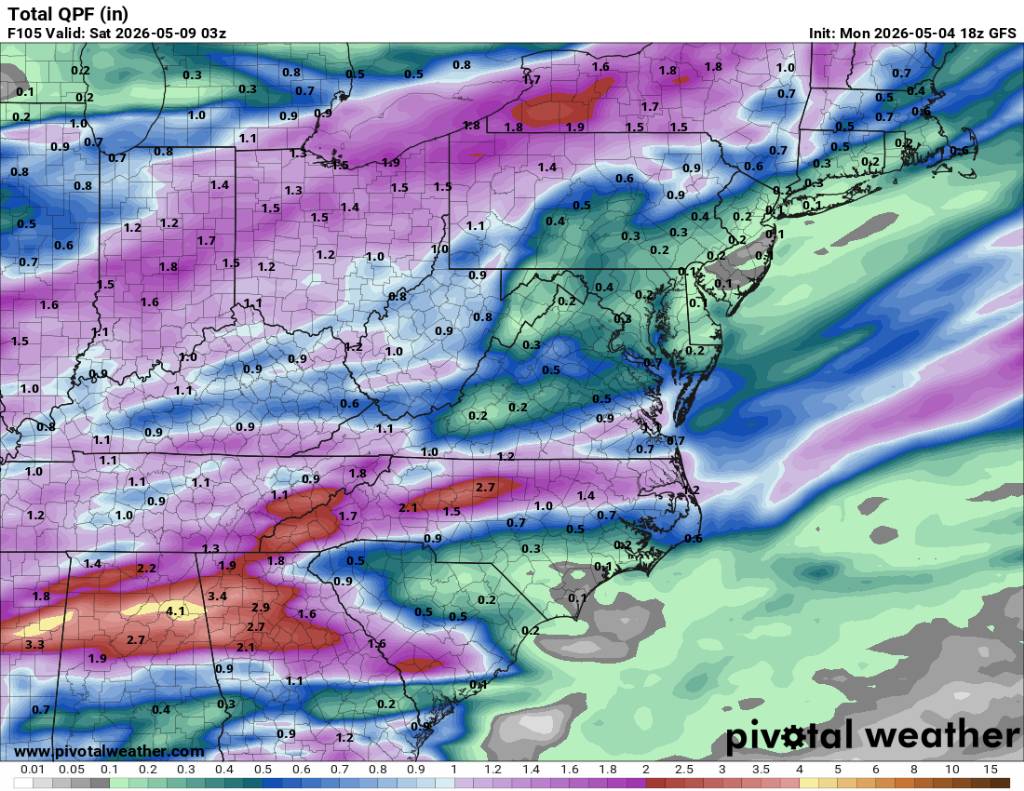
From LWX disco: "Possibility of someone being south of heavier axis Wed and north of axis on [Thu] resulting in local min in QPF." Beautiful evening though!
-
Thanks Scott.
- Today
-
If you play your cards right you might catch a few quality boomers today!
-
May locally grab 6th SVR watch of the season.
-
Landing in DIA soon. Need to get out Weds at 945am. We'll see. Sent from my SM-S921U using Tapatalk
-
That squirrel's a flashing neon sign for hawks! I need to research the two mulberry trees better. I think one's a red and not sure about the other - the one is dark purple to black the other starts paler but gets darker as it ripens. They're very old, I was told they're pre-1900. Our Forester took DBH and crown measurements a couple years ago to check against state records but I don't recall him mentioning what varieties he thought they were. The one I suspect is a red mulberry is 90" circumference, the other is 125" - definitely old and pretty big. The UNH 'big trees' site shows two bigger by 20" circumference, not a lot ...
-
last time ny had a serious reservoir storage problem was got to be in the early 1990's.
-
Been watering for a couple weeks. Going out in a few mins to turn on the sprinkler. Looks like another tenth or so from mother nature the next few days.
-
Hi @Stebo
-
I'll finish this bourbon then headed out to turn on the sprinkler.
-
lol another tenth or so incoming through Friday. Repeating pattern with the guidance- juices up D4-5 then deteriorates to paltry useless rain that wets the top hundredth of soil.
-
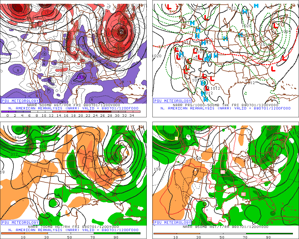
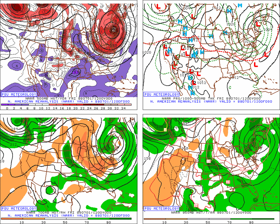
Impressive for 7/1!
-

2026-2027 Strong/Super El Nino
snowman19 replied to Stormchaserchuck1's topic in Weather Forecasting and Discussion
Yet another major WWB is gearing up, which will generate yet another DWKW. And there are hints of EPAC TC activity starting up, which generate more WWBs in their wake. If there was any doubt left that we are destined for a super El Niño (IMO a top 3 super Nino), this should put it to rest -
Windy, clear/sunny here 71