frontranger8
-
Posts
336 -
Joined
-
Last visited
About frontranger8

Recent Profile Visitors
1,969 profile views


-
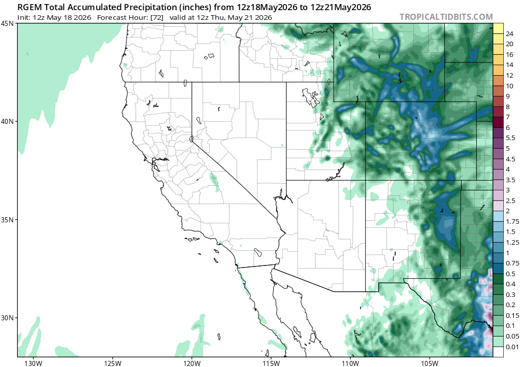
Most models are also showing a decent amount of additional precip Tue-Wed.

-
Had .3" yesterday and another .15" overnight from heavy drizzle. Still looks good to pick up at least another .5" from this storm today.
-
What's the latest you've seen snow there? I don't think I've seen it more than a day or two after Mother's Day here.
-
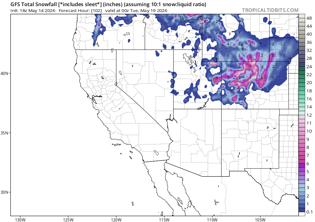
GFS doubling down lol
-
WTF
-
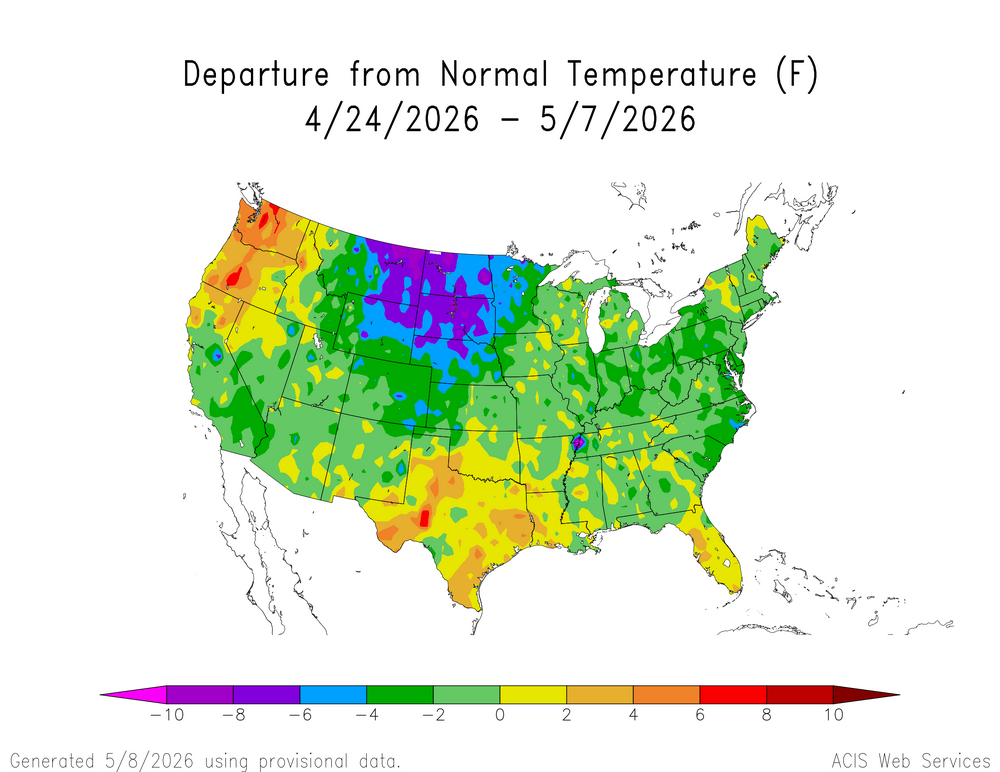
Been nice to get a pretty cool stretch the past couple weeks.
-
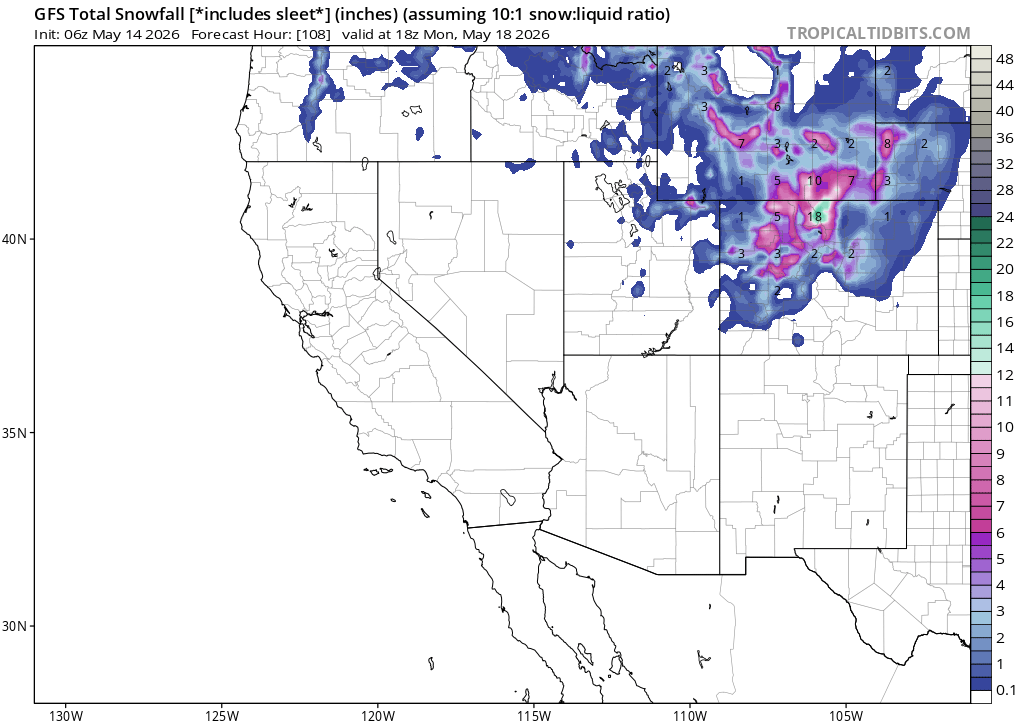
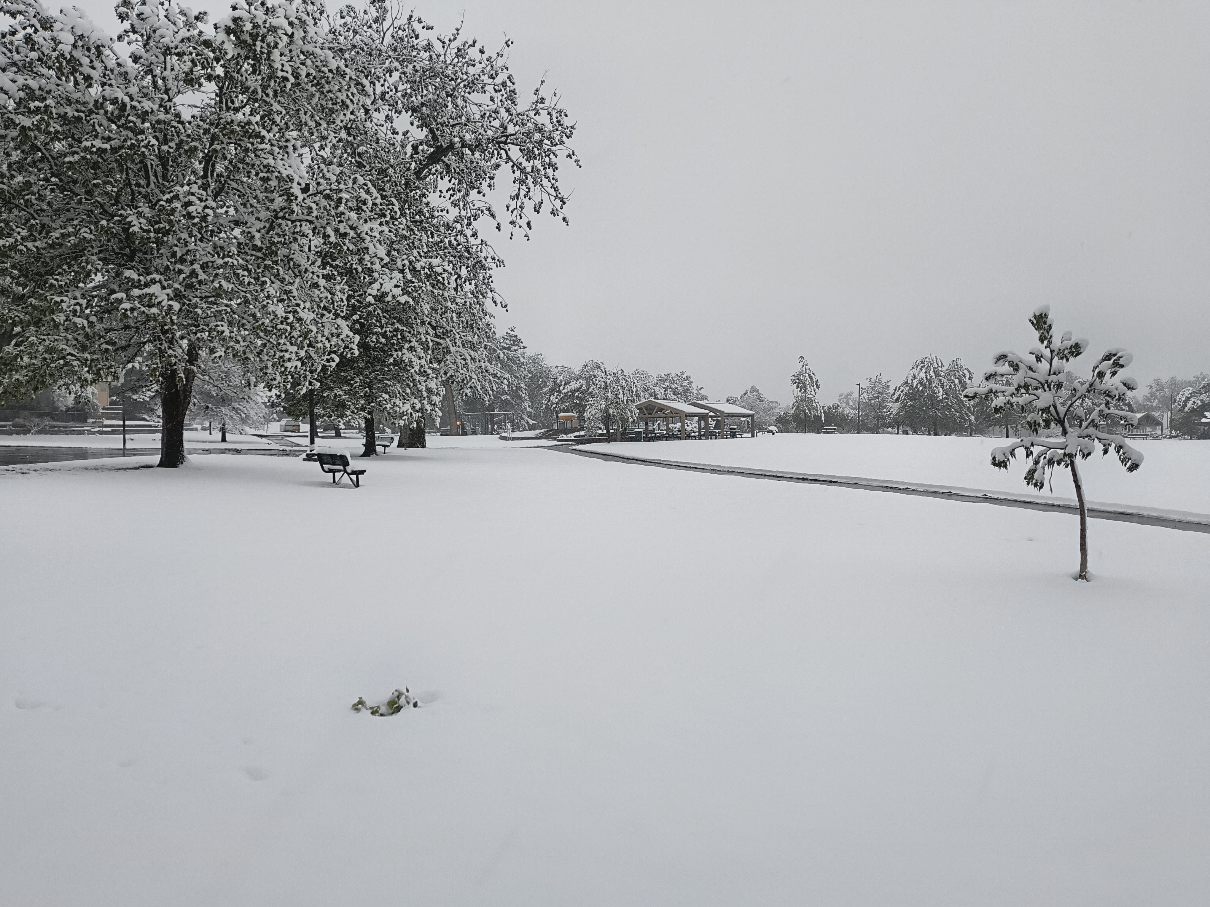
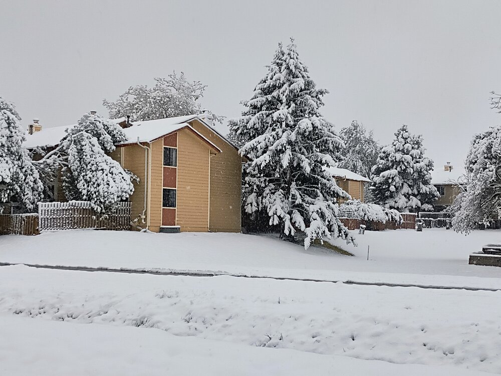
The snowstorm this week officially delivered 5.8" to the airport, making it the biggest May snowfall for Denver since 2003. It also pushed 2025-26 down to 6th least snowy winter on record, with 33.1" for the season.
-
I'm totally fine with that! Just happy to get one more snowy day in after a terrible winter, and a bunch of drought-fighting moisture. The green up over the next week should be epic.
-
8" storm total here. By far the most I've seen in May in my 19 years here. 3.5" was my record.

-
Pretty much exact same here. Just light snow past couple hours, very little additional accumulation. Gonna be all about rates the rest of the storm.
-
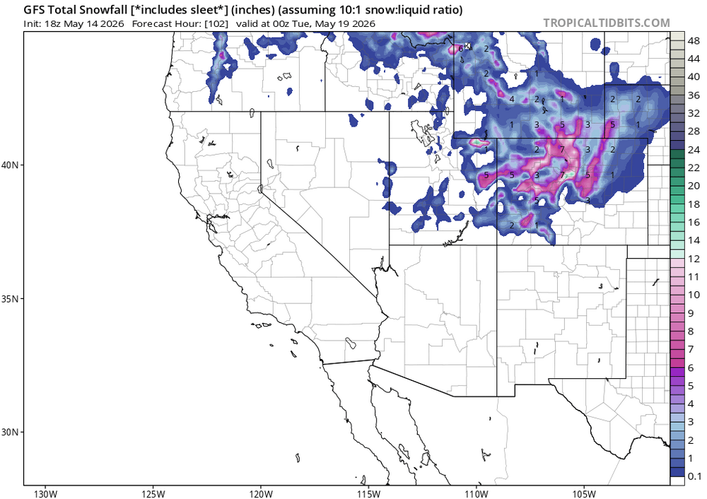
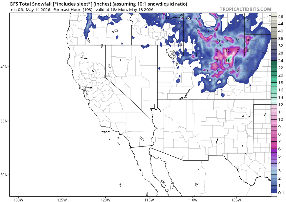
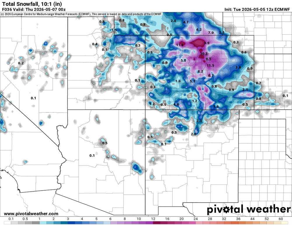
All the 12z models are coming in snowier, especially for your area it seems. 12z Euro...
-
This one's looking pretty juicy. Not sure how long temps will be cold enough for snow, but I don't think precip will be an issue.
-
Think this is the first time I've seen a WSW in May. URGENT - WINTER WEATHER MESSAGE National Weather Service Denver CO 116 PM MDT Mon May 4 2026 COZ038>041-050800- /O.CON.KBOU.WS.A.0003.260506T0200Z-260506T2100Z/ Larimer County Below 6000 Feet/Northwest Weld County-Boulder And Jefferson Counties Below 6000 Feet/West Broomfield County-North Douglas County Below 6000 Feet/Denver/West Adams and Arapahoe Counties/East Broomfield County-Elbert/Central and East Douglas Counties Above 6000 Feet- Including the cities of Golden, Elbert, Highlands Ranch, Brighton, City of Denver, Longmont, Kiowa, Fort Collins, Denver International Airport, Larkspur, Lakewood, Littleton, Fondis, Parker, Arvada, Loveland, Nunn, Boulder, Hereford, Aurora, and Castle Rock 116 PM MDT Mon May 4 2026 ...WINTER STORM WATCH REMAINS IN EFFECT FROM TUESDAY EVENING THROUGH WEDNESDAY AFTERNOON... * WHAT...Heavy snow possible. Total snow accumulations between 3 and 8 inches possible, heaviest on colder surfaces and west of I-25. * WHERE...Fort Collins, Boulder and the western suburbs of Denver, Denver, and Castle Rock. * WHEN...From Tuesday evening through Wednesday afternoon. Heaviest Tuesday night into Wednesday morning. * IMPACTS...Heavy wet snow will accumulate on tree branches and powerlines, possibly causing them to break and lead to power outages. Despite lesser accumulations on roadways, slick and hazardous conditions are still possible for the Wednesday morning commute.
-
Go figure, we couldn't get snow in February and are now gonna get slammed in May.
-
Somewhere above 6000' is gonna get buried. Doubt I get more than an inch or two here in the city, but at least it looks like a much needed soaker.