All Activity
- Past hour
-
Webcam for Marquette:
-
never said otherwise, but it’s especially important for this event. Good thing that doesn’t look to be the case here (with the first band anyhow), though seems to be setting up a bit farther south than modeled, so the heart of the TC metro may miss out on the biggest totals.
-
Pity that MSP isn’t the bullseye but this should still end up with substantial totals at the airport. Going to go out and do round 1 of shoveling and measure soon.
-
Cross posting in here
-

3/16/26 Severe Weather Event Thread (Day 2 MOD Risk)
Eskimo Joe replied to Kmlwx's topic in Mid Atlantic
06z HRRR had a UHI track from Dulles right to York, PA, another right over DC< and two more through Stafford and La Plata. Wow. -
lol, so bad
-
NOAA is downplaying any snow potential.
-
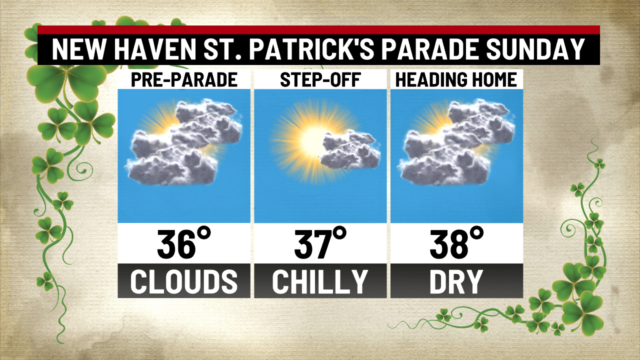
Great Irish like day for the New Haven parade...

-

3/16/26 Severe Weather Event Thread (Day 2 MOD Risk)
Weather Will replied to Kmlwx's topic in Mid Atlantic
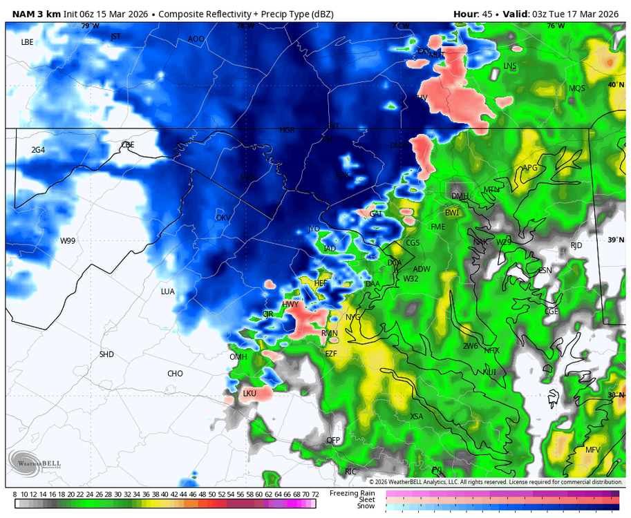
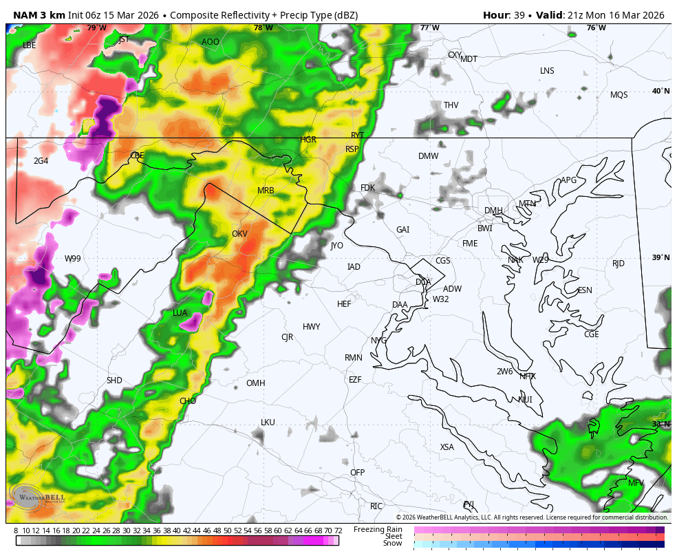
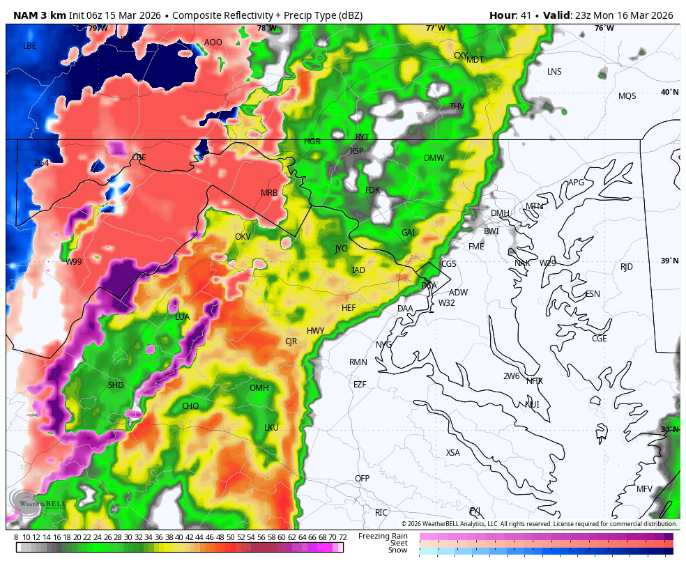
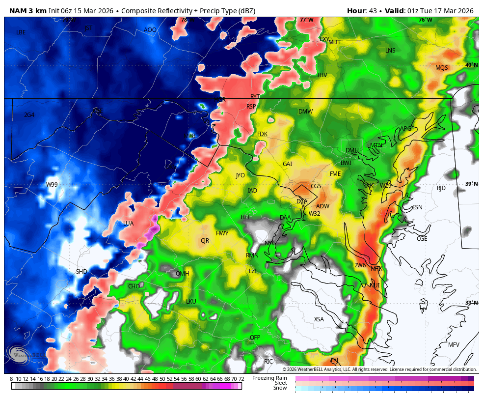
WB 6Z 3K NAM for Monday evening starting at 5 pm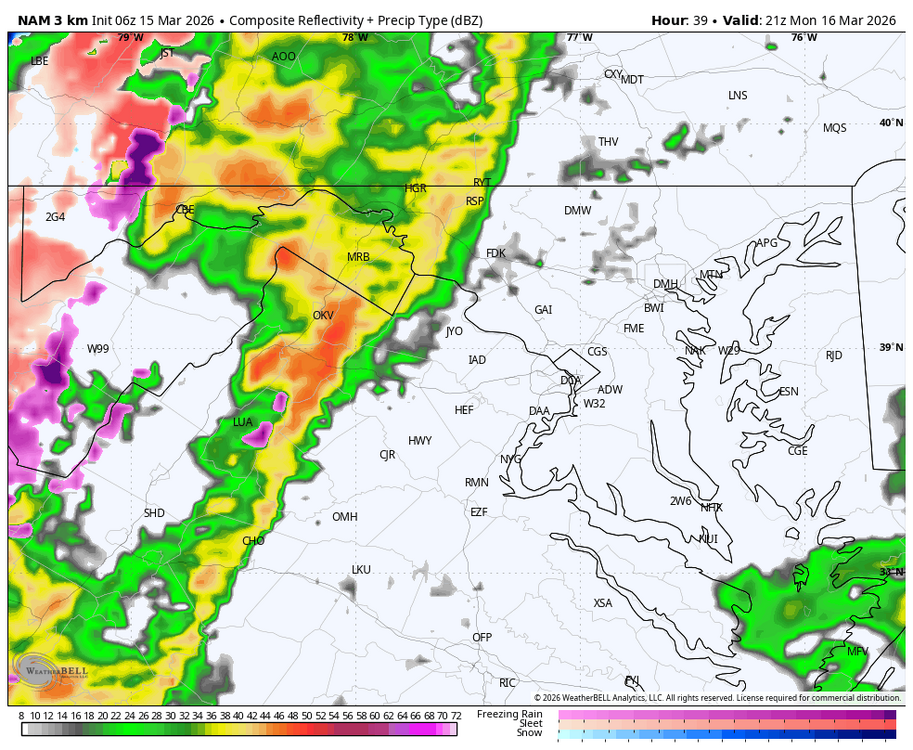


-
Hrrr a little more tepid. Last time it did this is was closer to correct. We’ll see if it ramps up as we get closer.
-
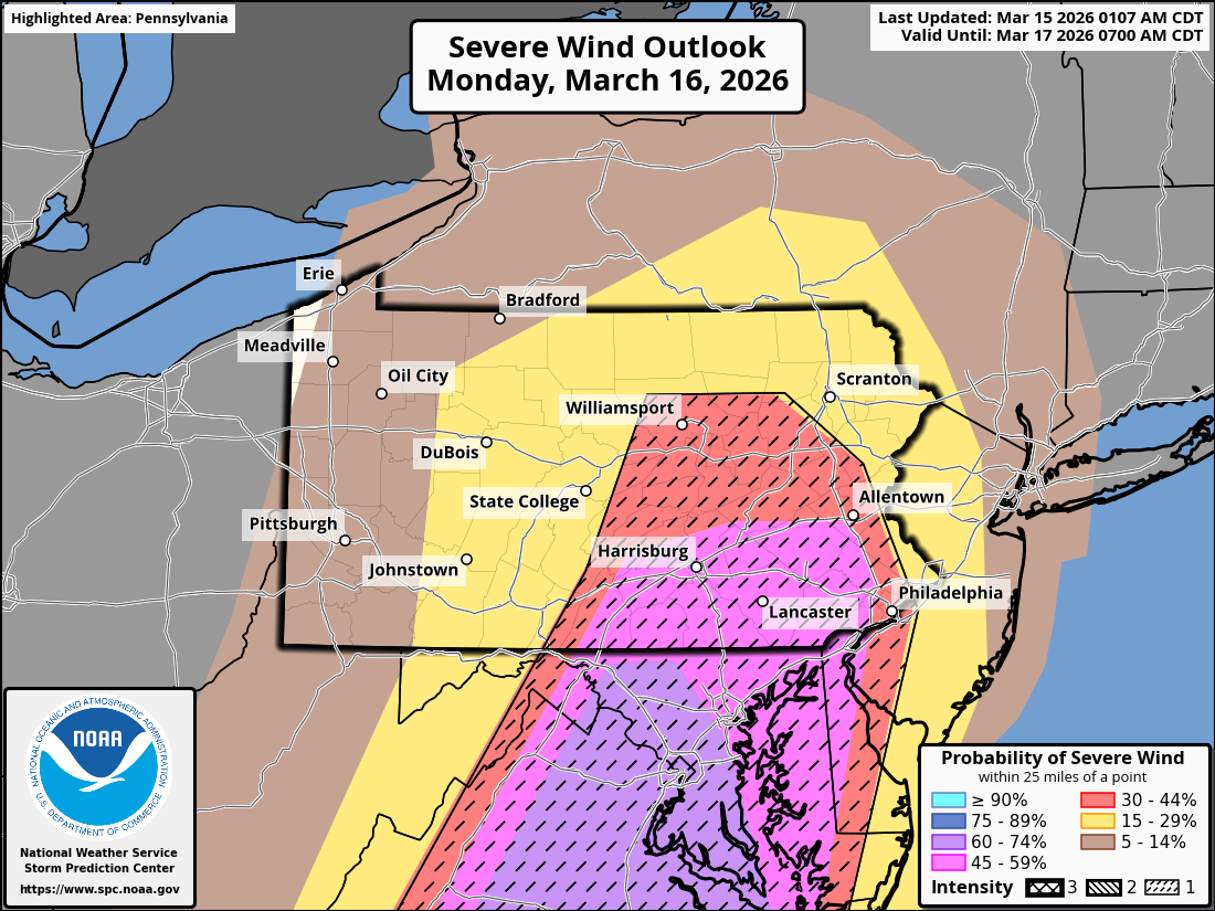
We have been upgraded to a Moderate Risk. 15% tor and 60% wind.
-
It’s been a rough finish to winter. That’s for sure.
-
SPC ...Carolinas into MD/PA and vicinity... Areas of showers may occur early in the day especially but should rapidly lift north, allowing areas of heating and gradual destabilization over the entire area. As the surface trough deepens, low-level wind will back and strengthen throughout the day. Supercells producing tornadoes appear most likely ahead of the cold front from SC into NC and southern VA. Models vary with degree of instability, but strong tornadoes do appear possible with effective SRH of at least 300-400 m2/s2. Fast storm motions over 50 kt suggest a long tracked tornado will be possible. Meanwhile, a robust line of storms will develop as the cold front pushes east, stretching from the Carolinas to southern NY. With a moist air mass and large-scale support, this line is expected to produce particularly damaging winds, along with QLCS tornadoes across the remainder of SC/NC, VA, MD, and much of southern PA. This will likely peak during the late afternoon hours. The activity may eventually interact with cool trajectories off the Atlantic during the evening.
-

E PA/NJ/DE Spring 2026 Obs/Discussion
Newman replied to PhiEaglesfan712's topic in Philadelphia Region
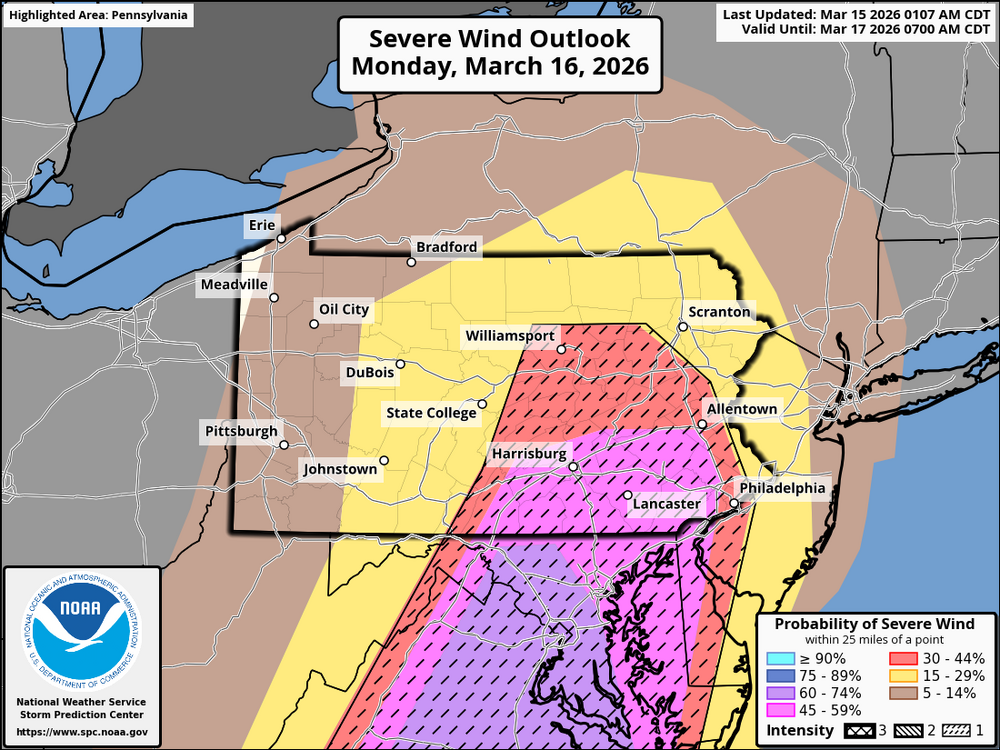
Latest Day 2 from the SPC. 45-60% hatched wind for most, greatest tornado risk is just to the west across south-central PA where a 10-15% hatched risk is outlooked. Given the extremely high shear but low cape environment, damaging QLCS winds will be favored but there will be line mergers and perhaps a few lone cells capable of a stronger tornado. The failure modes I'm seeing are 1. Given the potency of the upper-level trough, there may be "too many" showers and storms developing and competing with each other pre-frontal 2. Early day clouds and showers will limit destabilization 3. Strong southerly winds may or may not create a localized "minimum" in severe weather across SE PA where a narrow marine layer could advect off the Chesapeake Bay Regardless, we haven't seen a severe weather event of this caliber in at least a few years. It will get very cold again behind the front, so make sure if you lose power you have a plan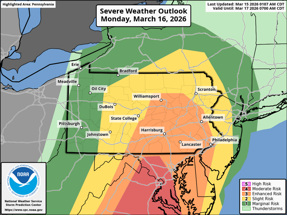
.thumb.png.55435d921b680ccfb01912ff0915f3c8.png)
-

3/16/26 Severe Weather Event Thread (Day 2 MOD Risk)
Imgoinhungry replied to Kmlwx's topic in Mid Atlantic
Looks like a bit of a later start per nam and hrrr recent runs? Hopefully no impact to school dismissal. . -
2026 Mid-Atlantic Severe Storm General Discussion
Eskimo Joe replied to Kmlwx's topic in Mid Atlantic
- 256 replies
-
- 1
-

-
- severe
- thunderstorms
- (and 7 more)
-
06z Euro is southeast with the heavy secondary defo band
-
Ready for 1" here and 7" in Harvard. This is RFDs chance to escape the sub 30 club
-
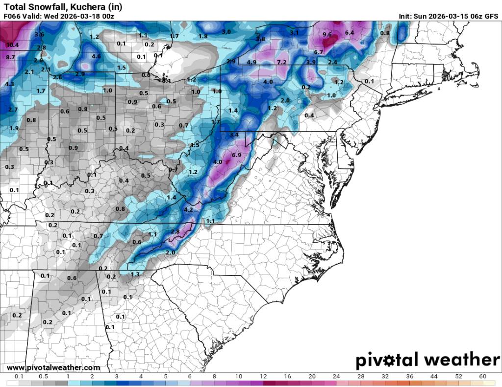
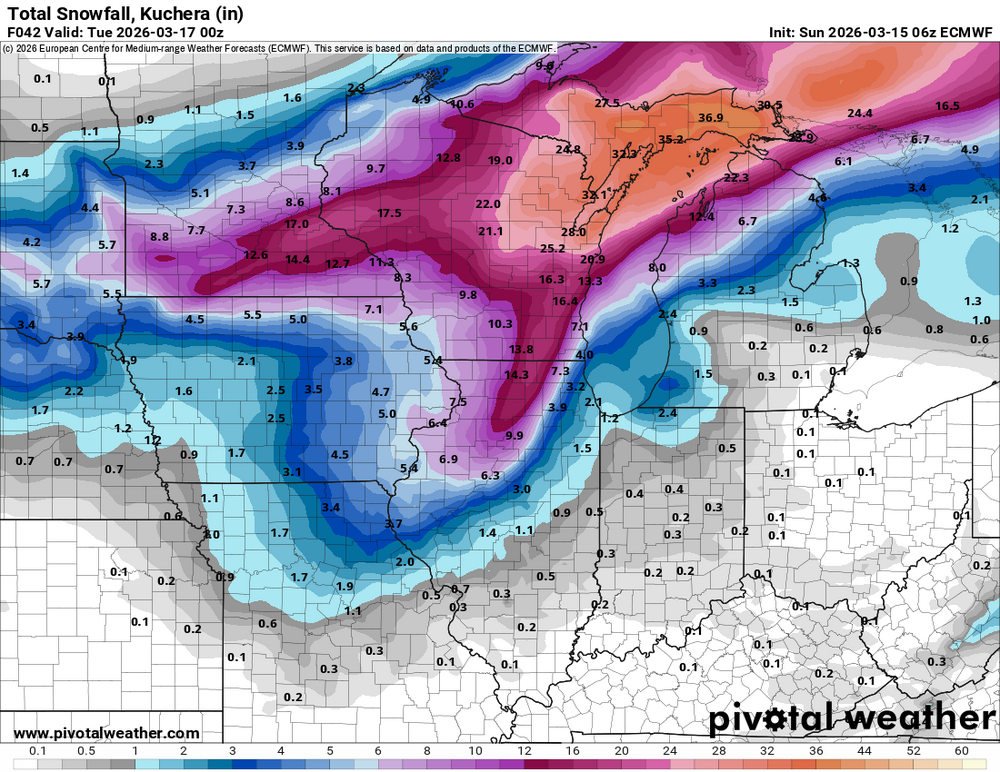
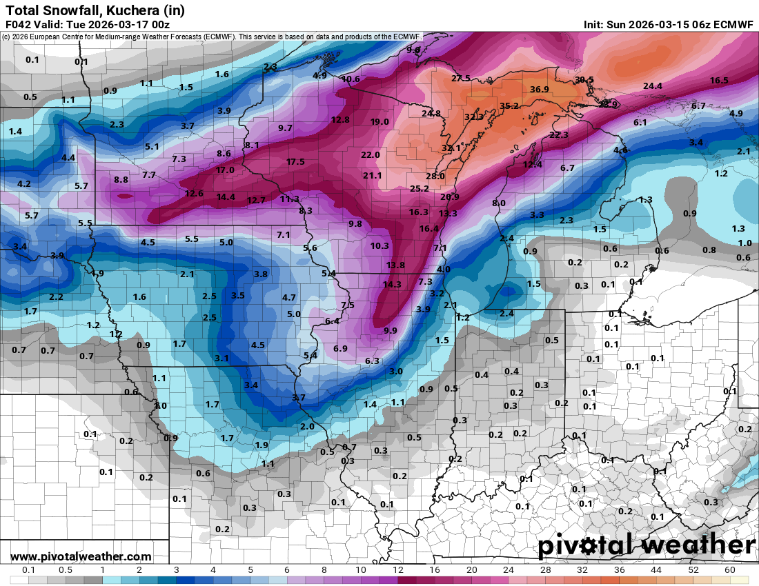
I mainly posted to show the continuing snow hole near State College. It’s difficult for the map generating program to get the grids perfect with such a large gradient involved with the snowfall. This map below has some added numerical percentages. But the resolution is always going to struggle unless you can create a more zoomed in map.

-

3/16/26 Severe Weather Event Thread (Day 2 MOD Risk)
George BM replied to Kmlwx's topic in Mid Atlantic
Well hello there pinned severe thread. First time we've done one since February 25, 2017 IIRC when Ian made one for that event (That event produced an EF-1 in La Plata IIRC). -
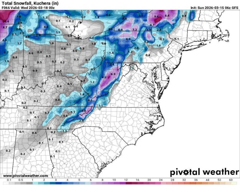
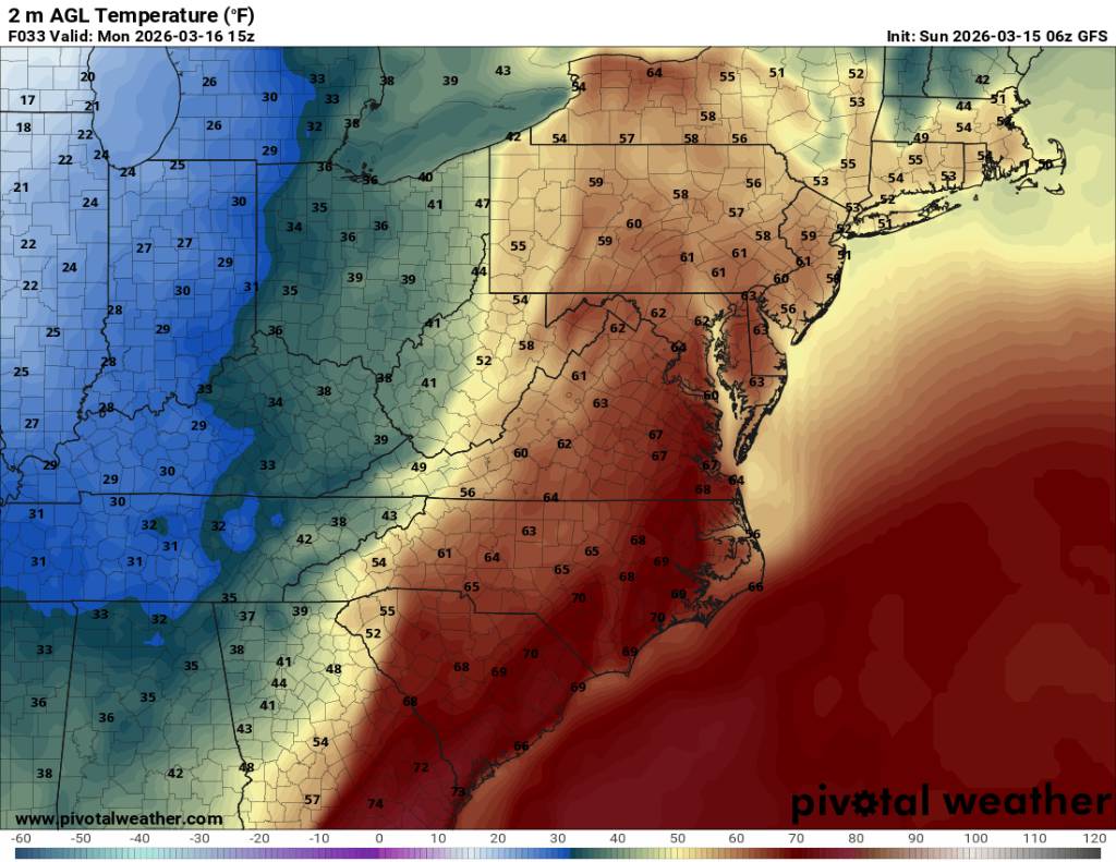
Going to be some back to back cold cold nights. Sent from my SM-G998U using Tapatalk
.thumb.jpg.34f6a8572c028dbaeeb0768f5c2a12a4.jpg)
.thumb.jpg.5ac50cc269ee8a9a4cf3ef9ba25ffd41.jpg)
-
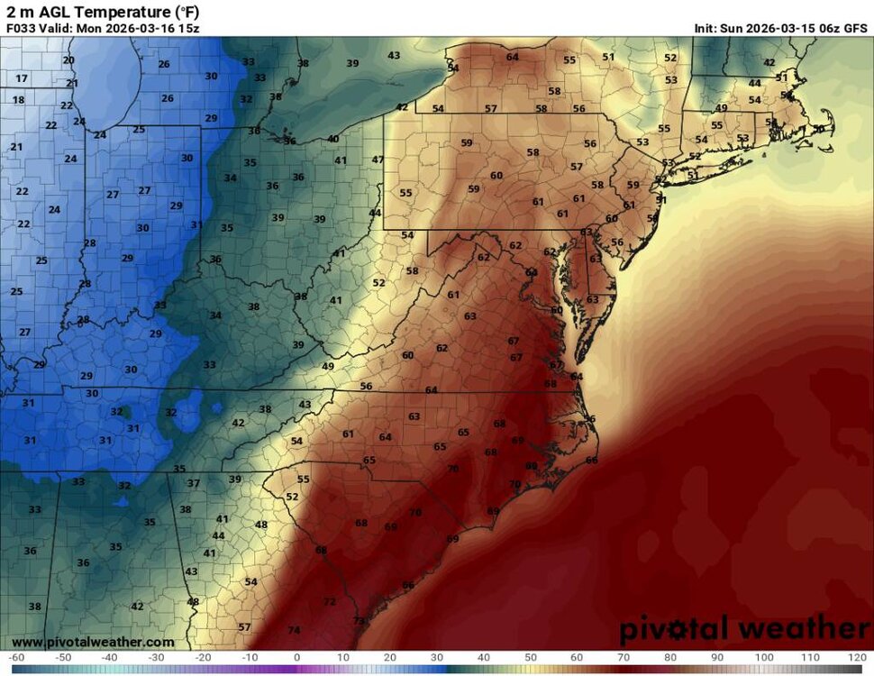
Going to be a huge temp crash tomorrow during the day. Sent from my SM-G998U using Tapatalk
.thumb.jpg.1326cfe19d6d6e19b24f9d6c0285e7b8.jpg)
.thumb.jpg.c7bd2219262c397c7cda8d7afd5e481e.jpg)
-
Looks decent Sent from my SM-G998U using Tapatalk
-
Latest on storms risk on Monday


.gif.bf815ab746a2b655fd2d6c9103730e55.gif)


.png.e3cd79f0dec43487032846dd4597a6fa.png)


.jpg.2600828088bfb137225aecca456ca9d4.jpg)
.jpg.f16e795eac6bd9d762c42fcc327f9ad4.jpg)
.jpg.8d79dd88ec4041e0674b41ecd6be1d47.jpg)
.jpg.e0713078267bf8fd67f6dc8536b67d75.jpg)