All Activity
- Past hour
-

Central PA Summer 2026 Discussion/Obs Thread
Voyager replied to Voyager's topic in Upstate New York/Pennsylvania
Well, hopefully those who saw them this past weekend won't see them again. -
 ....I can't even begin to tell you how bad it is with hs students including athletes. We literally have to teach players how to pay attention and how to absorb and understand what is being taught.
 -
It’s not nearly as hot as last week but I still suffered in the humidity while working in the yard. I’m getting soft in my old age.
-
Hopefully the outflow boundary delivers as it moves through Raleigh.
-
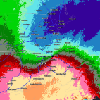 I visualize data for a living. I can't imagine there being a circumstance where I would find that graphic meaningful. It would even be odd if your range was 90-95. The word "authority" is doing a lot of heavy lifting IMO.
 -
what about the heavy T- storms tomorrow and Friday with possible flooding downpours ?
- Today
-
Falls lake getting hit yet again. Just a storm magnet all of a sudden.
-
Upgrade to slight for tomorrow for DC and points east?
-

Occasional Thoughts on Climate Change
donsutherland1 replied to donsutherland1's topic in Climate Change
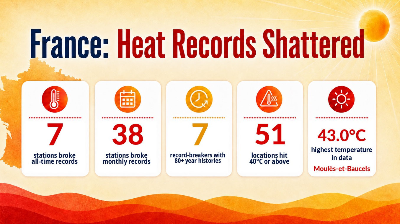
All-time record heat returned to France today. The temperature reached as high as 109.4F (43.0C) today.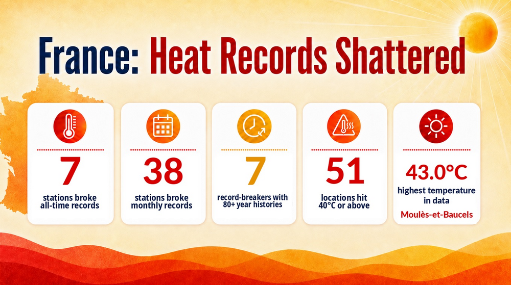
-

2026-2027 Super El Nino
dmillz25 replied to Stormchaserchuck1's topic in Weather Forecasting and Discussion
It’s on discord now if you want the link ill dm it to you -
 What a day! Upper 70’s. Dry. Heat comes back tomorrow (ish)
 -

2026-2027 Super El Nino
snowman19 replied to Stormchaserchuck1's topic in Weather Forecasting and Discussion
-

E PA/NJ/DE Summer 2026 Obs/Discussion
Birds~69 replied to PhiEaglesfan712's topic in Philadelphia Region
82F/DP 70F I had enough of these DPs... -

Hoisting the Sultan Signal: Heavy Rain Event July 5-7
BrianW replied to WxWatcher007's topic in New England
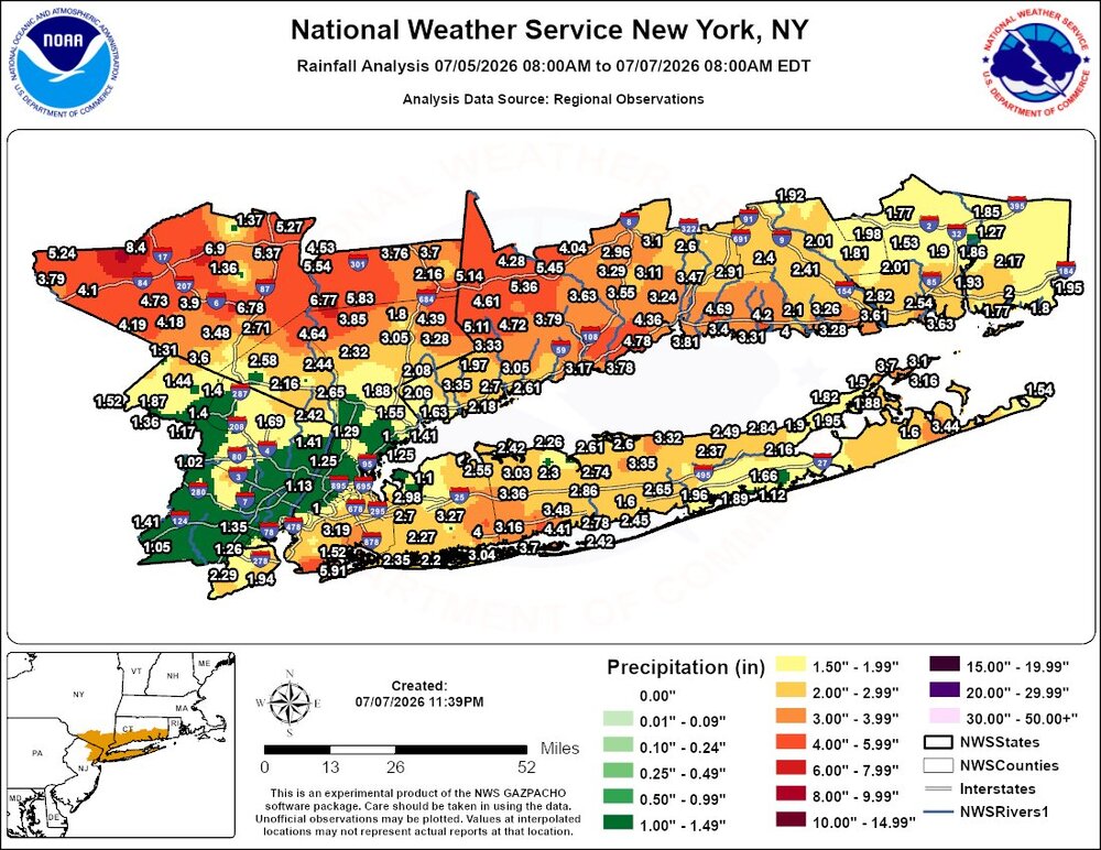
-

2026-2027 Super El Nino
GaWx replied to Stormchaserchuck1's topic in Weather Forecasting and Discussion
Ray, Good advice! I’m careful with potential bias of forecasts from any source, especially internet based looking for clicks or likes ($). This source is putting some emphasis on the cooling N Atlantic and AMO decline tendencies as an additional important factor to consider for especially the E US, something I haven’t seen a whole lot here and elsewhere (not specifically you though). So, this gives a different perspective (both Atlantic and Pacific influences) from most discussions I’ve seen with lots of support from both historic data and latest forecasts from 3 of the most widely followed seasonal models, none of which are warm this winter as a whole for the bulk of the E US. Also, note that this article from a European source also includes warm maps for the upcoming European winter. -
 Yeah I mean that’s who quality controlled that! Indeed it does. A whole can of worms that’s probably human nature pushed to the extreme by proliferation of social media and algorithms. Only bound to get worse, unfortunately, and many of us are guilty of it as we rocket through the digital age.
 -
....the attention spans of some people shall we say are lacking? Lol
-

2026-2027 Super El Nino
40/70 Benchmark replied to Stormchaserchuck1's topic in Weather Forecasting and Discussion
Just be careful with that severe-weather-weenie site. -
 I can certainly imagine lol. Its interesting how the human brain works
 -
Anyone having a hard time keeping indoor rh down?
-
https://www.spc.noaa.gov/products/outlook/day3otlk_0730.png day 3 marginal risk issued includes us .
-
There have been numerous psychological studies done on what works to attract viewers/readers..I ve participated in several focus groups on advertising. Ive always been amazed about what prompted some people to react to the ads/commercials....
-
This weekend looks really good.
-
 This. We can blame hype but the amount of video easily available now is something never seen before. It’s the same with any outrageous behavior captured on film. There have always been Karens… since the dawn of time… but now you see video of every single person doing something obnoxious or dumb. Dumb people making bad decisions have always existed, too. You just never saw it. I don’t think people understand the gravity and how our perception has changed on certain things since every human holds an HD camera in their pocket.
 -
2026-2027 Super El Nino
GaWx replied to Stormchaserchuck1's topic in Weather Forecasting and Discussion
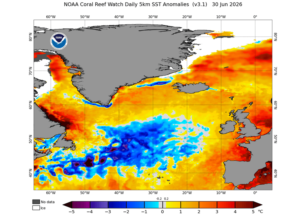
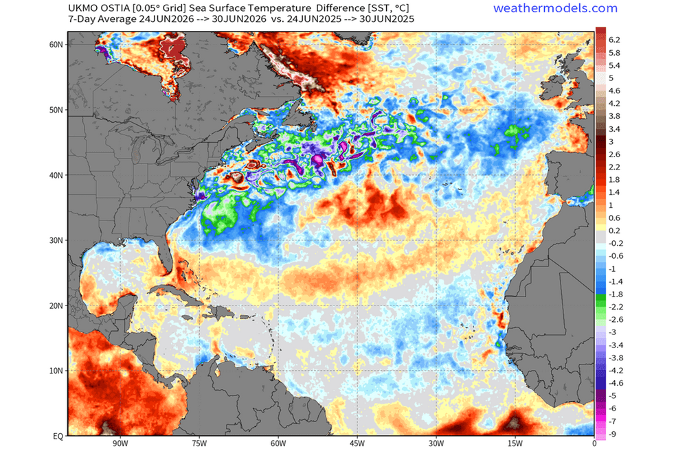
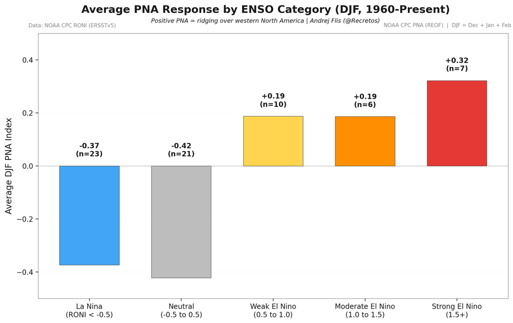
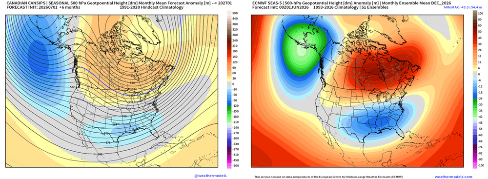
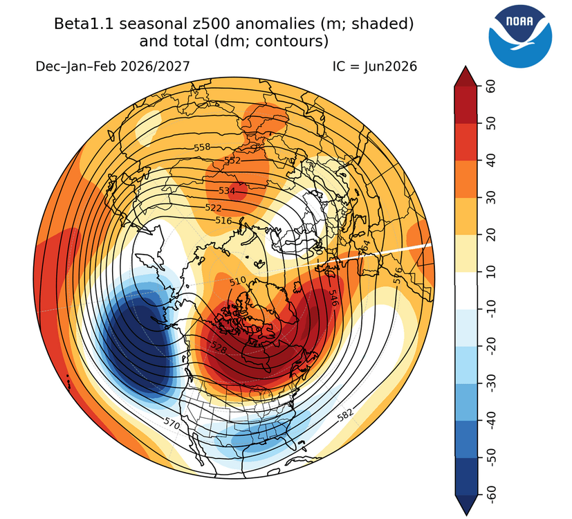
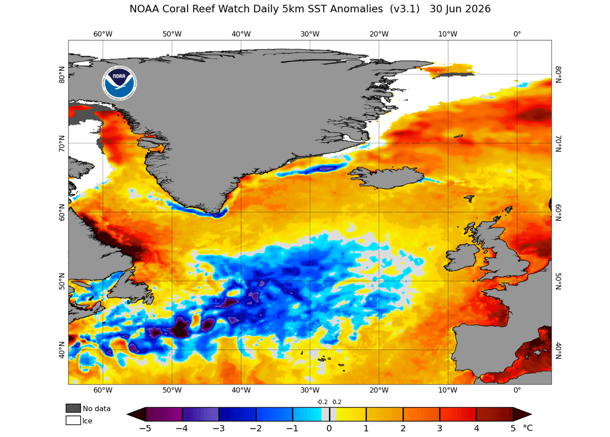
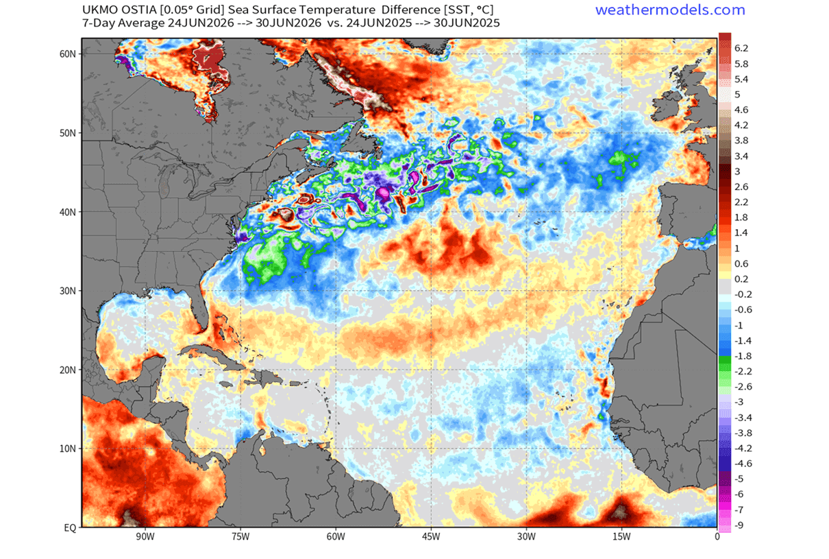
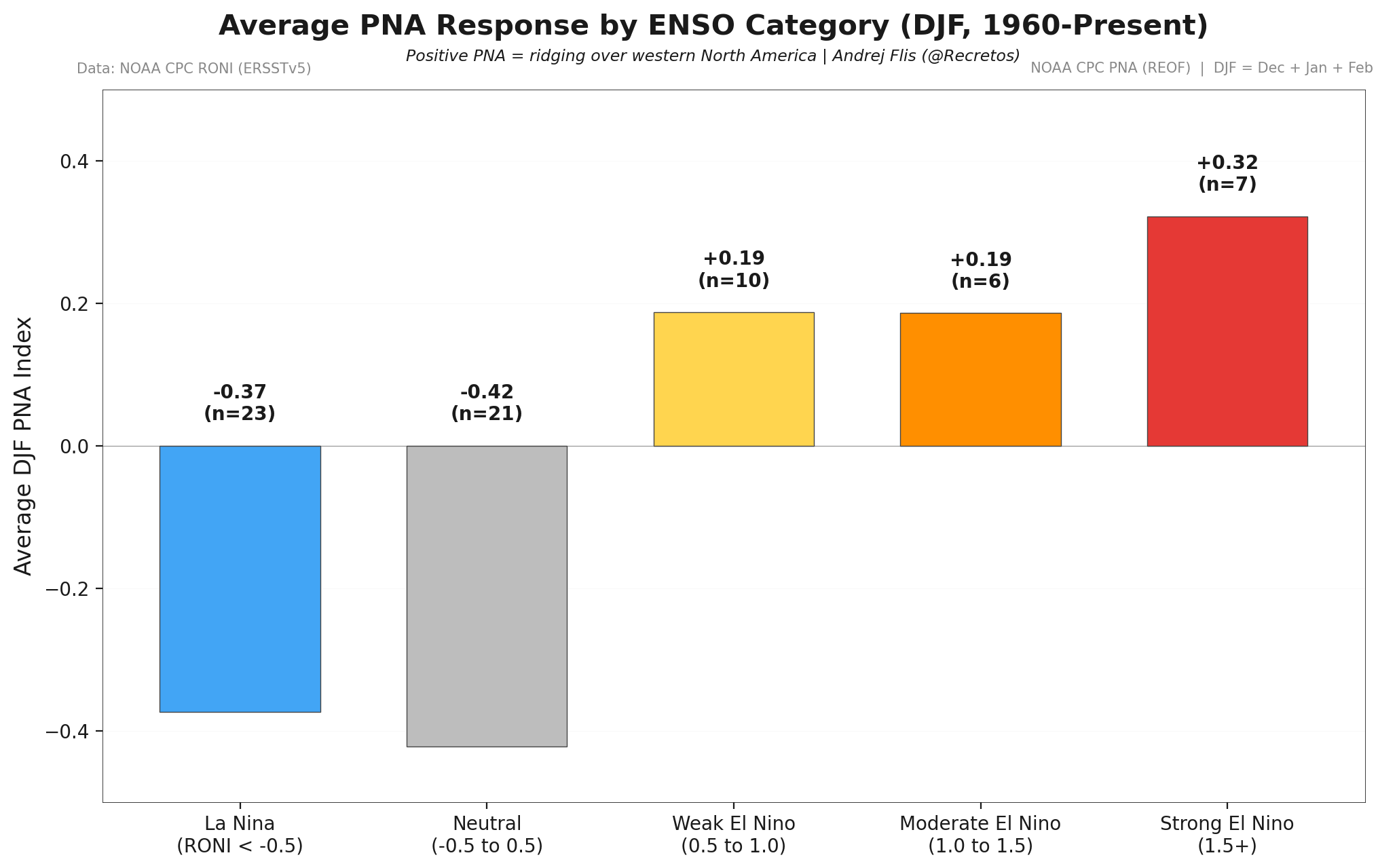
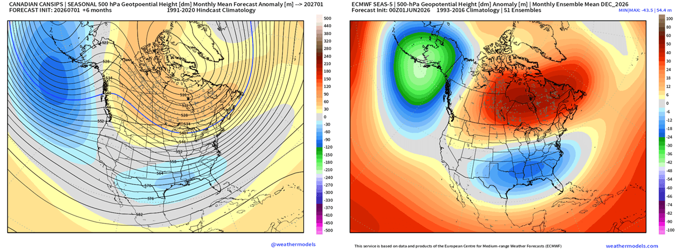
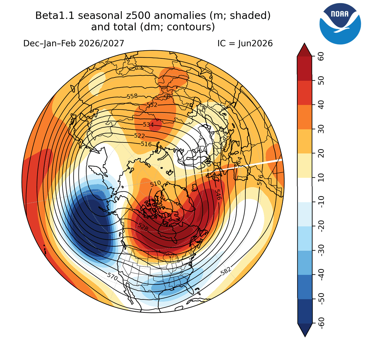
A Cold Atlantic Anomaly Returns as Super El Niño Shapes Winter 2026/2027 Early Forecast Signals Together, the Atlantic cold blob and Super El Niño signals are already giving strong early hints for Winter 2026/2027 pressure and temperature across the United States, Canada, and Europe. If we look at the actual observation image below, it shows the real ocean temperature trends over time. It looks nearly identical to the model simulation of a weakening AMOC. This supports the fact that the AMOC is indeed weakening, even faster than first anticipated. This temperature signature of the warm Gulf Stream area and cold North Atlantic is one of the strongest indicators of the AMOC weakening. Data shows the formation and growth of a new “cold blob” pattern, forecast to last into 2027. You can see a very clear cold ocean anomaly, stretching back towards the Gulf Stream area. This anomaly is much larger than last year, continuing the long-term cooling trend of the subpolar North Atlantic. You can see that the main cold area is linked back into the Gulf Stream and towards the east coast of the United States. Below is an even more dramatic analysis image. It shows the 1-year difference in surface temperature for the last week of June. This shows that the North Atlantic is much colder currently than it was this time last year. What stands out most is the Gulf Stream area, which shows several degrees lower temperatures compared to last year. North Atlantic Cold Anomaly and Super El Niño Forecast North American Pattern: Where Ocean and Atmosphere Collide The atmospheric pattern we found the connection to is called the Pacific-North American pattern, or PNA. This basically tells us that a Fall cold blob anomaly in the Atlantic corresponds to a positive PNA pattern in Winter. Not meaning that the cold anomaly itself is responsible for a colder winter over the eastern United States, but it can be like an indicator of what is to come. But this year, we have a far stronger driver on the rise, the Super El Niño. Below is the analysis of the winter period during the last 4 Super El Niño events. You can actually see a very similar pattern to the +PNA above. Below is the December 2026 pressure forecast from the ECMWF model that we used above for the ocean temperatures. We also added the CanSIPS model to compare different predictions. You can see that both forecasts show a strong positive PNA pattern, with a high-pressure system over Canada, a deep low in the North Pacific, and a low-pressure zone over the central and southern United States. We can add another model into the mix, the CFS from the United States CPCcenter, which covers the whole Winter 2026/2027 period. Below is the pressure forecast that again shows an identical pattern to the two predictions above, with a clear Super El Niño pattern and a positive PNA over North America, with a ridge into Europe. https://www.severe-weather.eu/long-range-2/atlantic-anomaly-and-super-el-nino-shaping-early-winter-2026-2027-predictions-united-states-canada-europe-fa/ @snowman19@40/70 Benchmark