All Activity
- Past hour
-
Been there for five years. Why change now?
-
That is a crazy thing to track, but thanks for sharing. It was cloudy here in the 50s today.
-

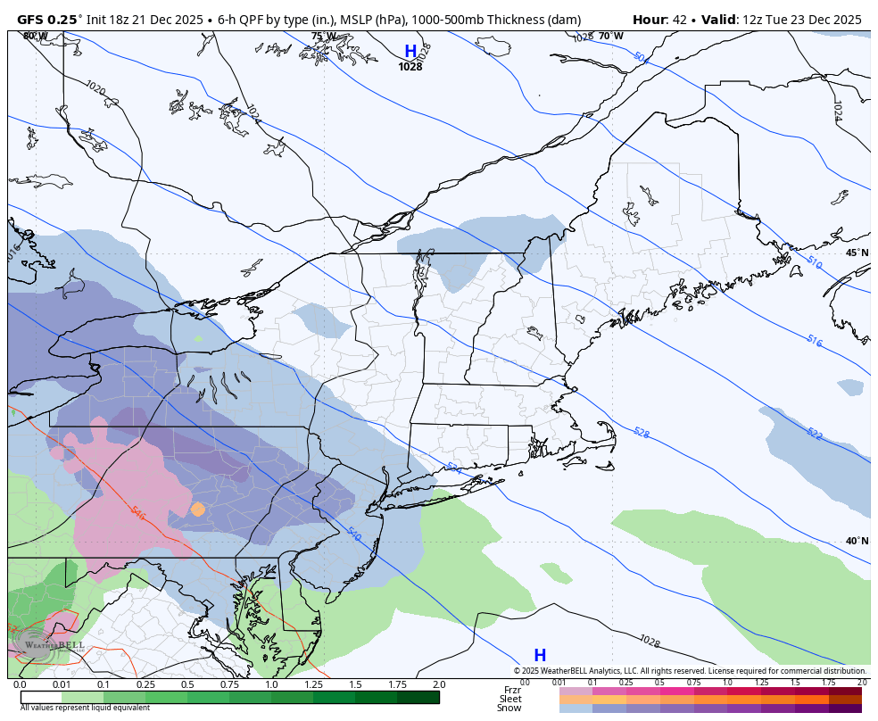
White Christmas Miracle? December 23-24th
ORH_wxman replied to Baroclinic Zone's topic in New England
I’d keep it at 1-3” for most of SNE and adjust higher or lower if needed tomorrow. There’s a chance there could be a little sucker hole in the middle of SNE as the WAA dies out and the IVT gets going further northeast. We don’t know if that’s going to happen but if it does, there could be an area of 1” type totals. That’s why leave it at 1-3” for now. -

December 2025 regional war/obs/disco thread
H2Otown_WX replied to Torch Tiger's topic in New England
South coasters in tubs with toasters -
Record low humidity this afternoon for this date and nearly for the month of December (around 15%)
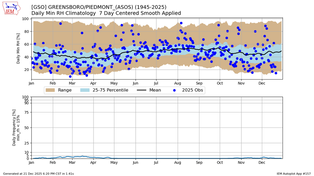
-
Currently: Clear. Breezy. 24.6°
-

December 2025 regional war/obs/disco thread
moneypitmike replied to Torch Tiger's topic in New England
Yeah----probably the snowiest town in ORH county. Outside of Lunenburg, of course. -
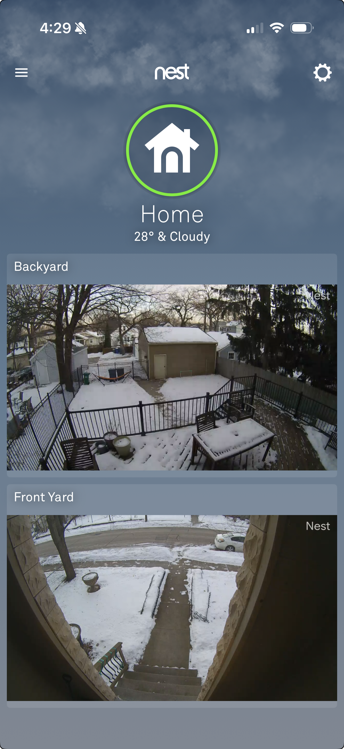
3”-4” of hard glacier with some dust on top. Here’s the front and backyard view right around sunset.
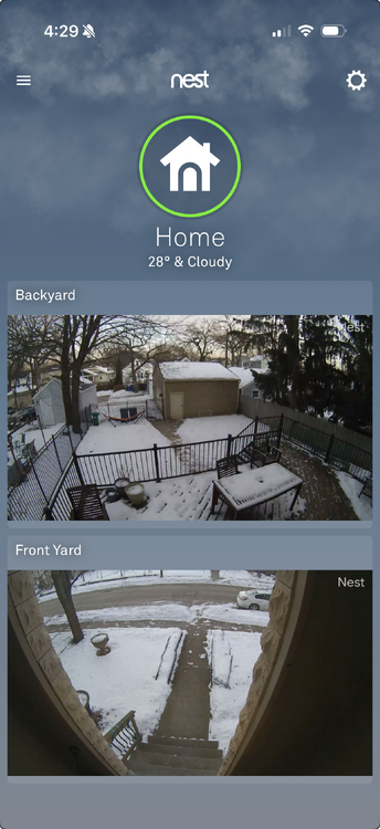
-
Ashburnham 1,367 asl great spot
-

Occasional Thoughts on Climate Change
frontranger8 replied to donsutherland1's topic in Climate Change
For most PNW stations, December has seen around 1-2F warming since 1940s. February hasn't warmed at all. Summer warming has been much more pronounced. -
Yeah i guess my question is why we need the warm pool to extend east this year and not last year. For feb it makes sense. What is different about this January vs. last January when we had a +PNA?
-
He was among my wxtwitter follows for quite a while when I was on there and I agree with this assessment. I didn't know it was a thing, but he did sort of seem to relish crushing EC snow weenie dreams Note, I am not commenting on his or anyone's specific thoughts on this winter.
-
He was calling for a TNH+ pattern with -EPO for the winter not too long ago, maybe a couple of weeks. I do follow him and he gives good background information under the hood, but the latest tweet of his lacked the usual substance and reasoning for a big change is his position/outlook.
-
40s tomorrow then 50s and 60s for the next week. Here comes the warm spell. My guess, mid to late January we have a shot at snow again.
-
EPS trend for 12/29 @ 12z. Look at that trend towards colder weather. And some are already cancelling winter.
.thumb.gif.0df05a3399405174af71faa42cec2562.gif)
-
How happyclam sauce ?
-

Central PA Winter 25/26 Discussion and Obs
Blizzard of 93 replied to MAG5035's topic in Upstate New York/Pennsylvania
18z GFS is bringing 1 inch of snow to Harrisburg & Lancaster on Tuesday am, with closer to 3 inches for the Williamsport area.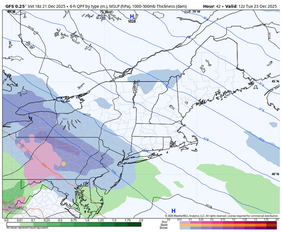

-
Lol. Your area and right over @powderfreak’s head.
-

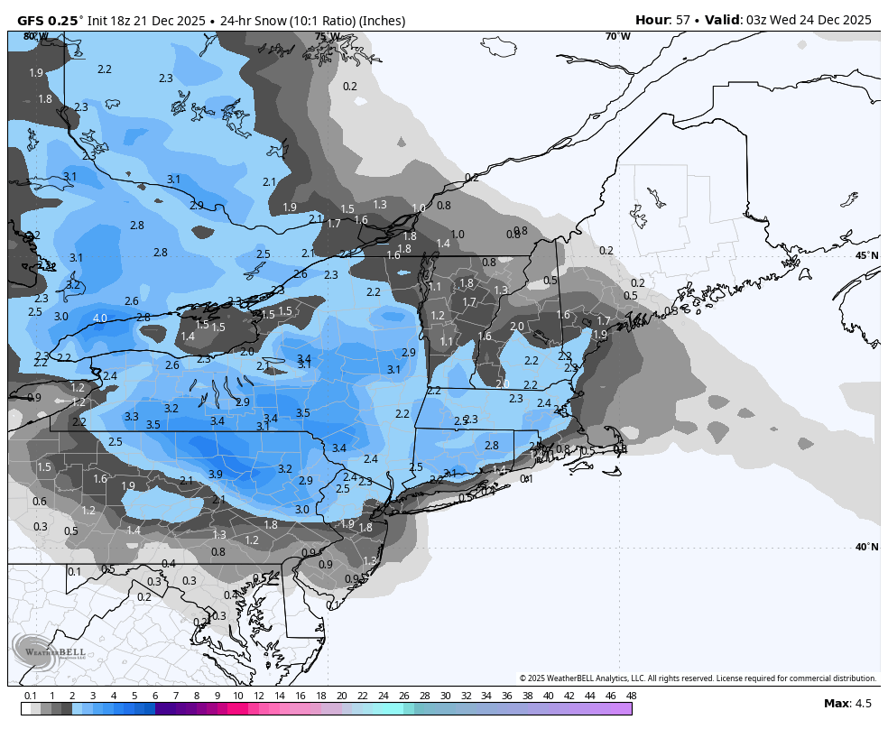
Possible Light Snowfall (1" - 4") on Tuesday Dec 23
psv88 replied to Northof78's topic in New York City Metro
Yea it’s a weather discussion board. We talk about weather, good, bad, ugly. Sorry I hurt your feelings -

Possible Light Snowfall (1" - 4") on Tuesday Dec 23
IrishRob17 replied to Northof78's topic in New York City Metro
And yet you still felt the need to point out the melting. Interesting. 29/14 and blustery. -

Possible Light Snowfall (1" - 4") on Tuesday Dec 23
coastalplainsnowman replied to Northof78's topic in New York City Metro
We definitely have the airing of grievances part covered. - Yesterday
-
I think Friday still bears some watching. A few ECM runs and GFS-AI run the precipitation into a wall of CAD. Lots of northerly low level drain. It's a much better threat for New England, but there's still enough time and enough ensemble spread... Pretty low likelihood however outside of some ice across the northern interior or maybe flakes to end.
-
RDU now has Columbia’s climate. RDUs climate has shifted to DC. Do that across the country
-
850 FXUS61 KOKX 212101 CCA AFDOKX Area Forecast Discussion...CORRECTED National Weather Service New York NY 401 PM EST Sun Dec 21 2025 ... QPF overall will be light, largely near or under a quarter inch, which will limit any potential snowfall. Forecast amounts have not changed significantly from the previous forecast, with up to an inch along the coast, and 1 to 2 inches moving inland northof interstates 80 and 95, with highest amounts in the elevated areas of the interior LoHud Valley, interior SW Connecticut, and NE NJ. Central Park Snow Observer activation is not expected at this time.
-
Possible Light Snowfall (1" - 4") on Tuesday Dec 23
psv88 replied to Northof78's topic in New York City Metro
Yea no that’s not me. Just being realistic.


.gif.e9f944784cb38f7ba105c9ef6b0fa374.gif)