All Activity
- Past hour
-
I strongly feel this way about Severe Thunderstorm Warnings, which I am not convinced anyone takes seriously at this point. Tornado Warnings… imo technology has advanced to where we can be fairly confident based on radar that a tornado is occurring or imminently possible. As long as folks still take those warnings seriously, and I think they do, I don’t have issues with their pace. I do think it’s somewhat fair to say that tornado warnings the way you’d prefer them have been somewhat replaced by PDS warnings, at least in populated areas, which I’m not sure is good comms strategy. I don’t think most normal folks recognize the difference between a warning, PDS warnings, and emergency.
-
Lots of bark but no bite in south Cary: .09". Just a few miles north I know you got hit pretty good.
-
 Rays arrows are straight, not curved like that guys.
 -
About to pour. FINALLY.
-
Looked like it shifted just SE of here. Found a traffic cam at 1D and could see suspicious stuff SW of me. Being in a ground level condo I did not have the best view. Would have went out to look but even then would have had to go out to the center of the circle here. So we just found the safest place to be and watched radar. I had been watching the line come in but just as I thought it was going to be fine our phones went off.
-
 I still think he’ll get a decent drink. Although he can’t hate me for a 5 mile STD error. STD being Stein Deviation
 -
Nada here so far. I think we'll get enough to keep the lawns happy. Its not like this July has been a dry month on LI.
-
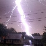
159 kA bolt just 2 miles SE of here. Shook the whole damn house. was looking out the window and almost got BLINDED by it. was at 8:57 PM
-
Spending the week in Almond, SW of Bryson City. Multiple heavy rain showers this evening. Very dark at various times in the midst of those storms. Looking forward to lower temps and humidity the next couple of days. Saw we got significant rain this evening back home in Hickory, too.
-
Inch of welcome rain. T&L, not too much wind.
-
Lost power here for ten mins or so with that last hit from the storms. Pretty impressive with the windswept heavy rain and tons of lightning. Looks like we will finish up with 2.57" here. Incredible.
-
Still only 0.03" so far here today. I see on radar there's a skinny line of downpours in Somerset County that's heading in this direction, so hopefully some heavy rain shortly.
-
How did you fare? I was right in between the couplets, but the one that was there right before it split into two basically went over our house.
-
I thought I was headed for a dead ratter, but a cluster of thundershowers popped up overhead and I lucked into 0.65
-
I am sure this topic has been discussed a lot over the years, but I guess I am too lazy or unskilled to find out where. However, my son and I were discussing the whole premise behind issued "Tornado Warnings". My old fogey feelings are that the "tornado warning" label issued by LWX, at least in the Mid Atlantic area gets way overused based on the actual number of genuine tornadoes that are produced and touch the ground. I don't have the actual percentages for how many times a "Tornado Warning" actually produces a genuine twister that hit the ground, but my gut says the percentage would be rather low. On the other hand, my son feels it is completely a good idea to put out "Tornado Warning" whenever a cell shows the the earmarks on radar, wind direction, hook indication, etc...He takes the side of it is for the safety of the people and if they are warned, then they can prepare. My son also has a better appreciation of all of the technical tools that are utilized in making the decision to warn a storm, than I do. I totally get that as well. I just feel like the number of times I have run into the basement over the years to flee a "tornado warned storm" to end up with nothing more than a gusty storm and rain is overkill. In fact none of the tornado warned cells has ever produced a tornado where I live. The only time I remember going into the basement for the power of a storm that was indeed a worthwhile decision was for the derecho. And I believe they were straight line down draft winds and not tornados. But the sound of branches and limbs falling was enough for me to round up the family to go to the basement. So, am I an old fogey who wants to have visuals of a sighted tornado to flee to the basement? Or should I go with my son, trust the technologies and respond appropriately every time a tornado warning is issued for my area. Are they issued too frequently? and if so, why? what specific parameters are being used to make the go ahead in warning a storm? I am curious how many of you feel we get too many issued tornado warnings for the amount of actual tornados that touch down? Thanks for sharing your thoughts, opinions, and rationales. Maybe I can be persuaded to think differently. Gopper Towson
-
0.0
-
Vienna got completely skipped by the storms - just one gust of chilly wind and one peal of thunder. Looks like upper NW DC caught the worst of it though.
-
1.5” so far - heavy rain
-
1 inch on the day
-
 top 10 online pharmacy in india: LifeAccess Pharmacy - LifeAccess Pharmacy
 -
Storms firing off in CNJ are aimed at the city.
-
1.78” and counting. Approaching 7” for the month.
-
0.11" so far.
-

2026 Mid-Atlantic Severe Storm General Discussion
Eskimo Joe replied to Kmlwx's topic in Mid Atlantic
Central and Western PA were upgraded earlier this summer. At one point there were over six tornado warnings going in a severe thunderstorm watch.- 1,665 replies
-
- 1
-

-
- severe
- thunderstorms
- (and 7 more)
-
Northwest Warren County and southwest Sussex County look to be getting drenched per latest radar.