All Activity
- Past hour
-
 I was on eastern Long Island the weekend before last and they got absolutely rocked with severe on the 4th of July. Damage in every yard, with multiple measured gusts of 87. I saw Hartford got 3" hail that day too. Better than anything I've seen nearby this spring. BTown has been hit a few times too as usual. Anyway I'm still involved in running the UMass radar and following wx back there closely.
 -
That small rain storm put down .95 in less than 20 minutes. It was some if the hardest rain I've seen in a while.
-
Bad street flooding right now around Glenwood/440 on my commute
-
WRONG! I guess my information was bad, this puts us in 3rd place. The record is 14 days in 1936, followed by 11 days in 1948. There was a logjam at 3rd place but 2026 will now hold the spot.
-
Decent evening on tap with sunny and 83/64 right now. While I don't expect much if any rain from the front, it's looking like some great weather Thursday through the weekend with upper 70s/low 80s and bright sunshine. Gimme that!
-
And nam is mostly Wednesday morning
-
Caught a nice roll cloud before the bottom dropped out here.
-

2026 Mid-Atlantic Severe Storm General Discussion
SolidIcewx replied to Kmlwx's topic in Mid Atlantic
Unless the “storm cluster” is coming right at me and within 10 miles im not gonna get my hopes up. I understand the frustration when it comes to severe weather in this area since moving here last year -
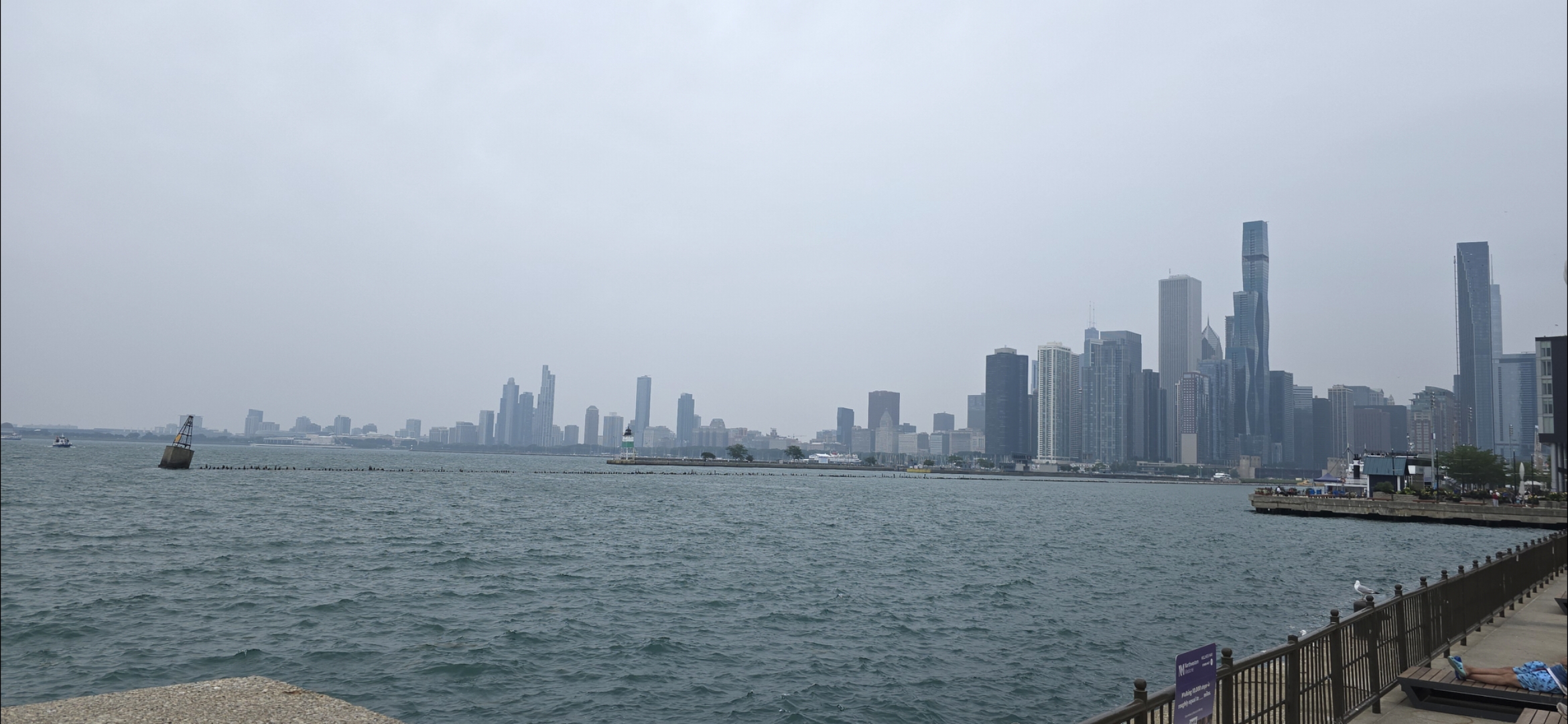
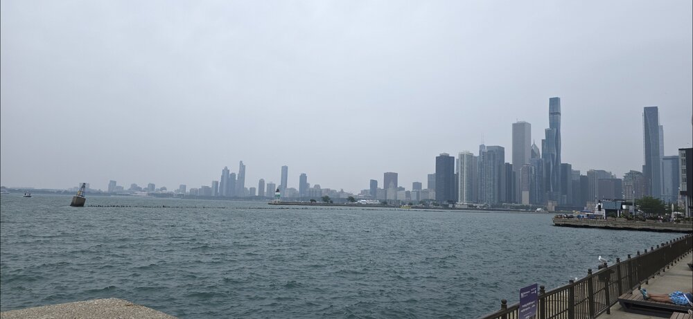
Smoky in Chicago. Tigers - Cubs @ 7pm
-
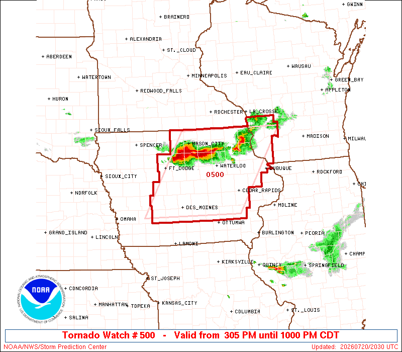
Today had potential to be the hottest day here, but the morning storms held the heat back in central and western Iowa.
-

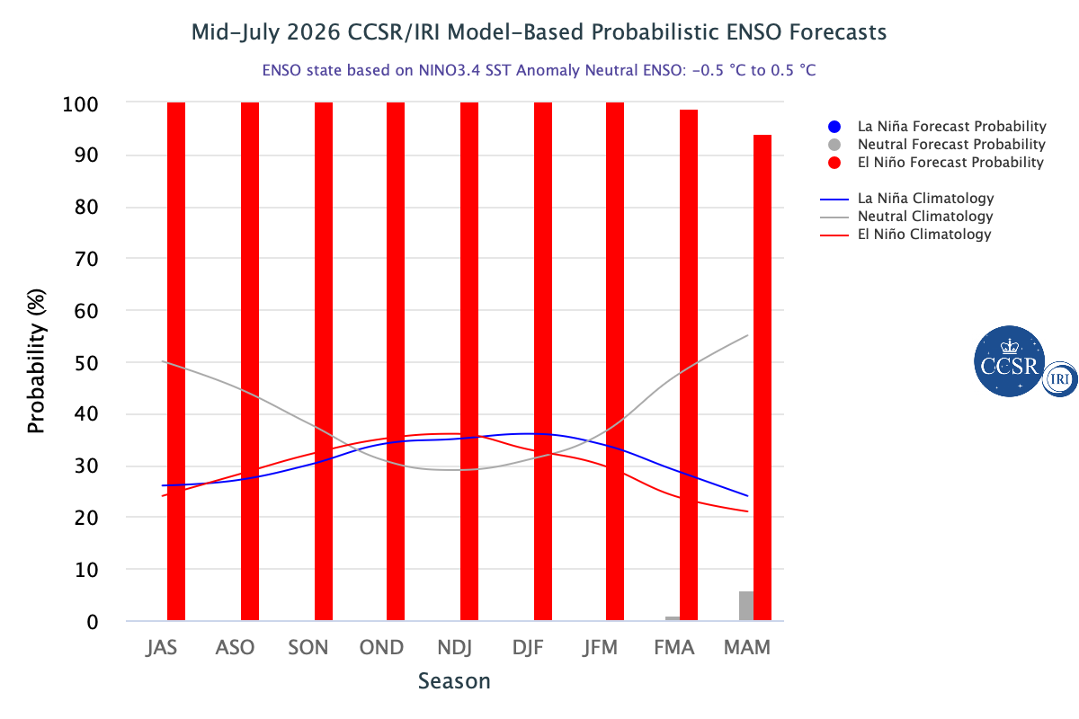
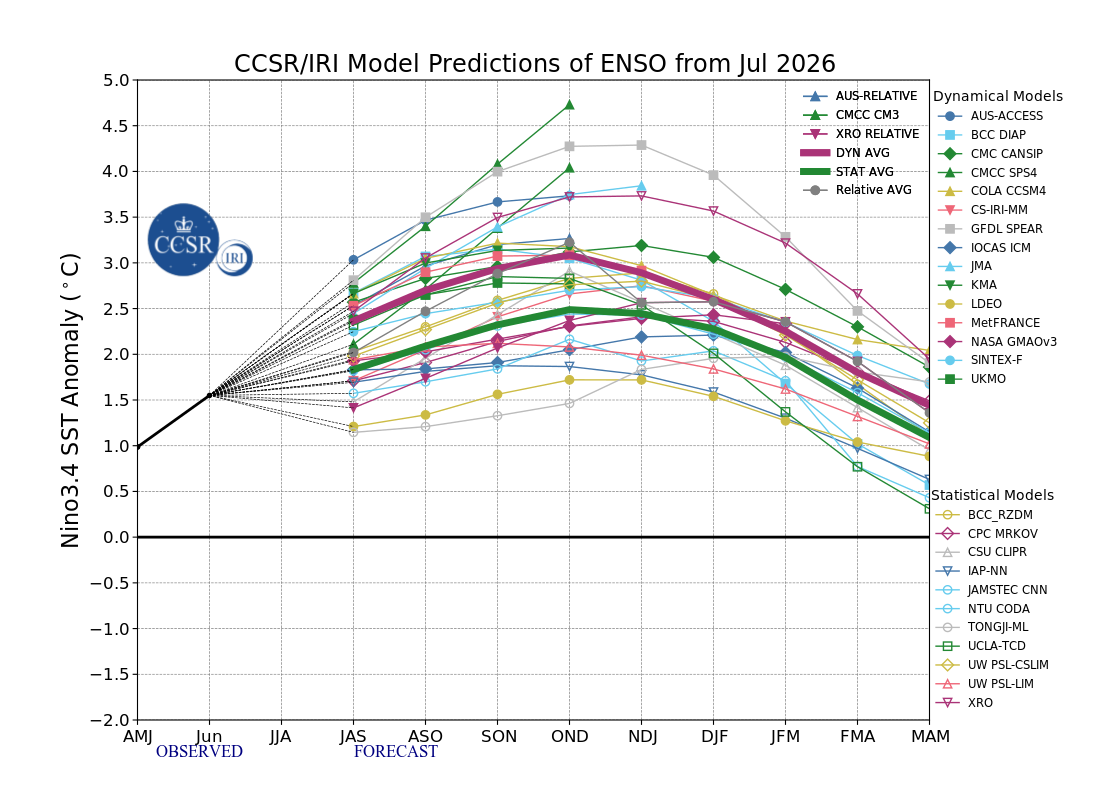
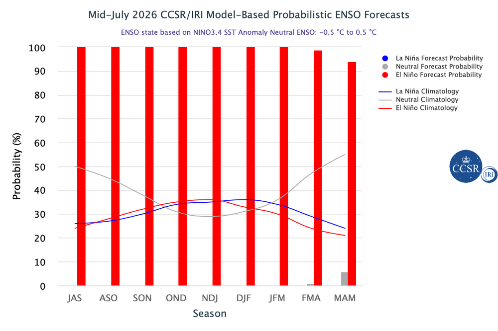
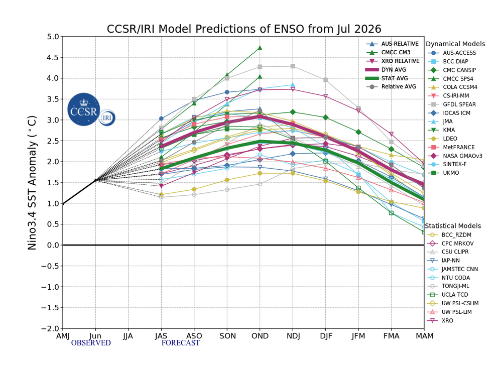
2026-2027 Super El Nino
PhiEaglesfan712 replied to Stormchaserchuck1's topic in Weather Forecasting and Discussion
-
-

Central PA Summer 2026 Discussion/Obs Thread
Itstrainingtime replied to Voyager's topic in Upstate New York/Pennsylvania
I tend to be very reserved/cautious. I'd be bailing hard on any outdoor event tomorrow evening. I'm nervous about driving 12.5 miles home from work. -
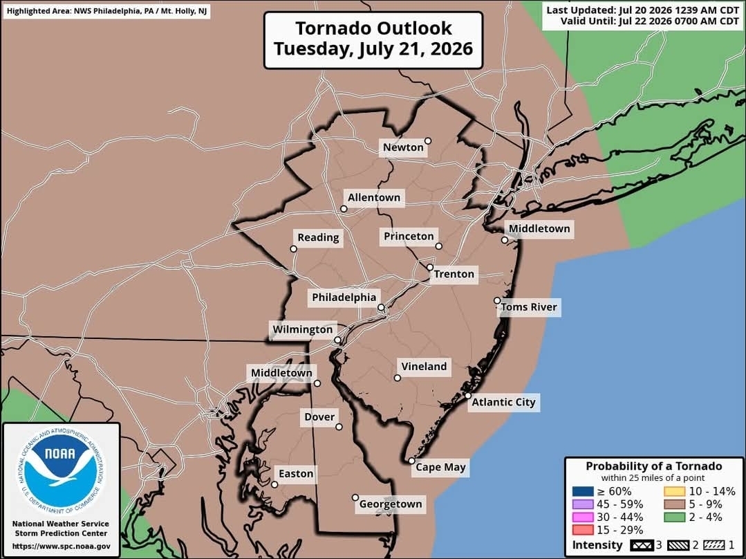
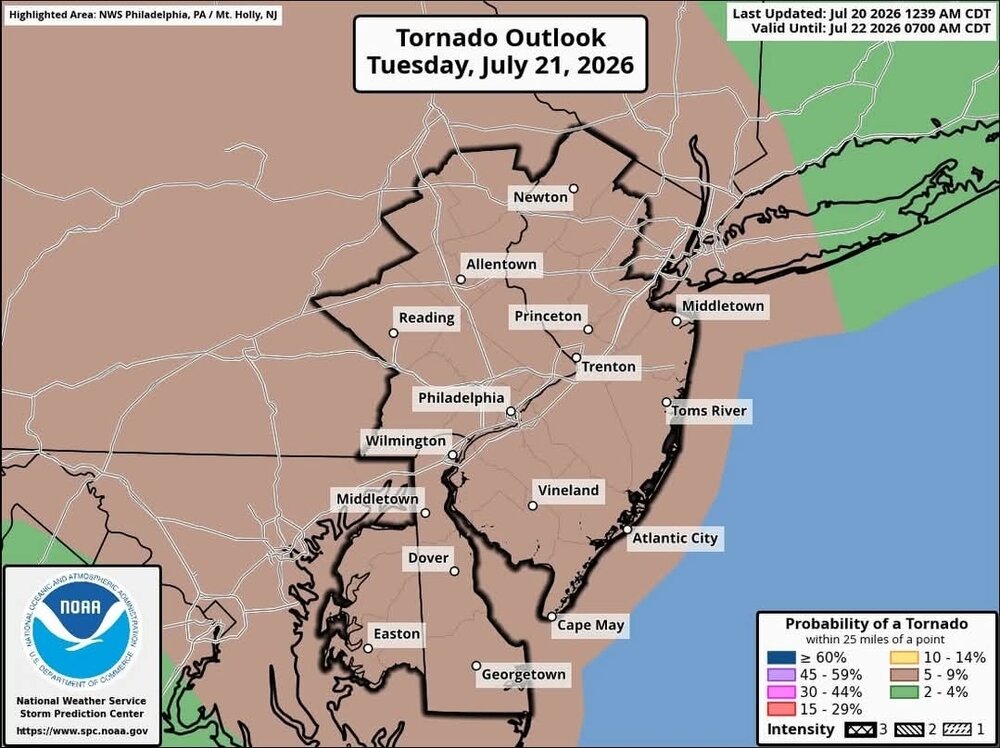
Afternoon LWX discussion mentions "significant severe weather episode" and "scattered significant wind damage reports"
- 1,193 replies
-
- 1
-

-
- severe
- thunderstorms
- (and 7 more)
-

Central PA Summer 2026 Discussion/Obs Thread
canderson replied to Voyager's topic in Upstate New York/Pennsylvania
Hive mind question; Have tickets for a show at Merriweather Post Pavilion in Columbia, MD, Tuesday. Would you bail given the forecast? The venue is in the woods and is a bowl that can flood. -
-
The daily downpour is underway here. Hopefully this doesn't continue, as I have some outdoor stuff planned for 6 I'd rather not have to change. I thought I was good when the chance was only 30 percent today.
-

E PA/NJ/DE Summer 2026 Obs/Discussion
Mikeymac5306 replied to PhiEaglesfan712's topic in Philadelphia Region
You think this morning was nice, look at what Friday and Saturday morning bring. -
You're in a wild mini-drought apparently. It's crazy how rain can be close and still miss you basically every day.
-
too cool! Trap pond is excellent for that type of sightseeing. I believe it is also the furthest north occurrence of cypress trees. I think we are pretty lucky in the relative abundance of wildlife we still have in this area. I get to see deer in my park at least a few times a month, and there is a groundhog up the street, as well as multitudes of very bad squirrels and a diverse variety of bird.
-
Storms are really blowing up in north-central Iowa. They should side sse down the outflow boundary from this morning's storms. Cedar Rapids is well east into the morning cold pool, so I'm not sure if the storms will be able to get this far east.
-
 Unfortunate. I enjoyed your posts. Stop in once a year when we have a convection threat.
 - Today
-
Last year was a frontloaded warm summer, with the heat wave in late June and the warmth lasting all through July. The summer pretty much ended after July 31.
-
I see the 18z HRRR has a round for around midday, and then a long break for the afternoon before a big round for the early evening.
-
Very, very doubtful. Maybe some TORs here though, 12/26/15 featured a violent EF4 in DFW. S Rockies hopefully will cash in on Nino climo, not too far of a flight / drive from here to N NM and SW CO.