All Activity
- Past hour
-
warm and rainy. incredibly easy forecast
-
 enjoy your warm rainy winter
 -
Another downpour this morning. We are really eating into that drought now. Thanks El Nino!
-
57 this morning
-
 There has been nothing to pay attention to for the vast majority of the area...lol
 -
 It’s possible it’s just humid with afternoon/ evening showers and storms next week. Doesn’t look like all day washouts . But there are signals of heaviest qpf in NNE
 -
 Been out of town for the past week and haven't paid any attention to weather at all.
-
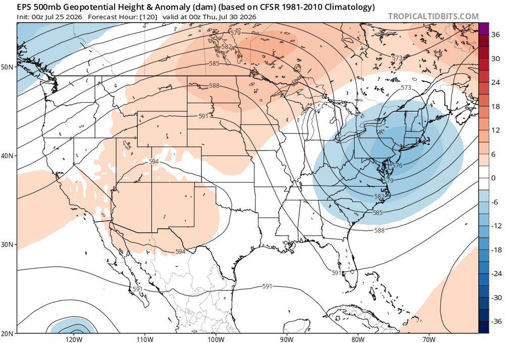
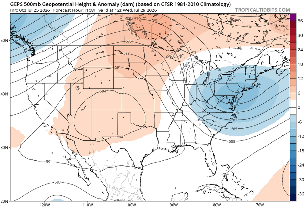
 Huge model differences. Euro washes bridges away in NNE on Wednesday/Thursday while the Canadian and gfs are pretty much dry next week
 -
Going to Sky Meadows always makes me want to buy a few acres out there with a modest house and live happily. Then I look at the prices in, say, Delaplane, and see that others with way more money than me have already had that idea. Got a few sprinkles overnight from the stuff that slid by to the south. Perfectly happy keeping the clouds around.
-
...yeah BUT the parade of Cat 5 hurricanes will soon be upon us...
-

2026 Mid-Atlantic Severe Storm General Discussion
MN Transplant replied to Kmlwx's topic in Mid Atlantic
There's a version I used in my graduate studies called NCAPE (Normalized CAPE). Normalized CAPE (J/kg)The NCAPE (Normalized CAPE) is CAPE that is divided by the depth of the buoyancy layer (units of m s**-2). Values near or less than .1 suggest a "tall, skinny" CAPE profile with relatively weak parcel accelerations, while values closer to .3 to .4 suggest a "fat" CAPE profile with large parcel accelerations possible. Normalized CAPE and lifted indicies are similar measures of instability. -
 many sites now below normal for high temps... the lows are what is keep this month above average so far.. but hottest Summer ever
 -

2026-2027 Super El Nino
snowman19 replied to Stormchaserchuck1's topic in Weather Forecasting and Discussion
Rapid warming in the western IOD region and cooling in the eastern IOD region around Indonesia/Australia. The +IOD is coming on fast. Once it gets established, it’s going to project onto (constructively interfere) that huge El Niño standing wave signal you showed and it’s going to increase the Bjerknes feedback even more @40/70 Benchmark@BlizzardWx @csnavywx @donsutherland1 -
Riding this hotness
-

Central PA Summer 2026 Discussion/Obs Thread
Blizzard of 93 replied to Voyager's topic in Upstate New York/Pennsylvania
These well below normal last few days have knocked down the monthly temperature departure at MDT to just +1.5 through yesterday. It’s hard to believe with the two heatwaves that we had earlier this month, but outside of that, it’s been a fairly pleasant July in terms of temperature. The severe weather has been the worst part for many of us. @Mount Joy Snowman it’s time for your back of the envelope calculation for MDT’s final monthly departure estimate. Do you think there’s a chance that a near normal month goes in the books when all is said and done? - Today
-
A cool 60 degrees after a light rain of about 0.15. I like seeing no heat wave in the forecast
-
Gorgeous morning to play a softball tourney
-
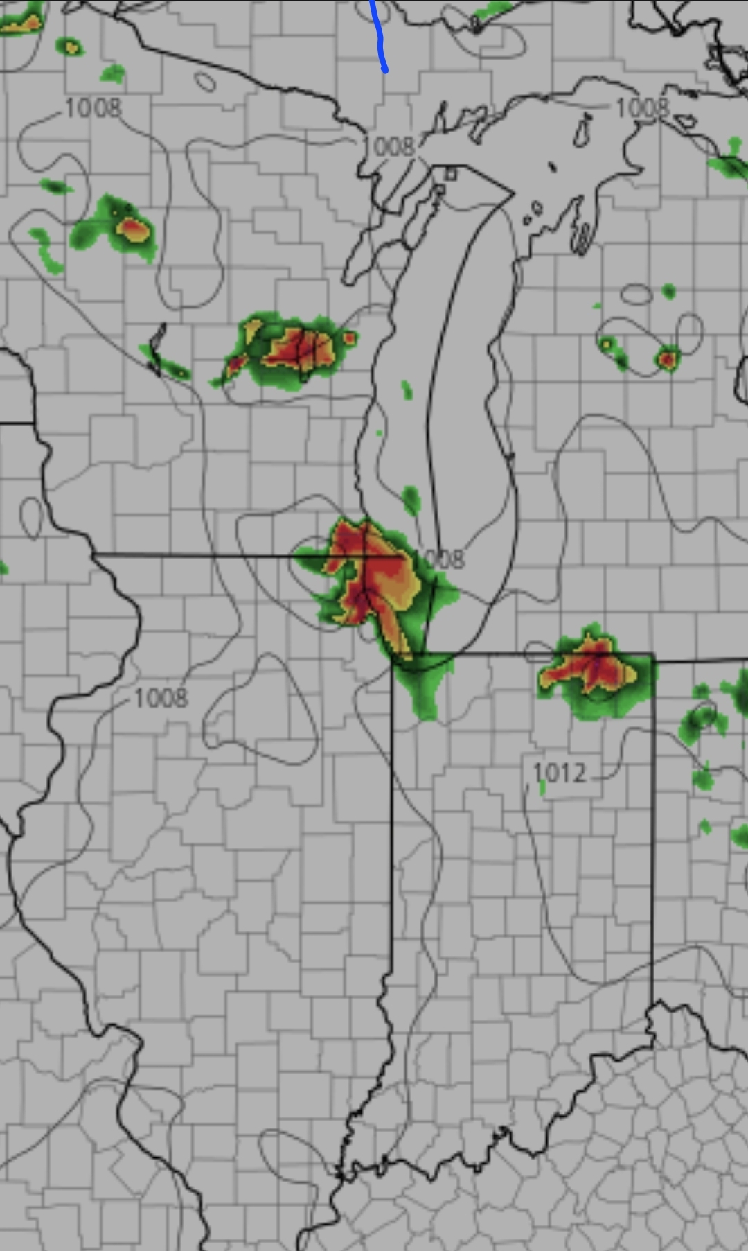
Messy setup.
-
Looks like might be congrats Dendy with the heaviest rain Tuesday
-
 Taunton's rental unit for next week? He doesn't have much luck with vacations.
 -
I'm down here just inland from Fenwick. Light shows and clouds here this morning. Hopefully it clears up this morning.
-
Nah, I will stay local. Worcester - eight straight days of below normal temperatures and temperatures in the '70s. Remarkable considering peak summer. The hot crowd can't win for losing.
-
 thank you, I appreciate you keeping us posted about MBY delightfully refreshing sub 60 morning out there for a run, or just drinking coffee
 -
Yep light rain just up the way from you in Lewes this morning.
-
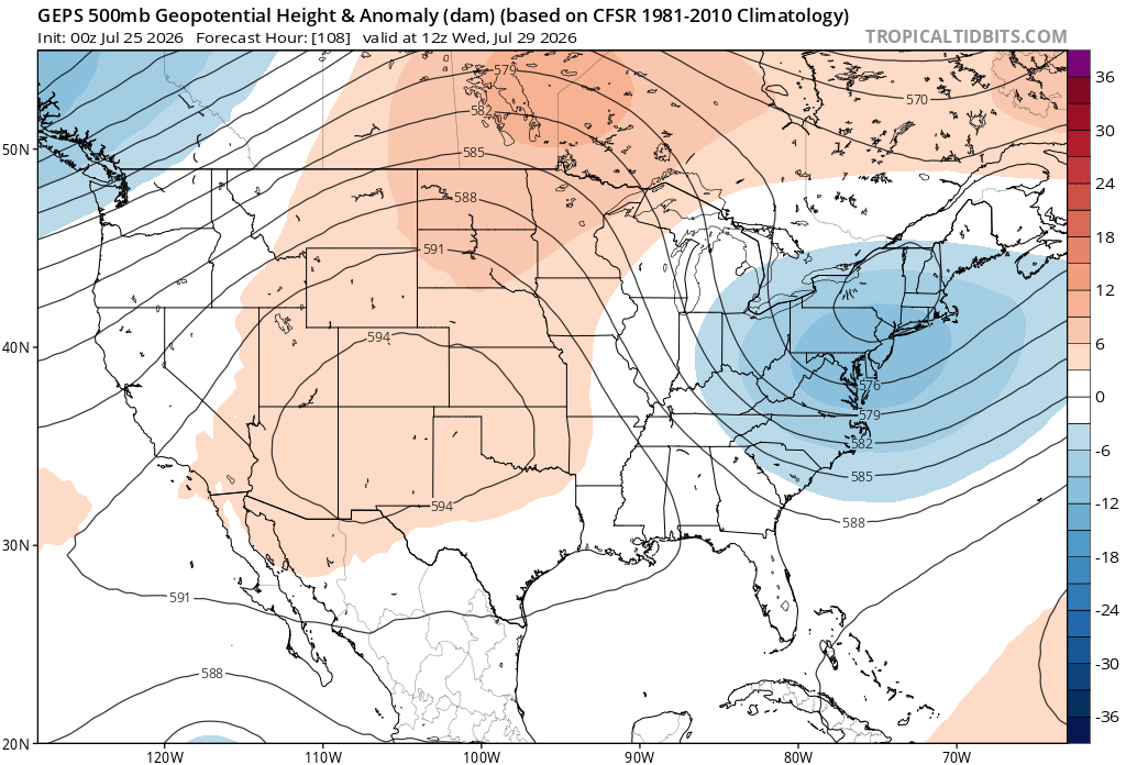
Models hinting at a rainy cutoff low this week. Details as to where the heaviest convection focuses will have to wait. Since the timing of how soon the upper low cuts off and captures the surface low vary from model to model.