All Activity
- Past hour
-
-
It's a fair point but it's not a good run of the model - this time. Better?
-
yeah and yesterday we were saying it just the GFS... The CMC has been locked into it solution so we cannot discredit it.
-

Pittsburgh/Western PA WINTER ‘25/‘26
jwilson replied to Burghblizz's topic in Upstate New York/Pennsylvania
Perhaps I regret saying this, but I don't necessarily mind an overamped look with four days to go. A typical trend is to see these de-amplify as we get closer (say within 24-48 hours). The Canadian is especially guilty of overpowering primary low pressures. I'd give it another couple days before accepting that solution. It is running into a rather stout cold-air source. The NBM, meanwhile, continues to tick upwards on snowfall means. Last three runs have increased from 6.7" to 7.4" and then 10.2" on the 13 UTC run. Continues the trend from yesterday. Odds of more than 12" have gone up to 30%; 62% chance of 8" or more. That's increased from a mere 4% overnight for the former. If any de-amplification occurs, however, those odds will decrease. Mean spread is currently 4" to 13" plus maybe a little more on the backend. -
Richmond Metro/Hampton Roads Area Discussion
mikeeng92 replied to RIC Airport's topic in Mid Atlantic
GFS best case scenario. CMC too amped, toss. Euro AI was still good for us I thought. -
Ok. Question about sleet "calculation". I'm showing about 2" Kuchera of snow for my location. Just blanket saying that would be .2 moisture. Showing .84 zr which would be .84 moisture (assumption). If calling for an additional 1" of moisture, how do you calculate what that would be in sleet?
-
It's a 6-12" snowstorm across our area followed by sleet. What adjective people use to describe that is up to them. It is pretty close to the worst case scenario given the setup, so to be fair in that way it is a disaster because we would underachieve in a rare big potential setup. But by most objective standards that kind of storm affecting our whole area would still be very rare, a once every 5 years type event, so calling it a disaster is kinda harsh...but depends by what lese you're viewing it.
-
“Cory’s in LA! Let’s MECS!” Jan. 24-26 Disco
Typhoon Tip replied to TheSnowman's topic in New England
LOL... not meaning to be a dink or cast shade, just sayn' -
Richmond Metro/Hampton Roads Area Discussion
RVASnowLover replied to RIC Airport's topic in Mid Atlantic
Yep GFS the only model so far with a good thump before the changeover -

Central PA Winter 25/26 Discussion and Obs
sauss06 replied to MAG5035's topic in Upstate New York/Pennsylvania
hasn't most of our epic storms included sleet during the event at some point? -

Richmond Metro/Hampton Roads Area Discussion
chris624wx replied to RIC Airport's topic in Mid Atlantic
I'll take this after the northward march last night. Cut my losses lol . -

Richmond Metro/Hampton Roads Area Discussion
Conway7305 replied to RIC Airport's topic in Mid Atlantic
6z euro was a tick south from 0z so hopefully bleeding stopped. Will see for 12z -
MO/KS/AR/OK 2025-2026 Winter Discussion
StormChazer replied to stormdragonwx's topic in Central/Western States
A definite trend amongst the runs. looking forward to the Euro in an hour. Canadian 06Z Euro GFS Icon(non-Kuchera so looks lower but isn't) -
Don’t ever remember worrying about suppression. Worried about if the Baja wave would eject. Was never suppressed or was will we have a wave move out or not. If it did we would get hit if not we didn’t.
-
I need you to look up the definition of "trend".
-

Central PA Winter 25/26 Discussion and Obs
pasnownut replied to MAG5035's topic in Upstate New York/Pennsylvania
primary held onto 114 and screwed my pooch. -
The Canadian is an absolute dumpster fire of epic proportions. I trust no part of that when it drives the primary that far north but then the thermals looks like the GFS lol.
-
Give me that CMC run for verification. Could get a round of golf in with that.
-

January 2026 regional war/obs/disco thread
ORH_wxman replied to Baroclinic Zone's topic in New England
@TheSnowman just needs to rip out a monster tune for this storm. Just rip it out as loud as you can and you’ll feel better. -

January 2026 regional war/obs/disco thread
Damage In Tolland replied to Baroclinic Zone's topic in New England
3-5 days of snows -
This is not a one run trend. The cutting primary sleet icy look showed up in 0z runs last night
-
\
-
Possible Record Breaking Cold + Snow Sunday 1/25 - Tuesday 1/27
SACRUS replied to TriPol's topic in New York City Metro
GGEM is 6-10 NYC with period of sleet. GGEM does have a bit of a warm / nw tendency at this range. Many of the good storms always have a period of sleet. -
Canadian is an Ohio River snow max. It's in the mid teens with sleet at 3PM Saturday north of Nashville.
-
MO/KS/AR/OK 2025-2026 Winter Discussion
MoWeatherguy replied to stormdragonwx's topic in Central/Western States
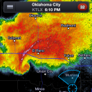
Nws Tulsa area in the cross hairs so far.


