

Quasievil
-
Posts
1,031 -
Joined
-
Last visited
About Quasievil

- Birthday December 2
Recent Profile Visitors
3,313 profile views


-
I have whiplash.
-
This right here is the La Nina effect.
-
GFS is def a touch SE of 06Z
-
Agree. I’m skeptical but only because of how notorious the Miller B types are around here. A west shift would help. Banter-y; my sister is sitting comfortably under a blizzard warning in NJ. Meh.
-
That could be more noise at this point. I do not envy anyone who makes a living having to make the forecast here.
-
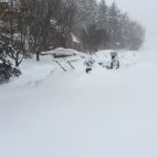
These setups are so worrisome. It smells of January 2010 here. Waiting for the IVT is dicey. We should honestly be very conservative around here, especially with a during the day cutting back on stickage..
-
That's a tucked thing of beauty.
-
Honestly, we're always hunting for max amounts but I would gladly taking this NAM'd result all day long. Starts snowing around 6-7am, still unloading mid+late afternoon with more to come. Simply stunning.
-
Feb 22nd/23rd "There's no way..." Storm Thread
Quasievil replied to Maestrobjwa's topic in Mid Atlantic
I support this message. -
Feb 22nd/23rd "There's no way..." Storm Thread
Quasievil replied to Maestrobjwa's topic in Mid Atlantic
I'm not really sure what's going on around here, did the Euro cave a bit to the GFS? -
Feb 22nd/23rd "There's no way..." Storm Thread
Quasievil replied to Maestrobjwa's topic in Mid Atlantic
CMC still has it tucked off the Chesapeake too. There’s little chance it’s going to happen like this but not sure I’m total Debbie Downer about it. -
Feb 22nd/23rd "There's no way..." Storm Thread
Quasievil replied to Maestrobjwa's topic in Mid Atlantic
Honestly, snapshot this moment. It’s perfectly indicative of how bad the models have been this winter, especially in the mid range. How can you base any forecast off of anything right now? -
Feb 22nd/23rd "There's no way..." Storm Thread
Quasievil replied to Maestrobjwa's topic in Mid Atlantic
Agree. We’ve been Charlie Brown with this football waaaaayyyy too many times. Still, 6z is what model watching is all about. Simply stunning blizzard. -
Feb 22nd/23rd "There's no way..." Storm Thread
Quasievil replied to Maestrobjwa's topic in Mid Atlantic
I know that the GooFuS is drunk but the 6z is pure porno. Obviously, I’m near the Bay so these rates would be insane. The key - Would Be. Still, it’s fun to see this.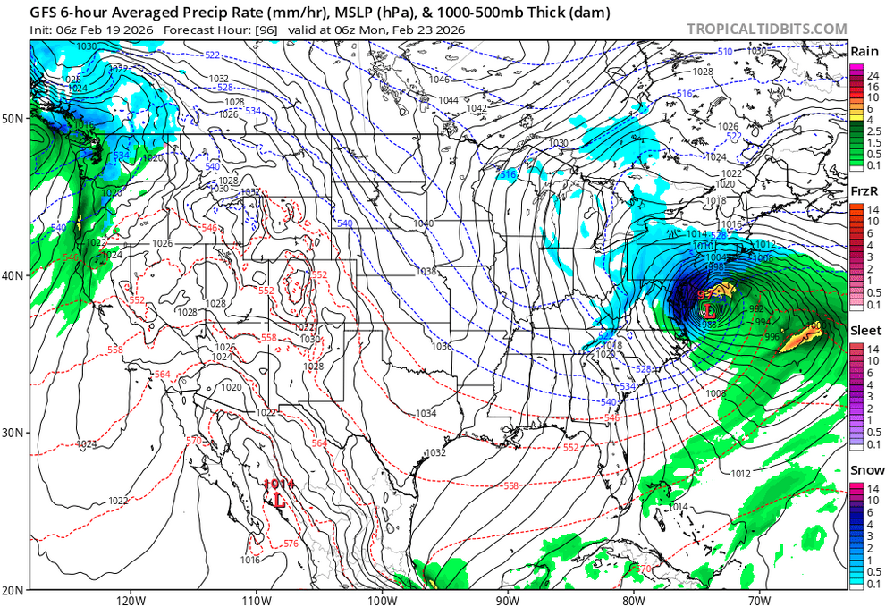
-
Until that’s settled, you can’t trust either of them, IMO.


