All Activity
- Yesterday
-
How cold was June 1876 if there was still ice in Duluth on June 28?
-
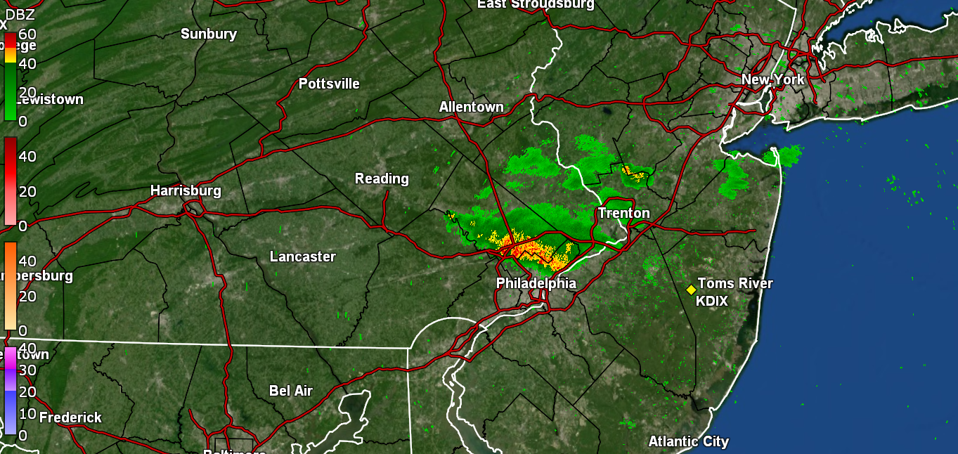
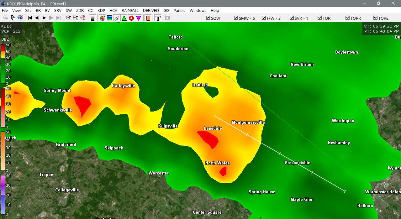
Severe storm moving through Augusta 50 miles away from Scarborough beach.
.thumb.jpg.c4a598100bcba70e87a2f08ce5d79a4c.jpg)
-

E PA/NJ/DE Summer 2026 Obs/Discussion
Hurricane Agnes replied to PhiEaglesfan712's topic in Philadelphia Region
Gully washer here with >2"/hr rates Have 0.67" so far and temp knocked down to 71.
-
I'm going to start before the sun comes up.
-
Where are you headed?
-
Decent shot of heavy rain and some thunder; almost .75” of much needed rain
-
For those of us who work outside, the upcoming heat wave isn't much to get excited about. I hope it's not as bad as it's currently looking.
-
Was out in Hoboken this morning. Very very warm along the waterfront. Got a little sunburnt even more doing yard work. Thursday is going to be brutal. Place to be looks to be Cape May with sea breeze all around.
-
Thank you we'll have to keep an eye beginning on Saturday then I imagine
-
Yes, but don't forget to be specific about the details - where, when, how much or you'll get chastised by vortex. Personally I don't care as I'm on a plane to another world of heat on Tuesday evening.
-
Yep. Was happening in Boston yesterday as well
-
LWX is back up and running
-
Is it supposed to get hot later in the week?
-
0.12” today/Columbia
-
The issue on Friday is that the ridging aloft is still almost right over us w/ very warm 700 mb temps. This is not conducive for convective development as things are capped. Any storms that manage to develop will just collapse on themselves due to very light winds aloft. Sat and after is better for tstms here. You can't treat a single convective parameter in a vacuum and run w/ that. Other things have to be present for tstms to develop and sustain. Using the K-index like this is like saying b/c there is a lot of CAPE, that means there will storms. Many days there is lots of CAPE, and nothing happens for various reasons. For the K-index itself, it is probably best for forecasting heavy rainfall potential as it indicates a solid moist vertical profile 700 mb and below. Also. an axis of higher indices often indicates a boundary present that may not show up on other analyses. K-index though in a solid svr wx environment often is low owning to dry air at mid-levels. Dry air at mid-levels actually tends to be better for svr wx overall as it can mean an EML is present.
- 872 replies
-
- 3
-

-

-
- severe
- thunderstorms
- (and 7 more)
-
don’t waste your keystrokes responding to that troll. he does not post in good faith, never has.
-

E PA/NJ/DE Spring 2026 Obs/Discussion
BBasile replied to PhiEaglesfan712's topic in Philadelphia Region
And on Thursday... GFY ECM.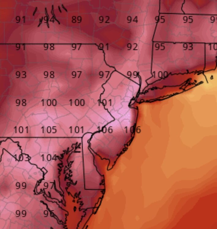
-

E PA/NJ/DE Summer 2026 Obs/Discussion
JTA66 replied to PhiEaglesfan712's topic in Philadelphia Region
Approaching 1.00” -
High of 92 before the rains came. Picked up another 1.02" today from 3 different storms.
-
Pretty much all of falls lake got 1.5-2.5+” today. Currently a flood advisory. Excellent!!!
-
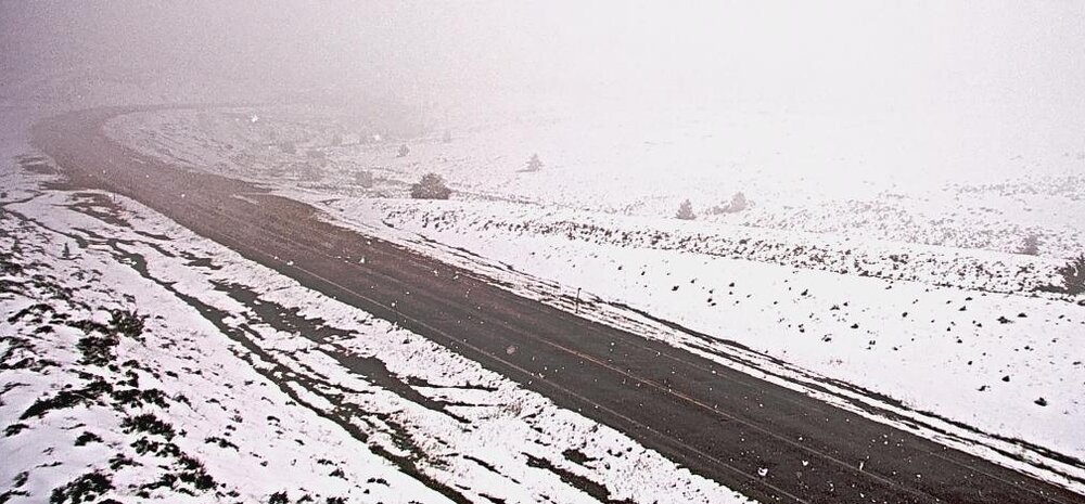
Big Hole Pass, MT, ~7400'
-
https://x.com/TonyPannWBAL/status/2071349776344351200 Tony Pann @TonyPannWBAL Big Boomers over the top of the Heat Dome later this week? Below you'll see a plot of the "K Index" from the Canadian GDPS. It's a measure of T-Storm potential. Anything 40+ is good. You can see the bullseye (red) on Thursday is well North of MD. By Friday, that 40+ zone sinks into MD. Stay tuned...
-

E PA/NJ/DE Summer 2026 Obs/Discussion
Birds~69 replied to PhiEaglesfan712's topic in Philadelphia Region

-

2026-2027 Super El Nino
LakePaste25 replied to Stormchaserchuck1's topic in Weather Forecasting and Discussion
Where are you seeing an EWB? Do you have any charts showing it? -
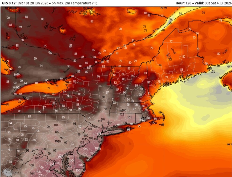
I have been looking at the GFS and Euro on Weatherbell. The maximum 6 hour temperatures for later this week. Lots of 100 to 105F in the major cities. Ouch, a 108F in DC. I think this is the day of maximum heat but Boston cools down with a seabreeze. Also of note but I didn't post is the crazy minimums in some of the major cities. It's going to be tough to get down below 80F in places like NYC to DCA.


.jpg.3f6f02df1fbea90af81824d597c8e1d1.jpg)