All Activity
- Past hour
-

2026-2027 Record-breaking El Nino
EasternLI replied to Stormchaserchuck1's topic in Weather Forecasting and Discussion
I've learned a great deal about the MJO over the years. Because I view it as an important phenomenon but also didn't like relying on others for real updates. I wanted to know more than what the simple phase space diagrams can offer. This is a challenging year to be trying to follow the MJO. Need to be able to dig into it a little deeper to really see what's going on with it. Or to even see it at all. Like I mentioned earlier in the thread, the RMM charts can be misleading sometimes. This year is one of those times. The following from the CPC global tropics discussion also points that out, updated yesterday: https://www.cpc.ncep.noaa.gov/products/precip/CWlink/ghaz/index.php "The Madden Julian Oscillation (MJO) has continued a pattern of constructive and destructive interference with the El Nino low-frequency base state over the past few months as the El Nino signal has strengthened. Over the past week, the RMM-based index showed the MJO intensifying as it moved through the Maritime Continent and into the Western Pacific (Phase 6) where it once again began to constructively interfere with El Nino. The MJO signal has now reached a stronger amplitude than the last time it emerged in Phase 6, back in late June when the El Nino signal was superimposed on the enhanced phase of the MJO. Upper-level velocity potential anomalies over the past week show a weak MJO signal farther west moving through the Indian Ocean, suggesting that the strong El Nino background state may be distorting the position of the MJO in RMM-space. With this ongoing constructive interference with the El Nino base state, RMM-based forecasts keep the MJO signal over the Western Pacific (Phase 6) for the next two weeks. Although consistent with phasing, models are split on the amplitude of the signal, with the ECMWF and CFS predicting a robust MJO over the next week and the GEFS maintaining a weaker signal. During Weeks 2 and 3, the GEFS begins to amplify the signal and maintains a strong MJO, while the ECMWF shows a weakening signal moving into the unit circle. By the end of week-3, the models agree on the signal moving into Phase 7. Over the next four weeks, the upper-level velocity potential anomalies show a stationary wave-1 pattern with the enhanced divergence envelope remaining over the Eastern Pacific. However, eastward propagation of the MJO signal can be seen in the wave filtering, showing the signal propagating from the Indian Ocean into the far Eastern Pacific." -
 mexican medicine store: Mexi Safe Rx - international pharmacy
 -

Central PA Summer 2026 Discussion/Obs Thread
canderson replied to Voyager's topic in Upstate New York/Pennsylvania
About 11.5” more than me lol -
88/71 split today with dews in the 50's.
-

Augdewst 2026: Summer's Last Stand
Snowedin replied to Prismshine Productions's topic in New England
So uh when are we going to get this hazy, smoky sky outta here? I can barely make out that little ball of happiness that’s supposed to be bright and shiny this time of year. -
Interesting tidbit concerning are warmer winters for our sub, and also how they panned with 2.0+ ENSO index. Strong El Nino 's (2.0+) with DJF anoms for our sub. Index starts 1950. 1965/66: 3.916/-2.95/0.602 (0.523) 1972/73: -1.79/2.231/0.517 (0.319) 1982/83: 3.654/2.22/ 3.322 (3.065) 1991/92: 1.032/2.588/3.181 (2.267) 1997/98: 2.367/3.004/6.436 (3.936) 2015/16: 6.008/1.142/2.196 (3.115) Top 10 winters with index (if known). 2023/24 (4.902): 5.682/2.796/6.229 (1.4) 1877/78 (4.689): 6.14/3.006/4.92 (unknown but probably a strong El Nino from NOAA SST data) 1931/32 (4.282): 4.771/5.141/2.935 (unknown but probably neutral conditions from NOAA SST data) 1997/98 (3.936): 2.367/3.004/6.436 (2.3) 2001/02 (3.920): 3.974/4.306/3.479 (-0.3) 2011/12 (3.404): 2.882/3.288/4.043 (-1.0) 1881/82 (3.151): 3.666/1.095/4.692 (unknown but probably neutral conditions from NOAA SST data) 2015/16 (3.115): 6.008/1.142/2.196 (2.3) 1918/19 (3.068): 3.724/3.617/1.864 (unknown but probably a moderate El Nino from NOAA SST data) 1982/83 (3.065): 3.654/2.22/3.322 (2.4)
-
https://forecast.weather.gov/product.php?site=lwx&issuedby=LWX&product=PNS
-
(002).thumb.png.6e3d9d46bca5fe41aab7a74871dd8af8.png) Hi Mike I did of course supply all of the above information to Claude to ensure we got a useful result! As you know homogenization remains nothing more then a hypothesis-driven statistical correction, it is of course not a measurement. Pairwise algorithms like PHA infer breakpoints from neighbor differences, and when 44 of 51 Berkeley breakpoints at Chesco stations are a code 4 meaning empirically detected, with absolutely no metadata backing, that's an algorithm asserting station changes that are clearly not able to be documented. That is a legitimate target for scrutiny, it is not fringe skepticism. My finding that the adjustment series itself carries a significant linear time trend (r² 0.34–0.67) is the greatest point I have — a correction for discrete, random station artifacts shouldn't behave like a smooth ramp as these adjustments do!
Hi Mike I did of course supply all of the above information to Claude to ensure we got a useful result! As you know homogenization remains nothing more then a hypothesis-driven statistical correction, it is of course not a measurement. Pairwise algorithms like PHA infer breakpoints from neighbor differences, and when 44 of 51 Berkeley breakpoints at Chesco stations are a code 4 meaning empirically detected, with absolutely no metadata backing, that's an algorithm asserting station changes that are clearly not able to be documented. That is a legitimate target for scrutiny, it is not fringe skepticism. My finding that the adjustment series itself carries a significant linear time trend (r² 0.34–0.67) is the greatest point I have — a correction for discrete, random station artifacts shouldn't behave like a smooth ramp as these adjustments do!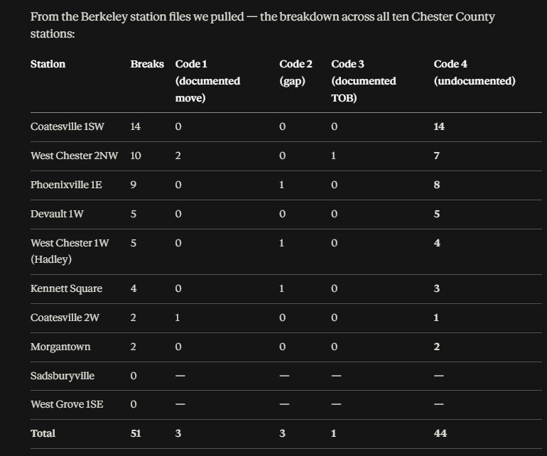
-
That's a long way off to determine anything weather wise. Even with a crystal ball. Tbizz has canceled many a vacation on speculation. Never seems to work out as he planned.
-

Augdewst 2026: Summer's Last Stand
VivaManchVegas replied to Prismshine Productions's topic in New England
We would be coming home on Tuesday. We have a place up there so I avoid Sunday afternoon or holiday traffic like the plague. -

Augdewst 2026: Summer's Last Stand
Cyclone-68 replied to Prismshine Productions's topic in New England
Just my little contribution but the traffic that weekend (Labor Day) up there can be insane -
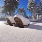
Is that your yard or a Garden Center?
-
Yes, the criticism has been rife. Most armchair ppl were calling it out b/c of what KLWX radar showed. They failed to account for TBWI radar! Many of these kind of QLCS spin-ups are low-level, and if the radar is not close (say within 30 mi), it can overshoot the solid low-level rotation. QLCS tors are *far* more common than once thought. They account for 20% of all tors now.
-
Augdewst 2026: Summer's Last Stand
VivaManchVegas replied to Prismshine Productions's topic in New England
I don't think I have done this before, but I need a little help. I got a choice of two weekends to take some time off and make them long. I can do both but my significant other is trying to schedule something. Location is a little north of Bangor Maine. Its either the weekend before Labor day or labor day weekend. Right now the weekend before looks like a washed out mess. Decision time is Friday of this week. I think I am going to roll the dice and go with Labor Day. Anyone want to share their crystal ball? -

Augdewst 2026: Summer's Last Stand
Brewbeer replied to Prismshine Productions's topic in New England
Wow, what a find. Absolutely the quietest place I’ve ever been. Dead silent at night. I recommend. -
NWS confirmed tornado Monday afternoon near Dundalk. EF0. All those poor armchair Mets from Twitter saying the TOR warning was wrong
- 1,886 replies
-
- 2
-

-
- severe
- thunderstorms
- (and 7 more)
-
https://mexisaferx.com/# mexican pharmacies that ship to us
-
Augdewst 2026: Summer's Last Stand
backedgeapproaching replied to Prismshine Productions's topic in New England
Missed the core of that cell by about a mile or two..decent outflow gusts, thats about it. As its departing SE.._compress59.thumb.jpg.d06d96afeef6961ec770684fb5d60780.jpg)
-

Augdewst 2026: Summer's Last Stand
Damage In Tolland replied to Prismshine Productions's topic in New England
How will tonight screw everyone except W and SW CT? -
Best time to travel in Alaska is in September just after labor day. No mosquitos!
-

Augdewst 2026: Summer's Last Stand
vortex95 replied to Prismshine Productions's topic in New England
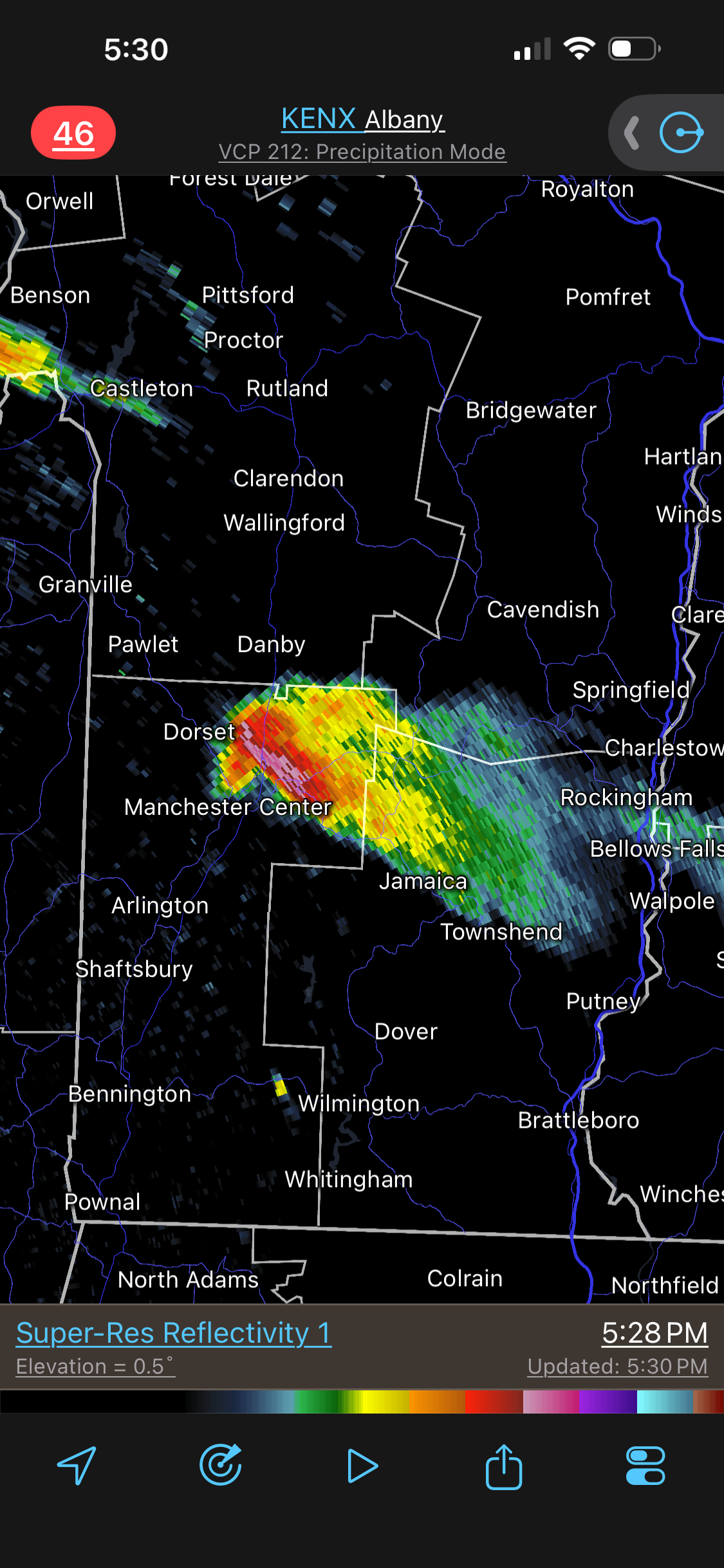
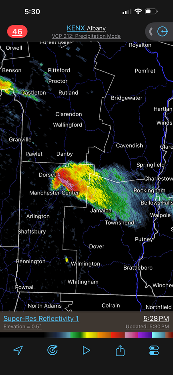
Can @weatherwiz see the CB from his place??? Clear as a bell to the N! No warning on this? Strong hail core. White VIL on Radarscope means svr almost for sure. Obviously a supercell, and 90% of all supercells produce some form of svr wx.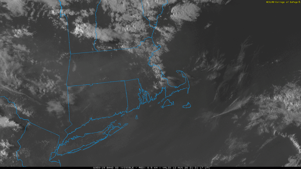
- Today
-
.thumb.gif.f92b16c631a1d15d405ed77b33f0710d.gif)
Augdewst 2026: Summer's Last Stand
Torch Tiger replied to Prismshine Productions's topic in New England
Nice supercell in S VT -
Not saying its gonna go down like this (wrt HL blocking), but the last time it developed early in winter and became a sustained feature was 2009-10. Started as a Scandi h5 ridge then evolved into a legit west-based -NAO. We know what happened from there.
-
Strangely comfortable today 86F/53%, light breeze from the North We've been missing the rain lately, just another half inch of rain last weekend, bringing August to 1.0".
-
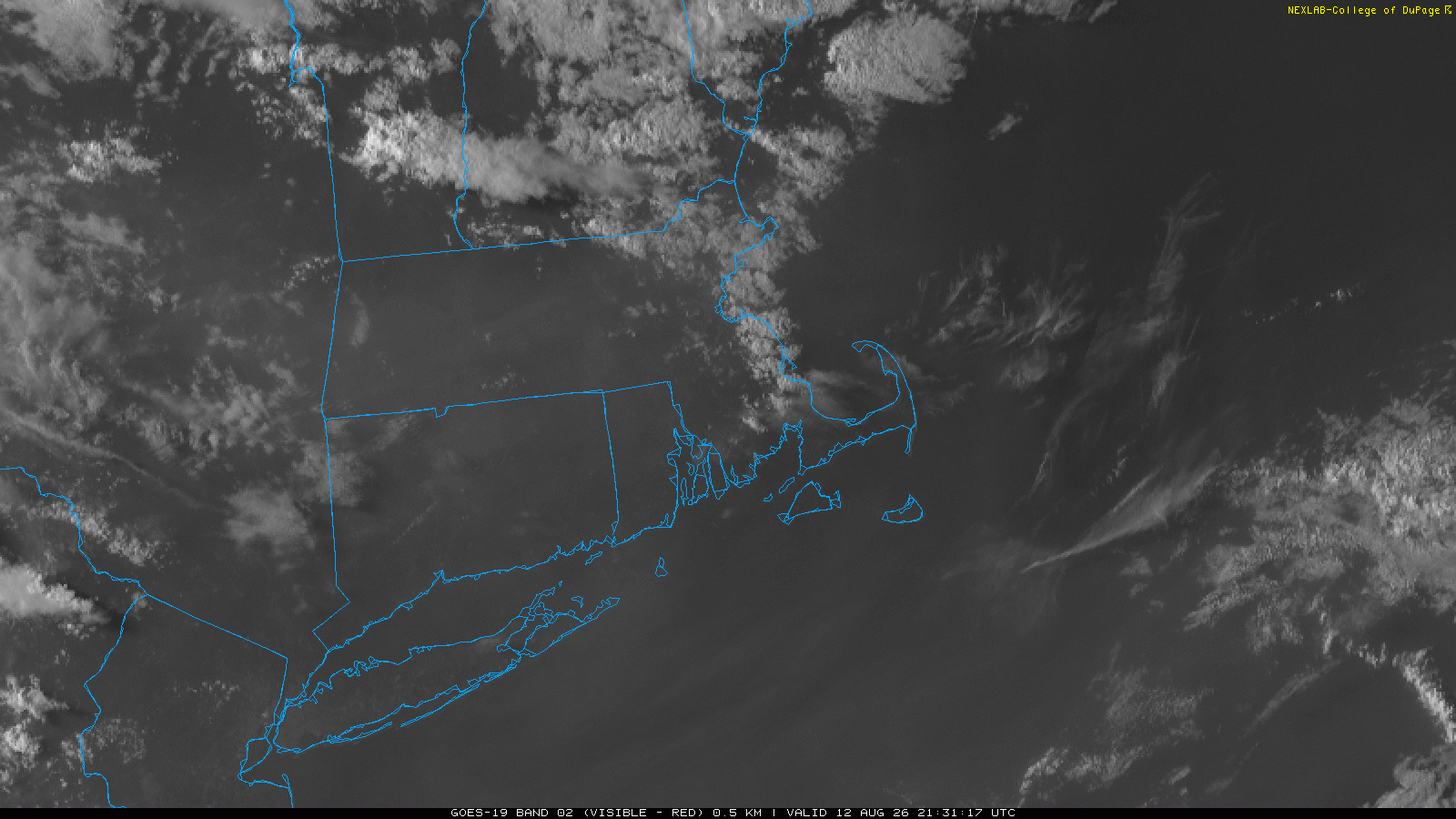
Very few perfectly clear areas that did not have smoke or clouds muddying the signal, but yes! Federalsburg on the eastern shore was about the best.








_compress59.jpg.176be5c845c8831e1c6803bd5a89a740.jpg)