All Activity
- Past hour
-
Wow. That is crazy only being maybe 3-4 miles away
-
Not enough shear so if it isn't on top of you it won't make it.
-
51 here
-
it happened again the same evening. woo storms!
-
 It almost looks like a TUTT with perhaps a sputtering TD underneath. TUTT are not and anticyclonic outflow over top - opposite. What's interesting about that is that TUTT's are often a part of TC evolution. But, they are near-by ... not directly overhead. The near-by model: The mechanism/relationship there is that their circulation proximity pulls an outflow channel which improves the mass-restoring inflow potential and the TCs gets a boost. It's like a pulsar and star and the pulsar siphoning material off the star, and it flows into an accretion disk. But in this case the TUTT is over top. No channel. I'm not sure that's what is happening here but the general CB exhaust motion doesn't inspire anticyclonic U/A has been established very well, and in fact, the deeper object motion is slowly cyclonic about a broadly defined axis.
 -
This will be a rare occasion that a dense smoke plume prevented 100°+ heat and higher departures.
-
 This Gulf system is absolutely crap
 -
 46.6F this morning. Yeesh. bring me some 90s please.
 -
Seems to be trending a bit north today with less of a time window over water. Probably only gets to minimal TS at this point. Satellite appears to be showing more northerly shear today as well
-
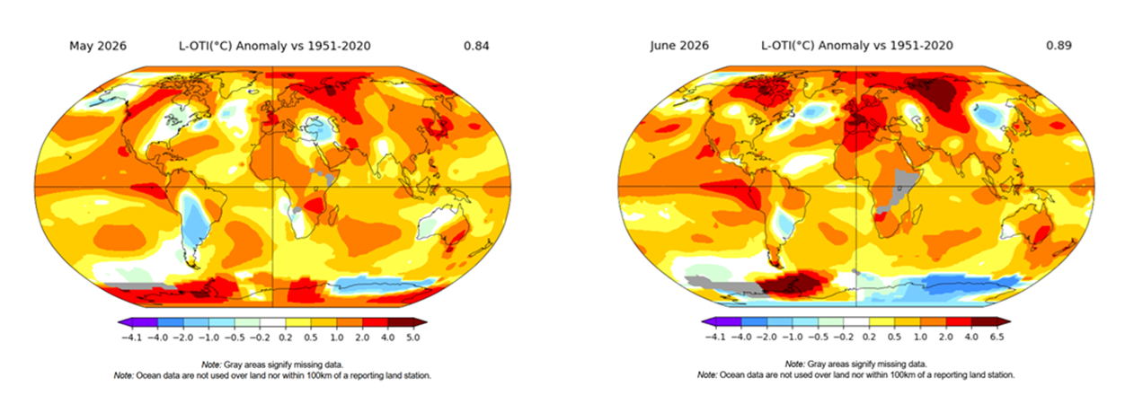
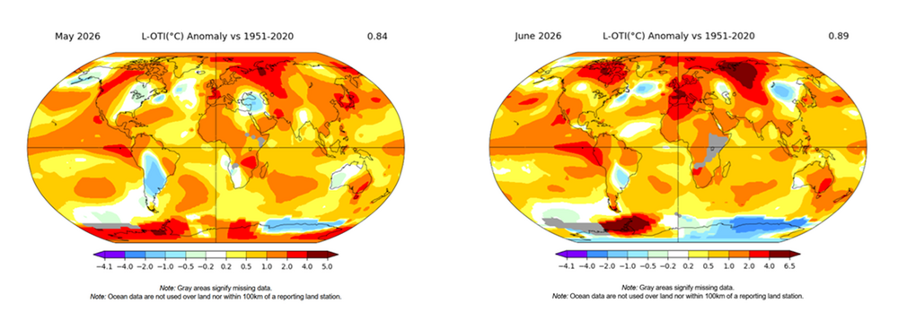
Nice condensed way to put that ... ...I've also been impressing upon this phenomenon myself since last October... 7 or so of the last 9 months have have been cooler relative to the planetary seemingly fixed hot spots, yet still warmer than normal relative to our own climate means. Relativity is baking people's perception, perhaps. We base our impressions on a combination of sensible experiences over the time... mixed up with "group theory"- haha. But, here's an example of May and June per NASA's GIS tool - granularity and so forth, notwithstanding. Clearly there is a preferential/bias to result cooler over eastern mid latitude N America, than it is ( again ... relative to climate) N-S-E-W and abroad. But combining sensible experience with headlines that rarely include our region when it comes to warmth ... it's a bit obfuscating/false impression making - maybe. Anyway, we're above normal, just not as much. There are a few other cooler nodes as one can clearly see ... I haven't been paying as close attention to those in all honesty - preoccupied by how warm enthusiasts are being tormented locally ( haha). I wouldn't be shocked however if these are "geological resonant feedback" regions. In other words, wholesale planetary factorization 'sort of' fixing those cool vs warm regions. Some of that's got to be true. I mean, the perennial N/A pattern ( PNAP ) has a flat ridge west, nadir-ing flow east, as the westerlies impinge on the western N/A cordillera ... forced up and over, and then Coriolis bends the flow into NVA... etc.. But, that does probably contribute to why our "heat domes" are too transient to be part of the cool kids. Something like that could be normal elsewhere.
-

Central PA Summer 2026 Discussion/Obs Thread
canderson replied to Voyager's topic in Upstate New York/Pennsylvania
57 here. What a great morning. -
I just watched Jim Cantory say that it seems to be trending more towards a LA landfall. That's more in our wheelhouse for remnant moisture than Texas. That will just mean Frederick and Glen Burnie get flash flooding lol
-
Almost expect to wake up to one of those every day right now. Since it started we haven't missed a day yet. Hoping some day this week will not have an air quality alert!
-

Central PA Summer 2026 Discussion/Obs Thread
Superstorm replied to Voyager's topic in Upstate New York/Pennsylvania
56F low in Lancaster. . -

Central PA Summer 2026 Discussion/Obs Thread
mahantango#1 replied to Voyager's topic in Upstate New York/Pennsylvania
53 here this morning. -
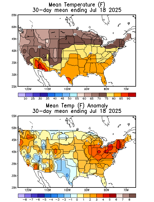
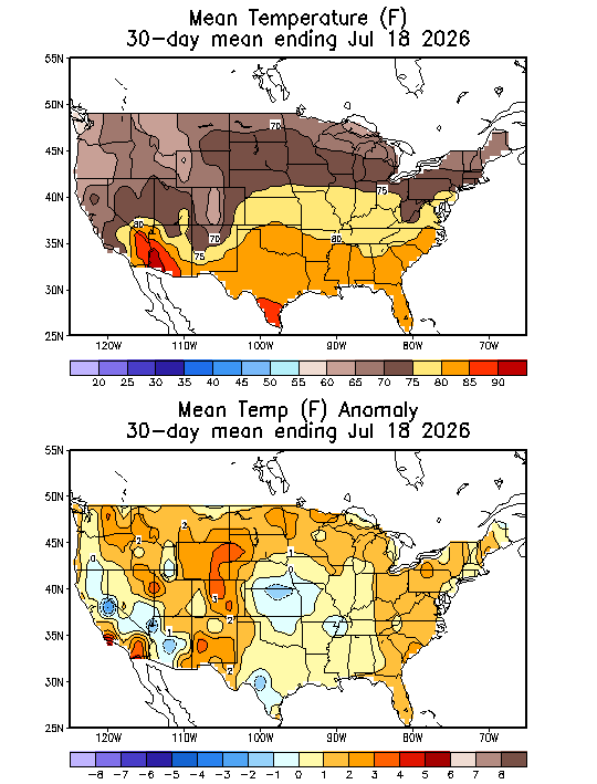
 Yeah unless we’re getting 10” of rain in a month and a bunch of 60-70° ratters it’s tough to pull off BN summer months now…even with 1991-2020 normals. CON had 14 mins in the 40s or colder in July 1965 and an extreme of 35°. That’s hard enough for SLK to pull off today.
 -
not much has changed on this front
-
Point/click has my rain chances for tonight through Wednesday night of 60%, 70%, 90%, 80%, 80%. I'm calling it now: less than 0.2 total and a total whiff wouldn't surprise me. Too bad that new depression in the Gulf is expected to move west towards Texas. A tropical system up the coast is the only way I can think of that would get real rain here.
- Today
-
Seems like Upton is discounting the widespread regional flood threat for tomorrow and Wednesday. Thoughts ? AFD from KOKX
-
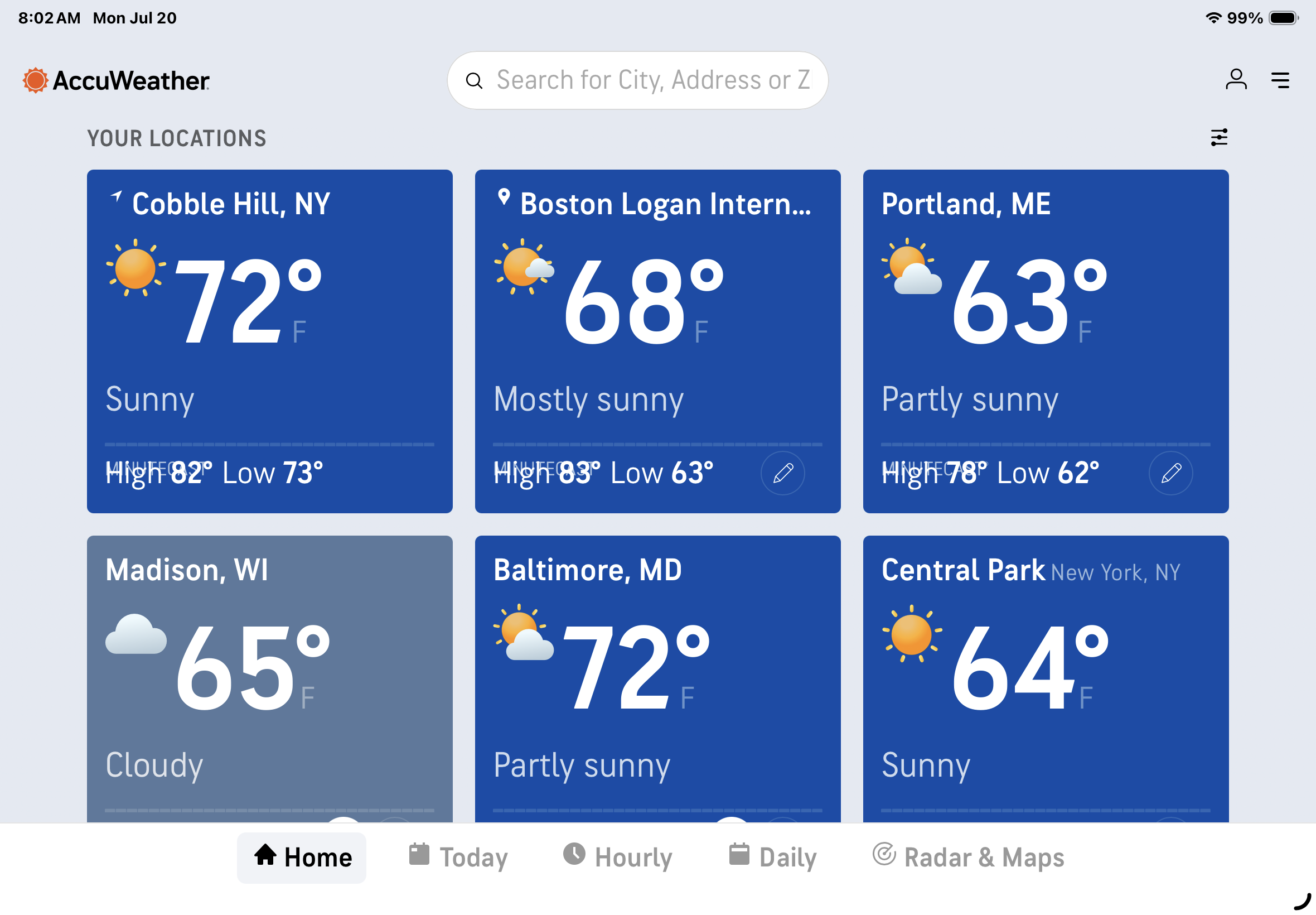
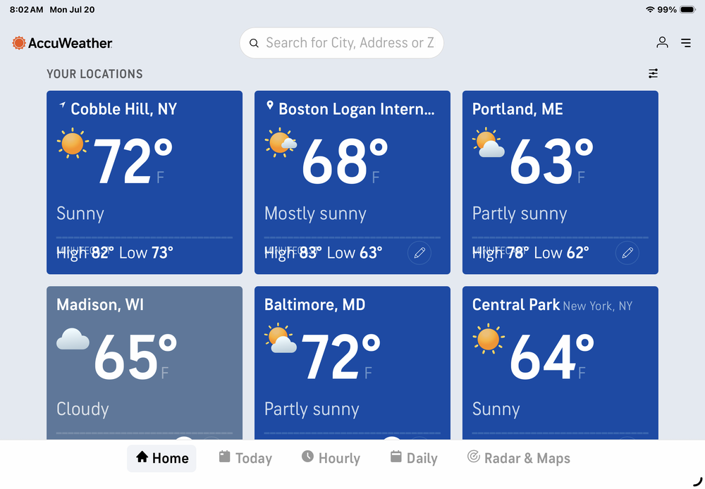
72 in my UHI blessed Brooklyn postage stamp as opposed to 64 at Central Park, probably due to natural air conditioning. As always …
-
 Gardeners and farmers don’t forget the year ago pattern. It’s imprinted on us like a scar. A few of us here fit that mold.
 -
If you want to make a cogent background warming argument it’s that we have BN persistence in the northeast but N to AN tendency.
-
Highly doubt that persists through winter.
-
 The season is not record hot/cold until it's over. Let's' see how the remainder plays out.