All Activity
- Past hour
-
Not much changed in the 18z NAM at the end though it is a tax colder.
-

January 24-26: Miracle or Mirage JV/Banter Thread!
mappy replied to SnowenOutThere's topic in Mid Atlantic
You think having unlimited reactions would be a mod perk amirite? -

January 25/26 Jimbo Back Surgery Storm
Upstate Tiger replied to Jimbo!'s topic in Southeastern States
NAM surface at 75
-

Possible Record Breaking Cold + Snow Sunday 1/25 - Tuesday 1/27
NEG NAO replied to TriPol's topic in New York City Metro
there is a banter thread and I think debating opinions is fine - but draw the line at trying to bully someone telling them to stop posting or name calling -

Possible Record Breaking Cold + Snow Sunday 1/25 - Tuesday 1/27
allgame830 replied to TriPol's topic in New York City Metro
Who's right on the edge.... central NJ or the city or LI..... I'm 30 miles north of the CITY. So explain who you mean by WE ARE? -

Possible Record Breaking Cold + Snow Sunday 1/25 - Tuesday 1/27
eduggs replied to TriPol's topic in New York City Metro
The GFS has not been good lately relative to the Euro, CMC, and UKMET. I don't trust it at all, especially when it's an outlier. I like the ECM-AI as a model - it's a little less amped than the other 3 so it gives me some encouragement. -
and 78
-
72 18z NAM
-
Slightly flatter look so far. Everything helps
-

Richmond Metro/Hampton Roads Area Discussion
Ephesians2 replied to RIC Airport's topic in Mid Atlantic
NAM is going to be at least a SLIGHT improvement from what I've seen in the main thread -
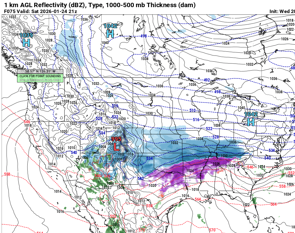
 If the 0 degree line is hugging LI like that very good chance some sleet makes it into NYC/LI and even southern Westchester and Coastal CT. The models other than the NAM tend to underestimate sleet.
 -

January 2026 regional war/obs/disco thread
tiger_deF replied to Baroclinic Zone's topic in New England
Ah that makes much more sense! So there's no slick editing team in the background "He's describing the convective potential - scroll a few times to the left or else he'll be pointing at the ocean. Wait now he's talking about to the warnings in Chelmsford, quick someone get that on stat!" Not anymore... I started lurking here when I was 10, 24 now. Hard to believe it's been over half my life. -

January 25-26 Winter Storm Potential
PhiEaglesfan712 replied to Ralph Wiggum's topic in Philadelphia Region
This would be almost like the January 2022 storm. I'll gladly take this and run. -

Winter 2025-26 Short Range Discussion
hawkeye_wx replied to SchaumburgStormer's topic in Lakes/Ohio Valley
We only have 0.5-1.0" on the ground. -
Remember if you get a bad model run: 1. When is sampling? 2. That model has been terrible this season. 3. It has bias in that direction. 4. It injected bad data. 5. Point out the one run in the ensembles that buries you. feel free to add
-
This run is south of last run I believe will wait for the end.
-

Possible Record Breaking Cold + Snow Sunday 1/25 - Tuesday 1/27
SACRUS replied to TriPol's topic in New York City Metro
18z -
You have trails closed up there?
-
So far, looks slightly flatter out front and better confluence if anything
-
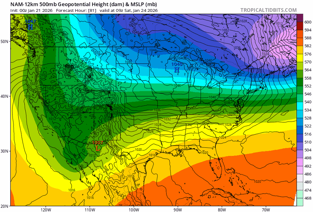
Chuck was comparing the 18z NAM to the 12z GFS, which is apples to oranges IMO but he isn't looking at what the rest of us are looking at...which explains the "what is he seeing" stuff. The 18z NAM is less phased and has more confluence in front than the 12z NAM through 60 hours.
-
Possible Record Breaking Cold + Snow Sunday 1/25 - Tuesday 1/27
allgame830 replied to TriPol's topic in New York City Metro
Its the same with every storm, nothing is going to change this go around! -

“Cory’s in LA! Let’s MECS!” Jan. 24-26 Disco
Winter Wizard replied to TheSnowman's topic in New England
I would consider the Euro to be the upper limit of this...IF everything aligns there potential would be there for most of the sub to see a foot+, just not sure where. My main concern would actually be dry slotting and a potential messy handoff between the initial low and the coastal. -
Still at 69hrs
-

January 24-26: Miracle or Mirage JV/Banter Thread!
WxUSAF replied to SnowenOutThere's topic in Mid Atlantic
I’ve used up all my reactions for today! I expect this to probably continue through Monday? -
Don’t love that high placement. .