All Activity
- Past hour
-

Winter 2025-26 Medium/Long Range Discussion
mimillman replied to michsnowfreak's topic in Lakes/Ohio Valley
Looks like an angry Pacific and some soakers in our future -
Soundings in Russell county for tuesday night.
-

MO/KS/AR/OK 2025-2026 Winter Discussion
JoMo replied to stormdragonwx's topic in Central/Western States
Can't believe it's been 15 years since the Blizzard of 2011. -
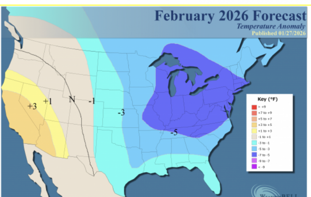
WxBell is cold in the E in general and downright very cold in the NE for Feb. Eric Webb has also had cold E US thoughts for quite awhile though I haven’t seen an actual Feb map from him. Any opinions?
-

February 2026 Medium/ Long Range Discussion: Buckle Up!
high risk replied to Weather Will's topic in Mid Atlantic
Saturday looks brutal, with temps in the mid to upper teens and sustained winds in the 20-30mph with higher gusts. -

Winter cancelled/uncancelled banter 25/26
Stormlover74 replied to Rjay's topic in New York City Metro
Born on groundhog day? -
Ya... I know that case study by heart. No one is perfect
-
WxUSAF's weak ass frontal passage thing.
Imgoinhungry replied to dailylurker's topic in Mid Atlantic
Gfs south and dry. Guess thats why this convo went crickets. . -
Have you looked at the ncsu analysis on that storm?? Theres no way Vale got 70 inches of snow [emoji23][emoji23] .
-
Below 0 temps possible next weekend with that setup
-

February 2026 Medium/ Long Range Discussion: Buckle Up!
Amped replied to Weather Will's topic in Mid Atlantic
Both the GFS and the CMC develop strong Gulf of Alaska lows in the day 8-10 time frame. Better hope that doesn't happen or its gonna be a Pac Torch. -
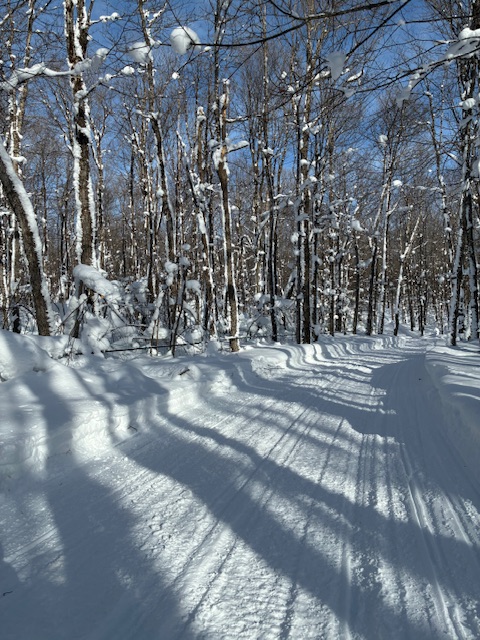
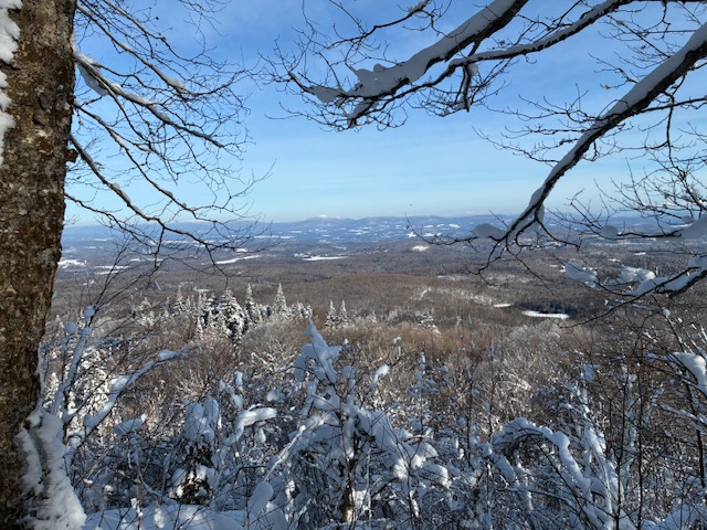
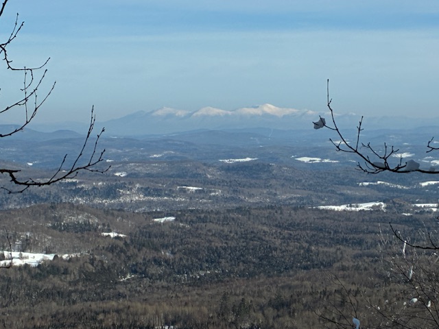
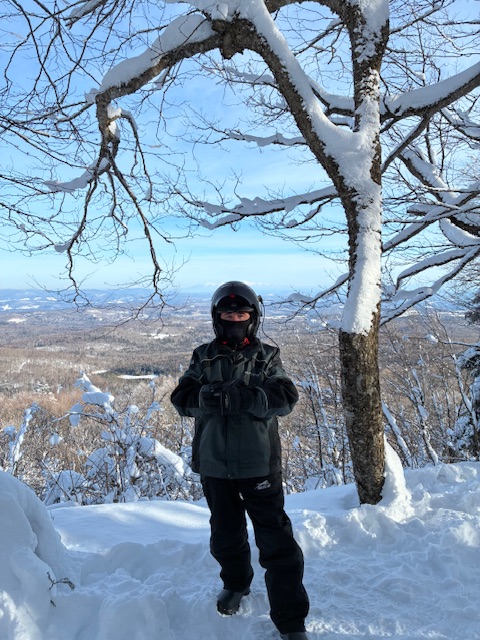
Went riding in the Danville-Walden-Hardwick area today. Truck thermometer read -8° as we drove to our starting point. Lots of snow, especially above 2000’ around Cole’s Pond. Some of you may remember the old Cole’s Pond weather cam and may remember how much that would show. Did a lot of exploring in northeast VT this weekend. Winter in full effect.
-
Praying for your family Stealing this. Welcome!
-
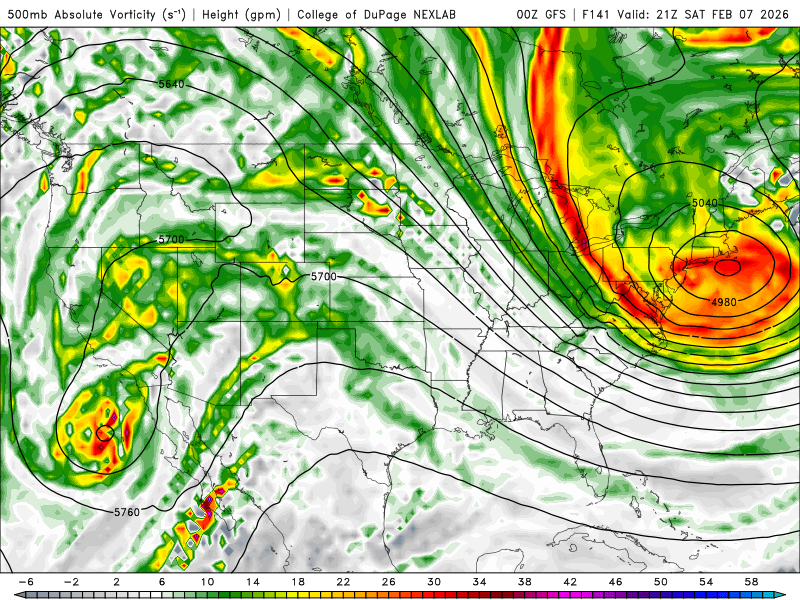
Here's end of 0Z Run 12Z Thursday.
-

Jan 30th-Feb 1st ULL/Coastal Storm Pics Thread
SouthboundYank replied to DTP's topic in Southeastern States
Thx for sharing the great pics, y'all...here's a video from just before 8:30 last night. Will post a few more stills from the storm and aftermath in the morning. -

Mid-Long Range Discussion 2026
WinstonSalemArlington replied to BooneWX's topic in Southeastern States
-
Rgem still showing possibility for SWVA.
-
The AIGFS has 1-1.5" liquid total for its run across our region. Almost all rain
-

Jan 30th-February 1st 2026 Arctic Blast/ULL Snow OBS Thread.
John1122 replied to John1122's topic in Tennessee Valley
Sitting at 5 as midnight approaches. Big full moon and snow makes it look practically like dawn outside instead of midnight. -
not every day you see something like this
- Today
-
Wife is in labor Winter baby!
-

Jan 30th-February 1st 2026 Arctic Blast/ULL Snow OBS Thread.
GBOVolz replied to John1122's topic in Tennessee Valley
Got a snow shadow a few minutes ago for @Holston_River_Rambler is I believe who mentioned pics before. . -
Yes, I know that . I'm saying the possibility at onset or ending as Snow in basically the SWVA Part of the Great Valley as the Euro and RGEM indicated earlier. Black Mountain and High Knob Massif Area.
-

E PA/NJ/DE Winter 2025-26 Obs/Discussion
snowwors2 replied to LVblizzard's topic in Philadelphia Region
Here too last nite…after my -6.8° early Saturday morning, I only mustered a +6.8° early Sunday am…Are my naysayers doubting that reading also…REMINDER~NOT PHILLY TINICUM‼️ -
Not to mention he looks like a retard


