All Activity
- Past hour
-
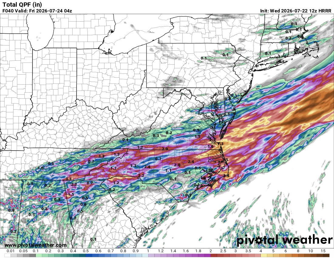
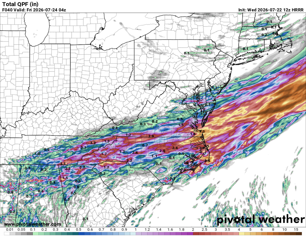
For all but Guilford county perhaps
-
The extreme Arctic warmth during recent summers has been focused more on the Atlantic side. This has left the Pacific sector under relatively better conditions. The circulation shift since 2013 has allowed the September average extent to average in the 4.1 to 4.9 million sq km range.
-
Do you guys think those showers make it to the city?
-
I’m calling the formation of Bertha as another MJO phase 8 related pattern recognition win for Joe Bastardi in addition to Arthur.
-
 73/66F Well there goes that. After another shower last night the grand total from this system looks to end at .36". The showers and storms forming are south and east of my location. Unless something happens to the west it looks like this is it. Thoughts Brian? Hope to make 1" for August!
 -
 Nah I’m just building up resistance now
-

Spring/Summer 2026 Pattern Discussion Thread
John1122 replied to Carvers Gap's topic in Tennessee Valley
The band of rain set up south of my area. Looks like 3-5 inches around that area and less than .5 here. Not too upset by that, too much rain here already lately. -

2026 Mid-Atlantic Severe Storm General Discussion
WEATHER53 replied to Kmlwx's topic in Mid Atlantic
You have been great to provide these last two discussions to me -
 There's a cure
 -
Ankle deep water. If SUCKDD
-
Lol f off
-
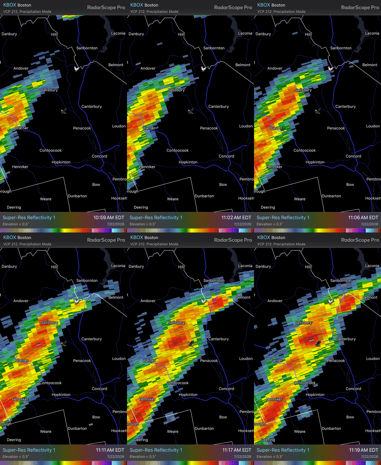
 Looks like we pour here soon.. but meh overall
 -
BULLETIN Tropical Storm Bertha Advisory Number 13 NWS National Hurricane Center Miami FL AL022026 1000 AM CDT Wed Jul 22 2026 ...CENTER OF BERTHA WOBBLING SOUTH OF THE MISSISSIPPI COAST... ...TROPICAL STORM CONDITIONS EXPECTED WITHIN THE WARNING AREA THROUGH TONIGHT... SUMMARY OF 1000 AM CDT...1500 UTC...INFORMATION ----------------------------------------------- LOCATION...29.8N 88.6W ABOUT 40 MI...65 KM S OF PASCAGOULA MISSISSIPPI ABOUT 55 MI...90 KM NNE OF THE MOUTH OF THE MISSISSIPPI RIVER MAXIMUM SUSTAINED WINDS...50 MPH...85 KM/H PRESENT MOVEMENT...WNW OR 290 DEGREES AT 6 MPH...9 KM/H MINIMUM CENTRAL PRESSURE...998 MB...29.47 INCHES Tropical Storm Bertha Discussion Number 13 NWS National Hurricane Center Miami FL AL022026 1000 AM CDT Wed Jul 22 2026 Bertha's satellite presentation has continued to degrade this morning, with all of the associated deep convection having been pushed well to the southwest of the exposed surface center due to strong deep-layer shear. That said, dropsonde data from NOAA and Air Force Reserve Hurricane Hunter aircraft indicate that the central pressure has changed very little from the previous advisory. The NOAA aircraft measured a peak 750-mb flight-level wind of 55 kt several hours ago, which equates to an initial intensity of 45 kt. More recent aircraft data suggest those winds may have decreased, but for now we'll continue to hold 45 kt in anticipation of additional aircraft and scatterometer data over the next few hours. Bertha's center has been deviating a bit north of the forecast track, and the current motion estimate is now 290/5 kt. Track model guidance insists that Bertha should resume a westward motion today, but wobbles and deviations like the current one are normal behavior for such a highly sheared tropical cyclone. Once a westward motion resumes, Bertha's center is likely to straddle the coast of Louisiana through Thursday and then reach the upper Texas coast by Thursday evening or night. The NHC track forecast lies along the northern edge of the guidance suite, partially to account for the recent northward jog and partially to closely follow the typically reliable HCCA and GDMI guidance. The expected weakening appears to be on the verge of starting, and the main question for the forecast is how quickly will Bertha lose intensity. Part of that equation is how much time the center will spend over land, while the system also continues to contend with strong northeasterly shear. The NHC intensity forecast maintains Bertha as a minimal tropical storm through 36 hours (around the time of a potential Texas landfall), but it's also possible that the cyclone could weaken to a depression or remnant low by that time. Like the track forecast, the intensity forecast is largely a blend of the latest HCCA and GDMI guidance. A remnant low forecast point is shown over Texas at 48 hours for continuity's sake, but Bertha could have dissipated by that time. FORECAST POSITIONS AND MAX WINDS INIT 22/1500Z 29.8N 88.6W 45 KT 50 MPH 12H 23/0000Z 29.6N 90.3W 40 KT 45 MPH...INLAND 24H 23/1200Z 29.5N 92.7W 35 KT 40 MPH...OVER WATER 36H 24/0000Z 29.4N 95.5W 35 KT 40 MPH...INLAND 48H 24/1200Z 29.0N 98.7W 25 KT 30 MPH...POST-TROP/REMNT LOW 60H 25/0000Z...DISSIPATED $$ Forecaster Berg
-
Yeah it is nice to have no AC running.
-

E PA/NJ/DE Summer 2026 Obs/Discussion
Chief83 replied to PhiEaglesfan712's topic in Philadelphia Region
Worcester, PA with a swing and a miss with a 0.05 for the day (Tuesday). -
The newer CMIP6 models place more importance on winter temps and the Atlantic front going forward. This year is a good example of that. Pretty good conditions present on the Pacific front, but the Atlantic front is weak enough to place the CAB near record lows with continental heat placing the CAA near record lows too. I keep expecting us to hit a wall here on extent (and we probably still will). However we may also get a decent late season run since there's still quite a bit of ice left to melt at lower latitudes in the Pacific. Regardless, I would not expect anything flashy until later next season or during the fall refreeze in '27. That's when big +ENSO tends to have an outsized effect.
-
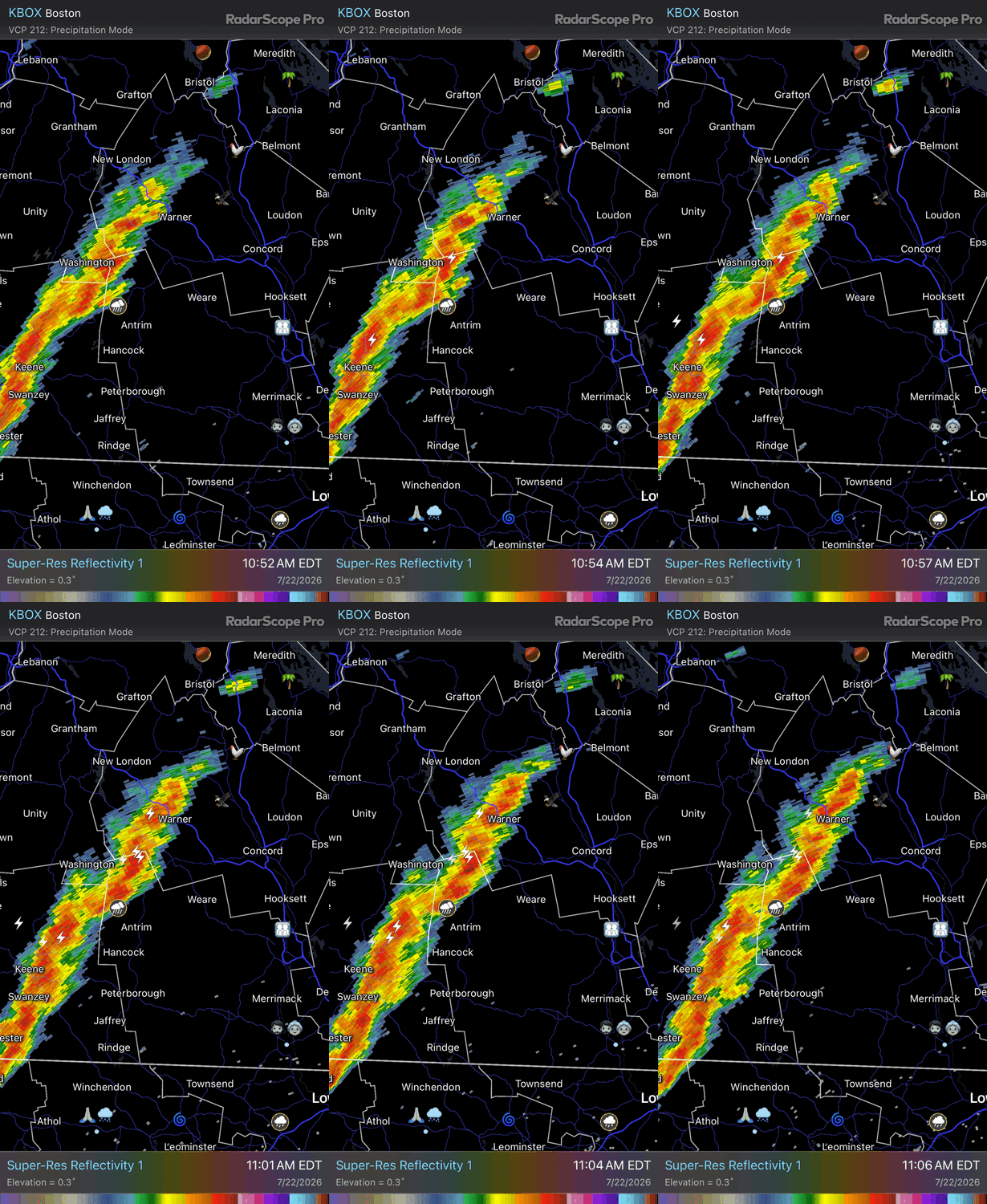
2 straight summers of webbed fists punching my nuts. Can’t wait for my 0.01”
-
Ticks are going to love this too. Ugh.
-
 I could see more of an argument if we were seeing something more anomalous like a barrage of like cutoff lows or something along the lines of a tendency for omega-block patterns (just using these as random examples) but this recent stretch of rains has been the product of slow moving frontal systems and warm front progression...kind of par of the course for mid-summer.
 -
That already happened up here, its right up there with the worst I've ever seen. Yesterday will only prolong that misery.
-
Mosquito explosion incoming?
-
 Inclined to agree with skepticism there. We have been dealing with this since last October... a basal trough that at times we see ridging, but we return to this footprint since prior to the ENSO switch onset. Most importantly, warm(cool) ENSO onset in summer isn't triggering much in the hemisphere. The hemispheric/seasonal cooling from N latitudes establishes improving gradient in autumn -that is when that forcing commences. To early.
 -

2026-2027 Super El Nino
40/70 Benchmark replied to Stormchaserchuck1's topic in Weather Forecasting and Discussion
I am getting a great deal of consensus from an early stage just like I did last season, which proved pretty damn accurate. My polar domain assessment should be ready hopefully before the weekend. It's taken a bit longer than I had hoped, which is par for the course if you're doing it right. -
 I'm fine with 4.5" here. No need for high water table/basement flooding issues.
 -
I had a very impressive ~3.75” July 12-15 at my place, which allowed me to stop irrigation for the time being. However, since then (~one week), I’ve had hardly any.