All Activity
- Past hour
-
A huge plume of rain literally 2-3 miles to my west for the last hour, yet it refuses to come east.
-
-
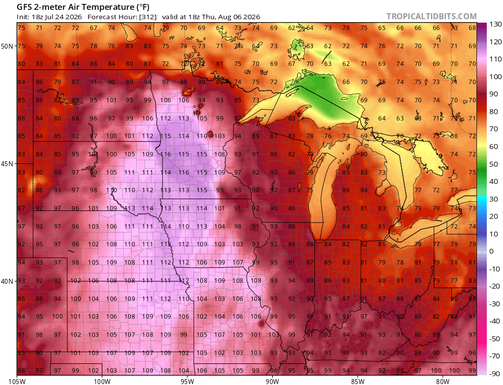
 Lol…C MN…puff puff pass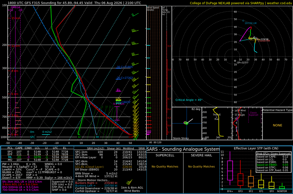
-
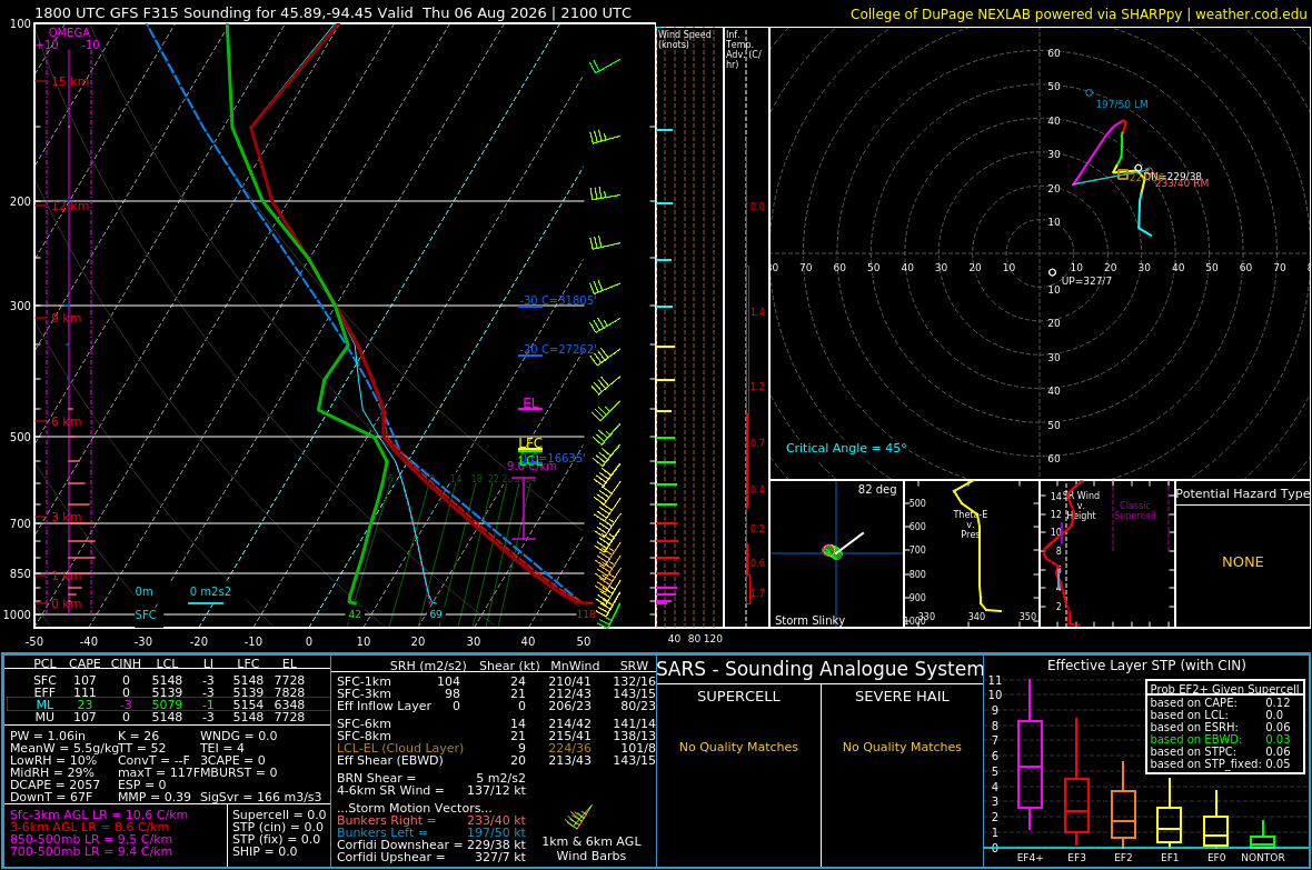
A little overmixed in fantasy land
-
August historically has a pretty good correlation with ENSO's peak later in the year. It's expected to become the strongest on record by Dec and here's the preceding Augusts: There is some -NAO in the mix but right now it's looking like this usually highly correlated month will not be anything special below-average-wise. PNA has been negative 6 straight months including July, and that is the source of the problem.
-
Take notes people. EJ is interested
-
High of 78. Picked up 1.24" for the day.
-

2026 Mid-Atlantic Severe Storm General Discussion
Eskimo Joe replied to Kmlwx's topic in Mid Atlantic
Sub-990 low running to Lake Erie in July could be interesting next Tuesday. -
 thann you for your input, winter related username
 -
Beautiful evening in OC. Reminds me of decades ago when I used to bring jeans and a light jacket on my summer vacations to the eastern shore.
- Today
-
Clouds from around 4pm today looking clear tomorrow, mainly sunny Sat and Sun.
-
Today's Highs: TEB: 84 New Brnswck: 83 PHL: 83 NYC: 83 EWR: 82 TTN: 82 LGA: 82 ACY: 81 ISP: 81 JFK: 80 BLM: 80
-

2026-2027 Super El Nino
raindancewx replied to Stormchaserchuck1's topic in Weather Forecasting and Discussion
If you go by the June -SOI (-22 is very strong for an El Nino historically) you'd expect a cooler than average Great Basin & New England. Not what we have. Moisture is closer though, its wet / dry in mostly the right areas, although spottier than I'd like. Long-term, -SOI in July is a weak cold West signal for Sept, and then the eastern ~5/6 of the lower 48 is weakly favored cold in October. Dec goes to Cold West, Warm East, Mild Plains favored. December also has the first deeper blue signal for precipitation - strongly favoring the Midwest/Southwest for a wet month. No big signals for January via July SOI. In February, SE is strongly favored cold, NW strongly favored warm. March is then a strong SW / Plains wet signal, weak SW cold signal. We're in a flash flood warning here - it's been a good monsoon day statewide (finally). So the precip map should move closer to the correlation map for New Mexico after today. -
 Leftovers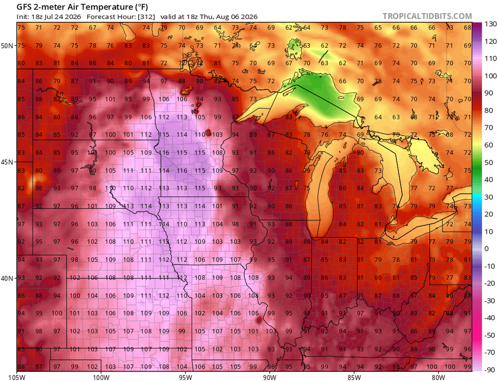
-
.thumb.gif.f92b16c631a1d15d405ed77b33f0710d.gif) wowzers
wowzers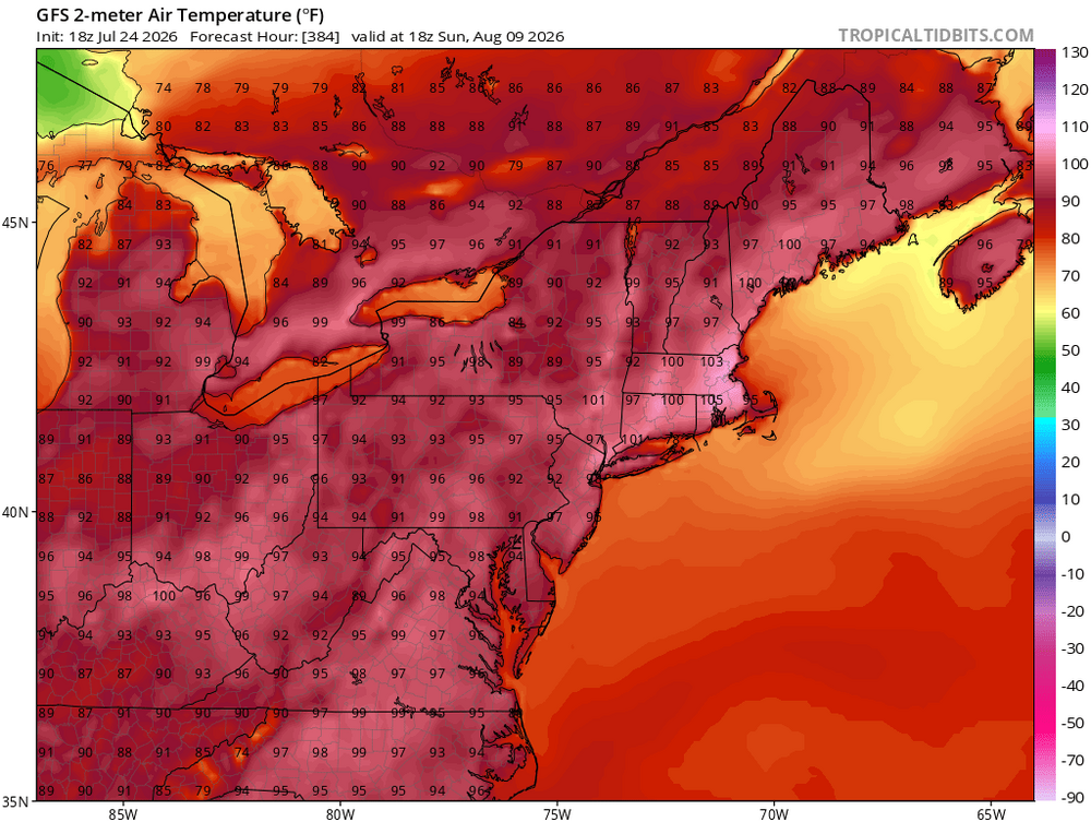
-
Yeah no kidding!
-
 God you are a genuine insufferable git. A joyless misery day in day out.
 - Yesterday
-
I am definitely skinny CAPE- relatively modest updrafts but over a vertically deep layer(quite long/tall) and with lots of juice. @ravensrulewill be along shortly
- 1,465 replies
-
- 2
-

-
- severe
- thunderstorms
- (and 7 more)
-
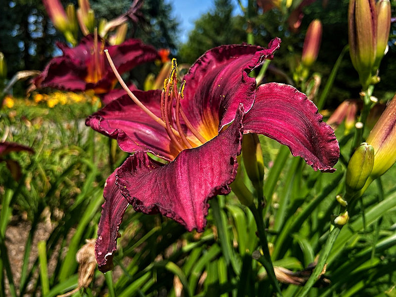
With temperatures topping out in the lower 80s, today was a great day to photograph some of the flowers and butterflies at the New York Botanical Garden. Five photos:




-

2026 Spring/Summer Mountain Thread
Maggie Valley Steve replied to Buckethead's topic in Southeastern States
And they are efficient rain makers to boot! -
 Euro and gfs pretty much nuke the entire week save for Monday and early Tuesday
 -
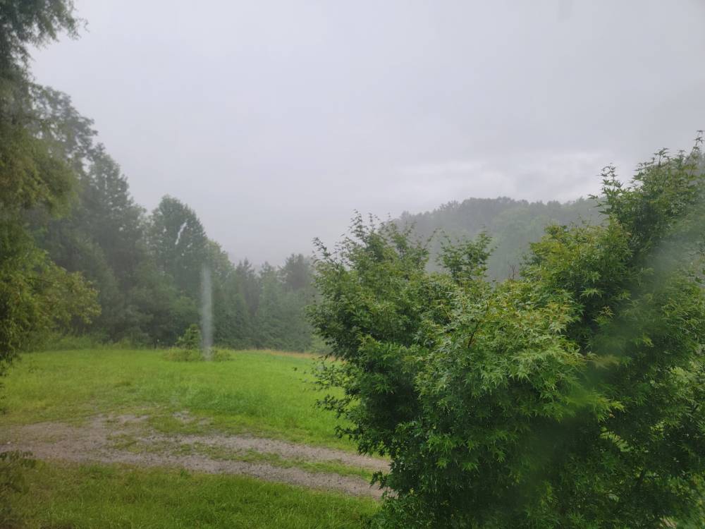
Pouring. Sent from my SM-G998U using Tapatalk
-
Absolutely dumping the rain this evening. Radar doesn't look like much but it's coming down hard.
-
81/58 split today.
-

Occasional Thoughts on Climate Change
donsutherland1 replied to donsutherland1's topic in Climate Change
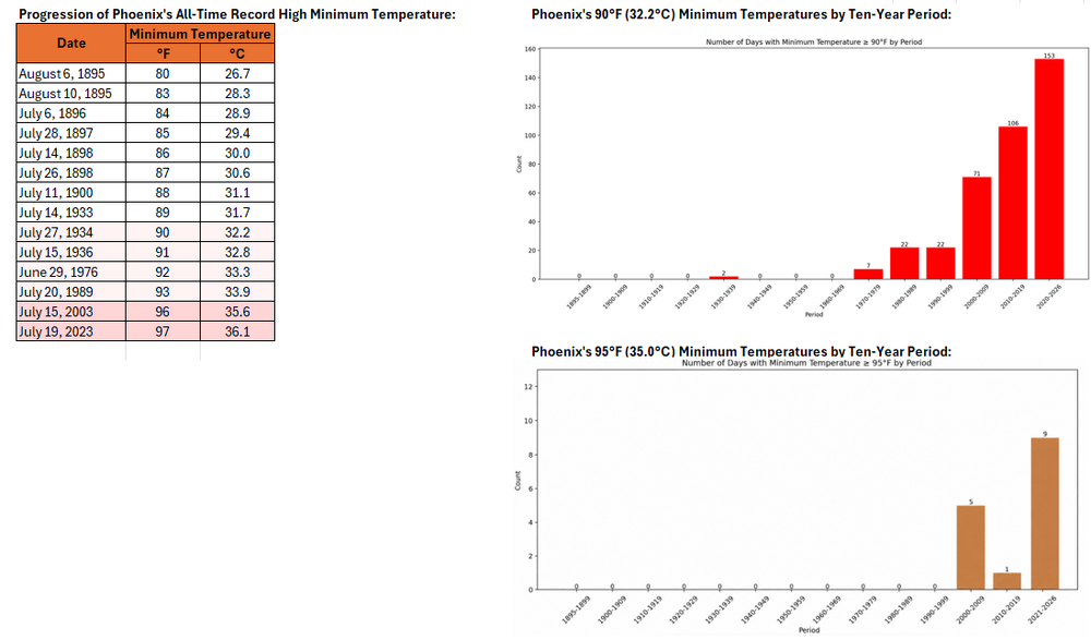
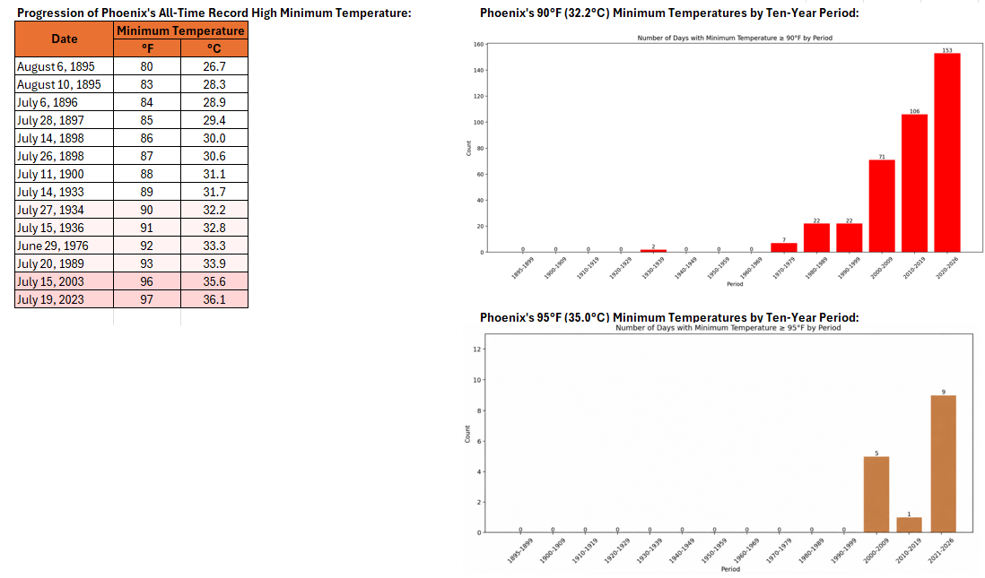
Phoenix is on track to tie its all-time record highest minimum temperature today. Minimum temperatures of 90° or above and 95° or above have increased in frequency in recent years due to a combination of the urban heat island effect and anthropogenic climate change.