All Activity
- Past hour
-
51 here. Was great running in shorts and summer gear
-
And the first who first posted that way too far out crappy snow accumulation map would be the first to call out someone else as banter and pointless to post a map that far out if it showed no snow.
-
Crazy. Could be 90 tomorrow, and mid 20's beginning of next week. Definitely a possibility of damage to plants bloomed already. My Bermuda grass is already 80% green.
-
Yeah woke up to a lot of the high res stuff showing me get nuked today Love these days though, the anticipation. I’ll be outside from like noon on waiting for these storms to pop
-
Maybe on Sunday you’ll get another chance to enjoy Spring in Chicago
-

Central PA Spring 2026 Discussion/Obs Thread
Voyager replied to Voyager's topic in Upstate New York/Pennsylvania
We might see some good storms tomorrow afternoon/evening...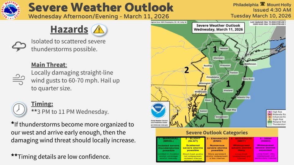
- Today
-
Just think you have summer and dews now until 12/31 in NYC.
-
If RDU hits 90 tomorrow it will not only break the daily record, it would be the earliest 90 degree day in RDUs history. The average first 90 degree day for RDU is May 11, if that puts into perspective how impressive that would be. I’m not saying it will happen but with a forecast high of 87 it would not take much to come close
-
No blocking. Of course it's done
-
Tomorrow is a real threat to push 90 degrees in areas. My point click is showing 87. Record high for the date is 85. Today’s forecast shows 82, with the record to beat being 81. It is starting out cooler than forecast though, currently sitting at 51
-
Day 2 SLGT for all
- 33 replies
-
- 1
-

-
- severe
- thunderstorms
- (and 7 more)
-
70 today
-
winter? lol
-
Yep winters done Pack it in
-
-
Euro is also a brief cooldown. Winter is done.
-
Why? She smells like a blooming Bradford Pear tree, is covered in an obnoxious yellow powder, draws flies, and can’t make her mind up from one day to the next.
-
The cool down is basically 2 days on Gfs and CMC.In and out. Boring.
-
It has been a very weird winter . The northeast has been staying cold all winter besides this week while the rest of the country is mild. NYC has more snow so far than Denver which is unheard of this late in the season . Im up to 47 inches here in Brooklyn NY. You would think that this upcoming mild period would bold well for the west but the trough is too far north.
-
The cool down is basically 2 days on gfs. In and out. Models dont look good at all for more snow. Hopefully something pops up and we get a few inches to reach 50 inches in the city.
-
Yeah, HRRR verbatim would be a treat locally with multiple storm hits.
-
BTW the new OKX storm archive is up, they changed the URL to something different so i know why my link was broken now used to be /stormevents still mostly ends at 2015, for earlier you have to use the wayback machine, and the links on there dont even work https://www.weather.gov/okx/stormarchive
-

E PA/NJ/DE Spring 2026 Obs/Discussion
Albedoman replied to PhiEaglesfan712's topic in Philadelphia Region
I guess the point I am making, is all of the years were either were going in or out of an el nino. It really does not matter until late october or early November anyway to call the upcoming winter. SST and the SJS controll the el nino anaywat. The best way to know is wait until late Novmeber and if Baja LP go to the 4 corners- watch out baby for Miller A's. The place that gets hosed the worst in the US is the mid south- some of the worst winter tornadoes in the country occur in November and December in the Memphis area in a raging el nino. I have experienced that too-- the infamous W Memphis Tornado in 1987 with massive flooding right after. The only time I witnessed 18 wheelers stacked on the second floor of a hotel after the tornado hit the truck stop and the huge I 40/55 interstate overhead signs twisted like licorice. What gets me is in all of those years above, I also had to shovel out in every one of those storms - el nino or not. To make outragous predictions this far in advance is complete stupidity. I guess that is why he is on TV In the case of our Oceanic Niño Index (ONI), there was one really oddball El Niño episode that maximized during the late summer/early fall in 1987. This El Niño is also unusual because it spanned two consecutive winters (1986-87 and 1987-88). https://www.facebook.com/watch/?v=850325316247225 -
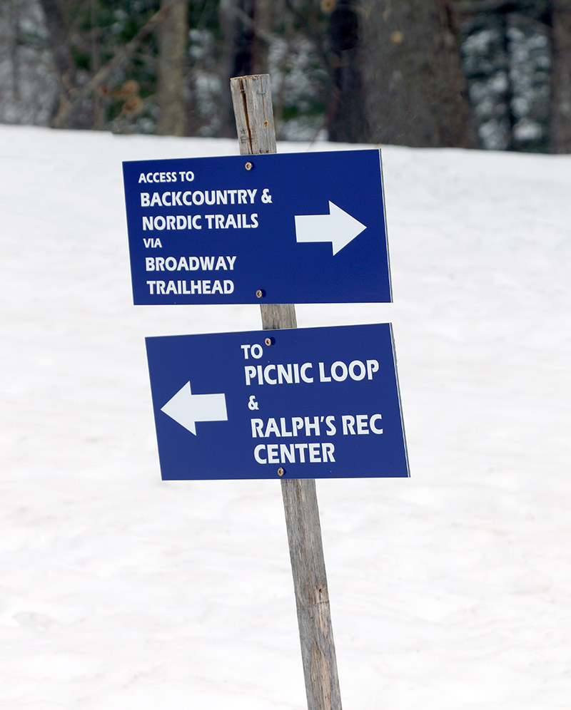
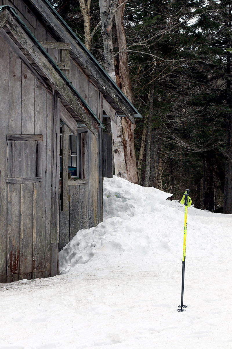
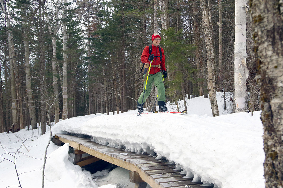
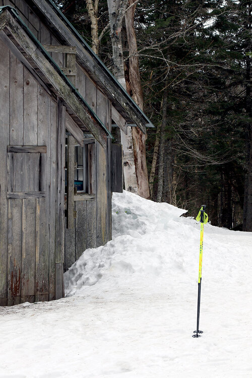
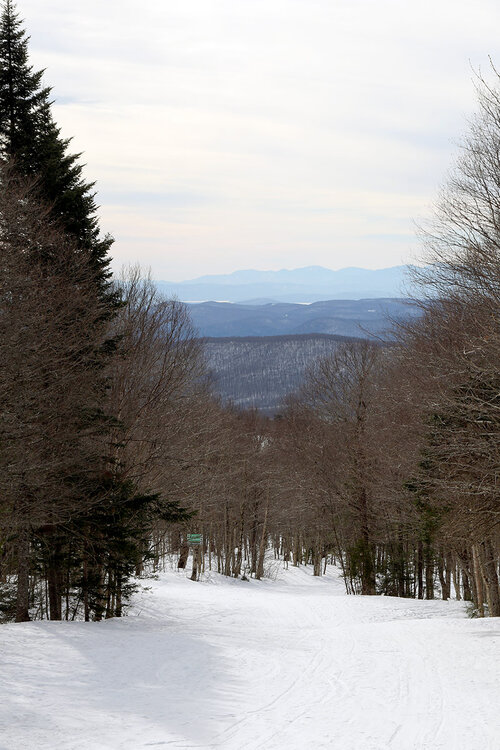
My colleague Mark is still in town for work and wanted to get in another ski tour when I had some time in the afternoon, so we headed up to Bolton Valley today in the mid-afternoon period. Temperatures were up into the 50s F at the mountain, but it was mostly cloudy all day, and I was hoping that would reduce the solar impacts and minimize any stickiness in the snow. In addition, temperatures around here did get down below freezing last night, so hopefully that would promote a start to the temperature cycling for some corn snow formation. Since Mark really liked the tour we took back on December 17th with my older son, we essentially repeated that today – it’s a route up the Bryant Trail to the Bryant Cabin, followed by a traverse out on North Slope toward the lift-served alpine terrain. In this case we modified it with a final ascent up to the top of Snow Hole to finish off with a slightly longer descent on the groomed terrain. When touring, off piste descents are often the goal when powder is in play, descending via the groomed alpine terrain was definitely the call today. The off piste snow is still deep, unconsolidated mush in areas that aren’t packed by skier traffic, and descents in that snow really aren’t an option. Thankfully, skier-packed routes like the Bryant Trail and North Slope are fine for travel because they are packed. We had to watch out in today’s travels though; if you plant your weight too far off the beaten path your boot will drop out two feet down into the bottomless mush – and that’s with your ski on. Plant your pole to far out into the unconsolidated snow and it will simply go down and disappear. Anyway, there’s a lot of consolidation that still needs to be done in the snowpack, and that’s probably due to the huge extended period of many weeks or even multiple months we had around here without a substantial thaw. In terms of the on piste conditions, they were dramatically better than what I’d experienced yesterday down at Timberline. Indeed, we were 1,000’ higher today, we had those clouds to minimize solar impacts, and there was a round of freeze thaw to help set up the snow. There was still some stickiness to the snow, but gliding was decent. I’d still recommend prepping your bases with spring wax to minimize that sticking of the skis until temperatures come back down however.


-
Who uses "ever" when referencing weather stats? I know it absolutely drives you insane that so much of the region saw above avg snowfall in the 2000s-10s. Ohio was clearly an anamoly in the well above avg snow that dominated MI/WI for many winters (particularly 2005-2015) but the trend of up then down the past 20 years is the same at Cleveland and toledo as the rest. TOL- past 10 years, 24.2", previous 10 years- 42.9" CLE- past 10 years 38.0", previous 10 years- 65.6"