All Activity
- Past hour
-

2026 Mid-Atlantic Severe Storm General Discussion
midatlanticweather replied to Kmlwx's topic in Mid Atlantic
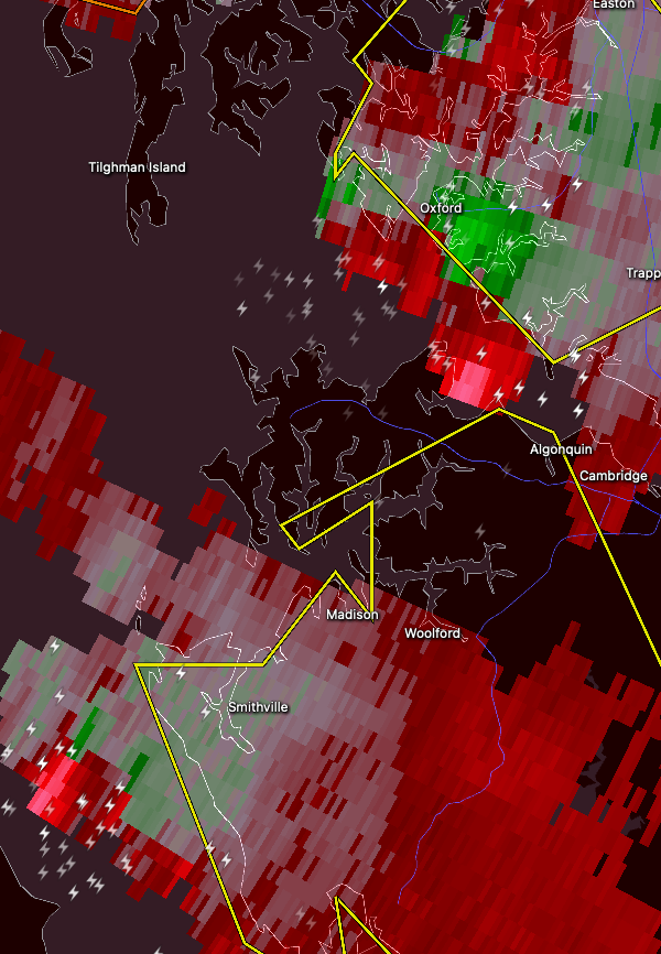
Stuff east of the Bay near Oxford and Smithfield looks a bit interesting for sure.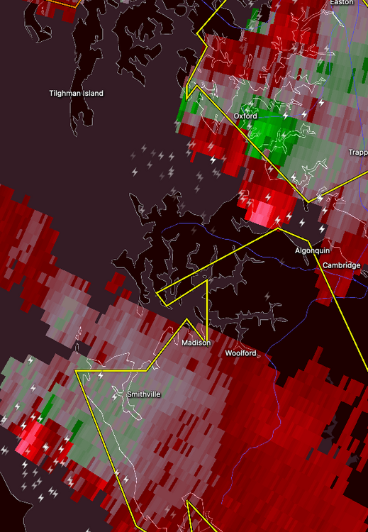
-

Mountain West Discussion
mayjawintastawm replied to mayjawintastawm's topic in Central/Western States
It's just SO frustrating (and this goes back to last Fall, really) when any kind of deterministic forecasts seem to underperform time after time after time, so it ends up being like Charlie Brown and the football (yes, I'm dating myself). For many in the SE Metro, including smokeybandit and me, it's been a constant state of "wait till next week/month/year" for a year or so. Before that, in fact, the region tended to overperform a bit, especially with snowstorms, acting like the northern edge of the Palmer Divide that it is. This year however, prior to last week, we had barely over 4 inches of water YTD, reflected by the D3 designation that for a time was the only part of the Metro area that had it. It messes with your mind! -
 I was working from home today. Just got the house painted and was waiting for the gutter guys oddly enough. They arrived at 2 and of course we got hammered at 3 pm. About a 1/2" of rain in 20 minutes. There was a 5 minute period that was crazy. They got the most important part done. Based on the forecast, see you when I see you.
 -
That was short-lived, box now east Rain
-
Storms ripping thru here now!!
-

2026 Mid-Atlantic Severe Storm General Discussion
MN Transplant replied to Kmlwx's topic in Mid Atlantic
Need to move to Maryland for rain -
Glad it did that after it went by me. Still a lot of lightning, power has been flickering for a bit
-
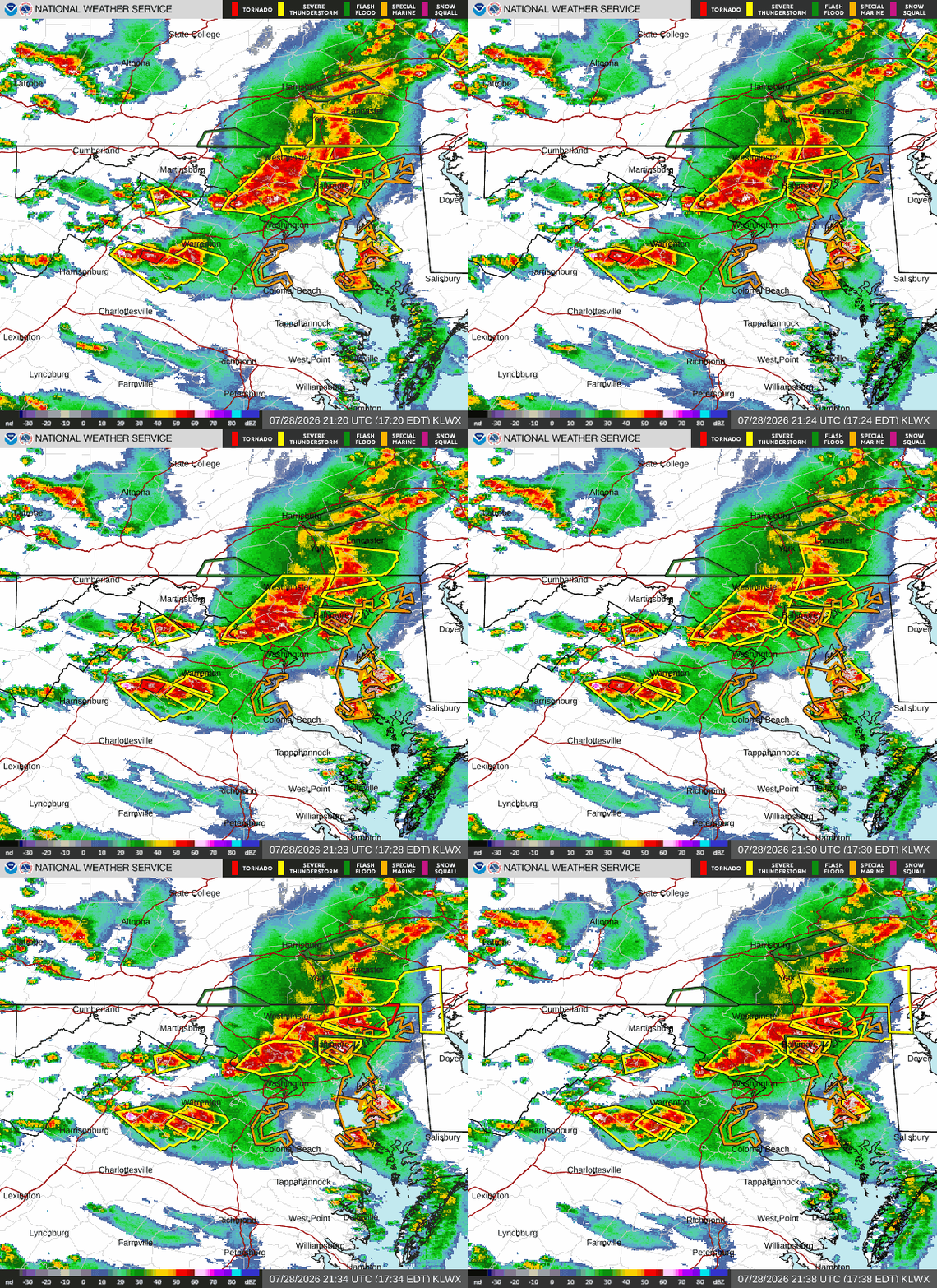
Very intense storms rolling thru central me now!!! Flash flood warnings up!
-
Just a bit short of 2” from the storm. Considerably cooler with a nice breeze now.
-
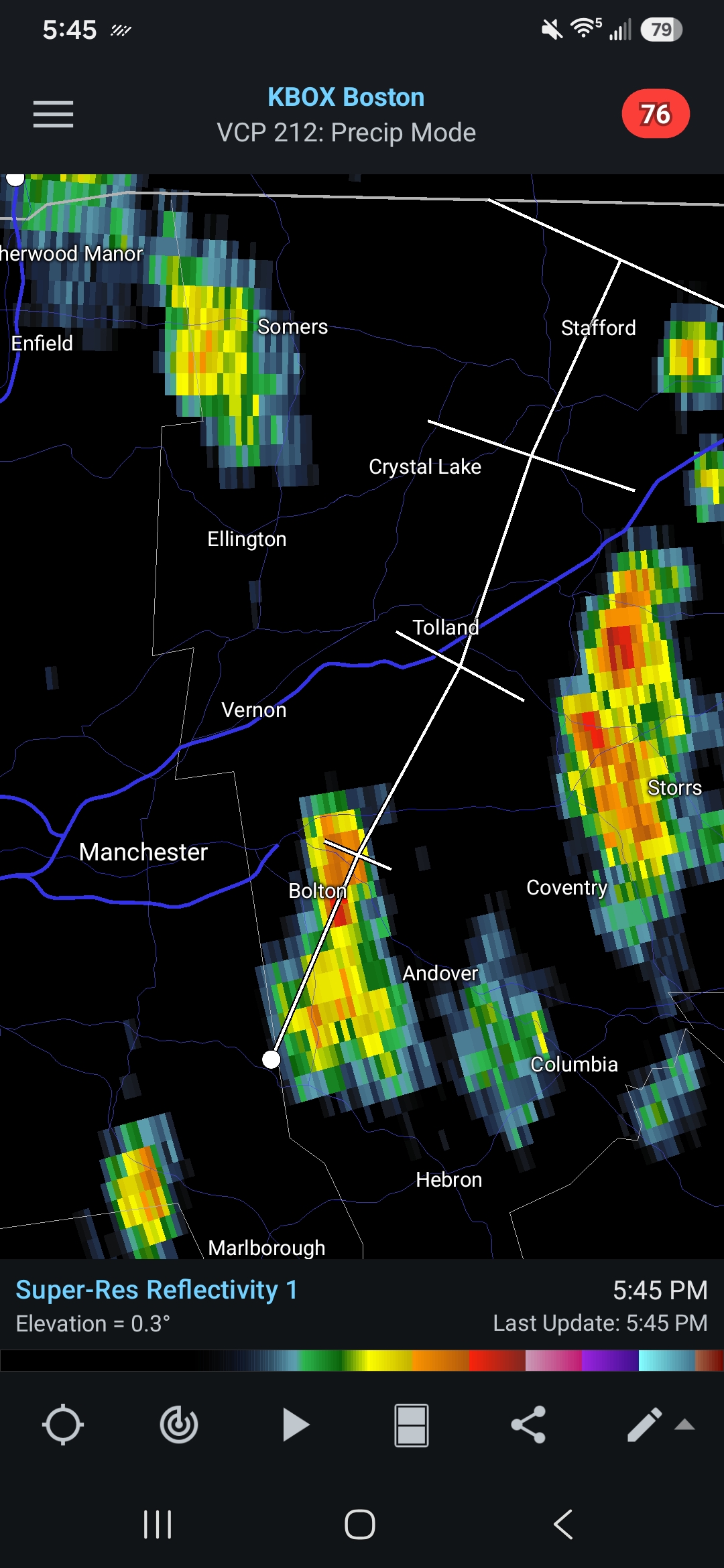
 Going to go over tolland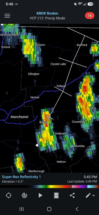
-

E PA/NJ/DE Summer 2026 Obs/Discussion
RedSky replied to PhiEaglesfan712's topic in Philadelphia Region
Mother of God rains are beating down on me with hail -
There might be something trying to form near Ashton/Cloverly in MoCo. Seems like a bow trying to get a notch.
-

2026 Mid-Atlantic Severe Storm General Discussion
batmanbrad replied to Kmlwx's topic in Mid Atlantic
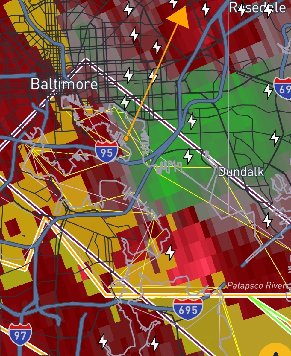
RadarScope showing TVS near Owings Mills -

2026 Mid-Atlantic Severe Storm General Discussion
AmericanWxFreak replied to Kmlwx's topic in Mid Atlantic
Mini bow moving NE thru HoCo . -
Pretty much our only hope. I don’t even care if we get storms - I just want rain.
-
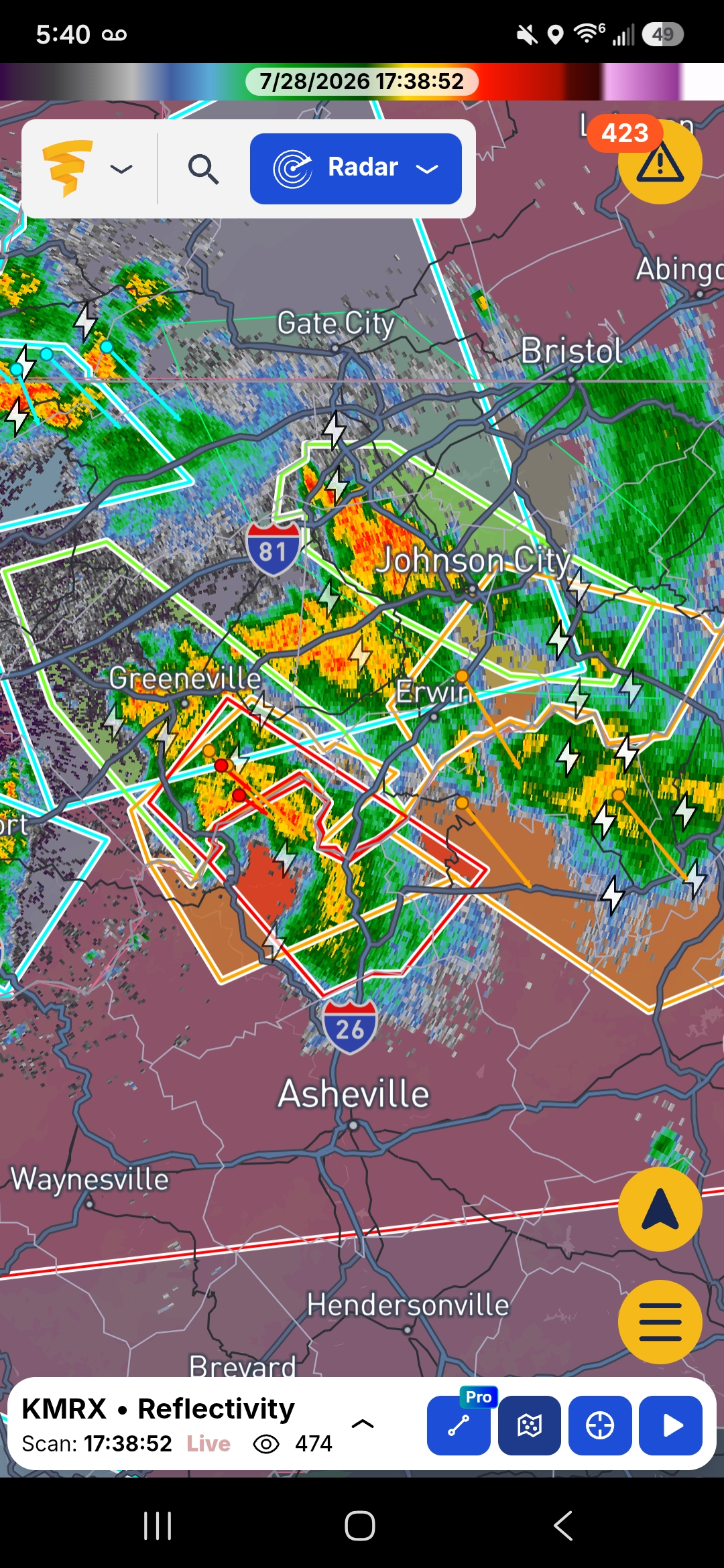
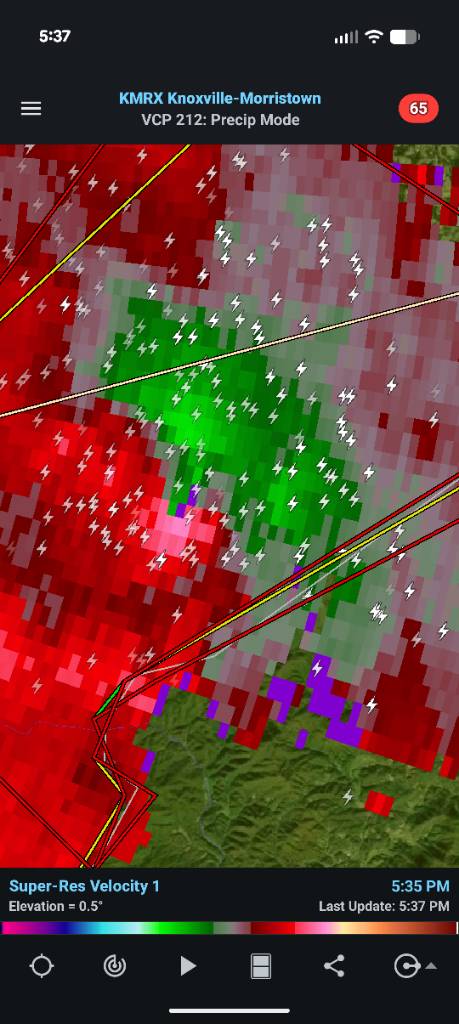
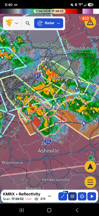
First NC tornado warning for today. Heavy cloud cover in CLT once again. About to head to the airport and hang out for a bit and watch it roll in.
-

E PA/NJ/DE Summer 2026 Obs/Discussion
The Iceman replied to PhiEaglesfan712's topic in Philadelphia Region
Yeah we had that brief downpour around noon and then nada. Honestly doesn’t feel as humid as earlier either. I doubt that line makes it through se pa intense but hopefully it holds enough for a period of steady rain. Was surprised to see the tornado watch for our area tbh -

2026 Spring/Summer Mountain Thread
Tyler Penland replied to Buckethead's topic in Southeastern States
Geez that cell near Bucket head is wrapped up. Sent from my Pixel 10 Pro using Tapatalk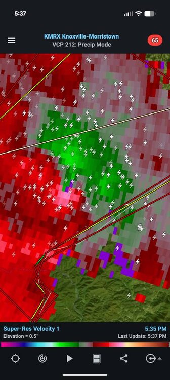
-
 We approve.
 -
E PA/NJ/DE Summer 2026 Obs/Discussion
The Iceman replied to PhiEaglesfan712's topic in Philadelphia Region
I thought we’d see more development out ahead of the front but it’s all been pushed NE. I’ll be surprised if the stuff out west holds together, doesn’t even feel humid out here with the wind. -
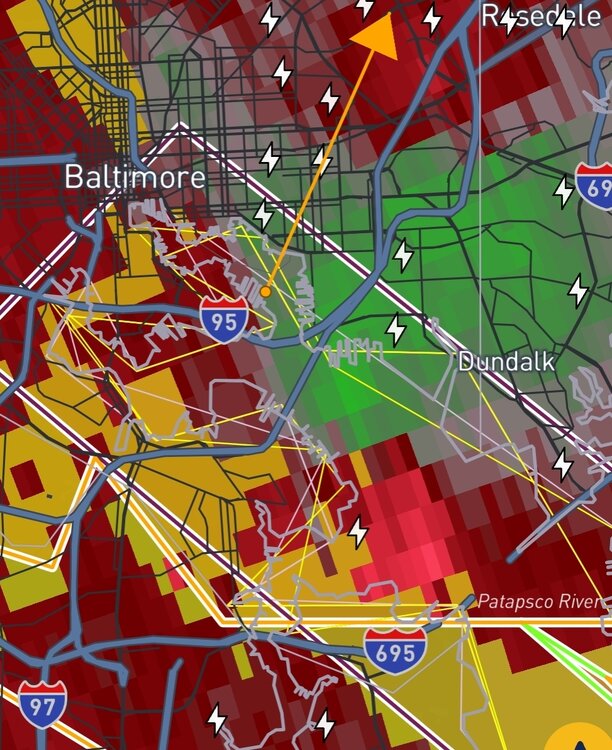
GTG ramping up on the Baltimore City cell. Wont be surprised to see it TW soon.
-
Stackin
-

Central PA Summer 2026 Discussion/Obs Thread
AccuChris replied to Voyager's topic in Upstate New York/Pennsylvania
Over 2.10” now in Lebanon . -
Severe Weather Statement National Weather Service Baltimore MD/Washington DC 532 PM EDT Tue Jul 28 2026 MDC015-025-282200- /O.CON.KLWX.TO.W.0031.000000T0000Z-260728T2200Z/ Harford MD-Cecil MD- 532 PM EDT Tue Jul 28 2026 ...A TORNADO WARNING REMAINS IN EFFECT UNTIL 600 PM EDT FOR NORTHEASTERN HARFORD AND NORTHWESTERN CECIL COUNTIES... At 532 PM EDT, severe thunderstorms capable of producing tornadoes were located along a line extending from near Delta to Bel Air North, moving east at 40 mph. HAZARD...Tornado. SOURCE...Radar indicated rotation. IMPACT...For those in the direct path of a tornado touchdown, flying debris will be dangerous to those caught without shelter. Damage to roofs, siding, and windows may occur. Mobile homes may be damaged or destroyed. Tree damage is likely. These dangerous storms will be near... Aberdeen, Havre De Grace, Bel Air South, Perryman, Richardsmere, Octoraro, Rock Springs, and Conowingo around 540 PM EDT. Aberdeen Proving Ground, Rising Sun, West Nottingham, Farmington, and Woodlawn around 545 PM EDT. Other locations impacted by these tornadic storms include Perryville, Cardiff, Churchville, Darlington, Carsins, Pylesville, Scarboro, Forest Hill, Bynum, and Port Deposit. PRECAUTIONARY/PREPAREDNESS ACTIONS... TAKE COVER NOW! Move to a basement or an interior room on the lowest floor of a sturdy building. Avoid windows. If you are outdoors, in a mobile home, or in a vehicle, move to the closest substantial shelter and protect yourself from flying debris.
-
Phone just went off for tornado warning, I'm a little south