All Activity
- Past hour
-
Lake America will produce bigly. You guys are gonna get buried this winter. 500"+.
-

Mid-Long Range Discussion 2026
WinstonSalemArlington replied to BooneWX's topic in Southeastern States
Heinous -

2026-2027 Record-breaking El Nino
mitchnick replied to Stormchaserchuck1's topic in Weather Forecasting and Discussion
Papers by people who have an agenda or financed by those in a position to profit? Idk, just asking. I find it hard to believe anything I read when comes to any issue that's been politicized. And even when results are true, mundane results can be hyped or sensationalized to create a false impression of importance/urgency. Like making a big deal about the rising of a few tenths of a degree in a very small portion of the Pacific off S. America when the record was 29 years ago. I mean if GW was so urgent, it wouldn't have taken 29 years to beat the record by a few tenths of a degree. That doesn't strike me as a "rapidly shifting climate." -
Tomorrow through Monday will see highs reach the upper 70s and lower 80s. It could turn somewhat warmer to end August and start September. However, no excessive heat appears likely through the remainder of August and into the opening days of September. The ENSO Region 1+2 anomaly was +4.0°C and the Region 3.4 anomaly was +2.6°C for the week centered around August 19. For the past six weeks, the ENSO Region 1+2 anomaly has averaged +3.87°C and the ENSO Region 3.4 anomaly has averaged +2.43°C. The ongoing strong El Niño, which has reached super El Niño threshold, will continue to strengthen through the summer. The SOI was -7.34 today. The preliminary Arctic Oscillation (AO) was -0.286 today. Based on sensitivity analysis applied to the latest guidance, there is an implied near 58% probability that New York City will have a cooler than normal August (1991-2020 normal). August will likely finish with a mean temperature near 75.9° (0.2° below normal). Supplemental Information: The projected mean would be 0.7° above the 1981-2010 normal monthly value.
-
 This guide explains it well: MedGuide USA - very detailed.
 -
Beautiful day on fire island. High around 80 with a warm breeze. Excellent late summer week.
-
More details can be found at MedGuideUSA. Good luck!
-

Augdewst 2026: Summer's Last Stand
HIPPYVALLEY replied to Prismshine Productions's topic in New England
Could be a dry autumn stretch, should be some good December rains tho’. - Today
-
 The problem with that is, whatever is happening at the time is correlated to the linear rise in temperature. I would think there would just be more global high pressure, a more stable system - bigger swings does not jive with a total warming climate. 09-10 was the lowest NAO since the mid 1800s. I thought global warming would really inflate high pressure at the poles - but the opposite has happened over the last 11 years. Now it's swings or whatever that is the product of global warming. Something else I think is causing the mid latitude temps to rise relative to the poles.
 -

Pittsburgh PA Summer 2026 Thread
PghPirates27 replied to TheClimateChanger's topic in Upstate New York/Pennsylvania
looks like a nice warmup coming over the next week or so! -

Augdewst 2026: Summer's Last Stand
CoastalWx replied to Prismshine Productions's topic in New England
Couple decent cells over Scituate earlier. -

2026-2027 Record-breaking El Nino
bluewave replied to Stormchaserchuck1's topic in Weather Forecasting and Discussion
There are papers discussing changes to the teleconnections like the NAO and AO as the climate continues to warm. Bigger swings from one state to another. One of the best papers actually came out a year before the biggest swings began in the NAO and AO in 2009-2010. That is more the exception than the rule since most papers only come out after the change had already occurred. -
us pharmacy no prescription and pharmacy online us pharmacy no prescription http://images.google.be/url?q=https://medguideusa.com top online pharmacy and https://cyl-sp.com/home.php?mod=space&uid=169289 no prescription needed pharmacy [url=https://www.mf-shogyo.co.jp/link.php?url=https://medguideusa.com]online pharmacy no prescription needed[/url] foreign online pharmacy and [url=https://www.hapkido.com.au/user/ywqhmbzfuimailahh-com/]safe online pharmacies[/url] reputable online pharmacy no prescription
-

2026-2027 Record-breaking El Nino
stadiumwave replied to Stormchaserchuck1's topic in Weather Forecasting and Discussion
Its really not that big of a deal. -
According to most of us on this forum. But the majority of the population movement is to places like the Deep South and Desert Southwest like Phoenix. Just go on YouTube and pull up videos about how people in these areas stay in the AC as much as possible in the warm season. There is a couple on there that used to live in Minnesota that would rather deal with Phoenix summer heat than Upper Midwest winter cold. They adjust their summer routines to only go outdoors early in the mornings for more than a few minutes to avoid the heat. But to each their own. This world provides a wide array of climates to accommodate everyone’s wants and needs.
-
Third day in a row of rain all around us and plenty of thunder but not a drop at the house. At least I don't have to mow this weekend...
-
Nice summer day here with 70+ dews all day. Love to see the muggy meter bringing dews back as well.
.thumb.png.cc793d61a27d9a47f731ec7d4f2cabd4.png)
.thumb.png.3a3080aad72abb173819c5de9741f618.png)
.thumb.png.7a3c3ec6436792f78b187f829150c5dd.png)
-
.thumb.gif.f92b16c631a1d15d405ed77b33f0710d.gif)
Augdewst 2026: Summer's Last Stand
Torch Tiger replied to Prismshine Productions's topic in New England
Looks for the forseeable future unless next Tues/Wed. produce -
It just comes across like you think things like NAO, PNA, etc are altered from new Super El Nino's happening. We are probably rate of global warming x 2013-14 likely to see a Winter that cold again. Indices have not been on track since 2016 and that is a significant part of the NE warming trend. The 1970s were a big dip down in the late 1800s - 1960s global warming. No one is saying warming isn't happening but it's becoming too comfortable and too specific.
-
Why am I not surprised..
-
2026-2027 Record-breaking El Nino
bluewave replied to Stormchaserchuck1's topic in Weather Forecasting and Discussion
Sample sizes in a rapidly shifting climate will never be as large as they were when we were on a colder and more stable temperature regime prior to the 1980s and 1990s. Thresholds are a common part of systems like the climate which can have non-linear elements blending with more familiar linear ones. But the models aren’t advanced enough to know exactly where these are ahead of time. Most of the time a crossed threshold is a rear view mirror assessment. This is what so many climate studies come out after the fact instead of before. The post I responded to said the coldest stretch since the 1970s. -

Augdewst 2026: Summer's Last Stand
Lava Rock replied to Prismshine Productions's topic in New England
Nice thunderhead Sent from my SM-S921U using Tapatalk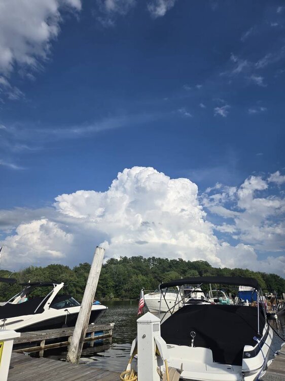
-
Update: Storm is out of the way. The football season has officially begun!
-
Afternoon AFD from LWX mentioned it KEY MESSAGE 2...Hot and humid conditions next week with increasing thunderstorm chances by midweek. Models are generally in good agreement that a strong mid-level ridge builds across the southern U.S. and into the Mid-Atlantic during the early to middle part of next week. Well above normal temperatures for late August can be expected as highs reach the lower to mid 90s. Hot and humid conditions are likely as heat indices reach the upper 90s and possibly the lower 100s. A more notable mid-level disturbance will progress from the northern High Plains to the Northeast toward the middle of next week. The ridge will be suppressed as a result, but it remains uncertain how much and how quickly this happens. The latest trend in the ensemble guidance is for the upper ridge over the Mid-South to be a bit further west. If this pans out, our area in the Mid-Atlantic will be in a more favorable location along the periphery of the ridge to be impacted by passing MCSs. Eventually, by mid week it looks like the upper ridge retreats enough to allow the shortwave troughs to move over our area. Several of the AI models indicate increasing severe potential at some point Tuesday through Friday, which is certainly possible given the high instability that will be in place, along with substantial upper-level support from any strong disturbance. It`s also possible a back door cold front tries to drop into the area by Wednesday or Thursday, leading to greater uncertainty in temperatures.
-
Absolute perfect day out this way. Clear and 83











.png.cd9d9e0899f4f033be688aa4f1658d9a.png)
.png.2998ecd16363aaf90fd494e38b1689c0.png)
.png.51aaa3d6ace4918b723a4d1dbbfe9f61.png)