All Activity
- Past hour
-

Saturday, July 18, 2026 Thunderstorm/Severe Weather Potential
SJonesWX replied to weatherwiz's topic in New England
grabbed a quick quarter inch here, the local vegetation rejoices -

2026 Mid-Atlantic Severe Storm General Discussion
Eskimo Joe replied to Kmlwx's topic in Mid Atlantic
Something's bound to pop on that.- 1,117 replies
-
- 1
-

-
- severe
- thunderstorms
- (and 7 more)
-

2026 Mid-Atlantic Severe Storm General Discussion
SnowenOutThere replied to Kmlwx's topic in Mid Atlantic
Interesting boundary collision is gonna happen right west/east along the Dulles toll road. -

E PA/NJ/DE Summer 2026 Obs/Discussion
JTA66 replied to PhiEaglesfan712's topic in Philadelphia Region
Sun starting to poke out here, 0.75” so far. 76F/DP 74F -

2026-2027 Super El Nino
Stormchaserchuck1 replied to Stormchaserchuck1's topic in Weather Forecasting and Discussion
Just your typical 5940dm -PNA block in El Nino. I think it has something to do with cold Arctic 90-day SOI is about to go lowest since 1983. -

E PA/NJ/DE Summer 2026 Obs/Discussion
Newman replied to PhiEaglesfan712's topic in Philadelphia Region
That activity will more likely than not become outflow dominant by the time it reaches the Lehigh Valley. Maybe some embedded spinners, but more likely a damaging straight line wind threat -
First post here but reporting 1.5" of rain fell between 1145 and 1245 in NE Queens. It was absolutely torrential for that hour here. The videos of the flooding from the LIE southward are absolutely insane with the crazy rainfall rates they got.
-
E PA/NJ/DE Summer 2026 Obs/Discussion
Newman replied to PhiEaglesfan712's topic in Philadelphia Region
3000 MLCAPE/5000 SBCAPE creeping into Philly now. Low level lapse rates also finally looking somewhat decent too. -

E PA/NJ/DE Summer 2026 Obs/Discussion
MGorse replied to PhiEaglesfan712's topic in Philadelphia Region
Watch those discrete cells in Lancaster County as they quickly move eastward. Some small discrete cells currently developing in southern NJ. -

E PA/NJ/DE Summer 2026 Obs/Discussion
enpawx_observer replied to PhiEaglesfan712's topic in Philadelphia Region
77/75 here. Temp has been more or less stable for the last 3 hours. Also of note, seems like there is still lingering smoke around here. -

Central PA Summer 2026 Discussion/Obs Thread
Voyager replied to Voyager's topic in Upstate New York/Pennsylvania
Well, I certainly did NOT expect 1.83" of rain from "round one", but that what I got in my backyard. With that said, I wonder if it stabilized the air mass enough that it thwarts our chances here for potential severe later on. It seems as if the focus is on points southeast as of now. -
https://www.star.nesdis.noaa.gov/goes/sector_band.php?sat=G19§or=ne&band=GEOCOLOR&length=24
-
Just got the alert for a Flash Flood Warning for my area. Thankfully it looks like the rain is almost over.
-

Saturday, July 18, 2026 Thunderstorm/Severe Weather Potential
hudsonvalley21 replied to weatherwiz's topic in New England
https://www.star.nesdis.noaa.gov/goes/sector_band.php?sat=G19§or=ne&band=GEOCOLOR&length=24 -

Saturday, July 18, 2026 Thunderstorm/Severe Weather Potential
Chrisrotary12 replied to weatherwiz's topic in New England
Holy smoke ahead of this rain, -

Saturday, July 18, 2026 Thunderstorm/Severe Weather Potential
dendrite replied to weatherwiz's topic in New England
Bitched myself to some rain. Channeled my inner tblizz. No new wives though. -
Im at my sister's in South Point Ohio but back home rain gage says .37
-
2026 Mid-Atlantic Severe Storm General Discussion
Eskimo Joe replied to Kmlwx's topic in Mid Atlantic
Gust to 31 mph, M1.17" rainfall Frederick City mesonet site at the Community College. -
Puke. Lookin' as worse as Friday. HRRR for tomorrow morning at 6am:| BAM believes Monday will be even worse. https://x.com/bam_weather/status/2078363153742590205
-

E PA/NJ/DE Summer 2026 Obs/Discussion
BBasile replied to PhiEaglesfan712's topic in Philadelphia Region
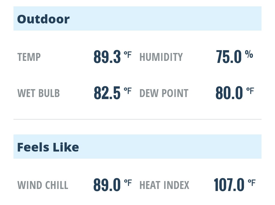
This atmosphere is primed.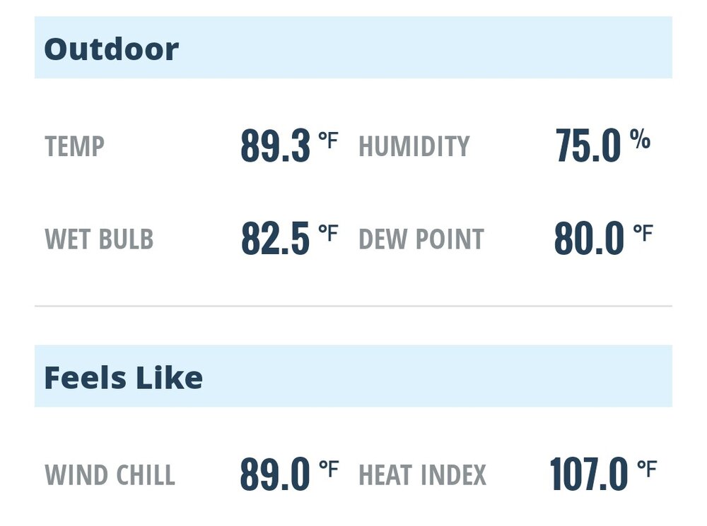
-
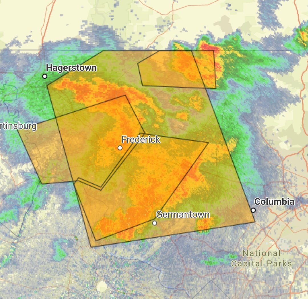
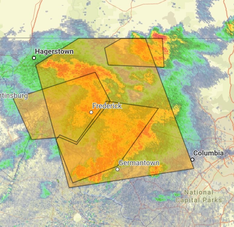
Yes! All the polygons.
- 1,117 replies
-
- 2
-

-
- severe
- thunderstorms
- (and 7 more)
-
Flood warnings issued as all our phones just got them
-

Central PA Summer 2026 Discussion/Obs Thread
Jns2183 replied to Voyager's topic in Upstate New York/Pennsylvania
it feels like a steam bath and a sun breaks out oh my God Sent from my SM-S731U using Tapatalk -

Saturday, July 18, 2026 Thunderstorm/Severe Weather Potential
weatherwiz replied to weatherwiz's topic in New England
def a good drink here. took a drive to Enfield/back and ran into some heavy downpours on the way there and again on the way back. cloud tops warming quickly though on the back end...lets get some sun. won't take much to get temps to jump -

Saturday, July 18, 2026 Thunderstorm/Severe Weather Potential
WinterWolf replied to weatherwiz's topic in New England
Yup..sun trying to come out now here. Got a good drink though from the first round.