All Activity
- Past hour
-
1.21" here. First day with any rainfall for this month.
- Today
-
When is it going to be the Mid Atlantic's turn? In the 2025-2026 Winter.
-

E PA/NJ/DE Summer 2025 Obs/Discussion
RedSky replied to Hurricane Agnes's topic in Philadelphia Region
7 in an hour and fifteen not good One big one -

E PA/NJ/DE Summer 2025 Obs/Discussion
LVblizzard replied to Hurricane Agnes's topic in Philadelphia Region
The Perseid meteor shower is out tonight and there are great viewing conditions for it! I went out into my backyard and saw 3 in 10 minutes. It’s probably even better in more rural areas with darker skies. -
We may not hit tomorrow if we can actually get some rain in here Sent from my SM-G970U1 using Tapatalk
-
-
No it’s not genius. If you actually knew wtf you were talking about you’d realize that. The wishcasting is on your part
-
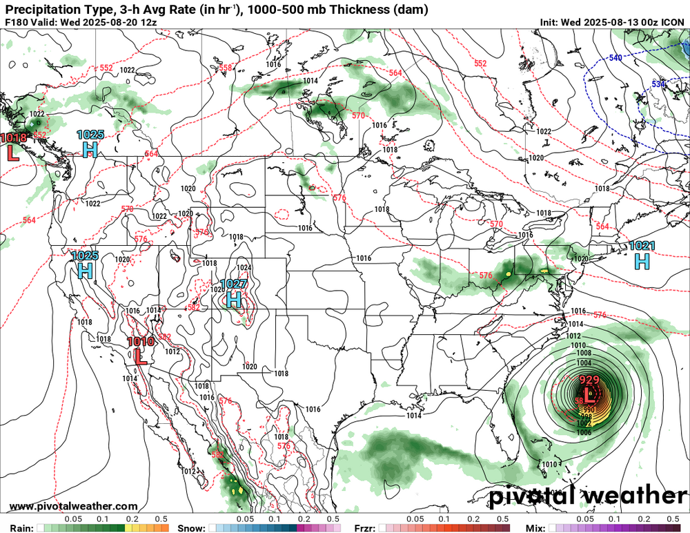
The 0Z GFS and CMC are both very close to Bermuda. Edit: 0Z Euro avoids all land in the W basin with it going ~250 miles W of Bermuda.
-
0Z UKMET: recurves safely from Conus but further W at 70.3+…so, this would be good news for Bermuda, too: TROPICAL STORM ERIN ANALYSED POSITION : 16.4N 39.2W ATCF IDENTIFIER : AL052025 LEAD CENTRAL MAXIMUM WIND VERIFYING TIME TIME POSITION PRESSURE (MB) SPEED (KNOTS) -------------- ---- -------- ------------- ------------- 0000UTC 13.08.2025 0 16.4N 39.2W 1008 31 1200UTC 13.08.2025 12 15.8N 41.9W 1008 27 0000UTC 14.08.2025 24 15.9N 44.1W 1008 27 1200UTC 14.08.2025 36 16.8N 47.1W 1008 28 0000UTC 15.08.2025 48 18.0N 50.2W 1009 30 1200UTC 15.08.2025 60 19.0N 53.8W 1007 32 0000UTC 16.08.2025 72 19.7N 57.3W 1005 31 1200UTC 16.08.2025 84 20.3N 60.3W 1003 33 0000UTC 17.08.2025 96 21.0N 62.9W 1001 38 1200UTC 17.08.2025 108 21.7N 65.6W 999 45 0000UTC 18.08.2025 120 22.7N 67.2W 998 43 1200UTC 18.08.2025 132 24.5N 68.3W 996 45 0000UTC 19.08.2025 144 26.6N 69.4W 993 49 1200UTC 19.08.2025 156 28.6N 70.1W 989 48 0000UTC 20.08.2025 168 30.7N 70.3W 984 49
-
Hello, yee old farts. It's been a while. Looks like Erin managed to shake off the drier air to the north by closing off a nice bubble and pocket of moist air in the 850 to 500 hpa layers with continued convective bursting near low level vorticity this past evening. It has managed to do this with relatively marginal SSTs (26°-27°C range) since leaving the Cabo Verdes. The COC will be moving into 27°+C during the daylight hours on Wednesday. Erin should continue organizing, and it's pretty clear this system will become the first Atlantic major hurricane for 2025 in a few days' time. Downstream implications for land interaction are still too early. Granted, it may swing and miss the Eastern CONUS, but there remains some uncertainty for Bermuda and even the Canadian Maritimes depending on trough interaction. Otherwise, Erin should be a powerful CV long-tracker and ACE machine.
-
Erin ain't looking so hot. But honestly that may be good to allow it to move more westward over time if it stays extremely weak.
-
Master.
-
Heavy squall line in Ontario
-
 Really an incredible winter that ought to be remembered as fondly as 1976-1977, but they didn't measure snowfall in the same manner or with the same diligence and so it gets lost in the shuffle... but the snow depth records tell the real story. It's like comparing the dead ball era baseball records to the modern era. Like you'd think the 1910s weren't that snowy at Buffalo until you look and see there was a foot of snow on the ground for most of the winter! These days, they'll be like X location picked up 100" of lake effect in 4 days, and the peak snow depth will be like 20 inches. December-February snow depth at Buffalo - actually had 6 more days of 18"+ than 1976-1977! At Erie, an absolutely absurd 20 more days of 18"+ than any other winter, despite 4 missing days...
 -

2025-2026 ENSO
so_whats_happening replied to 40/70 Benchmark's topic in Weather Forecasting and Discussion
I mean there is a lot of warmth with depth that has yet to be mixed. We do need much more in the way of tropical/ synoptic activity to really overhaul this region which will take time. There is definitely a noticeable shift trying to take place but the pattern is still very much entrenched across the region. As much as I want it to change it still needs time to make these changes.
-
I doubt we'll see another winter of 1944-45 though! Here are some scenes from the Finger Lakes and Buffalo, respectively. And Toronto, Ontario, in the wake of the Great Snowstorm of 1944:
-
More than one CAM has a repeat performance tomorrow over Chattanooga. Similar rainfall amounts. Hope that’s wrong.
-
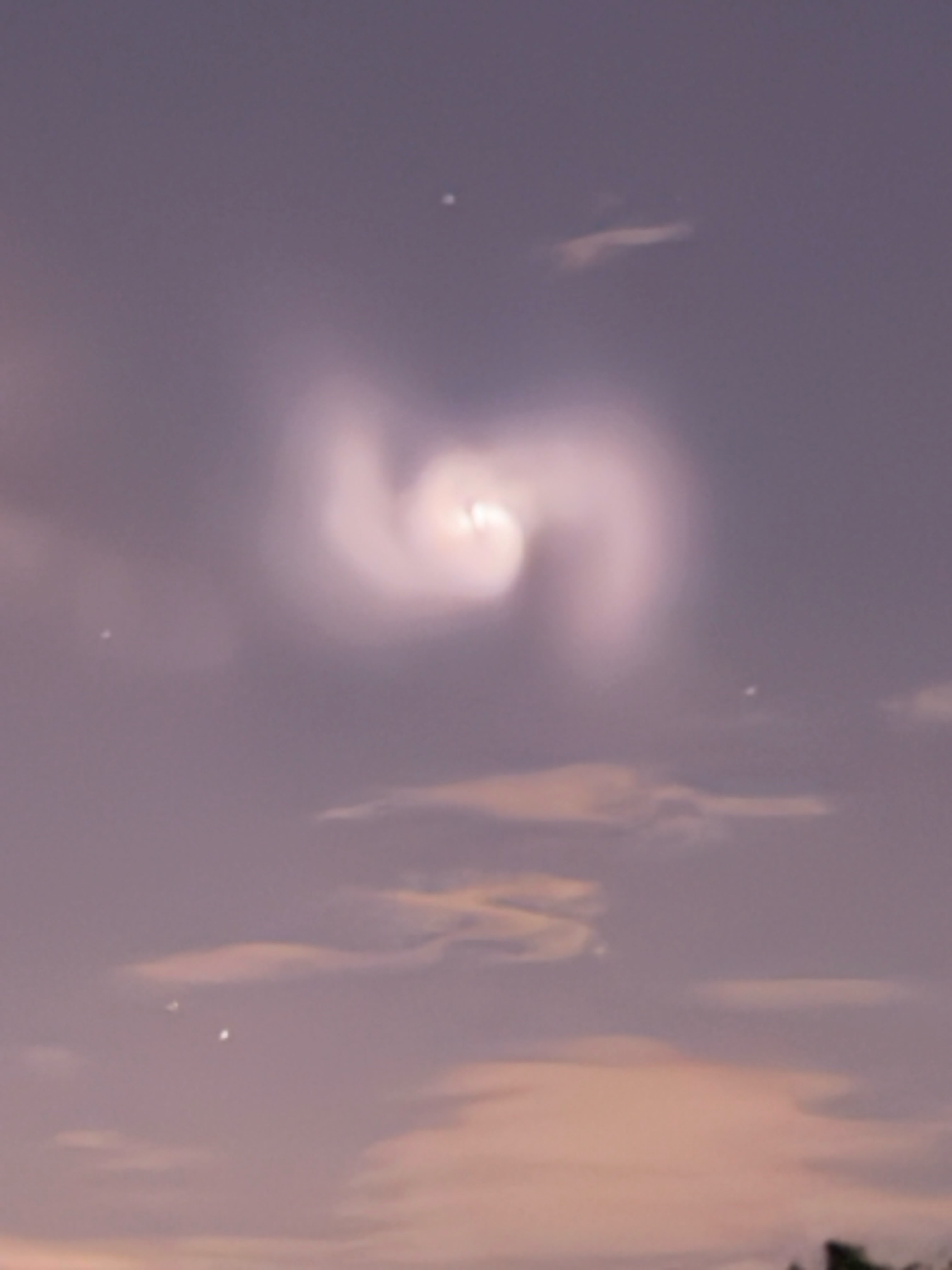
ula vulcan rocket launch was apparently visible overhead for all a short time ago.
-
 Some rain would be nice.
 -
Ya.. I have been unable to find the rocket launch info
-
Saw it near Pittsburgh. I assume a rocket launch. It was drifting slowly north.
-
Who saw this?

-
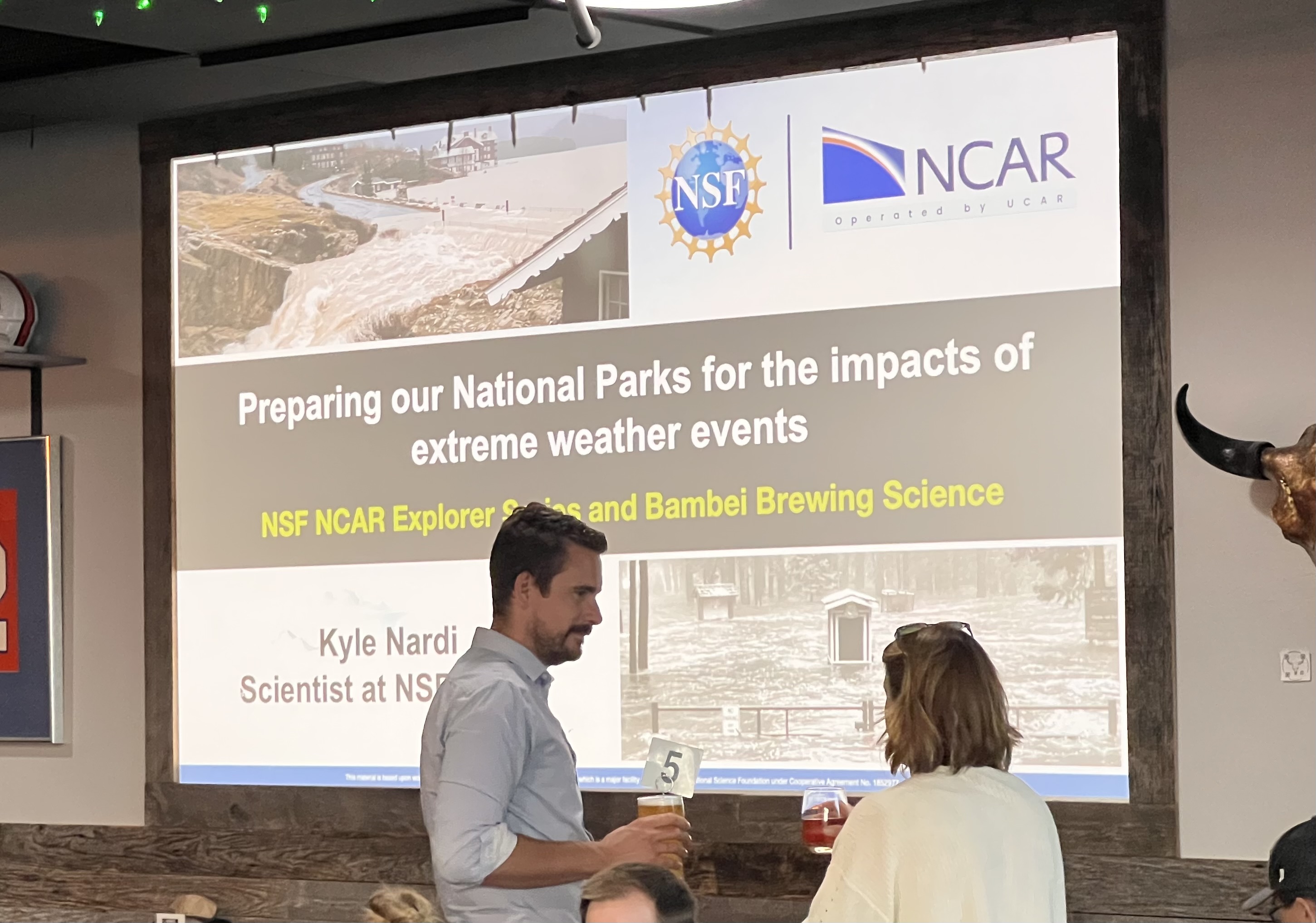
I’m in Colorado for another hiking trip and was lucky enough to get a tour of the National Center for Atmospheric Research (NCAR) today in Boulder. And then this evening there was a climate talk at a local brewery. Cool stuff. Also wondering if any Penn State alums know this meteorologist. Kyle Nardi.

-
Credit to a poster at S2K for this. Note especially how strong 3 of them get (to MH strength): 18z hurricane models, in 126 hours (00z 8/18): HWRF: 955 mb, 104 kt, 21.7N 62.0W HMON: 954 mb, 103 kt, 22.2N 62.9W HAFS-A: 942 mb, 119 kt, 20.5N 65.6W HAFS-B: 972 mb, 78 kt, 21.1N 65.7W
-
 Only 1983 did it.