All Activity
- Past hour
-

2026-2027 Record-breaking El Nino
stadiumwave replied to Stormchaserchuck1's topic in Weather Forecasting and Discussion
Makes you wonder if indeed the large SST anomaly in 1&2, 3 contributed to the SSW if it will also repeat. If that was a contributor to current warming then I think its inevitable it will occur again. If it does not occur again, then its likely that was not the cause of the current warming. But I would caution also, the same people warning about not taking seriously the stratosphere forecasts when it was showing a warming, need to be just as cautious about a long-range super recovery forecast. Bias is ridiculous. Recovery is a guarantee without other hits, and strong SPV would not be unusual considering the setup, however, could very well be overdone as well. -
Yes. I was also comparing it to last winter, which was one of the better ones around here in years. We'll regress this winter but it's fine if we can make it interesting once in a while (and the ski areas do relatively well).
-
October 31 1991: The Great Halloween Blizzard begins. Trick or Treating was memorable for the few who ventured out. 8.2 inches of snow fell at MSP airport by midnight, with much more to come the following day. (Note: You can read up on this storm here: https://www.weather.gov/dlh/1991halloweenblizzard ) For Saturday, October 31, 2026 1846 - Eighty-seven pioneers were trapped by early snows in the Sierra Nevada Mountains that piled five feet deep, with 30 to 40 foot drifts. Just 47 persons survived the "Donner Pass Tragedy". (The Weather Channel) 1950 - Unseasonably warm weather prevailed in the central U.S. for Halloween. The temperature soared to 83 degrees at Minneapolis MN, their warmest reading of record for so late in the season. (The Weather Channel) 1965 - Fort Lauderdale, FL, was deluged with 13.81 inches of rain, which brought their rainfall total for the month of October to an all-time record of 42.43 inches. (30th-31st) (David Ludlum) (The Weather Channel) 1987 - Halloween was a wet one in the southwestern U.S. Heavy rain in southern California resulted in numerous mudslides. Weather-related auto accidents resulted in three deaths and twenty-five injuries. Mount Wilson CA received 3.14 inches of rain in 24 hours. Yakima WA reported measurable rainfall for the first time since the 18th of July. The 103 day long dry spell was their longest of record. (The National Weather Summary) (Storm Data) 1988 - Twenty-two cities in the northeastern U.S. reported record low temperatures for the date. The low of 19 degrees at Cleveland OH was a record for October, and morning lows of 21 degrees at Allentown PA and Bridgeport CT tied October records. Nine cities in the southwestern U.S. reported record high temperatures for the date, including Phoenix AZ with a reading of 96 degrees. Showers made Halloween a soggy one in the southeastern U.S. (The National Weather Summary) 1989 - Halloween night was a soggy one in New England. Showers in the northeastern U.S. produced more than an inch and a half of rain in six hours at some locations. An invasion of cold arctic air brought an abrupt end to a week of "Indian Summer" type weather in the Great Lakes Region, and brought snow and subzero wind chill readings to the Northern Plains. In Colorado, Alamosa was the cold spot in the nation with a record low of two degrees above zero, and a Halloween night storm brought 3 to 6 inches of snow to the Front Range, and 5 to 10 inches to the nearby foothills. Icy streets around Denver the next morning made for a rather spooky commute. (The National Weather Summary) (Storm Data) Observances: 31 Sat Halloween 31 Sat National Caramel Apple Day 31 Sat World Savings Day 31 Sat National Magic Day 31 Sat World Cities Day 31 Sat Samhain 31 Sat Books For Treats Day 31 Sat Girl Scout Founder’s Day 31 Sat National Doorbell Day 31 Sat National Knock Knock Joke Day 31 Sat Reformation Day
-
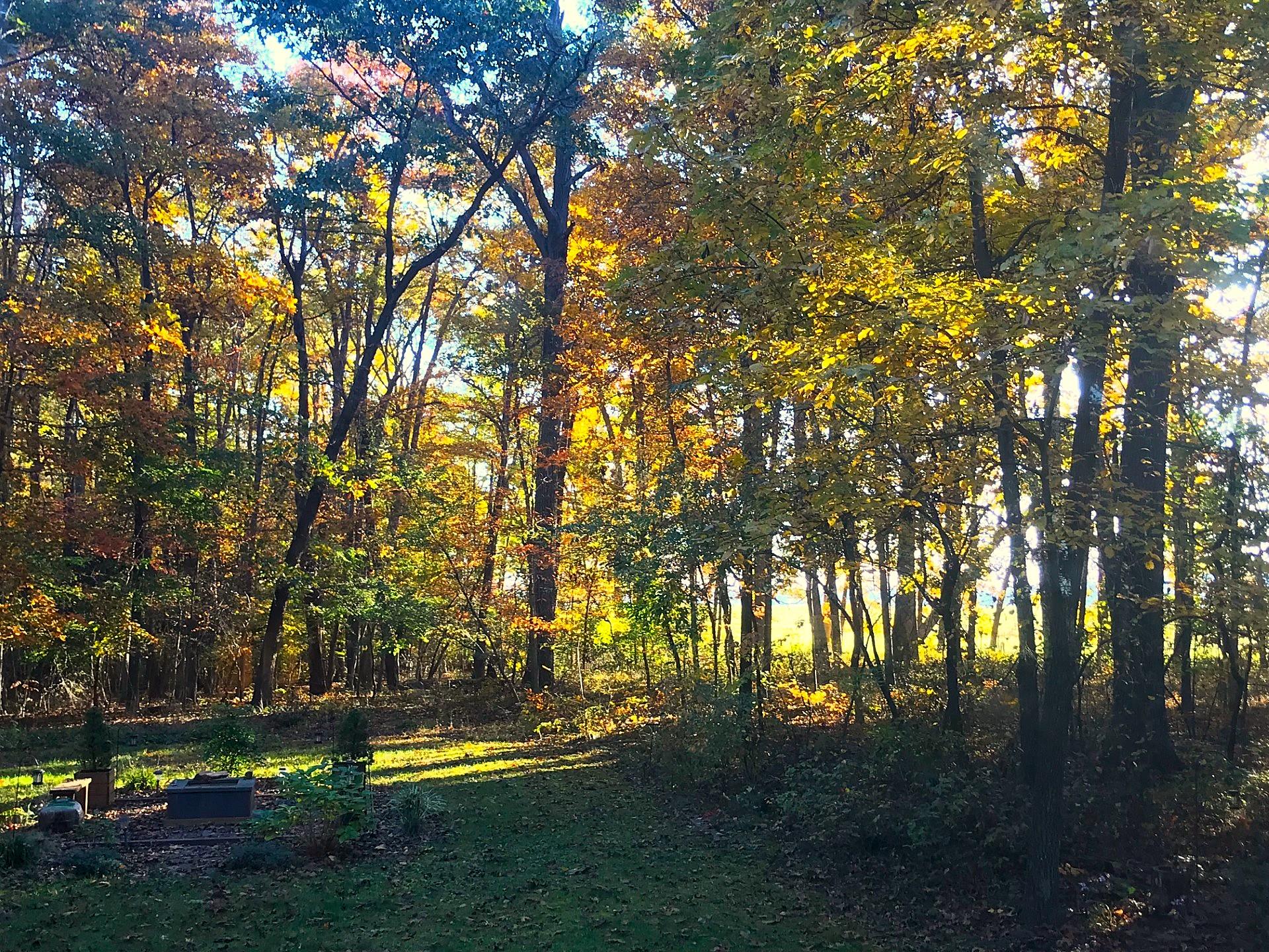
Central PA Autumn 2026
Mount Joy Snowman replied to canderson's topic in Upstate New York/Pennsylvania
Low of 39. Happy Halloween to all you ghouls! My kids are clearly not understanding this morning how long of a wait they have until trick or treat haha. -
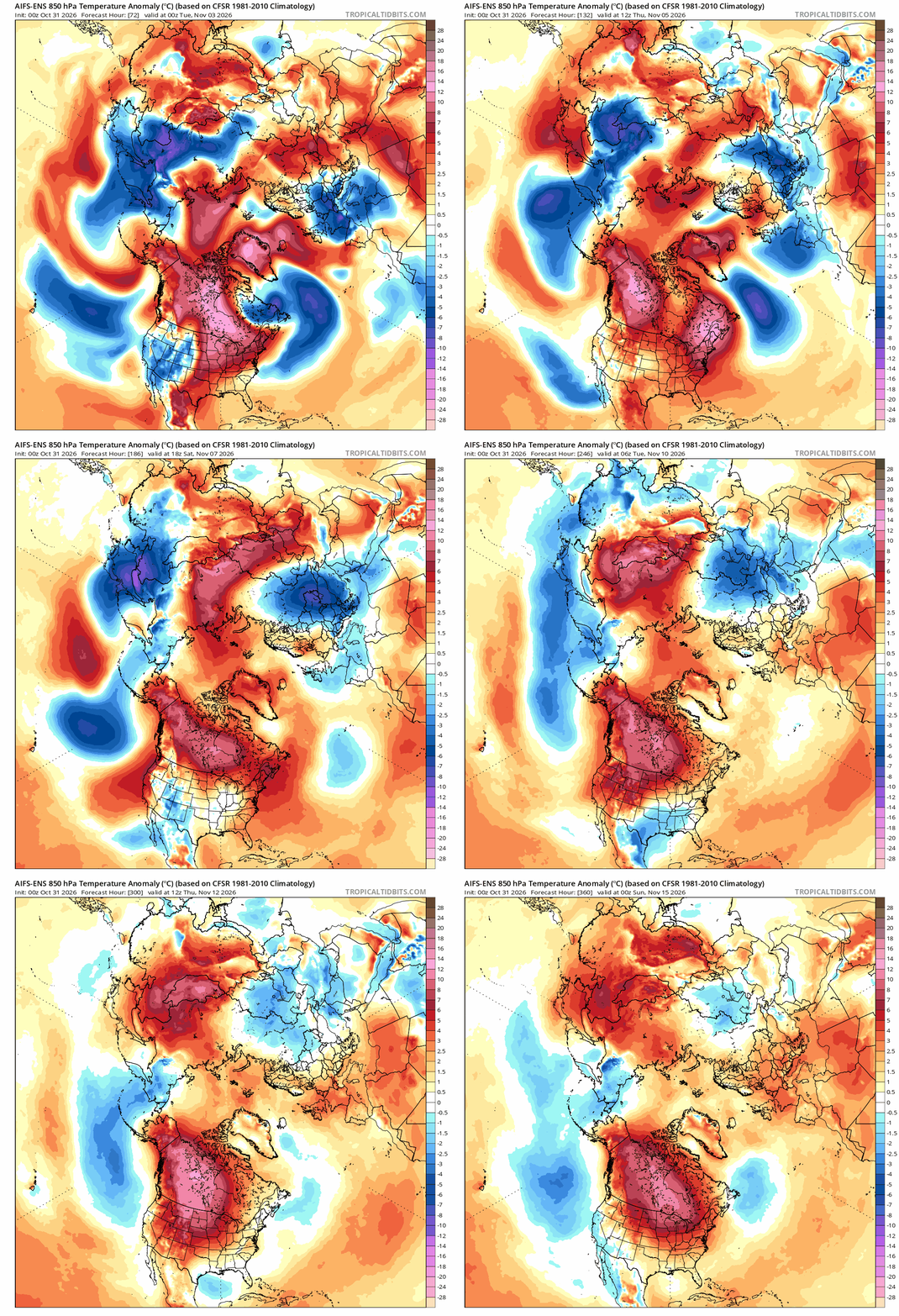
the SSW will make its own cold air
-
So pretty much what SNE gets every winter…. Sounds good.
-
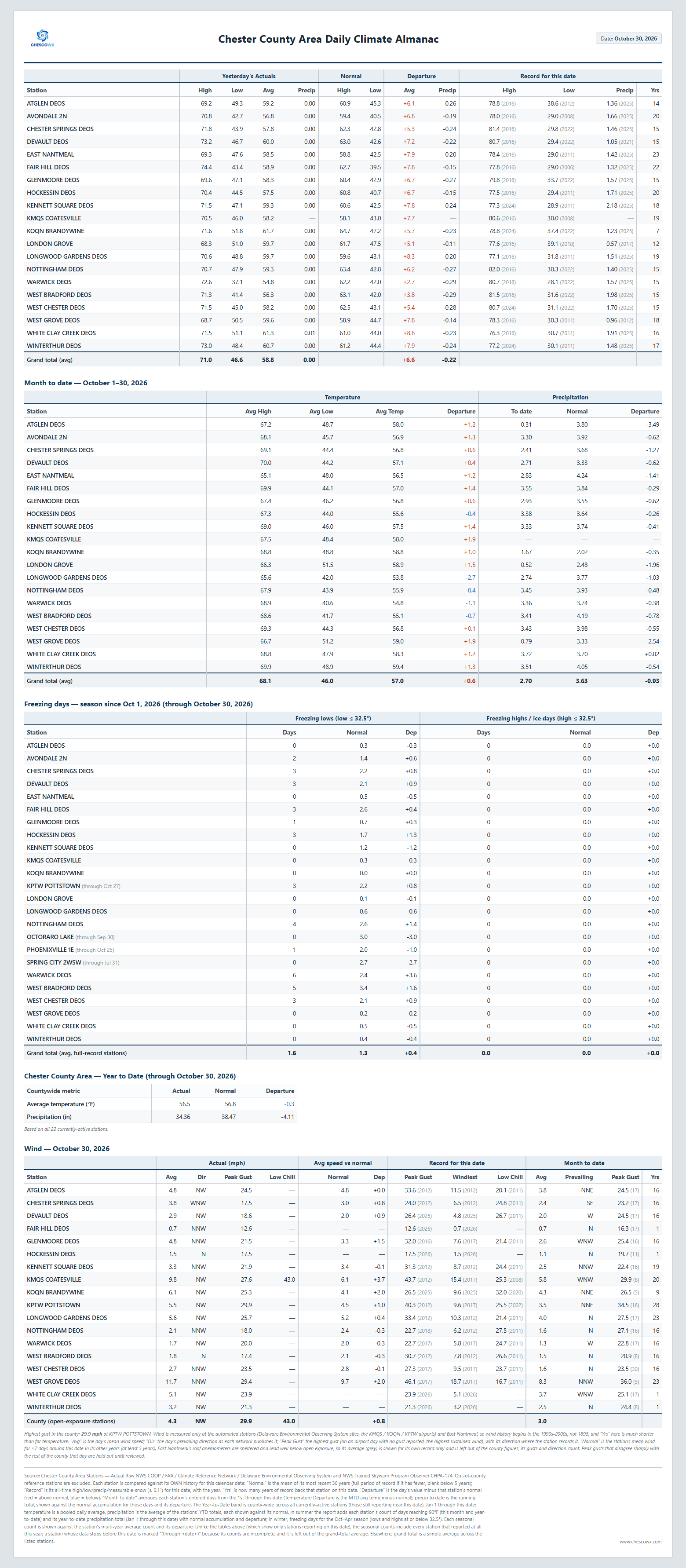
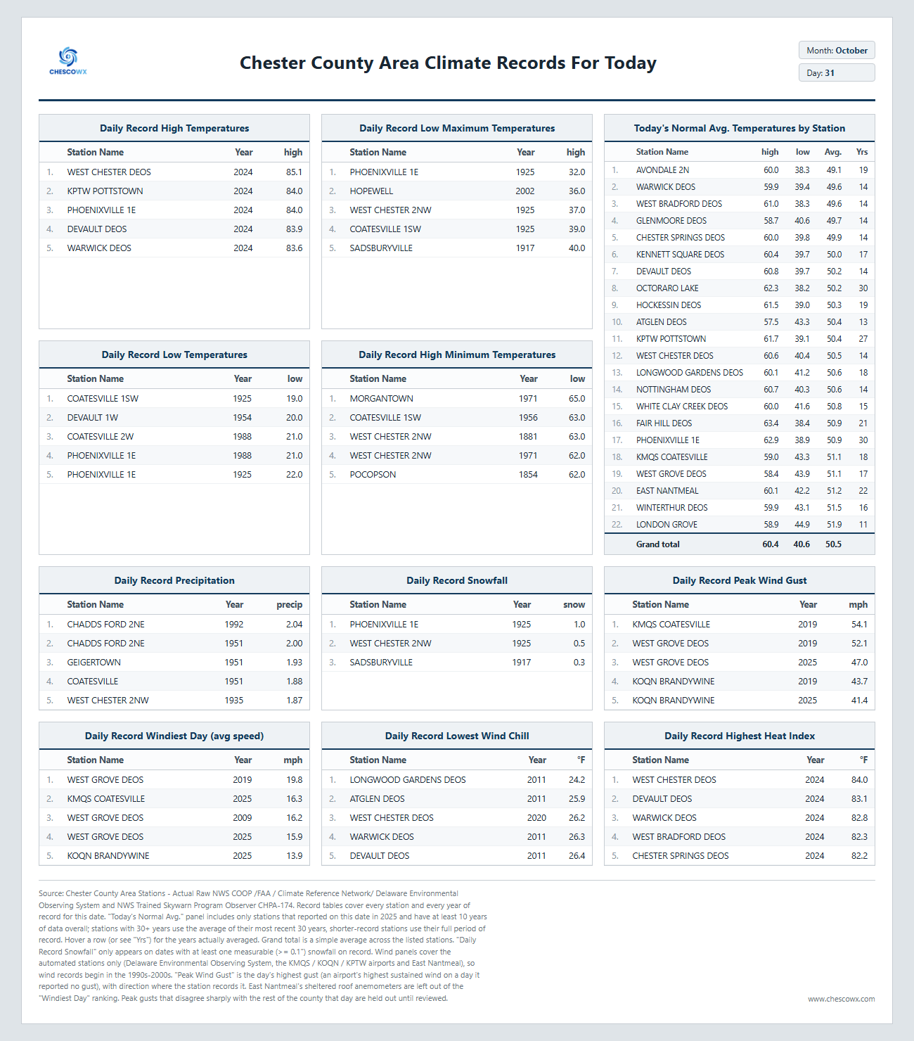
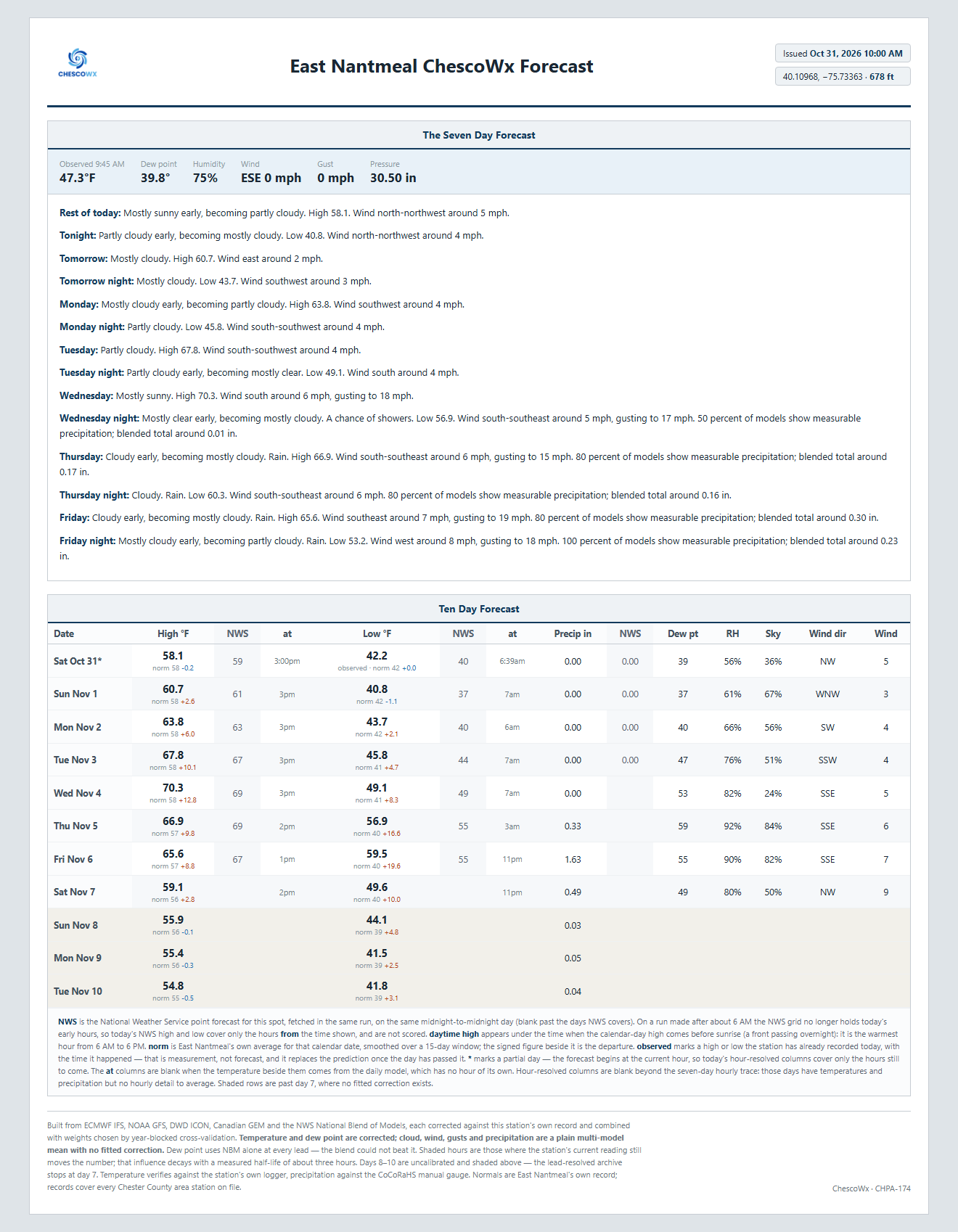
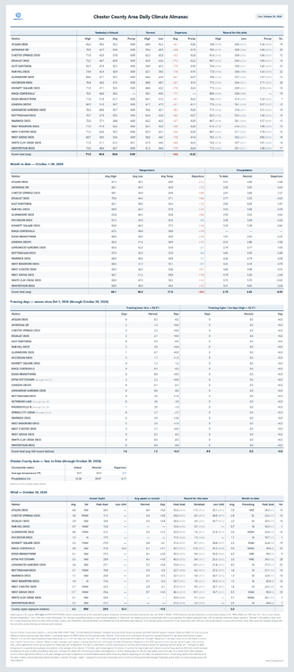
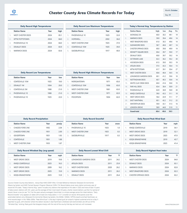
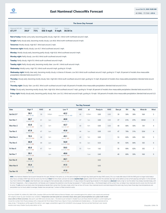
Happy Halloween to all of you!! Today we should see highs from upper 50's in ridge locations to the low 60's in valley spots. The NWS has issued a frost advisory for tonight for Eastern Chester County with temperatures just above freezing in valley locations while the ridge tops mainly across Western Chesco stay in the low 40’s. Temperatures will be near normal through Monday but by Tuesday we warm to the upper 60's which is 4 to 8 degrees above normal. It has been a while since our last rain but our next soaking rain looks to arrive Friday with around 1.6" possible according to the ChescoWx model. Of note 160 years ago today back in 1866 the Chester County Area was on the last day of a 3 day storm that left as much as 2.10" of rain at Pocopson. This was the remnants of an unnamed tropical storm which tracked within about 130 miles of the county.
-

E PA/NJ/DE Autumn 2026 Obs/Discussion
ChescoWx replied to PhiEaglesfan712's topic in Philadelphia Region
Happy Halloween to all of you!! Today we should see highs from upper 50's in ridge locations to the low 60's in valley spots. The NWS has issued a frost advisory for tonight for Eastern Chester County with temperatures just above freezing in valley locations while the ridge tops mainly across Western Chesco stay in the low 40’s. Temperatures will be near normal through Monday but by Tuesday we warm to the upper 60's which is 4 to 8 degrees above normal. It has been a while since our last rain but our next soaking rain looks to arrive Friday with around 1.6" possible according to the ChescoWx model. Of note 160 years ago today back in 1866 the Chester County Area was on the last day of a 3 day storm that left as much as 2.10" of rain at Pocopson. This was the remnants of an unnamed tropical storm which tracked within about 130 miles of the county.
-
But the split……
-

2026-2027 Record-breaking El Nino
MJO812 replied to Stormchaserchuck1's topic in Weather Forecasting and Discussion
Your area will still see plenty of snow. You got the lakes . -
Picked up 0.02" yesterday, and 0.04" early this morning.
-
2026-2027 Record-breaking El Nino
BuffaloWeather replied to Stormchaserchuck1's topic in Weather Forecasting and Discussion
We know the impacts of weaker Ninos and it isnt good for winter lovers. They're all very warm. The effects will be amplified. -

October 2026 General Discussion
OrdIowPitMsp replied to SchaumburgStormer's topic in Lakes/Ohio Valley
Happy Halloween, some wet weather overnight and throughout the day but overall this looks like the nicest Halloween here in 4 years with a high around 57. 2 of the past 3 have featured trick or treating with snow on the ground so not having to dress the kids in winter gear with costumes overtop will be nice for a change. -
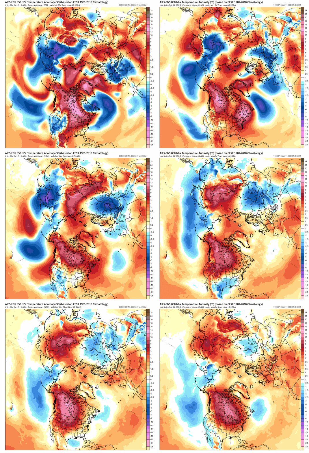
Canada is permachinooked in the extended
-
-
Yeah. I think it was just a preview of their winter forecast to premium members so they didn't break out month by month but it seemed JB was pretty clear that the numbers hinge on December being warmer. But he also indicated there's a chance for December to come in much colder and admitted it would blow their forecast if it did. Who knows, I guess I'll have to wait for the detailed forecast to come out to see what they really think.
-
Don't really care what temps do coming up. Let's start shuffling the pattern and get it active. I'm a bit resigned to a mixed bag of temps and precip most if not all winter.
-
So, by inference that might imply the expectation of a somewhat back-loaded winter? (ETA: a +1 departure for the season actually sounds pretty amazing, relative to some of the +4 to +6 I've seen tossed around. +1 would indicate some good opportunities for solid events can occur; +4 or +6 implies shit the blinds, and "party" like it's 2022-23!).
- Today
-
This is not going to get the job done: Cluster analysis of the leading two solutions from the earlier 12z guidance is lining up with the trend within 18z ensemble guidance favoring a northeast lift of low pressure system from the Mississippi Valley into the Upper Great Lakes region. If this trend continues and remains void the splitting mid/upper-lvl low scenario, forcing for ascent for meaningful precipitation may be extremely limited over the Carolinas. These solutions still do produce light rain totals over the Mid-Atlantic and into the Carolinas, but reasonable high-end amounts struggle to exceed 0.5" in 24 hours for the northern/eastern Piedmont and Coastal Plain where moderate to extreme drought persists.
-
It’s the softball season that never ends. Had playoffs last night, we came in as 4 out of 5 (lol). Beat team 5, then went on to beat team 1 and now play in the championship game 11/13!
-
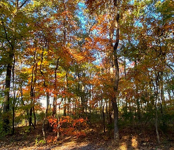
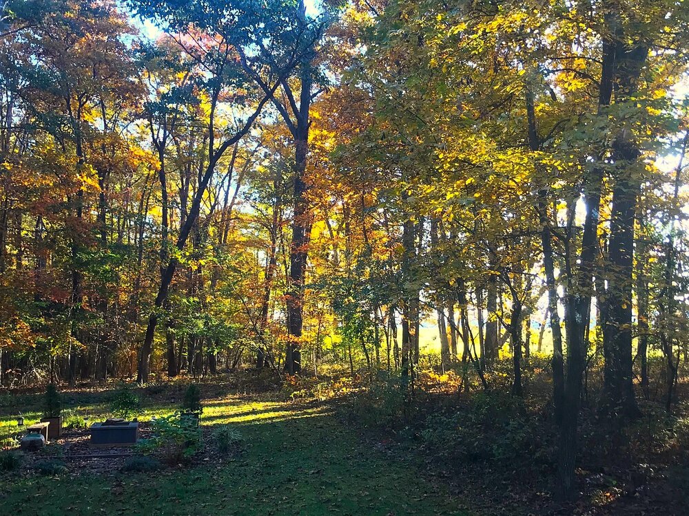
Low of 41. Gorgeous morning on the deck with coffee in hand.
-
-

2026-2027 Record-breaking El Nino
snowman19 replied to Stormchaserchuck1's topic in Weather Forecasting and Discussion
As @40/70 Benchmark and myself suspected, due to the hostile background state, the models are showing a rapid recovery to an above normal/strong SPV by December And as unbelievable as it is, this WWB looks like it may actually rival the one back in April. This is certain to cause more warming. I feel very good about my guess of this Nino peaking in December at a traditional ONI of +4C and a RONI around +3.5C. I still think the subsurface reaches a final peak of +13C next month. Also, no surprise that the SOI has gone negative again after a very brief positive run @donsutherland1 -
 DCA _ NYC _ BOS _ ORD _ ATL _ IAH _ DEN _ PHX _ SEA +3.5 +2.7 +2.2 +5.3 +2.0 +0.9 +2.7 +0.2 +3.0