All Activity
- Past hour
-
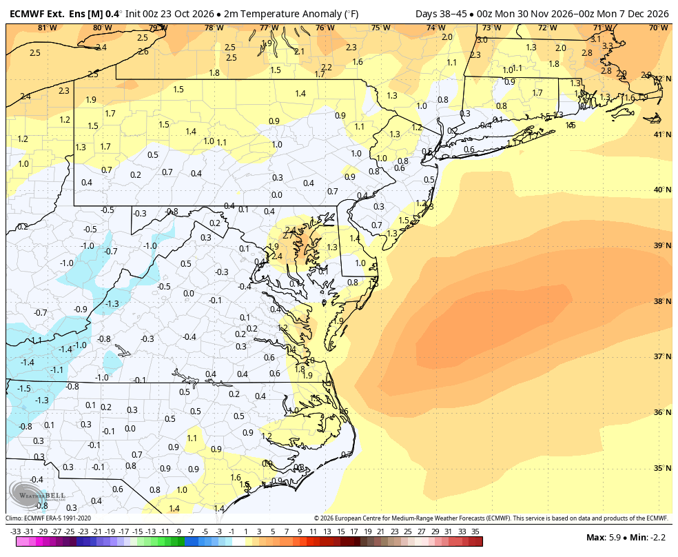
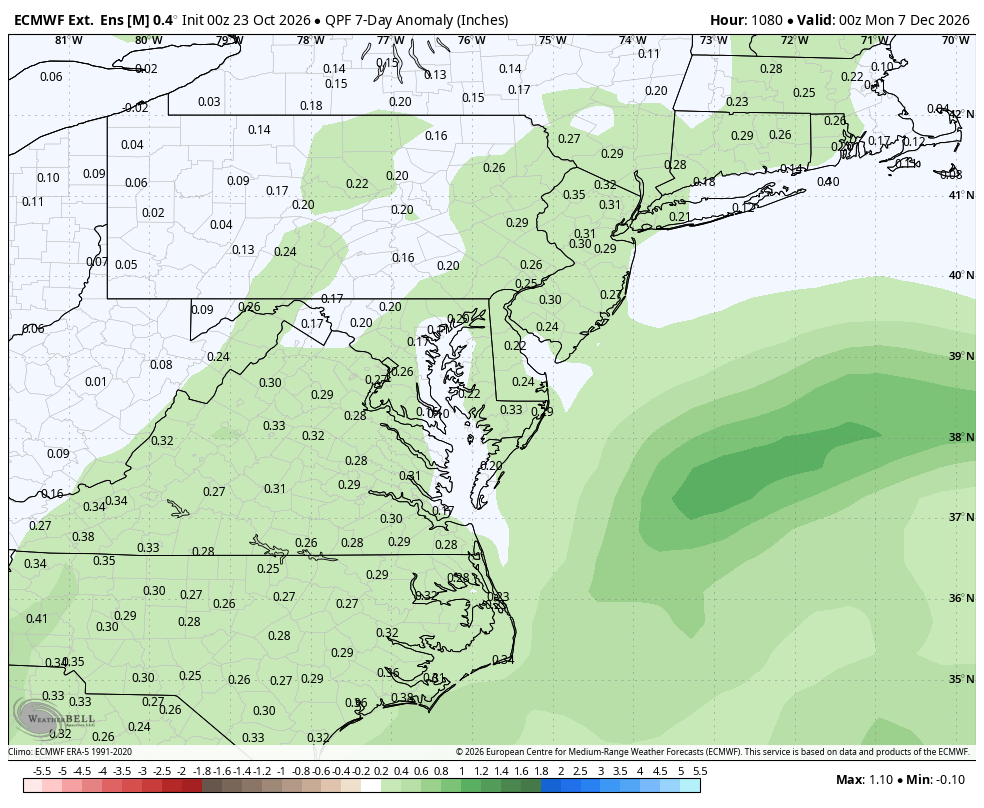
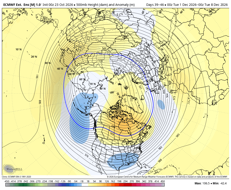
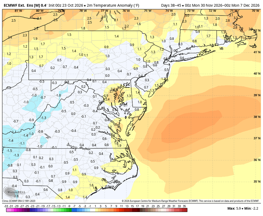
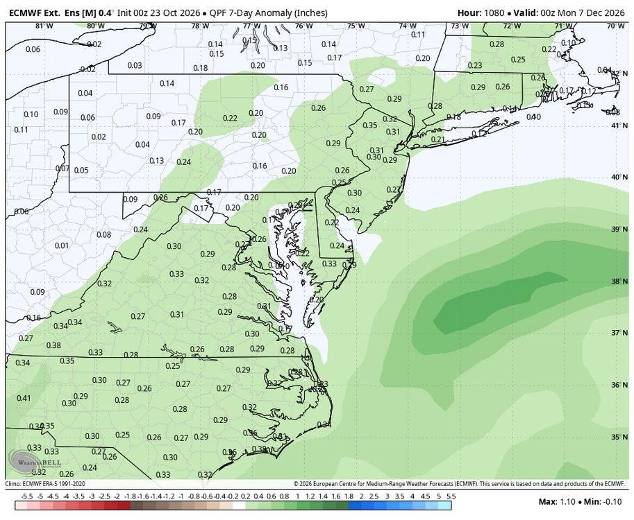
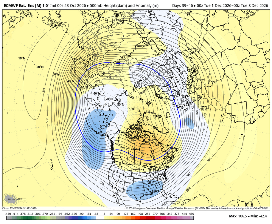
WB EURO weeklies for first week of December.
-

2026 Mid-Atlantic Severe Storm General Discussion
Eskimo Joe replied to Kmlwx's topic in Mid Atlantic
Not necessarily. NWS assigns new products to multiple test bed office concurrently to get data across multiple scenarios. It could be something like State College, Las Vegas, Duluth, and Binghamton. -
Any guesses on ORH and TOL for lows next few mornings? I think a 34 is doable
-
38 here when I drove to work at 8:00. Cool and crisp.
-
Ya…I do remember that.
-
Records: Highs: EWR: 87 (1947) NYC: 85 (1947) LGA: 86 (1947) JFK: 77 (1978) Lows: EWR: 30 (1997) NYC: 32 (1969) LGA: 32 (1969) JFK: 33 (1969) Historical: 1761 - A hurricane struck southeastern New England. It was the most violent in thirty years. Thousands of trees blocked roads in Massachsuetts and Rhode Island. (David Ludlum) 1843 - "Indian Summer" was routed by cold and snow that brought sleighing from the Poconos to Vermont. A foot of snow blanketed Haverhill NH and Newberry VT, and 18 to 24 inches were reported in some of the higher elevations. Snow stayed on the ground until the next spring. (22nd-23rd) (Sandra and TI Richard Sanders - 1987) (The Weather Channel) 1878: One of the most severe hurricanes to affect eastern Virginia in the latter half of the 19th century struck on October 23, 1878. This storm moved rapidly northward from the Bahamas on October 22nd and hit the North Carolina coast late that same day moving at a forward speed of 40 to 50 mph. The storm continued northward passing through east central Virginia, Maryland and eastern Pennsylvania. The barometric pressure fell to 28.78". The five minute sustained wind reached 84 mph at Cape Henry. During the heaviest part of the gale, the wind at Kitty Hawk, North Carolina registered 100 mph. The instrument itself has finally blown away and therefore no further record was made. 1920: Famed research meteorologist Theodore Fujita, was born on this date in Kitakyushu City, Japan. Fujita, known as "Mr. Tornado" after developing the international standard for measuring tornado severity, also discovered microbursts. 1947: Fish fell from the sky in Marksville, LA. Thousands of fish fell from the sky in an area 1,000 feet long by 80 feet wide possibly due to a waterspout. 1969: Boston, Massachusetts had a high temperature of 38 °F the coldest high temperature for October. (Ref. NOAA Boston Weather Events) 1987 - Thirteen cities in the southeastern U.S. reported record low temperatures for the date. It marked the sixth record low of the month for Greer SC and Columbia SC, and the ninth of the month for Montgomery AL. Showers and thunderstorms deluged Corpus Christi TX with five inches of rain. Winnemucca NV reported their first measurable rain in ninety-two days, while Yakima WA reported a record 96 days in a row without measurable rainfall. (Storm Data) (The National Weather Summary) 1988 - Denver, CO, reported their first freeze of the autumn, and Chicago, IL, reported their first snow. In Texas, afternoon highs of 93 degrees at Austin and San Antonio were records for the date. (The National Weather Summary) 1989 - A storm moving out of the Gulf of Alaska brought rain and high winds to the Central Pacific Coast Region. High winds in Nevada gusted to 67 mph at Reno, and thunderstorms around Redding CA produced wind gusts to 66 mph. Locally heavy rains in the San Francisco area caused numerous mudslides, adding insult to injury for earthquake victims. (The National Weather Summary) (Storm Data) 1997: Freeze 30°F killed tomatoes in Annandale, VA the earliest since 1992. (Ref. Annandale Weather Records) 2003: Arizona: Phoenix sets a record high and also breaks the record for the latest date for a triple-digit temperature as the temperature soars to 100 °F. (Ref. WxDoctor) 2005: Hurricane Wilma produced high winds pushing a high storm surge that breached a wide stretch of Havana, Cuba's seawall flooding area neighborhoods, spreading up to four blocks inland. (Ref. Wilson Weather History) 2007: Northern Louisiana: Cold air descends over northern Louisiana setting daily low maximum temperature records. El Dorado only reaches a high of only 52°F and Monroe, 54°F. (Ref. WxDoctor) 2015: On this day, Hurricane Patricia became the most powerful tropical cyclone ever measured in the Western Hemisphere as its maximum sustained winds reached an unprecedented 200 mph (320 kph) and its central pressure fell to 879 millibars (25.96 inches of mercury). Hurricane Patricia became the strongest Pacific hurricane on record shortly after midnight CDT early on Oct. 23. Air Force Hurricane Hunters had flown through the eye of Patricia and reported a sea-level pressure of 894 millibars as measured by a dropsonde inside the eye itself. Wind measurements suggested that the pressure measurement was not in the exact center of the eye and was probably not the absolute lowest pressure, prompting NHC to estimate the minimum central pressure at 892 millibars in its special 12:30 a.m. CDT advisory. Tropical cyclone strength comparisons are typically based on minimum central pressure. At 892 millibars, Patricia shattered the Eastern Pacific basin's previous record of 902 millibars set by Hurricane Linda in 1997. While a number of typhoons in the western North Pacific have been stronger, Patricia is now by far the strongest hurricane on record in any basin where the term "hurricane" applies to tropical cyclones – namely, the central and eastern North Pacific basins and the North Atlantic basin, which includes the North Atlantic Ocean itself plus the Gulf of Mexico and Caribbean Sea.
-
50 / 39 clear. Great stretch continues and marches into November. Overall near to slightly above normal for the 7 day period 10/30 - 10/30 then near normal beyond there and amazingly dry. Monday 10/26 and thu 10/29 looks like the warmest day of the next 7 - 10 and today the coolest, next shot at meaningful rain even though not being shown on the forecats, may come with the frontal passage next weekend.
-
He had some rough winters with it right after it was published.

-

Central PA Autumn 2026
Mount Joy Snowman replied to canderson's topic in Upstate New York/Pennsylvania
Low of 41. I haven’t had a freeze/frost here yet. Still plucking tomatoes off the vine, although they seem to be wrapping up. -
 zithromax 250 or buy zithromax online with mastercard average cost of generic zithromax https://www.google.bf/url?q=https://zpacksupply.com zithromax 250 mg australiaor https://brueckrachdorf.de/user/rqrgflygjs/ zithromax tablets [url=https://maps.google.lk/url?q=https://zpacksupply.com]where can i buy zithromax uk[/url] how to get zithromax onlineor [url=https://mantiseye.com/community/syjhcvscxp]zithromax cost[/url] zithromax for sale cheap
-
30.0 at 7. The first low above the 20's since a week ago today. Back down in the 20's tonight.
-
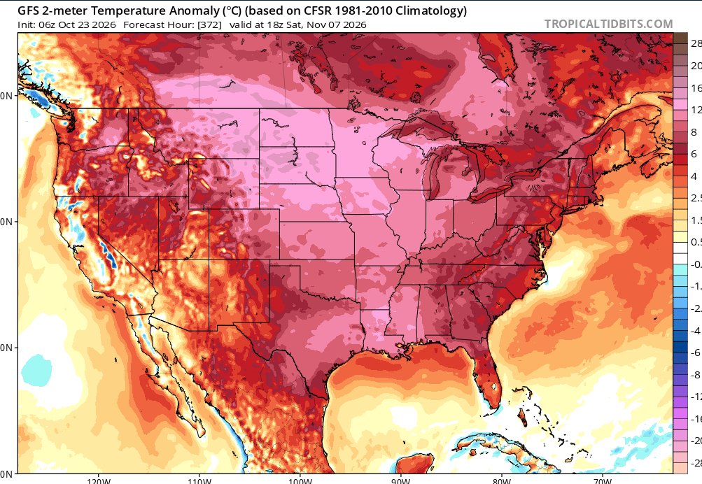
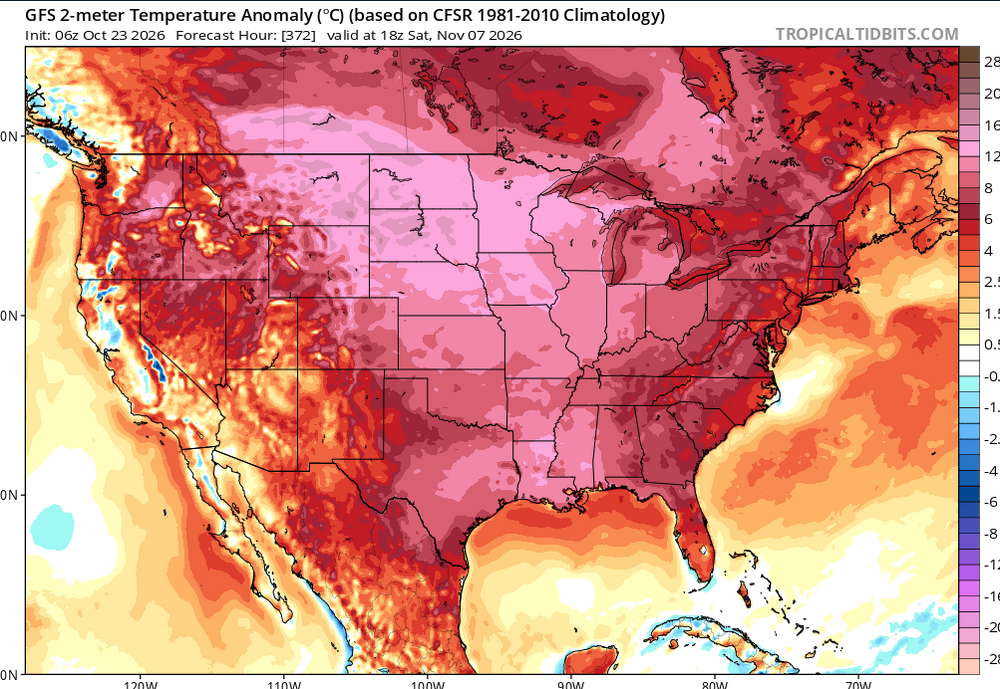
CONUS literally cannot stop torching. Every month since march 2026 was a total conus torch. We can't get a break.
-
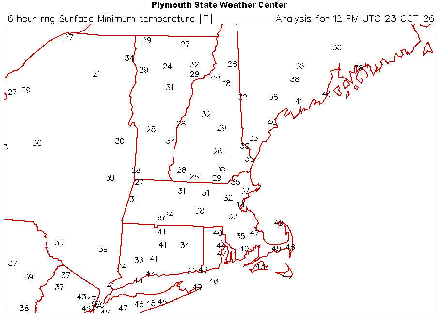
Yup. 10F colder at CON this morning. We stayed just mixed enough.
-
now riding
-
 Bubbler86 changed their profile photo
-
Another frosty morning despite it being breezy. I assume the wind picked up around sunrise. Min 35.6°
- Today
-
Haha thanks
-
Another 5 to 6 inches and it will match the summer low point.
-
buy levothyroxine online pharmacy LevoCarePharma buy synthroid with fast shipping
-
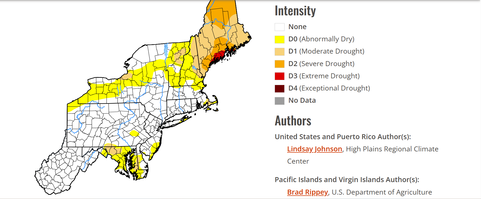
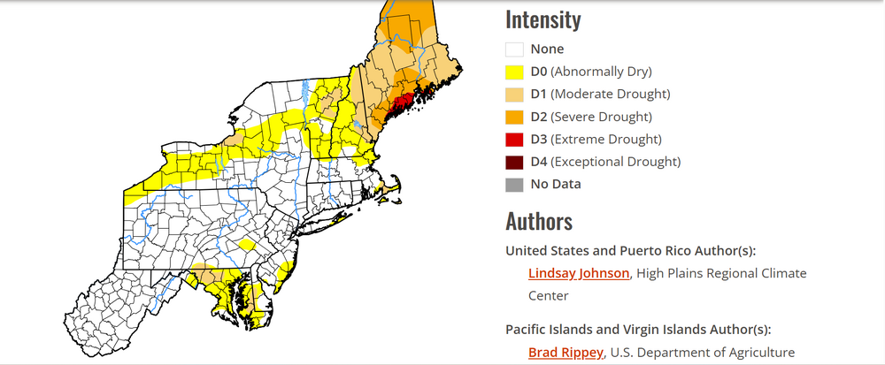
The weather has been amazing. Weather like this would be boring for many on this board, but love going out with nice temps and little wind. With that said, still some D1's and D0's in the Northern part of the forum. Despite the frost on the roofs, tender plants up here still going strong so having to start watering.
-
2026-2027 Fall/Winter Mountain Thread
Maggie Valley Steve replied to BlueRidgeFolklore's topic in Southeastern States
34 and frost for the 6th day. -
36 this morning and no frost.
-
I noticed that too, but wasn't sure what to make of it. I guess time will tell who wins round 1 of the Euro model war. Fwiw, AIGFS has 2 cold fronts moving through after 11/1.
-
It sure is making for some amazing fall weather. It's making for a smooth finish to the season for us seasonal business guys. It looks like another beautiful day on tap.
-
-6.56” precip at DCA and falling further behind