All Activity
- Past hour
-
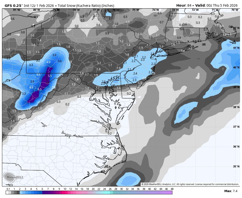
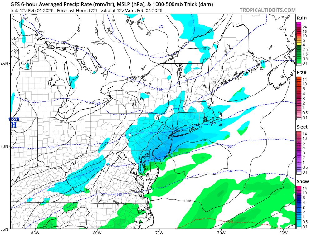
Wed clipper still worth watching IMO. It won’t be much but we’ll be close for a 1-3” type refresher. Maybe a little more if it can take in some Atlantic moisture.
-
Overnight low of 2. January precipitation: 2.76". Another month on the drier side of the ledger. January snowfall: 21.7". Snowfall season to date: 34.8".
-
GFS gives us a couple of inches from this
-

February 2026 OBS & Discussion
Freezing Drizzle replied to Stormlover74's topic in New York City Metro
The brutally cold season of 1976-1977 only yielded some 25 inches in the NYC area. (24.5" in CPK.) Yes, the snowfalls lasted. lol Heavy ice formation in the waterways. Area ferry services were suspended. Averages by month: November 1976 41.7 F (The coldest November since 1917 "primed" the cold waters.) December 1976 - 29.9 F January 1977 - 22.1 F February 1977 - 33.5 F -

February 2026 Medium/ Long Range Discussion: Buckle Up!
Weather Will replied to Weather Will's topic in Mid Atlantic
Midweek 1-2; 1-3 would be great; we will see what happens. -
You think it will take that long for the effects of the SSWE to be realized?
-
Thanks, thought it was me. Sorry for my negativity and I am stoked for the forum, historic storm
-

February 2026 Medium/ Long Range Discussion: Buckle Up!
mitchnick replied to Weather Will's topic in Mid Atlantic
.thumb.png.5dea90f5f1f05971b944298f3e7b9a26.png)
-
January 30th- Feb 1st ULL and coastal storm obs
NCBlizzard replied to JoshM's topic in Southeastern States
https://forecast.weather.gov/product.php?site=NWS&issuedby=MHX&product=PNS&format=ci&version=1&glossary=1 -

Possible coastal storm centered on Feb 1 2026.
Brewbeer replied to Typhoon Tip's topic in New England
12 / 2 F, bluebird skies here, a bit breezy -
I think we could epic torch like 2/22 or so into early March then have a secondary interesting stretch. I am not overly thrilled with anything in the near future. It probably gets pretty warm 9th-13th or so, especially areas SW of SNE. Then I do think we get a window there of maybe 8-10 days but feel it could go real ugly for a bit after that. Hopefully for places like the MA/SE/TN Valley it does not result in too much blooming because Nina-Nino transitioning March years long have a history of these active stretches in March after mild periods
-

February 2026 Medium/ Long Range Discussion: Buckle Up!
bncho replied to Weather Will's topic in Mid Atlantic
12z GFS more north edit: and east as well
-
Some neighbors with a sloped driveway did this! They were out there breaking squares of ice, turning them upside down, and sliding them down the driveway. Then they had a few inches of powder to push. Smart! Their driveway also faces south which is nice. I left about an inch of sleet on ours which is now pure, smooth ice
-
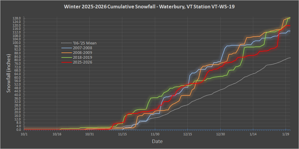
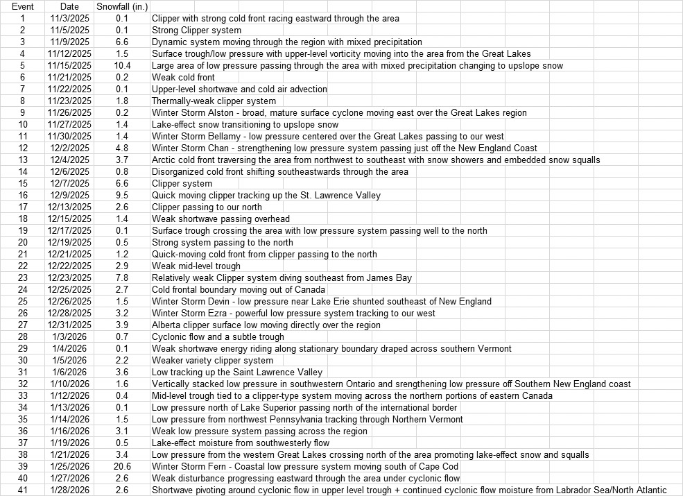
January has just finished up and we’re at the approximate midpoint of the snowfall season around here, so I have the plot with the latest seasonal snowfall progression from our site. The current season is the red trace in the plot, and since that flurry of activity leading up to Christmas, snowfall strolled along at a roughly average pace until about the second week of January. The slope of the average snowfall trace can be used for comparison, but at that point the pace of snowfall actually fell off to a bit below average. This season definitely started to fall behind the snowfall pace of those comparator seasons I have in the plot, and that’s how it was going until that big snowfall spike near the end of January representing Winter Storm Fern. That storm and the couple of additional events we’ve had this week have brough this season right back up into the mix among those other seasons. Starting with the numbers in hand at this point of the season, the stats can be used to get some odds of where the overall seasonal snowfall may end up: Chance of reaching average season snowfall of ~160”: 96.0% Chance of reaching season snowfall of 200”: 38.0% Chance of matching the 1st ½ season snowfall to reach 240”: 1.4% Clearly it would be quite unlikely for this season to continue with the snowfall pace we’ve seen so far for this first half. We’ve never had a season reach 240” of snowfall during my period of record here – none of those other strong seasons in the plot reached that total. I also have the storm list for the first half of the season below. I haven’t assembled stats on the pacing for the number of storm we get during the season, but we’re probably ahead of average there. If storm frequency were to continue at this pace, we’d have over 80 storms on the season, which is way above average – the greatest number of storms we’ve seen in a single season thus far at this site has been 64. If I were to run the numbers, I bet we’d find that there are fewer storms in the second half of the season relative to the first half. As we head father into the winter season, the tenor/typical weather pattern feels different than the November and December regime that has relatively warm Great Lakes and often provides lots of smaller systems/lake-effect events with frequent snowfall. But, every season is different, and we’ll see what Mother Nature decides to do this time around.
-
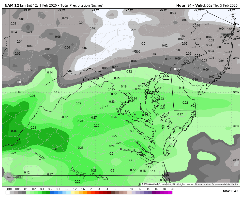
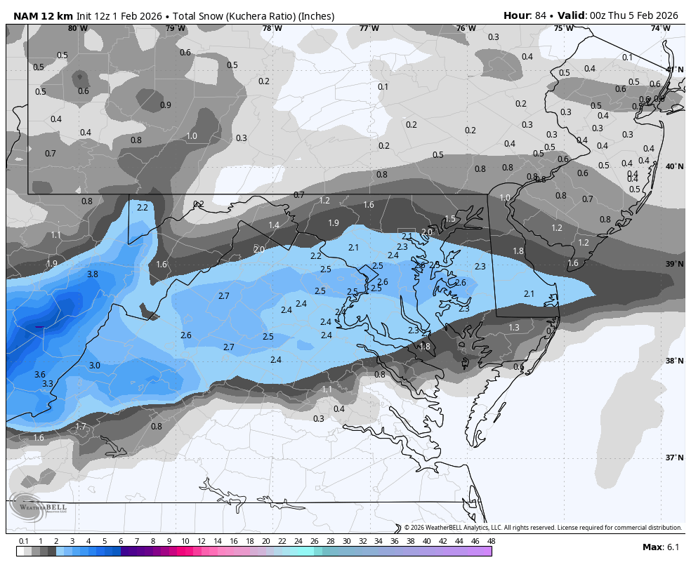
February 2026 Medium/ Long Range Discussion: Buckle Up!
Weather Will replied to Weather Will's topic in Mid Atlantic
WB 12Z 12K NAM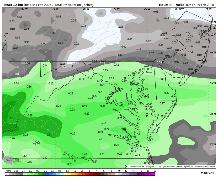

-
I thought that 1979 leading up to PD1 was colder, but I guess not. Also thought 1977 was in the mix too.
-

Jan 30th-February 1st 2026 Arctic Blast/ULL Snow OBS Thread.
jaxjagman replied to John1122's topic in Tennessee Valley
We got a unexpected dusting this morning -
Official forecast is only for 29 here. I'm in the 20s now too.
-
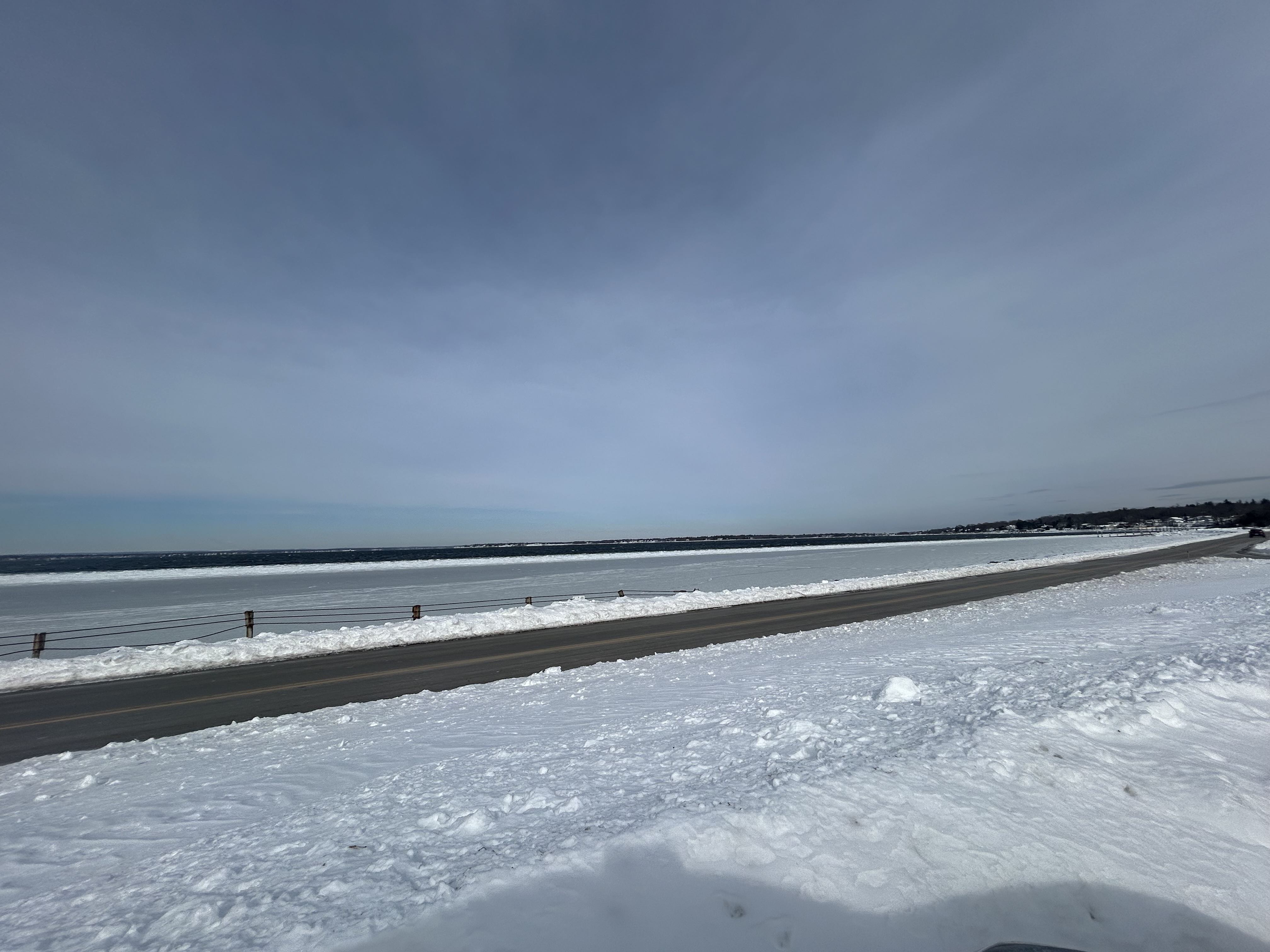
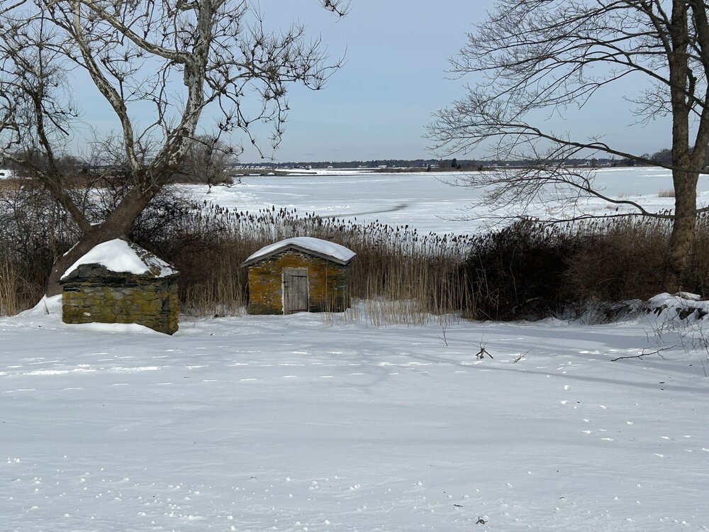
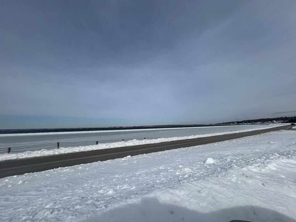
And some freezing of Narragansett Bay… it’s been a while.
-
Up to 23.4 here, after a low 7.2
-
Deep winter in Colt State Park in Bristol.
-

Possible coastal storm centered on Feb 1 2026.
CoastalWx replied to Typhoon Tip's topic in New England
2.5” Gloucester. 2-3” at my parents already. So close. -

Jan 30th-February 1st 2026 Arctic Blast/ULL Snow OBS Thread.
Knoxtron replied to John1122's topic in Tennessee Valley
-
His quoting my post wasn't about you unless you're running two different accounts...
-
You guys deserved a better storm. Even in my downslope area I'm surrounded by 6-10" plus in all directions and I got a little over 5. Grateful but not a memorable nor historic storm here. The wind last night was more memorable than the snow honestly. It was gusting over 50.


.png.1f05272681d8ff4871b4cad2d678e1c6.png)