All Activity
- Past hour
-
I like it this time of morning no legs jumpers, no big predictors, just a nice cool and smooth outlook. Good job, brother.
-

E PA/NJ/DE Winter 2025-26 Obs/Discussion
BBasile replied to LVblizzard's topic in Philadelphia Region
Low this morning was 7.1F. It has since warmed up significantly to 8F. -
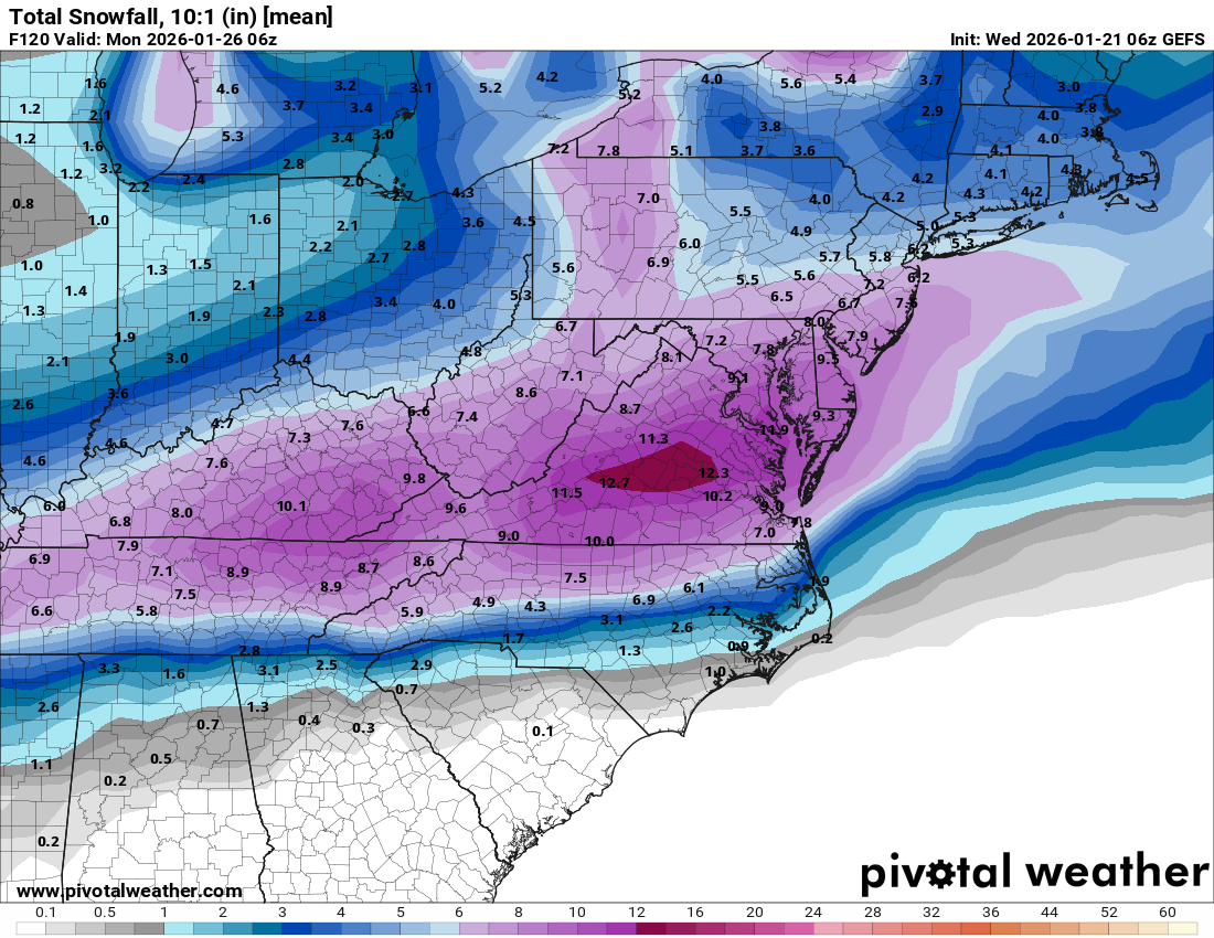
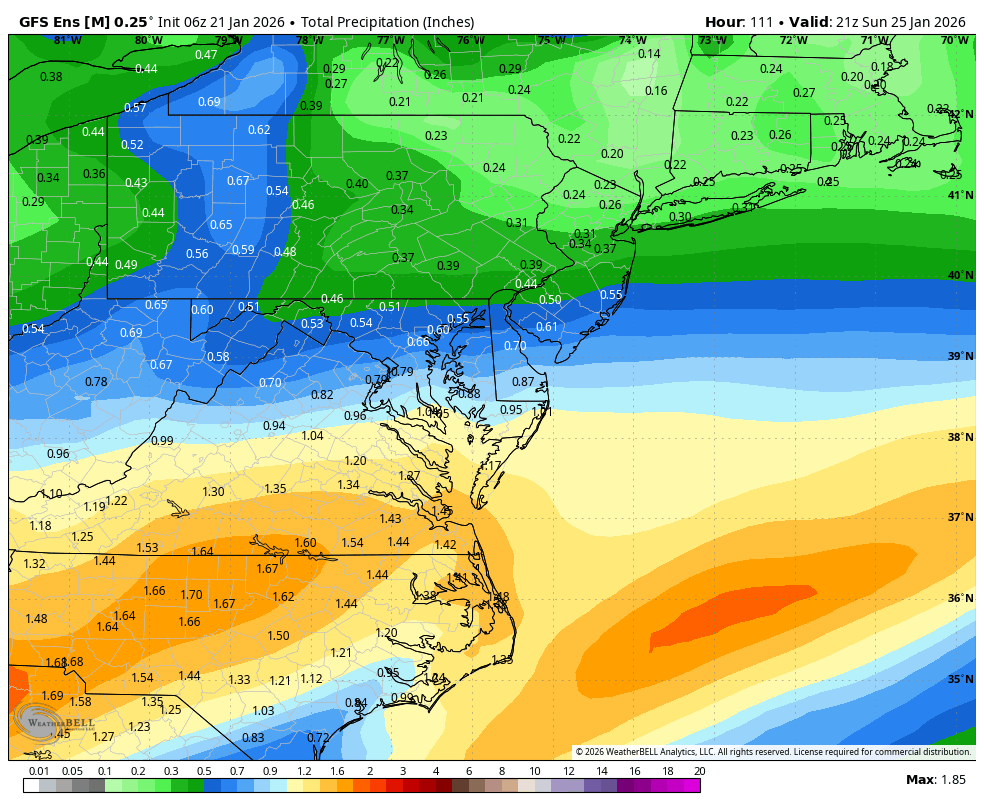
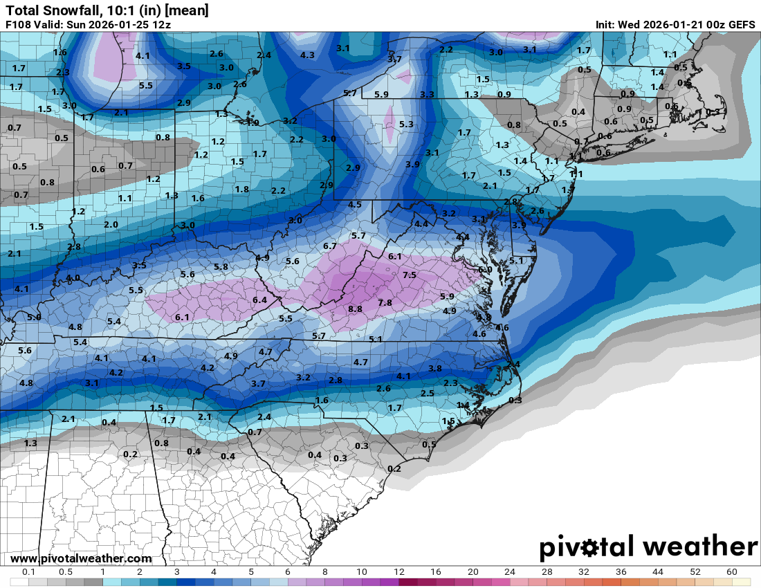
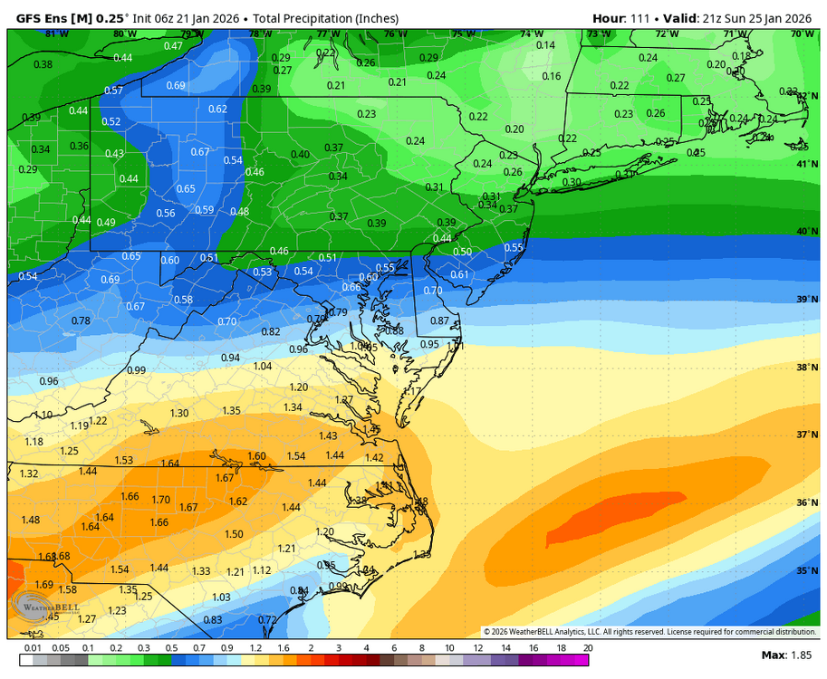
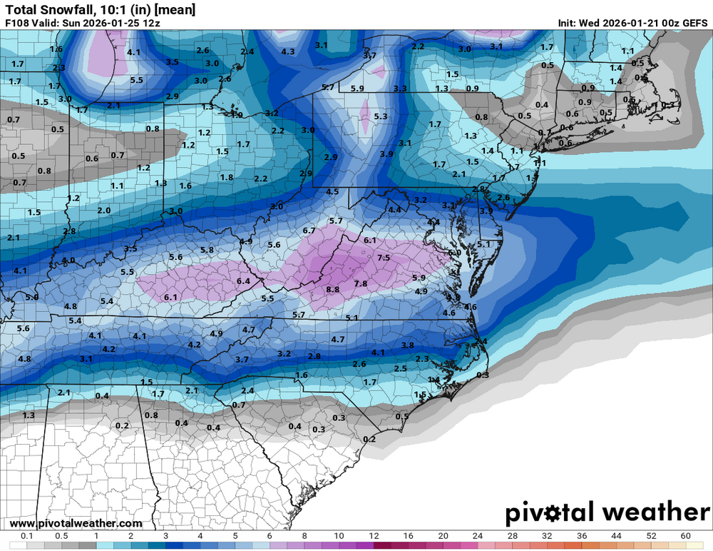
Will, is the QPF map through the entirety? I’m thinking its hard for places to get 6” of snow off 10:1 ratios with .48 qpf…
-
.
-

January 2026 regional war/obs/disco thread
Roger Smith replied to Baroclinic Zone's topic in New England
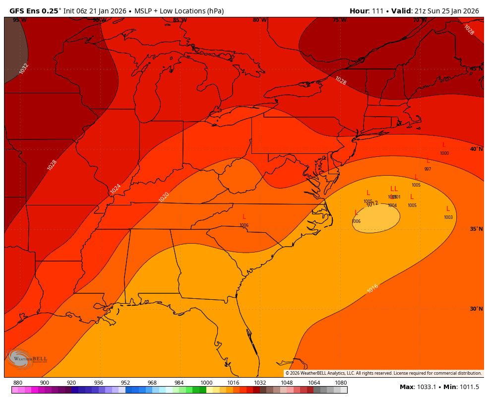
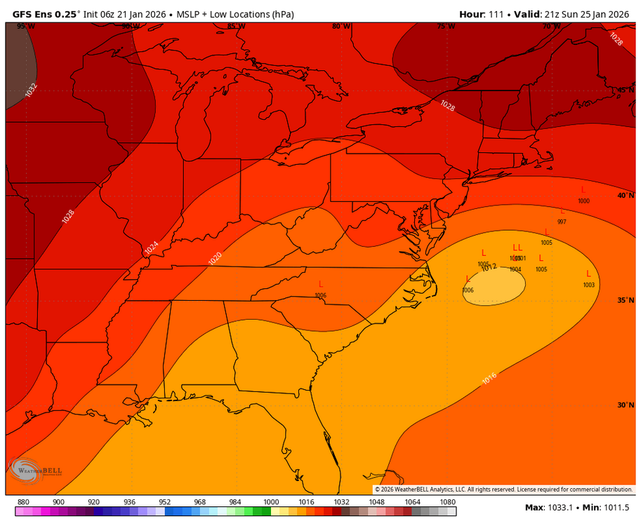
Willing to bet this bombs out near Long Island and buries the region in feet of snow. Model trend is baby steps towards that end result. If this drops to 980 instead of 998, look out. -
Well its the Euro vs the GFS. hard to go against the euro though. It would be a shame if we wasted all this cold air and a cold ground. Both yesterday and this morning's lows were 13 degrees so far.
-
And the full run
-
It has dipped to 12.9 at the farm in Louisburg and the airport is sitting at 14! Think that’s the coldest reading for both this season. Sitting at 21.2 here at home. Might fall a little more at both locations
-

January 2026 regional war/obs/disco thread
40/70 Benchmark replied to Baroclinic Zone's topic in New England
1.0 -
WB 6Z GEFS is a hold, even slight tick south. Coastal low is main low, not amped solution with a primary going into WV.
-

MO/KS/AR/OK 2025-2026 Winter Discussion
rockchalk83 replied to stormdragonwx's topic in Central/Western States
Not the whopper the 00z was, but the 06z GFS is still a good hit for most, with warning criteria snows along and S of US 54: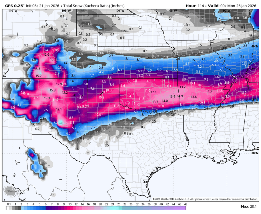
-
Besides the storm this weekend, my god the extended cold!
-

January 25/26 Jimbo Back Surgery Storm
NorthHillsWx replied to Jimbo!'s topic in Southeastern States
Short answer- yes. Strength of HP does not mean it cannot get caught up in the flow and be transient. This is a huge common misconception that strong HP areas just can’t be moved, if there isn’t blocking, they will just keep on going. That being said, in this case we do have blocking. What we’ve seen shift is orientation. As the trough tends to dig further west, it is pulling our HP further north and opening up an escape path for our low to ride up the coast, in this case a miller B. Also while our HP is strong, the low has been trending stronger as well meaning it isn’t simply going to slide under the high. The high remains in an optimal spot for CAD areas so low level cold very likely will be there in the CAD favored regions throughout the storm but our storm system is likely still going to trend north as well as long as the trough keeps moving west. If I had to make a call now I’d say ATL has ice to rain, upstate has sleet to ice, SC midlands stay mostly ice, triad/foothills mostly sleet, triangle sleet to ice and coastal plain sleet to ice to rain. Snow will likely be limited to border counties and relatively brief. Think max snowfall might actually be in DC area up into Pennsylvania. Virginia likely gets thumped but I think with the coastal and miller b that warm nose changes the southern half over to sleet and eastern Virginia might actually be dancing with cold rain (Va beach, eastern shore). -

January 2026 regional war/obs/disco thread
moneypitmike replied to Baroclinic Zone's topic in New England
A James winter for the ages. -
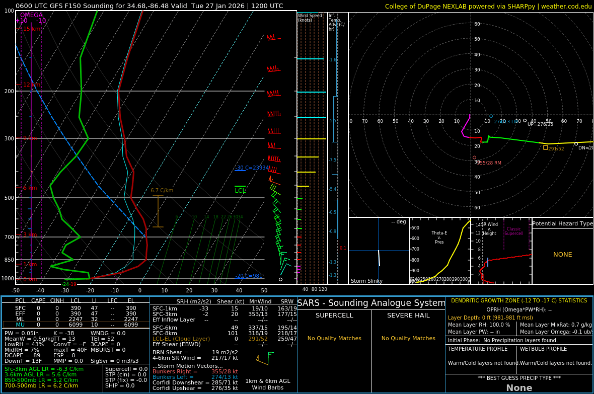
Check this 6z gfs sounding over AL. Near -30c at the sfc and near 0c at h85.

-
GEFS still not buying the Euro, ticked south at 6z
-

January 2026 regional war/obs/disco thread
UnitedWx replied to Baroclinic Zone's topic in New England
Nice to wake up to this... and not nightmares of Torchy narrating Massengil commercials -
Not even the NAM is on its side. lol.
-
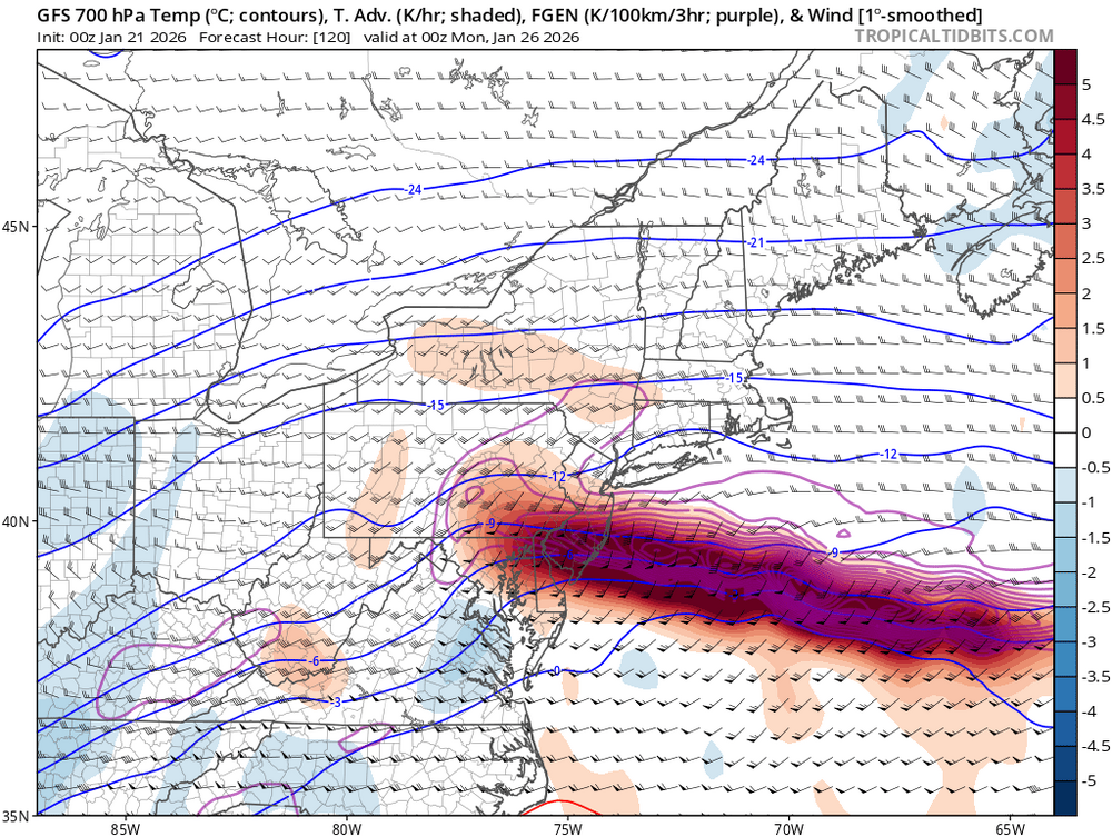
Hawt panel on the gfs. Dendrite bomb hopefully for wherever the predominant snow band sets up.

-
A story as old as Time. .
-

Central PA Winter 25/26 Discussion and Obs
Voyager replied to MAG5035's topic in Upstate New York/Pennsylvania
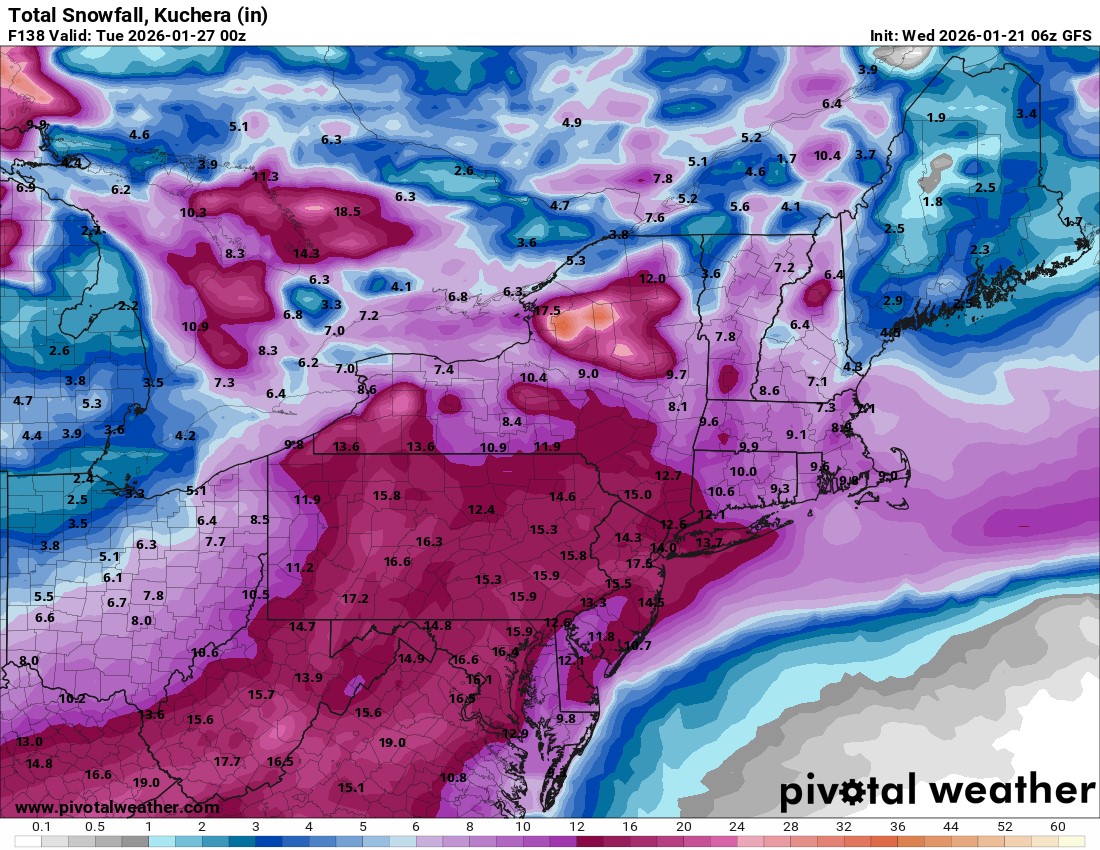
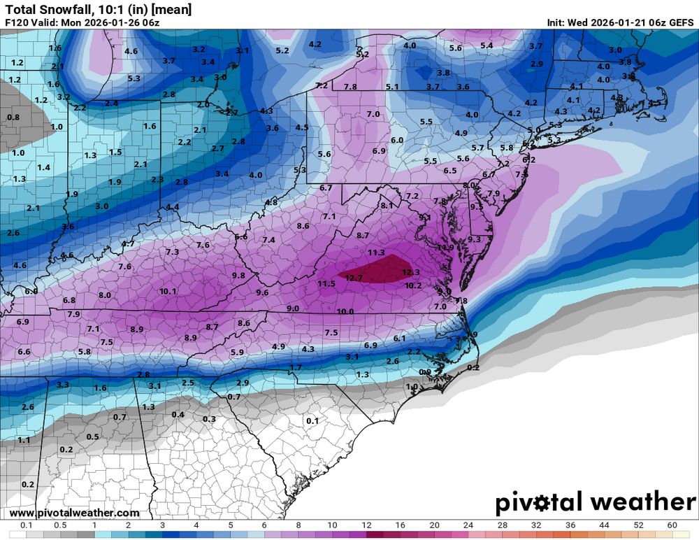
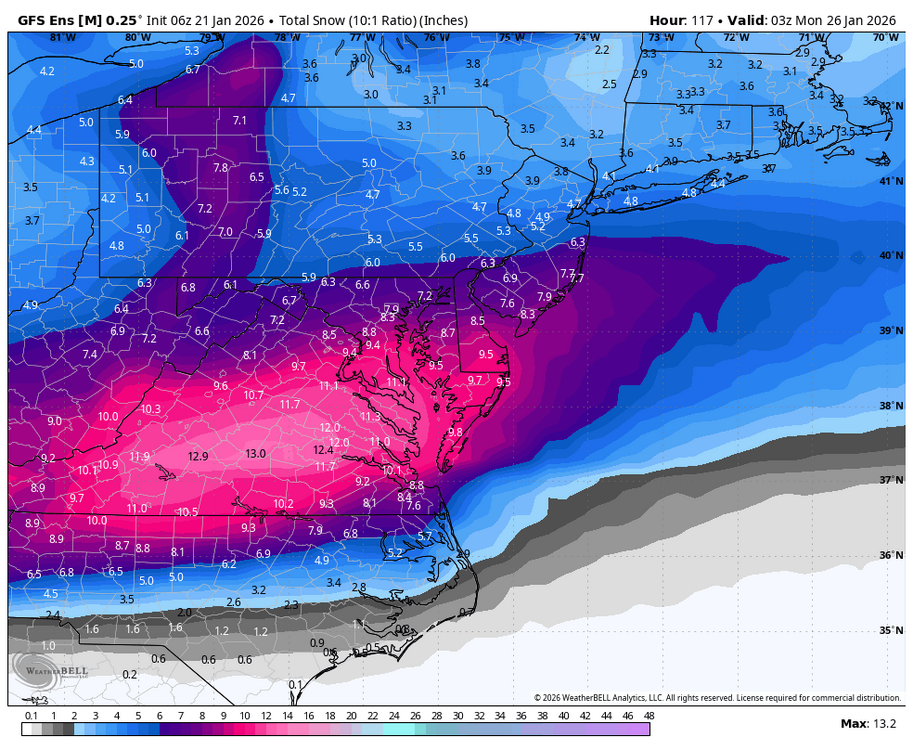
6z GFS holds serve... Considering the high ratios this one should have, I think the Kuchera map is the right way to go.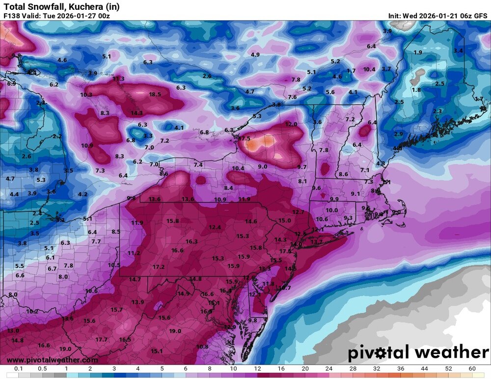
-
Honestly my expectation too. It won’t shock me to see these 10+ inch runs shift back down south, but I like the majority of folks around the Berks/Lehigh area for 6-8in
-
Case in point. The 06z Uk just ticked the northern wave 50 miles further east (more separation).
-

January 2026 regional war/obs/disco thread
ineedsnow replied to Baroclinic Zone's topic in New England
Close to a mini nuke on the GFS next Thrusday and Friday -
Low of 5° so far