All Activity
- Past hour
-
Congrats on a good soaking tonight and tomorrow
-
Through 6 pm, rainfall amounts included: Bridgeport: 0.78" Islip: 0.07" New York City: 0.58" Newark: 1.00" White Plains: 0.50" Showers and periods of rain will likely continue into early tomorrow. Some locations could experience a thunderstorm. A general 0.50"-1.50" rainfall is likely. Some locally higher amounts are possible. Following the storm, readings will reach the middle and upper 70s tomorrow. Wednesday through Friday will likely see highs in the lower 80s. Some showers are possible as a warm front moves across the region on Friday. A warming trend could commence during or after the next weekend. Some of the guidance suggests that hot weather could return to conclude June. The ENSO Region 1+2 anomaly was +3.0°C and the Region 3.4 anomaly was +1.7°C for the week centered around June 17. For the past six weeks, the ENSO Region 1+2 anomaly has averaged +2.42°C and the ENSO Region 3.4 anomaly has averaged +1.22°C. The ongoing El Niño will continue to strengthen through the summer. The SOI was -19.68 today. The preliminary Arctic Oscillation (AO) was +0.029 today. Based on sensitivity analysis applied to the latest guidance, there is an implied near 90% probability that New York City will have a warmer than normal June (1991-2020 normal). June will likely finish with a mean temperature near 73.8 (1.8° above normal). Supplemental Information: The projected mean would be 2.4° above the 1981-2010 normal monthly value.
-
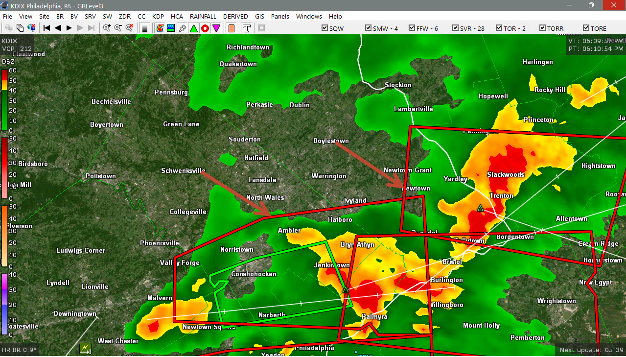
Seems like there’s a force field Baltimore north and west to prevent any storms from firing up
-
I saw dust devils a little earlier in the field(with crops) across from my driveway.
-
This bowed out storm complex rolling through looks pretty mean. 80 mph winds in the strongly worded warning text. They also activated the cell phone emergency alerts for it.
-
Mid shore is gonna get it, but north of you and probably south of me. Congrats Denton.
-

Wet late Monday 6/22 or another Fizzle?
Weather Will replied to Weather Will's topic in Mid Atlantic
Tornado warning in Charles County. -
Hopefully an infestation of grubs and fungus.
-
-

2026 Mid-Atlantic Severe Storm General Discussion
George BM replied to Kmlwx's topic in Mid Atlantic
Tornado Warning near Quantico and into Charles county, MD now. -
.01” here. .
-

E PA/NJ/DE Summer 2026 Obs/Discussion
WxUnit replied to PhiEaglesfan712's topic in Philadelphia Region
Earlier in the Exton PA area where the rotating storm went just north. Was able to photograph a funnel cloud from it. Was rapidly rotating like nothing Ive seen before.
-
Only .10 here. Best stuff north first, now south.
-

Junorch obs and discussion 2026
Damage In Tolland replied to Damage In Tolland's topic in New England
It had route 2 north for days. It was awful . Put the cake and cookies away -

E PA/NJ/DE Summer 2026 Obs/Discussion
Birds~69 replied to PhiEaglesfan712's topic in Philadelphia Region
Seems to developing more as it heads E....N and W burbs kinda got shafted.
-

E PA/NJ/DE Summer 2026 Obs/Discussion
pl0k00n111 replied to PhiEaglesfan712's topic in Philadelphia Region
Pretty windy and rain city in palmyra, NJ. -

E PA/NJ/DE Summer 2026 Obs/Discussion
Hurricane Agnes replied to PhiEaglesfan712's topic in Philadelphia Region
Down to sbout 1.5"/hr with 1.88" in the bucket . Temp 70 dp 69. -
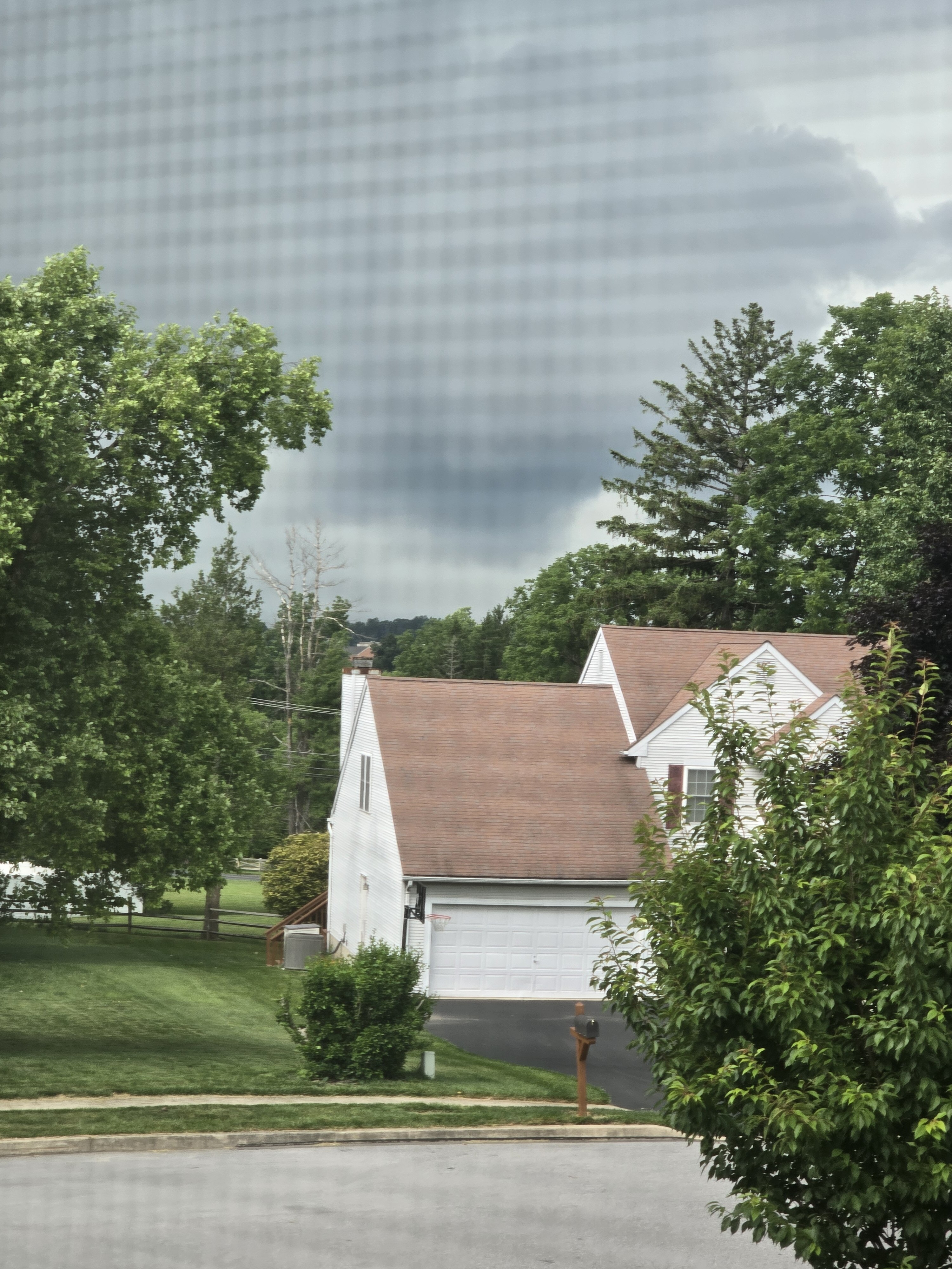
At least we are getting some late afternoon sun after a pretty gray cloud deck today.
-

E PA/NJ/DE Summer 2026 Obs/Discussion
soadforecasterx replied to PhiEaglesfan712's topic in Philadelphia Region
Although I got hit by a storm only 0.13" All the good stuff either went north, east or south -
Fringe-y today. with over 3" mtd not complaining
-
Ha. He’s about to hit 1”
-
Guy bitched his way to a Jack. I’ll be lucky for a half inch with this batch.
-
Always the split. The line over Kent Island just misses and the line over VA will go poof as it approaches. Seems to be the general rule for the midshore.
-
He’s drunk. Hrrr has done well. I can’t wait to pour bleach on his lawn.
-
It's like Cross Mountain is a wall these days where all rain goes to die. Heavy radar returns just fall apart and the rain just splits. I had about 10 minutes of a shower. I don't recall in my lifetime ever seeing rain dry out specifically over this small area so often. I've seen droughts before but this one seems like almost a micro drought.