All Activity
- Past hour
-
This post is ridiculous. Now you’re posting completely untrue, false information about a model run and you should get a warning for it. The new 3K and 12K NAM have zero snow anywhere in NYC even at 10:1 ratios. The wishcasting needs to stop. Put it in banter, not in a serious thread
-
Overall idea hasn’t changed much, but we may get “luckier” with snowfall amounts.
-
Probably some white rain at the onset, maybe even a little grass accumulation at best but will all turn to rain with temps near 40F.
-
They aren’t as good of models to pick up on the small things that matter. Nam has trended south each run so it’s slowly getting there.
-
-
First Winter Storm to kickoff 2025-26 Winter season
dryslot replied to Baroclinic Zone's topic in New England
Looks like GYX stole my forecast. Tuesday Snow, mainly after noon. The snow could be heavy at times. High near 32. Calm wind becoming west around 5 mph in the afternoon. Chance of precipitation is 80%. New snow accumulation of 4 to 8 inches possible. Tuesday Night Snow likely, mainly before 10pm. The snow could be heavy at times. Mostly cloudy, with a low around 19. Chance of precipitation is 60% -

12th Annual Mid-Atlantic Snowfall Contest
NorthArlington101 replied to RodneyS's topic in Mid Atlantic
Making a very modest adjustment upward since I think we get off to a relatively hot start for December BWI: 13.4” DCA: 11.1” IAD: 15” RIC: 8.5” SBY: 9.1” -
Personally, I'd feel more comfortable with the Nam and Icon being on board. I know they have problems, but to be this close to the event and they have the rain/snow line 75+ miles north is odd, even for them, within 48 hrs.
-

First Winter Storm to kickoff 2025-26 Winter season
HoarfrostHubb replied to Baroclinic Zone's topic in New England
BOX is a bit aggressive here on the PnC Tuesday Snow, mainly after 9am. The snow could be heavy at times. High near 34. Calm wind becoming northeast around 6 mph in the afternoon. Chance of precipitation is 90%. New snow accumulation of 5 to 9 inches possible. Tuesday Night Snow likely, mainly before 2am. Mostly cloudy, with a low around 19. Northwest wind 6 to 8 mph. Chance of precipitation is 70%. New snow accumulation of 2 to 4 inches possible -

E PA/NJ/DE Winter 2025-26 Obs/Discussion
penndotguy replied to LVblizzard's topic in Philadelphia Region
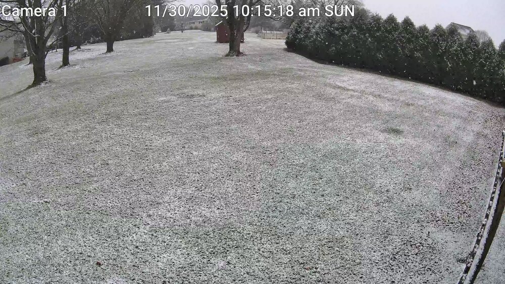
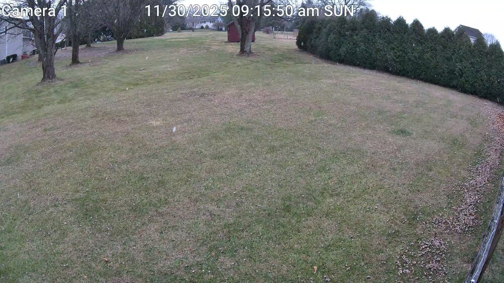
Well we are off and running officially a trace of snow IMBY looked nice falling temps fell back from 36f to 34f when the heavier band started, looks like it’s all done here. Now we watch Tuesday. -
Mod. Snow. 33.4°
-
you said that you would release another winter outlook in november if your idea about winter changed. maybe it's time?
-
Pittsburgh PA Fall 2025 Thread
Burghblizz replied to TheClimateChanger's topic in Upstate New York/Pennsylvania
Probably a bit progressive for this - but NAM showing the best thread the needle solution https://www.pivotalweather.com/model.php?m=nam&p=snku_acc-imp&fh=60 ☃ -
And the SPV will weaken again in mid late dec - might be helpful for early mid Jan too
-
First Winter Storm to kickoff 2025-26 Winter season
radarman replied to Baroclinic Zone's topic in New England
That Reggie solution is best case scenario for many IMO -
E PA/NJ/DE Winter 2025-26 Obs/Discussion
sibbley replied to LVblizzard's topic in Philadelphia Region
-
Dumping snow again.. .
-

First Winter Storm to kickoff 2025-26 Winter season
Ginx snewx replied to Baroclinic Zone's topic in New England
Last thing I want, and this is my only OCD side, is leaves on fresh snow, so I finished raking any stragglers in the snow blowing routes. Lots of doggie trails and now a 100 yd blower trip to the new coops. -
Nov 28-30th Post Turkey Day Winter Storm
homedis replied to Chicago Storm's topic in Lakes/Ohio Valley
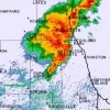
Woke up this morning to a foot in Lake Forest. Best winter storm since Feb 2021 hands down! -
E PA/NJ/DE Winter 2025-26 Obs/Discussion
Albedoman replied to LVblizzard's topic in Philadelphia Region
Location:Lower Macungie Twsp Posted November 23 The models have shown only one positive thing in the last two weeks for a major pattern change and a possible major snow event for us but when it will ever occur will just be plain luck. If you old timers recognize the current major pattern shift on the last weeks runs which we have not seen in nearly 6-10 years is identified as the four corner lows which are developing and pushing into the Gulf of America. Then these lows are quickly re-energized with a ton of moisture and are setting up for a good Miller A type of storm event- rain or snow along the east coast. The lows south of New Orleans into Tampa are impressive on the model runs. This is the best look in model runs in a long time as it appears the GOA is opening back up for business, however these low pressure systems are also quickly becoming southern sliders too. The cold dry air that does come through with a cold front is NOT retreating back up into Canada so quickly before the moisture reaches us. Would not be surprised if the Carolina's up to Washington DC sees more accumulating snow then us this year. This pattern is slowly setting up for a lot nuisance mix storm events snow/sleet to rain for our area if this keeps up. A pure snow event will be hard to come by in the next few weeks -

Occasional Thoughts on Climate Change
donsutherland1 replied to donsutherland1's topic in Climate Change
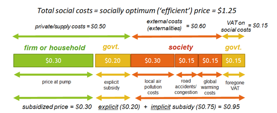
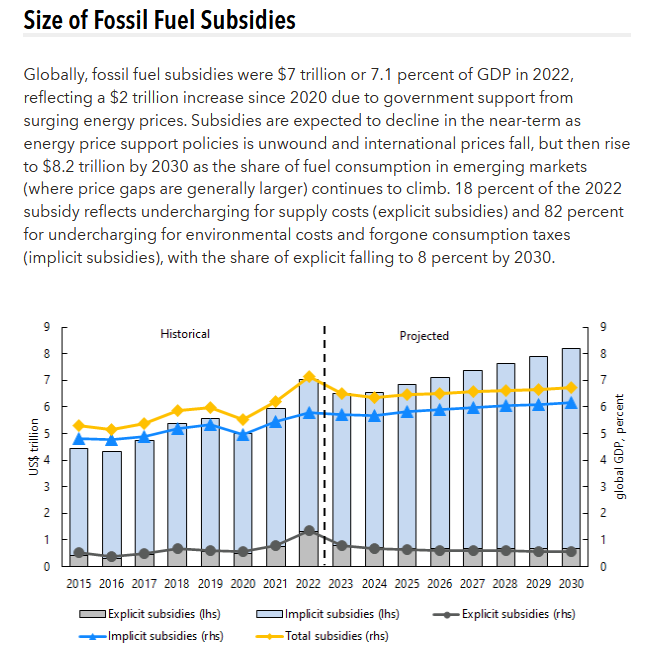
For perspective, no industry comes close to the explicit and implicit subsidies garnered by the fossil fuel industry. From the IMF: -
Why look at the op runs ? Are you new ?
-
Nov 28-30th Post Turkey Day Winter Storm
jlauderdal replied to Chicago Storm's topic in Lakes/Ohio Valley
Its ripping now, visibility 1/4 of mile. Everything that was cleared, is snow covered. -
First Winter Storm to kickoff 2025-26 Winter season
Sled replied to Baroclinic Zone's topic in New England
I just made sure my plow works. That ought to send it all north 20 miles.


