All Activity
- Past hour
-
 Do they go down the aisle and select fatties?
 -
Need a big fat QLCS to blow and rain all the smoke out
- 1,034 replies
-
- 1
-

-
- severe
- thunderstorms
- (and 7 more)
-
@high risk @wxmeddler @Eskimo Joe Can smoke lay boundaries? I know Eskimo mentioned it in his post above... but is it something that we should be watching tomorrow morning? Also, doesn't the smoke act as like a pseudo cap or EML in keeping the atmosphere from CI? Finally, wouldn't it also keep the moisture (dewpoints) up?
-
87 here much clearer as smoke south
-

E PA/NJ/DE Summer 2026 Obs/Discussion
Chadzachadam replied to PhiEaglesfan712's topic in Philadelphia Region
AQI is much lower than 2023 but the news said this was the first code purple since 2008, confusing. Even still, AQI of 265 imby is grounds for staying inside all day -
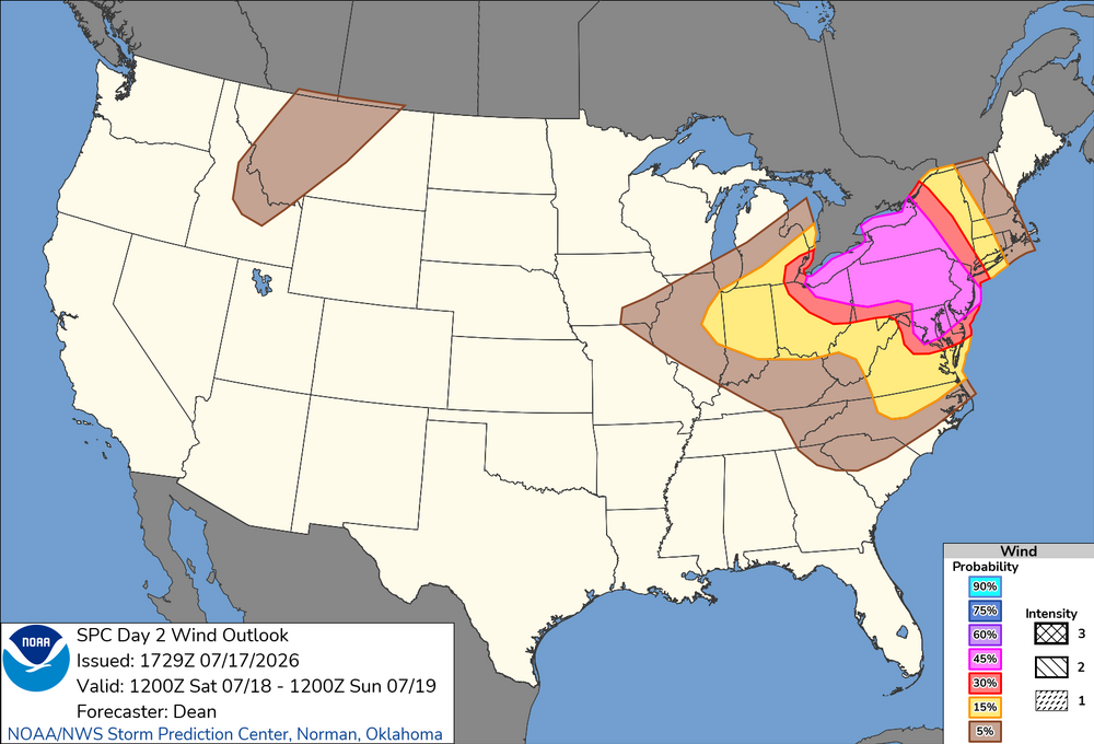
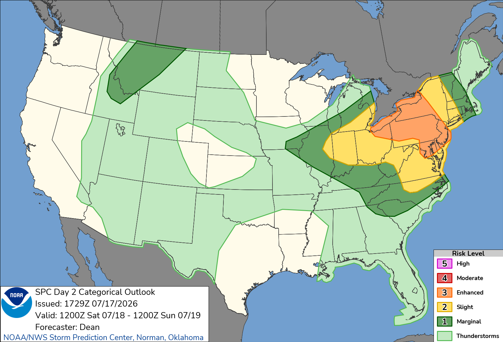
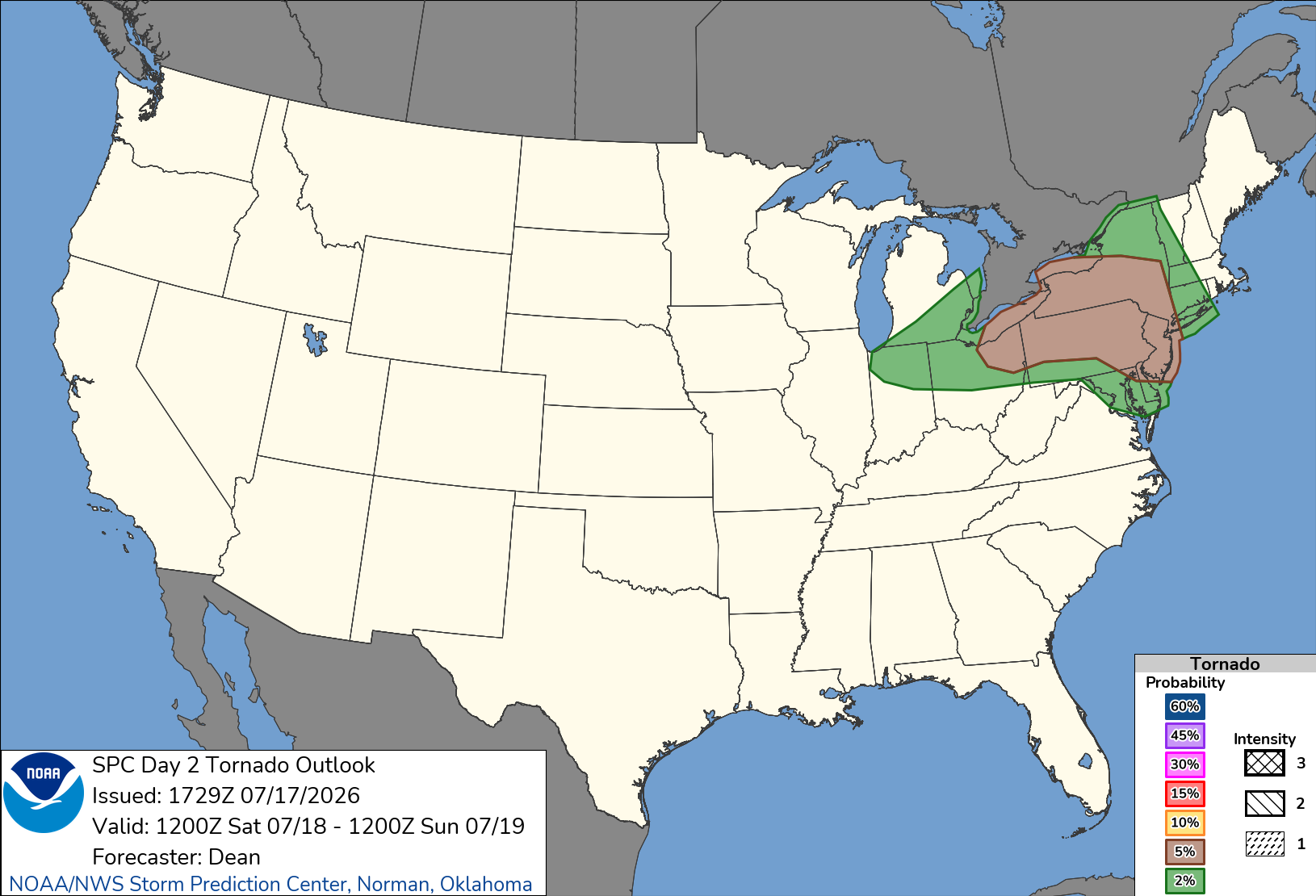
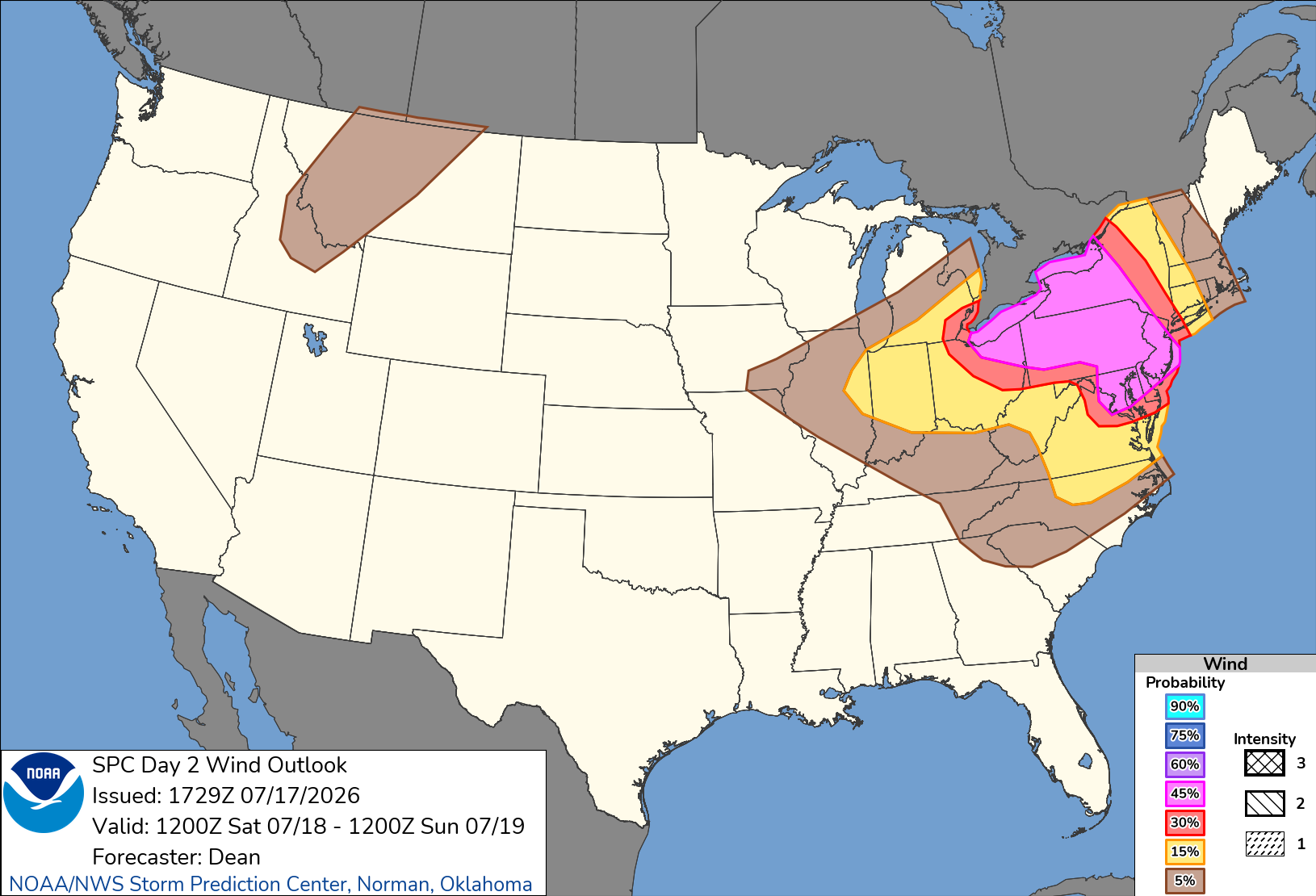
Day 2 Convective Outlook NWS Storm Prediction Center Norman OK 1229 PM CDT Fri Jul 17 2026 Valid 181200Z - 191200Z ...THERE IS AN ENHANCED RISK OF SEVERE THUNDERSTORMS FOR PARTS OF THE LOWER GREAT LAKES INTO THE MID-ATLANTIC... ...SUMMARY... Severe thunderstorms are expected across portions of the Ohio Valley and Lower Great Lakes into the Mid-Atlantic and Northeast, mainly Saturday afternoon into the evening. Some threat may linger into late Saturday night. ...Ohio Valley/Lower Great Lakes into the Mid-Atlantic/Northeast... An active severe-weather day is expected Saturday from parts of the Ohio Valley and Lower Great Lakes into the Mid-Atlantic, as scattered to widespread storms move through an increasingly favorable environment. A 45% wind area has been added, resulting in a categorical upgrade to Level-3/Enhanced Risk. The Enhanced Risk area is a combination of multiple regimes which may eventually overlap, with some areas potentially seeing multiple rounds of strong to severe storms. A mid/upper-level shortwave trough is forecast to move across the northern Great Lakes vicinity through the day, before approaching New England by evening. In conjunction with this shortwave trough, a deepening surface low is expected to move across southern Quebec toward northern Maine, as a trailing cold front moves through the Great Lakes and eventually parts of the Mid Atlantic and Northeast. A remnant surface front initially draped from southern NJ into western PA will lift northeastward as an effective warm front, in advance of the surface low and cold front. As strengthening deep-layer wind fields overspread increasingly rich moisture, a broad region from the Ohio Valley and Lower Great Lakes into the Mid-Atlantic and parts of the Northeast will become supportive of organized convection and severe-thunderstorm potential. HRRR-based forecasts suggest that smoke will become less prominent from west to east by afternoon, which should allow for relatively strong diurnal heating and moderate destabilization in areas not affected by early-day convection. Effective shear of 35-45 kt will support organized clusters and possibly occasional supercells from the Lower Great Lakes into the northern Mid-Atlantic and Northeast, while strong heating and steep low-level lapse rates will result in a favorable wind-damage environment within the somewhat weaker flow regime across the southern Mid-Atlantic and parts of the Carolinas. Elevated convection may be ongoing or else develop during the morning across parts of PA/NY, within a warm-advection regime associated with the returning warm front. Depending on the timing of this convection and downstream heating/destabilization, some intensification of ongoing convection may occur by early afternoon. Additional development may occur along the southwest flank of early-day convection and related outflow, which may intensify and move across the northern Mid-Atlantic during the afternoon. In addition to a wind-damage threat, some hail and tornado potential may also evolve with any supercell development, given the presence of favorable effective SRH. Farther north, a broken band of storms is expected to develop along the cold front and move across the Lower Great Lakes region, eventually reaching a larger part of OH/PA/NY by late afternoon or early evening. Additional storms may develop ahead of the frontal convection, depending on the extent of heating in the wake of early-day storms. Multiple wind-damage swaths may accompany this convection, along with some potential for isolated hail. Rich moisture and some enhancement to low-level SRH may also support a tornado threat with any discrete or embedded supercells, especially near the effective warm frontal zone or any remnant outflow boundaries from morning convection. An initially separate regime of storm development and severe potential is expected to develop along/east of a surface trough across parts of the southern Mid-Atlantic into NC. While deep-layer flow will tend to weaken with somewhat southward extent, strong heating and steepening of low-level lapse rates will provide a favorable thermodynamic environment for downbursts and damaging outflow winds. Depending on the extent of outflow from prefrontal storms, frontal convection may continue to pose at least an isolated severe threat through the evening as it spreads southeastward.
-
-
.thumb.gif.f92b16c631a1d15d405ed77b33f0710d.gif) Wednesday could be interesting timing-dependent and if we get some breaks
Wednesday could be interesting timing-dependent and if we get some breaks -
Much needed, decent coverage too.
-
ENH risk introduced on 1730z SPC OTLK
- 1,034 replies
-
- 1
-

-
- severe
- thunderstorms
- (and 7 more)
-

E PA/NJ/DE Summer 2026 Obs/Discussion
BBasile replied to PhiEaglesfan712's topic in Philadelphia Region
Enhanced for tomorrow.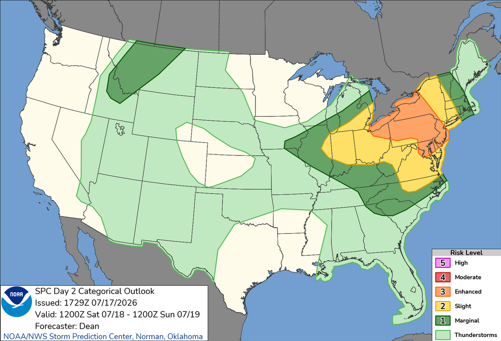
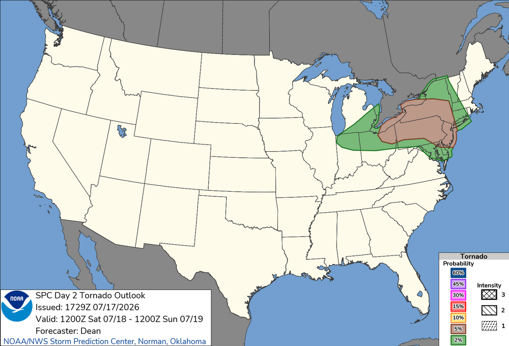
.thumb.png.a3493c024520326c9685b54ca963e7c3.png)
-
 Hot weather messing with lift. Needed 5 folks to give up their seats. Still had to burn fuel on tarmac before takeoff.
 -
Satellite and radar imagery definitely getting that "look" west of Florida with the MCV that is moving offshore. Mid-level rotation quite evident. NHC bumped odds up to 10/30 at 2PM. 12z Euro, GFS, Euro-AI all pinwheel this area of vorticity northward tomorrow up the West Coast of Florida
-
County cancelled some rec things but not adult softball, it’s play at your own risk. Sigh.
-
What about whole house battery back-up? @butterfish55 battery only installs a thing yet ? seems like if outages are short, battery tech might be far enough along to consider.
-
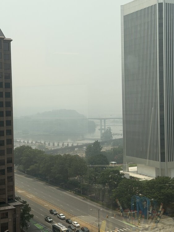
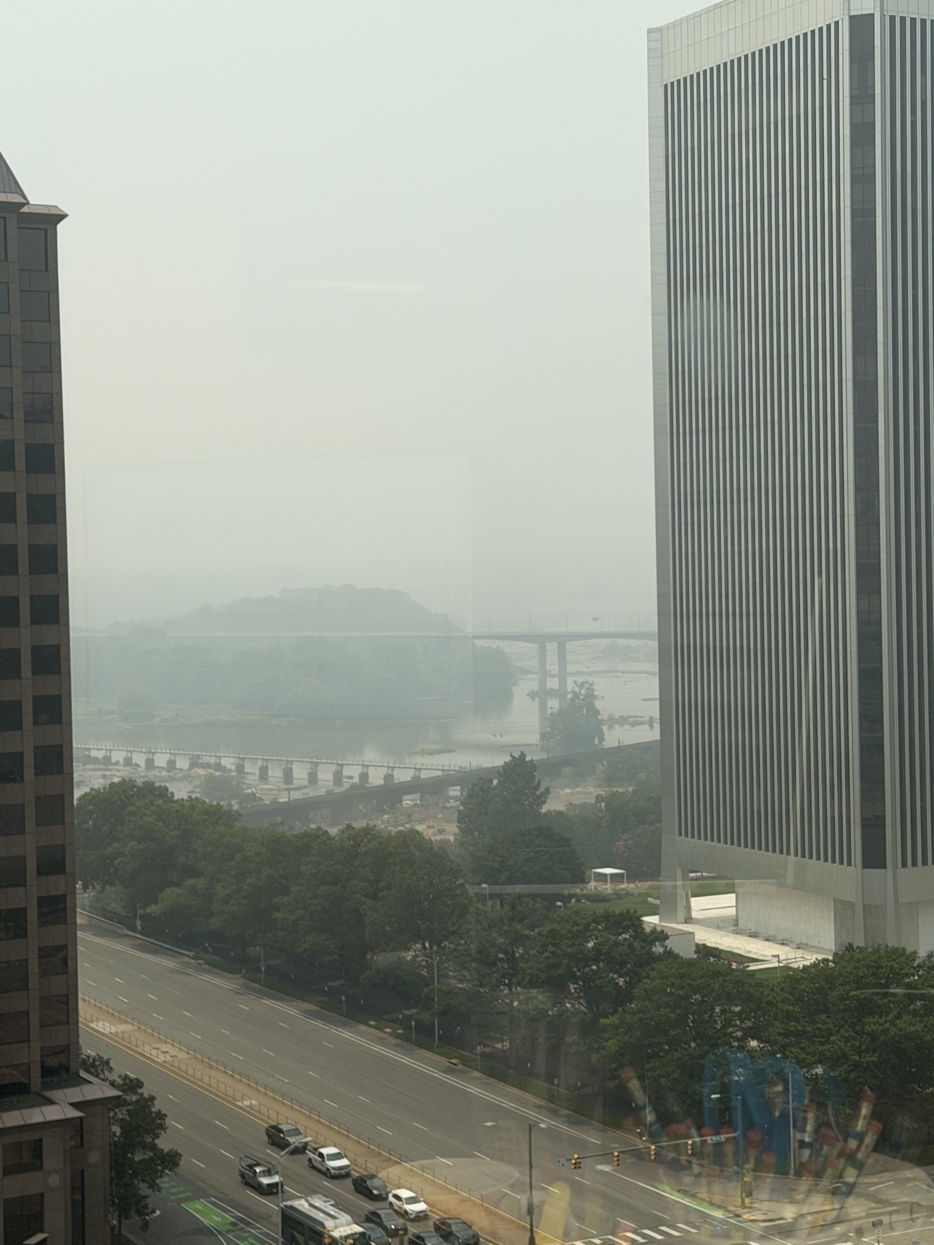
Probably does not do it justice. Why can’t Canada be burning some bacon or whiskey?
-
Lotta towers
-
Driving thru Frederick it looks worse than it did when I drove thru this morning.
-
E PA/NJ/DE Summer 2026 Obs/Discussion
BBasile replied to PhiEaglesfan712's topic in Philadelphia Region
Unfortunately, it's still quite smokey here. Can still smell it, too. As someone who is an outdoor runner and cyclist, and absolutely despises treadmills, this shit sucks. Looking forward to it's exit as well..thumb.jpg.a28158674b035fee7a19b3ff7f900758.jpg)
- Today
-
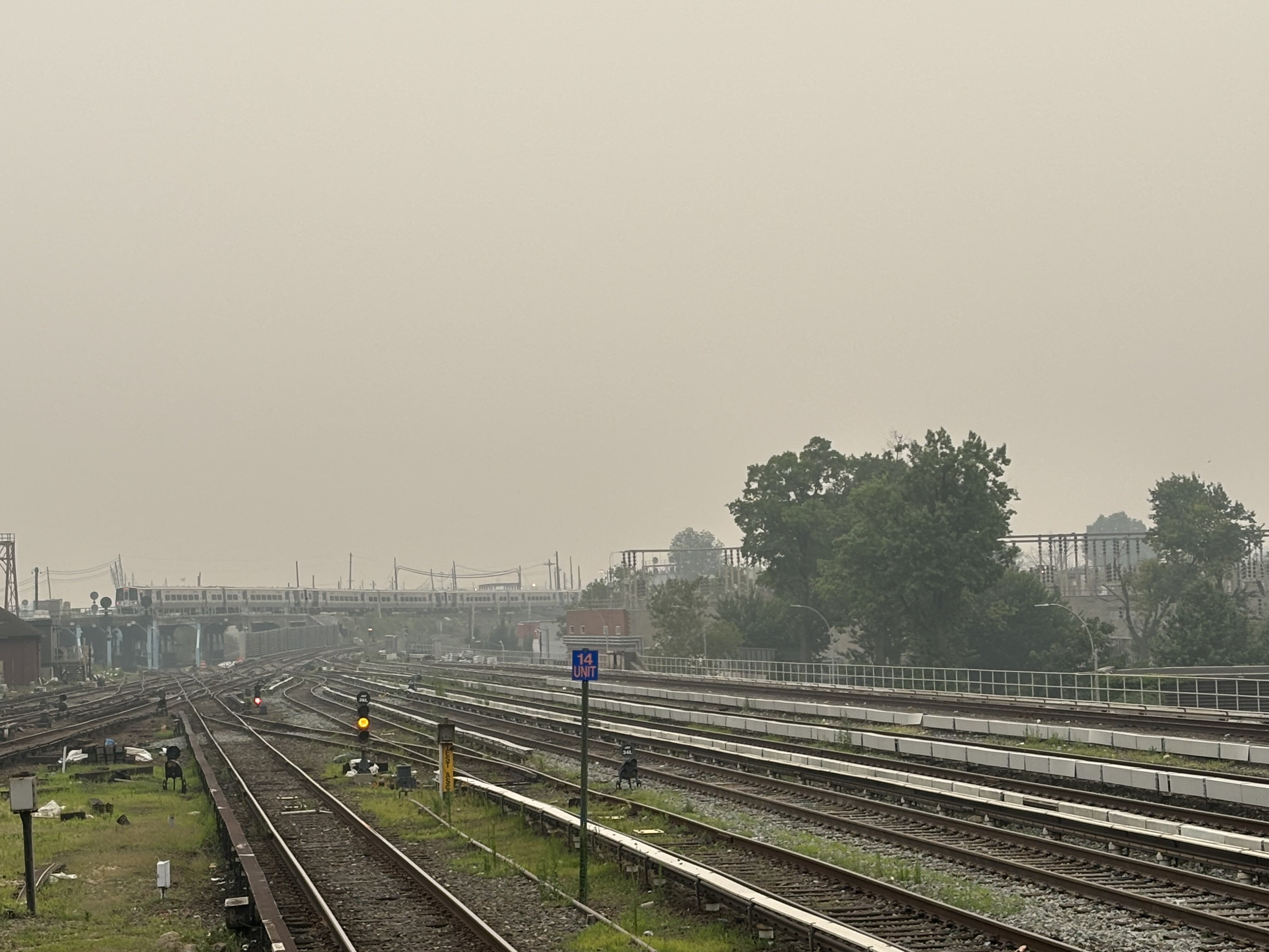
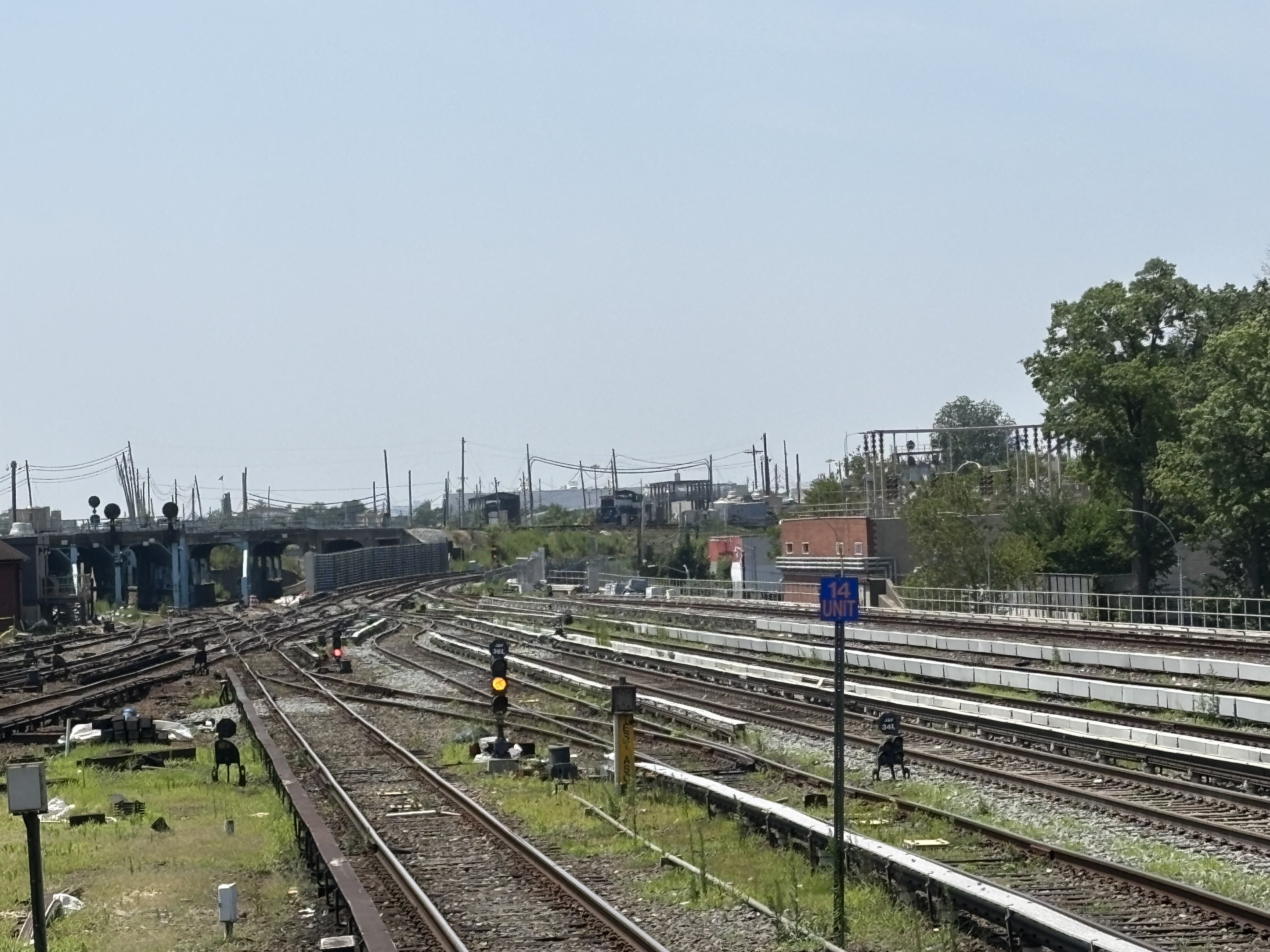
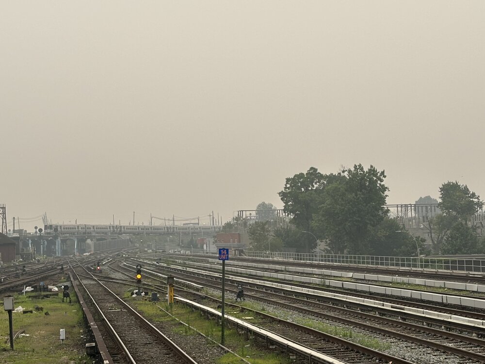
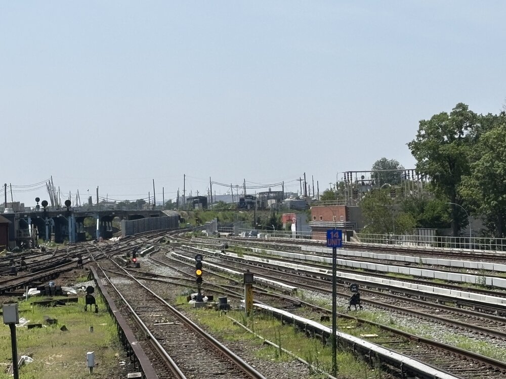
Same location about 19 hours later. Much bluer in the sky, a little haze with little humidity so it probably is a little smoke but no ill feeling in my chest and there’s a very distinct smell of a bit of smoke. But, much much better than yesterday early evening.

-
Had blue skies at home today. No smell if smoke but still hazey. Driving down turnpike you can almost see the cutoff from heavy smoke to light haze by Middlesex County area.
-
AQ Barney colors are not the purples I want. I want 24”+ purples in winter
-
SPC has three marginal risks out for Friday Saturday and Sunday Friday and Saturday are just for wind .
-
Thanks for the quick advice guys I'll probably go with a Generac. I'm a little worried about footprint and available space closest to where our gas/electric intake and meters, but I'll get the consultation and see. It's easy to lose motivation and keep kicking the can, but I guess worth at least seeing if logistically possible and getting a quote.
-
We began to dry out shortly after the super El Nino in 2023-2024 during the fall. The warmer climate requires more water than 50 years ago due to increased evaporation rates. One of the areas that needs more research are these expanding 500mb ridges that get stuck in place for weeks to months. So we get regions with record drought under the ridges which are bounded by record flooding like we are currently seeing in Texas. The more erratic precipitation patterns are a real challenge for the agricultural and landscaping fields. Since long range precipitation forecasts beyond a week or two aren’t the greatest. Trying to figure out where your local area will end up between the wet and dry extremes isn’t the easiest to navigate.





.png.0c9e1e256d62e09ca8a67861b7f3f9e8.png)






.jpg.ce96d6bb6a5125de704188bb6cdbf740.jpg)