All Activity
- Past hour
-
 farmacias online usa or mexican drugstore prescriptions from mexico https://images.google.ms/url?q=https://mexiph.com online drugs order or https://mantiseye.com/community/hjgzykdjjx tijuana pharmacy online [url=https://www.google.mn/url?q=https://mexiph.com]п»їmexican pharmacy[/url] mexican pharmacy what to buy or [url=https://www.0468wudi.com/home.php?mod=space&uid=268686]buying prescription drugs in mexico[/url] best pharmacy in mexico
 -

2026 Atlantic Hurricane Season
Stormchaserchuck1 replied to Stormchaserchuck1's topic in Tropical Headquarters
The southeast doesn't get enough rain? I'll disagree with you on that. -
http://quickph.shop/# worldwide pharmacy online
-
Between Karina and Lowell, the surfing conditions are prime on all corners of the islands.
-
Mega nino shit
-
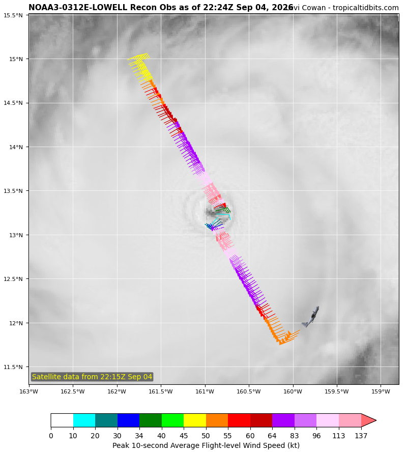
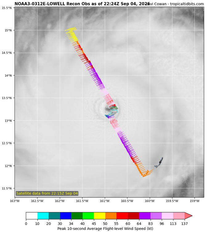
Lowell is putting on a show for recon right now
-

Septorcher 2026 Discussion - Endless Summer
CoastalWx replied to Damage In Tolland's topic in New England
Gonna tease Kauai -
canada rx pharmacy: prescription drugs canada buy online : reliable canadian pharmacy
-
I still dont understand why people bring up analogs of the 2015 strong NINO.That was a early onset of NINO IN 2014 and during into 2015 seemingly the Walker Circulation got broke down and you saw stronger EWB'S off South America which caused this to be a West/Central based NINO,unlike this year or 82-97,it really has no resemblence
-

super el nino banter thread
Maestrobjwa replied to forkyfork's topic in Weather Forecasting and Discussion
Forgive me, sir, but...if that is how you view this forum, then why do still post here? Are there not other spaces you can share your knowledge that you'll find suitable? -
2026 Mid-Atlantic Severe Storm General Discussion
Roger Ramjet replied to Kmlwx's topic in Mid Atlantic
No wind damage is good! -
Graf was correct again!!!!!! The NWS promised a 60% likelihood of storms. SPC issued a Severe Watch. Graf said partly cloudy with a 15% chance of any rain............ I have had 3 sprinkles. Graf is proving itself as a very credible source of information. This cannot be denied.
- Today
-

2026-2027 Record-breaking El Nino
jaxjagman replied to Stormchaserchuck1's topic in Weather Forecasting and Discussion
The warmth the past couple weeks in 1.2 tops the 82-97,pretty impressive either way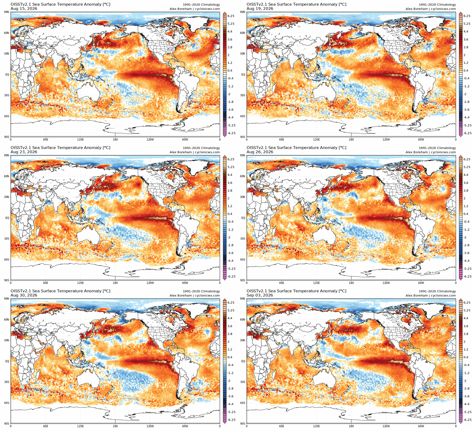
-
97
-

2026 Mid-Atlantic Severe Storm General Discussion
dailylurker replied to Kmlwx's topic in Mid Atlantic
I missed everything to the north until last evening when I started missing everything to the sw. At least I got to see flases of distance lightning last night lol -

2026-2027 Record-breaking El Nino
EasternLI replied to Stormchaserchuck1's topic in Weather Forecasting and Discussion
On the latest 30 day means of VP 200 anomalies. I see only one other event even remotely comparable to this one. 97-98 and this one looks like a beast next to that even. Super impressive stuff. I mean just look at this thing... -
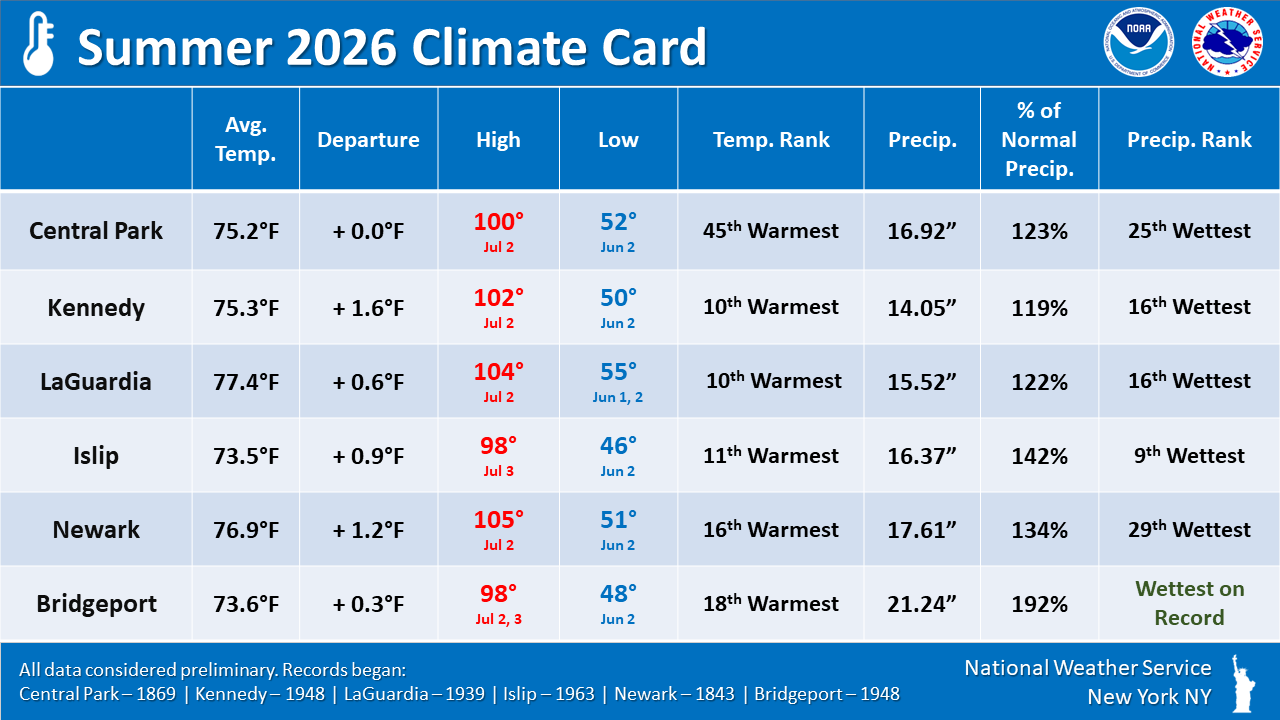
https://www.weather.gov/okx/climatecard Above summer stats locally.
-
As bad as a hurricane hitting the southeast can be, without them the southeast does not get enough precipitation.
-

2026-2027 Record-breaking El Nino
forkyfork replied to Stormchaserchuck1's topic in Weather Forecasting and Discussion
that's the most effort you people deserve -
88.8 today nice one.
-
The only given this winter is that Hubba Hubba Dave and I Need Frozen will somehow manage above normal snow in a Super Duper El Niño. All kidding aside, I do believe there will be a sharp gradient this winter, where you and I at least hit average. I think the interior has some potential to cash in on marginal events. In other words, I don’t think it’s a full dumpster fire N of RT 2.
-
Sunday weather looks amazing.
-
2026-2027 Record-breaking El Nino
EasternLI replied to Stormchaserchuck1's topic in Weather Forecasting and Discussion
After falling back somewhat, albeit much less than earlier forecasts were advertising. Seemingly due to some -MT activity mostly. The next +AAM uptick is now imminent and from an already very elevated level (>+2). Likely achieving a new high for this event (>+3). This time, it seems poised to more readily affect the NH than any other time over the summer. So that will be interesting to see how that plays out and how it verifies. Right on time it feels like, to me, as we start heading through MET autumn but let's see how it goes. -
.thumb.jpg.6a4895b2a43f87359e4e7d04a6fa0d14.jpg)
Central PA Summer 2026 Discussion/Obs Thread
Yardstickgozinya replied to Voyager's topic in Upstate New York/Pennsylvania
Unless something happens tonight, I never did end up under a core of any cell over the course of the last several days.