All Activity
- Past hour
-
96 here, by far my hottest day this season.
-
Man, your location might be underrated. You get the desert in the mid-Atlantic.
-
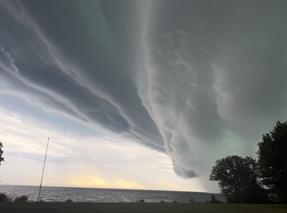
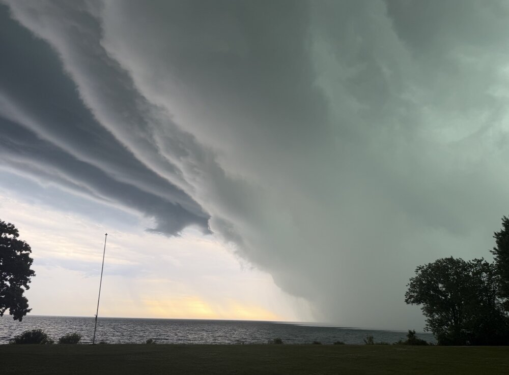
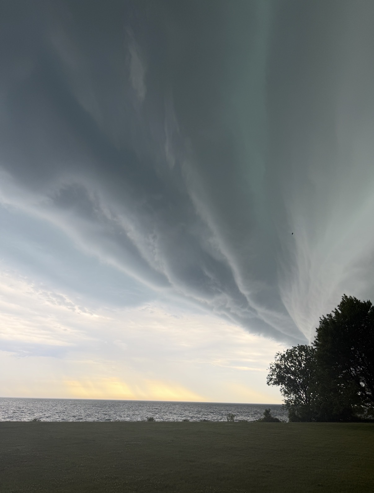
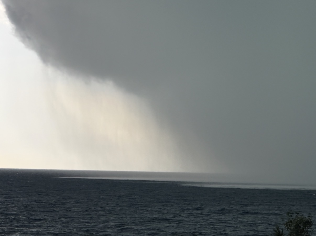
Confirmed tornado in northern Kenosha. Missed me by a few miles. Video here: https://x.com/kenoareaweather/status/2065212739945934931?s=46 Absolutely beautiful storm though

-
We don’t miss storms anymore lol. This one is super breezy. Just got home in time for the downpour portion.
-
Storm tops already collapsing on that squall line south of Route 80.
-

2026 Mid-Atlantic Severe Storm General Discussion
Eskimo Joe replied to Kmlwx's topic in Mid Atlantic
Casual ~3,000 square mile polygon.- 508 replies
-
- 1
-

-
- severe
- thunderstorms
- (and 7 more)
-
Wow, wind!!!!
-

Pittsburgh PA Summer 2026 Thread
Ahoff replied to TheClimateChanger's topic in Upstate New York/Pennsylvania
Pretty boring in my area of the South Hills, but that's no problem for me. -
Gonna need a downstream watch soon, environment in Michigan the storms are gonna be entering is juiced
-
Line coming into Frederick.

-
Iffy. It could end up morphing into something more disorganized, and be more spotty. Either way, doesn't look like a lot of rain, unless it manages to intensiify.
-

Central PA Summer 2026 Discussion/Obs Thread
Storm Clouds replied to Voyager's topic in Upstate New York/Pennsylvania
Man what the heck…the mountains ate that line! -

2026 Mid-Atlantic Severe Storm General Discussion
wxmeddler replied to Kmlwx's topic in Mid Atlantic
The mega warning has struck the area...- 508 replies
-
- 6
-
-

-
- severe
- thunderstorms
- (and 7 more)
-
2026 Mid-Atlantic Severe Storm General Discussion
Eskimo Joe replied to Kmlwx's topic in Mid Atlantic
Rather pronounced gust front from essentially the PA/MD line down to Middleburg, VA. Wonder if this ignites a fresh line or signals the end of the northern section of the storms? -
Really thin line of storms just approaching Harrisburg PA looks like 20 miles wide or less moving fast going to be interesting how they hold together after sunset as they approach the coast - just like the last few lines of storms in the previous weeks looks like the main threat is the winds in front of the storms passage
-

E PA/NJ/DE Spring 2026 Obs/Discussion
Hurricane Agnes replied to PhiEaglesfan712's topic in Philadelphia Region
Picked up 0.33" of rain yesterday, with a lot of sound and fury but not as much rain as expected but I take! Made it to 85 after a 67 low yesterday. Today it looks like I maxed at 94 just after 3 pm after a low of 71. Currently 89 with dp a horrid 77 and a STS was just lofted for the area (saw the line way out west and will see if it holds together) - -

Central PA Summer 2026 Discussion/Obs Thread
canderson replied to Voyager's topic in Upstate New York/Pennsylvania
In a severe warning. It’s not a severe storm. But spotty heavy rain (comes and goes) and fairly gusty winds (low 30s). -
Still 85 here and if I take my local WeatherBug app at face value, a dp of 74 as well. This is deep summer stuff for sure!
-
BULLETIN - IMMEDIATE BROADCAST REQUESTED Severe Thunderstorm Warning National Weather Service Baltimore MD/Washington DC 718 PM EDT Thu Jun 11 2026 The National Weather Service in Sterling Virginia has issued a * Severe Thunderstorm Warning for... Eastern Washington County in north central Maryland... Northwestern Howard County in central Maryland... Western Montgomery County in central Maryland... Frederick County in north central Maryland... Western Carroll County in north central Maryland... Northwestern Stafford County in northern Virginia... Loudoun County in northern Virginia... Northeastern Orange County in central Virginia... Northwestern Fairfax County in northern Virginia... Southeastern Rappahannock County in northwestern Virginia... Fauquier County in northern Virginia... Culpeper County in northern Virginia... The City of Manassas Park in northern Virginia... Prince William County in northern Virginia... The City of Manassas in northern Virginia... East central Madison County in northwestern Virginia... The western City of Fairfax in northern Virginia... Eastern Clarke County in northwestern Virginia... Southeastern Jefferson County in the Panhandle of West Virginia... * Until 800 PM EDT. * At 716 PM EDT, severe thunderstorms were located along a line extending from 8 miles west of Culpeper to near Delaplane to near Boonsboro to Greencastle, moving east at 40 mph. HAZARD...60 mph wind gusts. SOURCE...Emergency Management has reported many instances of trees down with this line of storms. IMPACT...Damaging winds will cause some trees and large branches to fall. This could injure those outdoors, as well as damage homes and vehicles. Roadways may become blocked by downed trees. Localized power outages are possible. Unsecured light objects may become projectiles. * Locations impacted include... Germantown, Centreville, Frederick, Rockville, Gaithersburg, Reston, Leesburg, Hagerstown, South Riding, Herndon, Fairfax, Culpeper, Vienna, Damascus, Broadlands, Lansdowne, Lowes Island, Brambleton, Warrenton, and Thurmont.
- 508 replies
-
- 1
-
-
- severe
- thunderstorms
- (and 7 more)
-
Sitting out back with my shorts fully rolled up, embracing the dews, rhodie bush war style has to be one of the most satisfying feelings across the realm of all human experience. #IYKYK
-
That newer to cell to the south looks ready to drop the next big one
-
Very bad wind, no rain yet.
-
Watch just issued WWUS from KWNS
-

2026 Mid-Atlantic Severe Storm General Discussion
paxpatriot replied to Kmlwx's topic in Mid Atlantic
Warned storm up here in Greencastle right now. Nice wind and rain. Little lackluster on the lightning. Hope my friends to the east get in on the action as well!- 508 replies
-
- 1
-
-
- severe
- thunderstorms
- (and 7 more)
-
Just missing out here by 10 miles… I guess I can grill up my Saugy’s without fear of being struck by lightning.


.thumb.jpeg.f5c6ba9d911ec96b3b124f8606aee58e.jpeg)