All Activity
- Past hour
-
29.5 and Clear. Hoping its icy enough in the morning to justify a remote work day
-

December 2025 regional war/obs/disco thread
DavisStraight replied to Torch Tiger's topic in New England
-30-40 below? -
First Winter Storm to kickoff 2025-26 Winter season
MarkO replied to Baroclinic Zone's topic in New England
Us folks on the 495 belt need as much help as we can get. It's down to 32F here in Lowell, and the Davis is reporting 22 at the cabin. Sounds kinda nuts, but I think the action is better here in Lowell. A dry 8" of snow up there is kinda meh, but if we can out an over producer in the 495 area, it will be a sloppy mess with power outages. -

First Winter Storm to kickoff 2025-26 Winter season
Damage In Tolland replied to Baroclinic Zone's topic in New England
This is not that and it’s not 1987 modeling with Sister Christian playing in the background. It’s over -

Winter 2025-26 Medium/Long Range Discussion
michsnowfreak replied to michsnowfreak's topic in Lakes/Ohio Valley
Its white out but certainly not nearly as deep as you. A clipper pattern will be interesting because the models struggle mightily outside of close range (which can be both a good and a bad thing). -

Nov 28-30th Post Turkey Day Winter Storm
Chinook replied to Chicago Storm's topic in Lakes/Ohio Valley
loops of this storm https://great-lakes-salsite.web.app/Nov_28_2025_GFS_surface_loop.html https://great-lakes-salsite.web.app/Nov_28_2025_radar_loop.html -

Pittsburgh/Western PA WINTER ‘25/‘26
ChalkHillSnowNut replied to Burghblizz's topic in Upstate New York/Pennsylvania
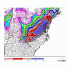
That’s where I am-just east of Uniontown on the summit/hoping the elevation keeps the mixing to minimum! The map shows me in same accumulation as you guys where 10 miles down the mountain might see 1” -
I use an ad blocker (Purify) that has always worked in the past, but now for this one specific site and this one specific issue it isn’t doing the job. Something must have changed on Tapatalk’s end, but holy god it’s annoying. Makes this site virtually unusable for me on mobile.
-
Don’t know anything specific about spots like domey’s, but 242 was packed all day. There’s two freeze cycles underneath about 12-18 so I think it would be good to go. .
-
https://www.facebook.com/share/v/14TwtUcsdyu/ An interestingly angled lake-effect event happening in Muskegon tonight.
-

Central PA Fall Discussions and Obs
WmsptWx replied to ChescoWx's topic in Upstate New York/Pennsylvania
The entire state minus metro Philadelphia is under WWA. -
RUNNAWAYICEBERG changed their profile photo
-

12/3 Snow/Sleet/Mix Bag of Everything Discussion/OBS
zenmsav6810 replied to Mikeymac5306's topic in Philadelphia Region
I think there is cold air around- something I saw a day or two ago showed the polar vortex as very fragmentary air mass right now. It makes me wonder if there is more cold air aloft than the models (especially the Mezos are accounting for). I was also impressed with the snow we got on Sunday despite the warm ground level temperatures. -
Comments are gold
-
Yeah unfortunately this one turned into a dog turd duster. Picked up perhaps a half inch of pixie dust. Nice to have daytime snowfall again though.
-
I mean schools do close and delay for stuff they wouldn’t have 20 years ago.
-
First Winter Storm to kickoff 2025-26 Winter season
Henry's Weather replied to Baroclinic Zone's topic in New England
In english, are you are saying that the antecedent mass might be colder than modeled and that the upper-air structure is an unclear signal for cold air mass retention? -
First Winter Storm to kickoff 2025-26 Winter season
Greg replied to Baroclinic Zone's topic in New England
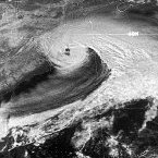
I remember that one. My surprise birthday snowstorm. -
First Winter Storm to kickoff 2025-26 Winter season
Typhoon Tip replied to Baroclinic Zone's topic in New England
agreed here. I discussed this several hours ago ... "The cyclone is going S. I looked at the 700 mb evolution..it's not clear it closes off enough to fist warmth over top - appears to stay open. Yet the 850 does closes S of RI. I'm getting suspicious of this warm idea coming in late. Not enough to call bull crap yet but close. We are advecting in a teens DP air mass. The already tepid sun will be dead to the environment in another 3 hours then tonight until 4 am... we're likely to get decent rad cooling production. We may see an environmental negative feed back on temperature and llv thickness. I tell you, wouldn't shock me if there's an icing band where these guidance are blithely punching a warm 925s into that antecedent, possibly poorly evaluating circumstance. " add to that... Dec 23 1997 was a different total scenario, but the timing with "cold capping" over a teens dp air contributed to one of the finest bust we've ever known - possibly the GOAT. -
36/22
-
I think you’ll enjoy synoptic too! It isn’t really my thing so writing posts like yours is difficult. It makes sense in my head, but getting it onto paper isn’t something I’m good at. I look forward to more of your writing!
-

2025-2026 Fall/Winter Mountain Thread
Maggie Valley Steve replied to Buckethead's topic in Southeastern States
I see another SSW event is ahead in a couple of weeks. Let the model mayhem continue! -
Winter traditions: canceling on Dec 1 sticking forks in storms before they start Crashing out over school delays 34.2/23. Lost 6 degrees in the last hour
-
Surface temps while a problem isn’t the biggest issue. The models have consistently had us dropping to near freezing but rising just enough as the precip arrives especially between 700 and 850mb for it to be rain

