All Activity
- Past hour
-
 ed online prescription: GlobalCare Pharm - ed meds on line
 -
This storm is wicked. It looked like a spaceship arriving and then boom. Dark as night with the street lamps on. Absolutely dumping rn.
-
Low of 62 with 61 DP. Pretty good for the swamp lands.
-
cheap ed medication: GlobalCare Pharmacy - online ed treatments
-

2026-2027 Record-breaking El Nino
Typhoon Tip replied to Stormchaserchuck1's topic in Weather Forecasting and Discussion
I'm getting this vibe from these outlooks that they're more interested in the N Atlantic/index correlation than the PNA to this point in time. Not sure why that lean as both it and the +PNA are at least linearly-neg correlated. The 2009/2010 season tucked a short lived but potent warm ENSO into the tail end of 2009 into the first quarter of '10. That was a winter whence the NAO became so excessive it jammed all events into the SE/MA, while up this way in NE ended up with suppression depression In a neutral ENSO year, a +PNA correlates more negatively with NAO during JAN/FEB anyway. But 2010 perhaps "over" ideally situated that result. There may have been other hemispheric things gong on that constructively interfered and drove a synergistic wild hyper response with that look that season/year. It was nuts! That one "snowmaggedon" storm looked as though it was really a hybrid between any cyclone at all, together with a mass-restoring forced nodal trough pinned there by the coupled -NAO state. fascinating. I believe at least a handful of official seasonal snow totals down there exceeded climo at sites around SNE and NNE - but not sure of that. Still, getting to within reach of N climates, in principle, evinces the point. It was like their 2015. But ...as 2015 demos... +ENSOs don't always do that. That's why I think the other was a bit of a "positive bust". It may be worth considering though that it can happen once, it can happen again. Leaning more E Can/NW Atl block with that weird neg tube of heights tunneling underneath down stream like Will was mentioning.. heh. It sort of reminds me of 'too much of a good thing' and you guys taxing the love lorn to get even more euphoric reach-arounds. For now, I guess it being so early in the game ...best to just go with +volatility for having lower heights in the TV whilst blocking resides N in the means - should that prevail. I'll tell ya though ... this will be an interesting autumn in the guidance. -
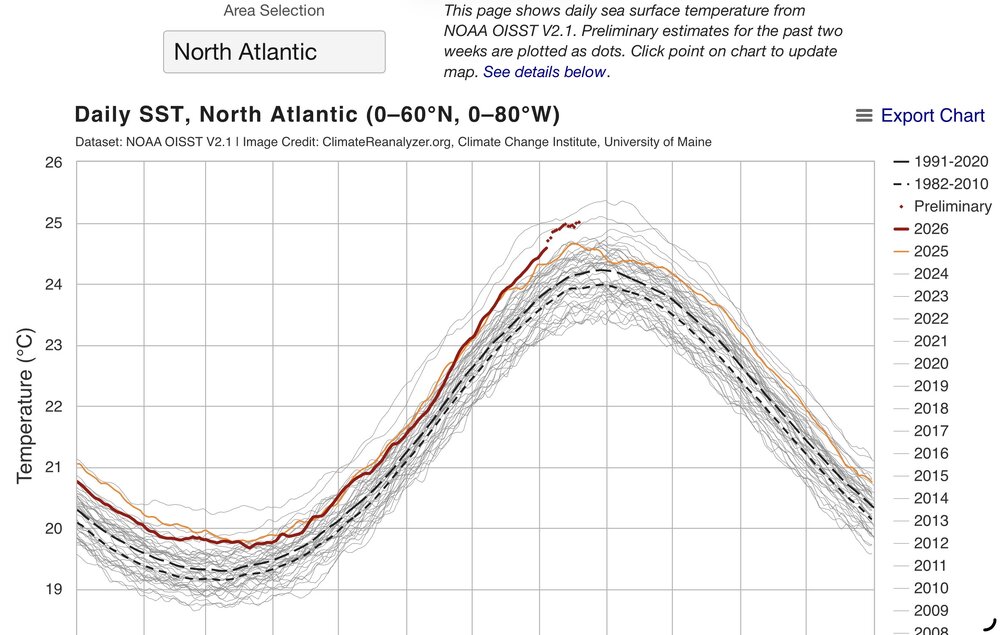
Yeah, same for the two tornadoes yesterday on the South Shore that began as waterspouts. Once the ocean gets warm enough later in the season, the South Shore becomes the focus. Earlier in the season the severe storms and flooding tend to focus closer to the North Shore. Very impressive Atlantic SST rise providing the fuel once the pattern becomes favorable for storms. 445 NOUS41 KOKX 210130 PNSOKX Public Information Statement National Weather Service New York NY 930 PM EDT Thu Aug 20 2026 ...Waterspouts in southern Queens and southern Nassau County... The National Weather Service New York, NY office along with emergency management partners are reviewing damage, ground truth, and radar data from two waterspouts that may have impacted portions of the eastern Rockaways and Atlantic Beach in southern Queens and Nassau counties. Both of these waterspouts appear to have come ashore between 6:30 and 7:00 PM on August 20, 2026. Based on radar data and videos/photos received, so far, the first waterspout appears to have been short-lived, coming onshore in the eastern Rockaways. No damage reports have come in, as of yet. Based on radar and videos/photos received, so far, the second waterspout appears to have come onshore in Atlantic Beach. We have received preliminary reports of damage from this and radar evidence shows it may have survived for longer after coming onshore. We will continue to gather more information and investigate reports of damage in more detail. We will come out with an official statement on Friday, with more details.
-
A+ morning!!! Crystal clear blue sky, Light breeze and 67! 64.2 for the low! More please!
-
Strong virga storm yesterday, tippy bucket measured a T.
-
Thank you!
-

2026-2027 Record-breaking El Nino
csnavywx replied to Stormchaserchuck1's topic in Weather Forecasting and Discussion
We've tapped the brakes here on the subsurface (peaking in the short run around +10-11C) as the trades temporarily recovered a bit, but the recent very strong WWB plus a migration of the standing wave towards 160W over the next ~10d should put the pedal back to the metal. CFSv2 forecasts are just playing catch-up on fully integrating the effects of wind stress and should bottom out here in the next week or so before crawling back up. -
.thumb.jpg.6a4895b2a43f87359e4e7d04a6fa0d14.jpg)
Central PA Summer 2026 Discussion/Obs Thread
Yardstickgozinya replied to Voyager's topic in Upstate New York/Pennsylvania
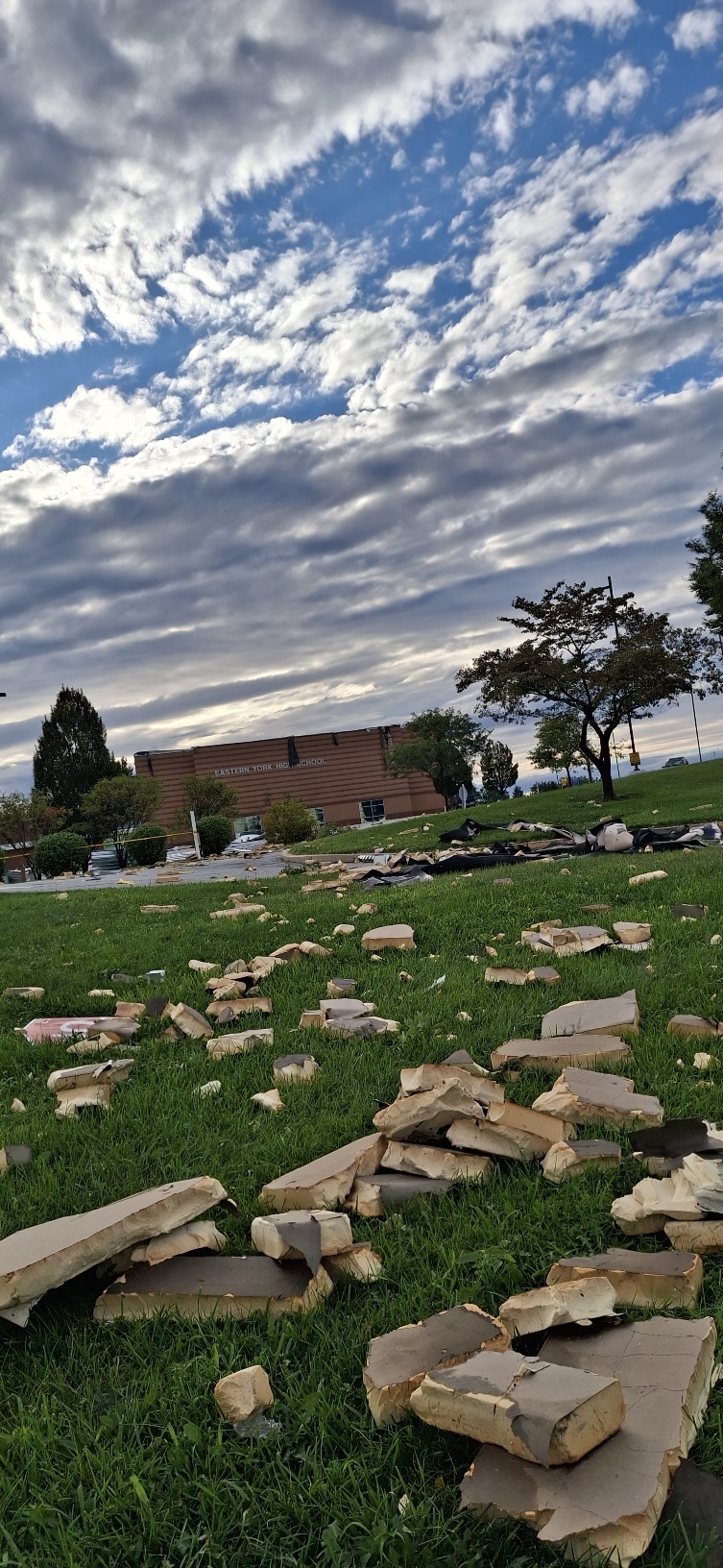
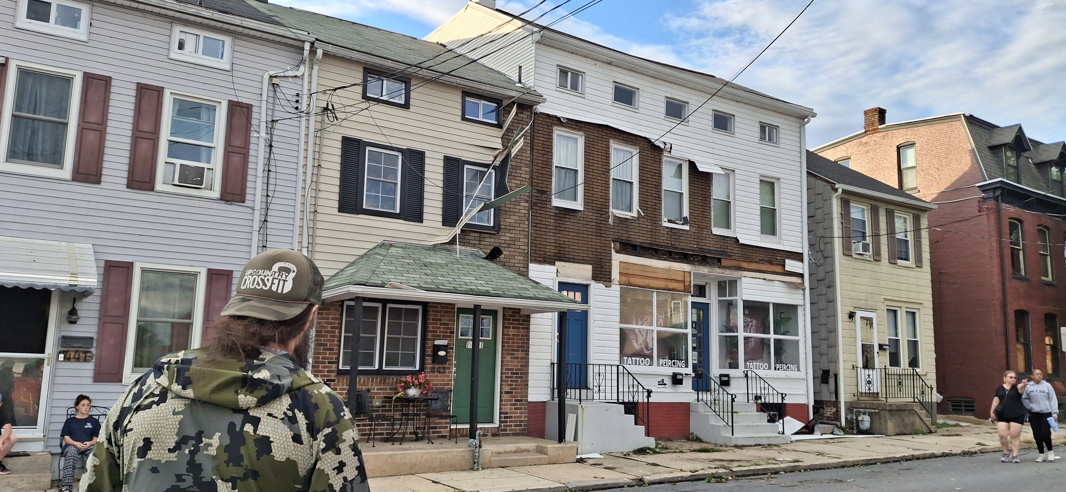
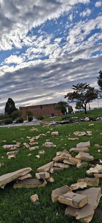
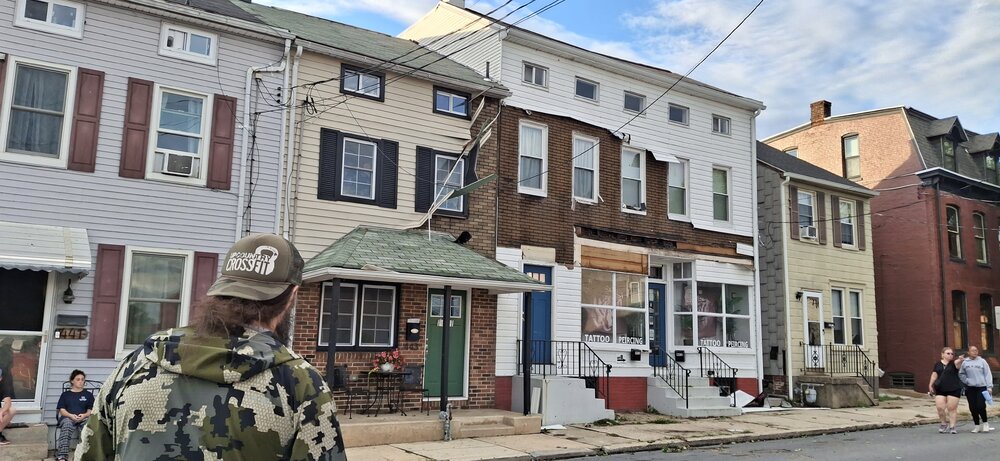
My best friend arrived. in town from Maui yesterday. He just rode out Hurricane Lala only a few days ago . He was pretty amazed to see that kind of damage after not living in Pennsylvania for twenty years. It just so happens he was back in town fishing with me in august 2023 when the Maui fires broke out just a few miles from his gym and home . After all the excitement, my buddy from ended up hooking into and landing a 42lbs Flathead on a chatter, bait and 12lb test targeting bass while we had our other rods out for flatheads. We never thought the fish would end up being landed, but after nearly 26 minutes, and several long runs out into the river, we landed the big girl and his new personal best flathead. My other lifelong best friend was buried just a few days ago leaving behind 2 teenage daughters at the age of 48 do the secondary brain cancer. What a crazy up and down week It's been. Anyways, waiting on pictures from my buddy from our storm and fishing events yesterday. I thought I had more pictures to post today, but after looking through my gallery, it looks like I already posted all the best ones for the most part.
-
Wagons east for tomorrow. Might squeeze out a dry day. Sunday looking wetter
-

Central PA Summer 2026 Discussion/Obs Thread
Superstorm replied to Voyager's topic in Upstate New York/Pennsylvania
I was thinking same thing. . -
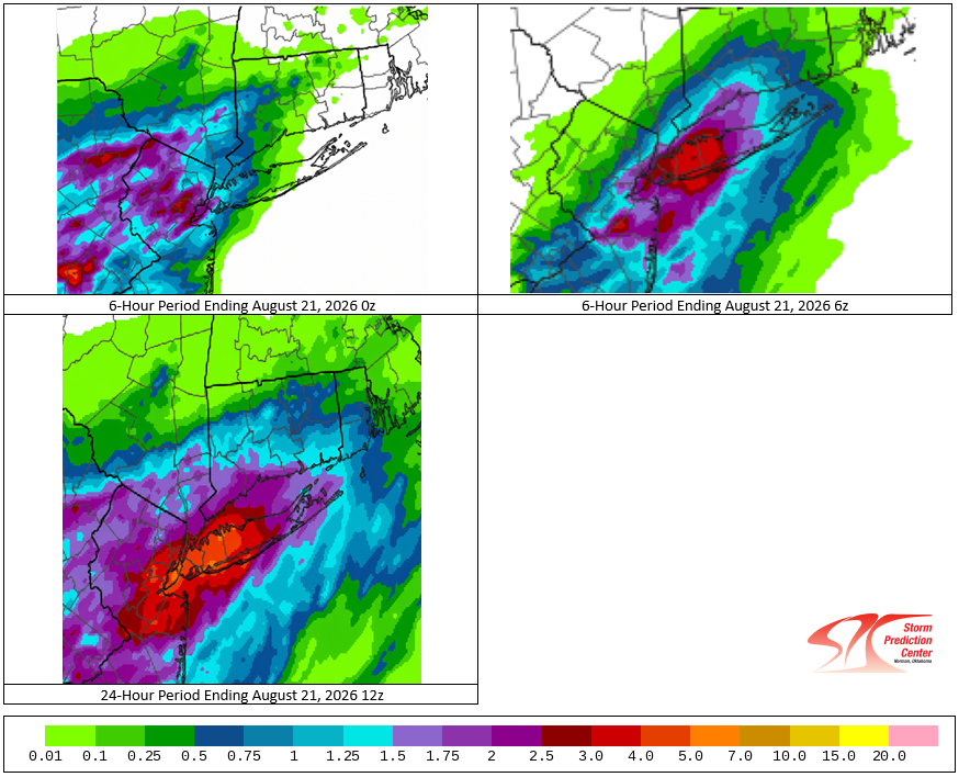
Yesterday's daily rainfall records: Islip: 3.27" (old record: 2.61", 2001) New York City-LaGuardia Airport: 2.86" (old record: 1.31", 1963) Although overdone, it seems that yesterday's 12z HREF did quite well with the axis of heaviest rain occurring in the Nassau/Suffolk County areas.
-
Big storm and no power this morning
-

Augdewst 2026: Summer's Last Stand
Chrisrotary12 replied to Prismshine Productions's topic in New England
Did it even rain here? -
Quite possibly the best morning in months outside right now
-
4.48" total so far in Bay Shore, just unreal. Biggest rain event here in years. SW Suffolk got crushed
-
Aug is always the time of year we get these deluges on LI. I’m sure it has to do with the waters finally being warm enough not to kill the convection. Not as bad as prior years but it’s a repeat theme.
-
https://securemedonline.shop/# Tadalafil Tablet
-

Augdewst 2026: Summer's Last Stand
dendrite replied to Prismshine Productions's topic in New England
I’d rather die, than give Rufus control - Today
-
Patchogue was the heaviest spot far on Long Island with 5.05 inches. Daily Precipitation Report Station Number: NY-SF-85 Station Name: Patchogue 0.9 SE Data Explorer Observation Date 8/21/2026 6:30 AM Submitted 8/21/2026 6:43 AM Gauge Catch 5.05 in. Notes --
-

Augdewst 2026: Summer's Last Stand
Damage In Tolland replied to Prismshine Productions's topic in New England
4.65” MTD for you . Soaker there -
Augdewst 2026: Summer's Last Stand
dendrite replied to Prismshine Productions's topic in New England
1”+ for Ditty and 2”+ for Gibbs 0.06” here Mostly the theme of the summer excluding one event. -