All Activity
- Past hour
-

New Years Day 2026 - 1st snows of the new year possible
Damage In Tolland replied to Baroclinic Zone's topic in New England
Plows have not come once . It’s kind of eerie and nostalgic. https://imgur.com/a/F2ahCg4#XH87xdh https://imgur.com/a/F2ahCg4#M4TQLIW -
New Years Day 2026 - 1st snows of the new year possible
Fozz replied to Baroclinic Zone's topic in New England
Easton is about to get hammered. -
The early January cold and snowy pattern is no more. But stay tuned everyone; mid January looks great!! Its only 2 weeks away. This time we promise!
-
12/31-1/1 Possible Snow Showers/Squalls to Start 2026
osfan24 replied to bncho's topic in Mid Atlantic
Wind gust woke me up. Figured it had to be the front so checked my phone and saw alert and radar and ran out to check it out. Everything covered instantly. Very fun 15 minutes. -
7F with 1mi visibility and snow. What a way to kick off 2026, happy New Year to everyone.
-

New Years Day 2026 - 1st snows of the new year possible
ORH_wxman replied to Baroclinic Zone's topic in New England
-
I ran through an 18” drift and exhausted myself but it was worth it
-
I think the GFS is out to lunch. It has been all winter. I guess a broken clock is right twice a day though, and I won’t discount it quite yet. It has some support from the 0z GEM, but the GEM ends before the transition on ~Jan12 is depicted on other modeling - the GEPS kicks the tucked in trough out of the West right after 240. Eastern trough looks on time on the 0z Euro, every nonGEFS ensemble suite I can find, and the AIs. The ensembles have not budged overnight…EPS, GEPS, AIFS Euro, AIGEFS. Roll with them at this range. Check ensemble member counts. As I noted yesterday, the main concerns are cold source regions and if the ridge continues to retrograde (doesn’t stop in the West or eastern PAC). It could be the MJO is trying to gain same amplitude…but it has been so inaccurate this winter I am not using it a ton - yet. When see switched to the chinook in late December, modeling projected the event to start right after the 10th. It took another 12 days before it actually showed up. I think the same thing is occurring here…just with the cold. If non-GEFS ensembles begin to move…that is worth paying attention to. GFS verification scores have been terrible of late.
-
Another surprise 1-2”, and I should be around 25-26” for the season.
-

Central PA Winter 25/26 Discussion and Obs
canderson replied to MAG5035's topic in Upstate New York/Pennsylvania
I’m going with .5” but it’s really hard to tell. Have had a bunch of 45-50 mph wind gusts so it’s blown everywhere -
General concensus is still up with the PNA as of today's update.
-

Central PA Winter 25/26 Discussion and Obs
mahantango#1 replied to MAG5035's topic in Upstate New York/Pennsylvania
About 3/4inch of snow fell last night here. -
New Years Day 2026 - 1st snows of the new year possible
Bryan63 replied to Baroclinic Zone's topic in New England
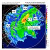
Ah, always forget how north Taunton goes. That piece of the line coming through Attleboro looks pretty healthy. -
2025-2026 Fall/Winter Mountain Thread
strongwxnc replied to Buckethead's topic in Southeastern States
Tis the new year folks. 19.6 yesterday morning and 39 this morning! -
The ECMWF AIFS Ens I heard are doing well. This shows we are back in business by the 15th. GEFS AI at the very bottom.
-
Missed the squall line since I was sleeping but nice to wake up to a fresh coating of snow. Any chance Sunday’s system keeps trending north?
-

2025-2026 ENSO
Ralph Wiggum replied to 40/70 Benchmark's topic in Weather Forecasting and Discussion
His new year's resolution was to get more clicks. -
New Years Day 2026 - 1st snows of the new year possible
tavwtby replied to Baroclinic Zone's topic in New England
yessir, honestly haven't stayed up past midnight on New Year's or any other day in quite awhile now -
Temperature here went from 37 to 32 in about 5 minutes as the snow squall went thru. Now 26
-

New Years Day 2026 - 1st snows of the new year possible
weatherwiz replied to Baroclinic Zone's topic in New England
1.3" of snow 11.6" on the season 88.4" away from 100 Had a good feeling about this one the other day -
New Years Day 2026 - 1st snows of the new year possible
The 4 Seasons replied to Baroclinic Zone's topic in New England
yup we got majorly screwed. you should be about 0.5. i measured 0.5 then 0.1 from the squall so 0.6 total. which matches up very closely to surrounding cocorahs...wallingford 0.6" and North Branford 0.5" -
Nice write-up @George BM, but I'll 100% pass on ever wanting that to happen. That WOULD be catastrophic, to sat the least.
-

New Years Day 2026 - 1st snows of the new year possible
Fozz replied to Baroclinic Zone's topic in New England
Round 2 is looking good for you. -
New Years Day 2026 - 1st snows of the new year possible
wx2fish replied to Baroclinic Zone's topic in New England
Backbuilding in Weymouth into round 2. Im sure hes sitting on a beach glued to his ring cam -

New Years Day 2026 - 1st snows of the new year possible
Ginx snewx replied to Baroclinic Zone's topic in New England

