All Activity
- Past hour
-

January 24-26: Miracle or Mirage JV/Banter Thread!
Darkstorm replied to SnowenOutThere's topic in Mid Atlantic
Try being a reddit mod. -
As much as I'd love a total snow storm. This is screaming sleet and freezing rain.
-

Richmond Metro/Hampton Roads Area Discussion
RVASnowLover replied to RIC Airport's topic in Mid Atlantic
GEFS says hold up! More amped and has more mixing -
 yeah dew points are in the single digits maybe the second batch will if it makes it her later but i think this will be a non event
 -
GFS definitely south. Think that’s the first model run all day I’ve seen with the LV with less than 10in
-
Should be around 6:15pm
-
Came here to say this. The Euro is dead to me.
-
We’re gonna reel this one back in. I feel it. Can you feel it too?
-
No bueno
-
Pretty sure sheared out is off the table here
-
Pretty sure it didn’t latch onto Feb ‘13 until the day of the storm.
-

Southern MD / Lower Eastern Shore weather discussion
AlexD1990 replied to PrinceFrederickWx's topic in Mid Atlantic
Beautiful to see. Really really hope some of the 0z suite follows suit, hopefully with the new data.. -

Possible Record Breaking Cold + Snow Sunday 1/25 - Tuesday 1/27
SnoSki14 replied to TriPol's topic in New York City Metro
God that makes me feel old. I remember that bust clear as day. Remember waking up to like an inch of snow with schools shut down. Still the biggest winter forecast bust I've ever experienced. -

Pittsburgh/Western PA WINTER ‘25/‘26
colonel717 replied to Burghblizz's topic in Upstate New York/Pennsylvania
-

Possible Record Breaking Cold + Snow Sunday 1/25 - Tuesday 1/27
NJwx85 replied to TriPol's topic in New York City Metro
The radar is more bark than bite. It’s not reaching the ground here in Montvale. -
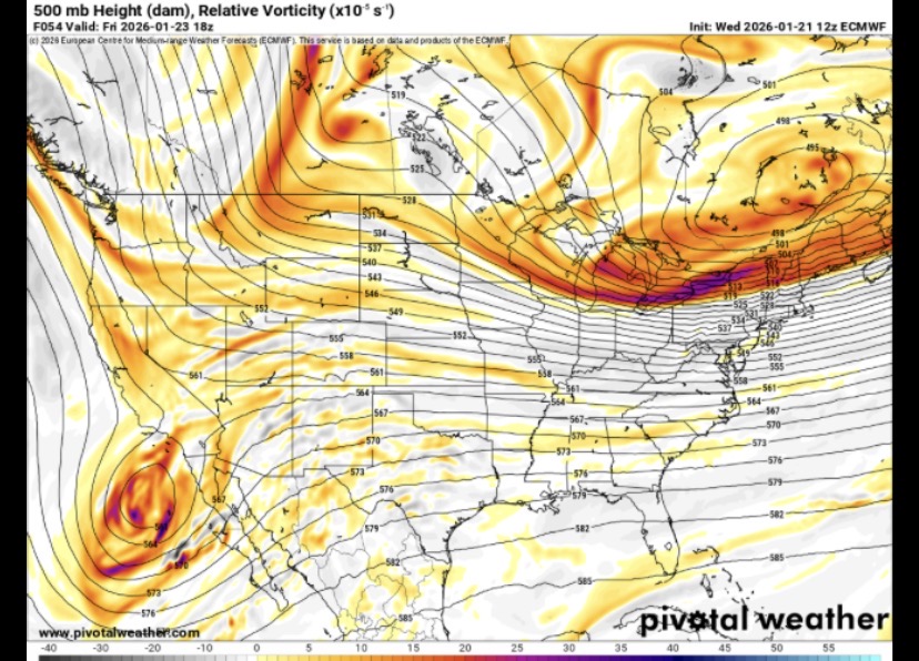
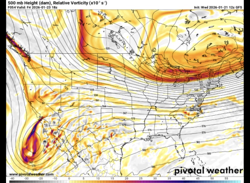
The gfs depiction fits the profile of a normal miller b. I buy the solution even if I don’t buy the source.
-
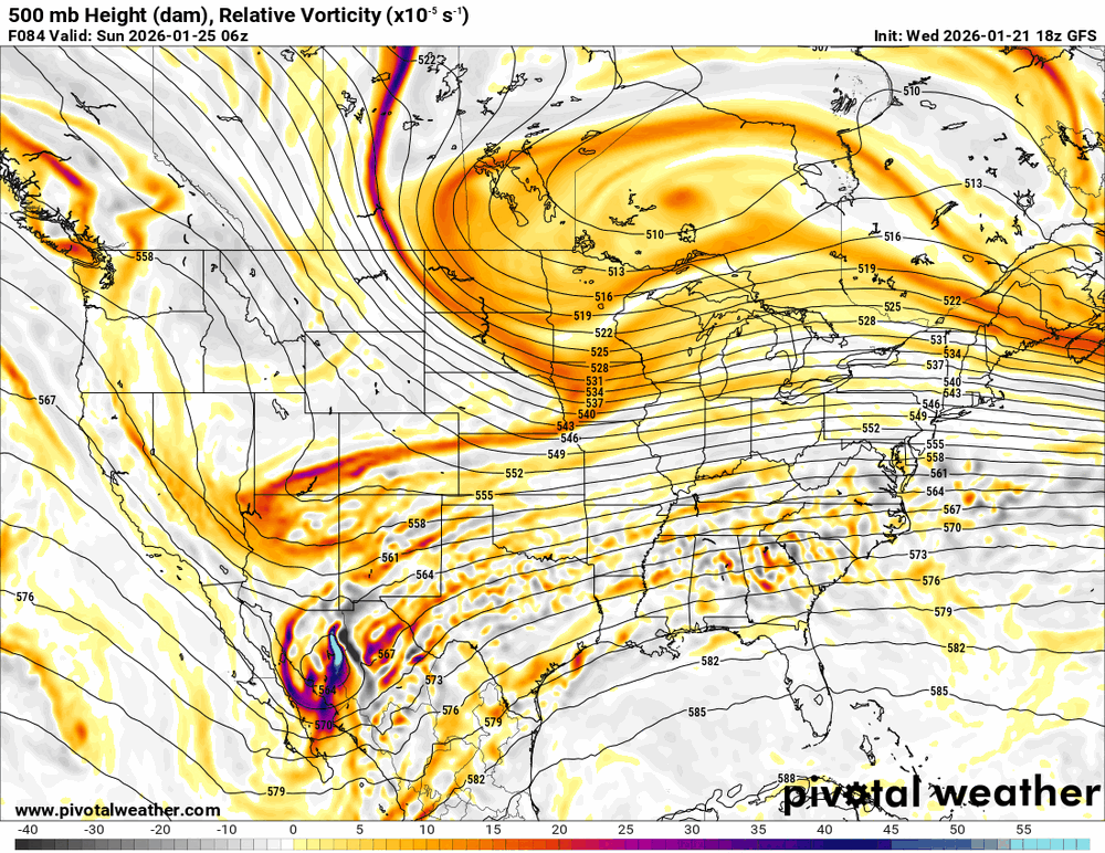
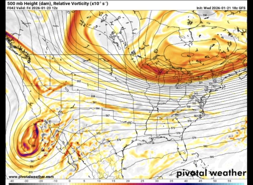
Oops accidentally grabbed the 12z GFS. Here’s 18z same time.
-

January 25/26 Jimbo Back Surgery Storm
SEwakenosnowforu replied to Jimbo!'s topic in Southeastern States
It was not rare between 2000 to 2014....numerous large all snow events...in Wilson at least -
What's it matter? I heard the Euro nailed Sandy...
-

Central PA Winter 25/26 Discussion and Obs
paweather replied to MAG5035's topic in Upstate New York/Pennsylvania
The storm of the Century! -
Thanks for the clarification! Leave it Zulu time to confuse the entire thread, lol
-
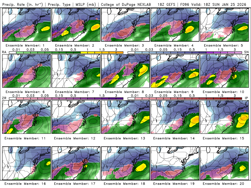
All of the models are getting it tonight, except the GFS. Gotta keep that government small!
-

MO/KS/AR/OK 2025-2026 Winter Discussion
stormdragonwx replied to stormdragonwx's topic in Central/Western States
Once that Hurricane Hunter data gets fully plugged in we should know the real story by the time the 06z runs go live. -
Yep, shows how easily this system could get bullied south and become a sheared out system. Seems like anything from amped to modest to even a two-part system is on the table.
-
My guy...


