frd Posted December 26, 2019 Share Posted December 26, 2019 19 minutes ago, bluewave said: But my concern is that the weaker IOD influence may eventually lead to more amplified forcing in those unfavorable phases. bluewave, that is an interesting concern. I have read, from a couple mets, that the desire for colder outcomes in the East eventually rested in part to a weakening of the record +IOD. I did not come across any mentions of weaker IOD influence leading to more amplified forcing in those unfavorable phases. Unless, I misunderstood what Webb posted, I thought that when the IOD weakened it would enable more traditional and assertive West Pac forcing to arise, and even the possibility of increased -NAO phases. I would appreciate why you feel the weakening + IOD might be a concern. Honestly, I was happy to see the + IOD weaken, now you have me concerned. For reference, here is one of Webb's posts regarding the weakening IOD. Please take note, this is from back on December 10th, simply inserting it here so you can get a better idea of what I was referring to . Link to comment Share on other sites More sharing options...
MJO812 Posted December 26, 2019 Share Posted December 26, 2019 2nd week of January looks really cold on the gfs, gets and eps. Link to comment Share on other sites More sharing options...
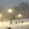
donsutherland1 Posted December 26, 2019 Share Posted December 26, 2019 Just before sunrise today: Link to comment Share on other sites More sharing options...
the_other_guy Posted December 26, 2019 Share Posted December 26, 2019 Just drove from Westchester to Cleveland. Real warmth starts in western 1/3 of Penn. 64 in Youngstown, 62 in Cleveland...With the sun down on December 26 Long story short, It could be worse for us in the Northeast... Link to comment Share on other sites More sharing options...
bluewave Posted December 26, 2019 Share Posted December 26, 2019 bluewave, that is an interesting concern. I have read, from a couple mets, that the desire for colder outcomes in the East eventually rested in part to a weakening of the record +IOD. I did not come across any mentions of weaker IOD influence leading to more amplified forcing in those unfavorable phases. Unless, I misunderstood what Webb posted, I thought that when the IOD weakened it would enable more traditional and assertive West Pac forcing to arise, and even the possibility of increased -NAO phases. I would appreciate why you feel the weakening + IOD might be a concern. Honestly, I was happy to see the + IOD weaken, now you have me concerned. The +IOD was associated with subsidence near the Maritime Continent during the first half of December. As the +IOD weakened, forcing returned there the last 10 days. It coincided with all the record warmth across the US this week. Now the Euro has forcing returning to phases 4-5 in early January. But there is a lag with the MJO. So the first few days of of January will have a lingering mild phase 5-6 influence. Then a colder pattern following the phase 7 passage. Finally, that cool down may be followed by a phase 4-5 warm up. The pertinent forcing changes are all within the more reliable day 1-10 period. Link to comment Share on other sites More sharing options...
donsutherland1 Posted December 27, 2019 Share Posted December 27, 2019 4 hours ago, PB-99 said: The + AO regime portrayed now is due to the TPV sitting in W Canada, so the heights underneath are higher but not warm. The 9 - 13 is BN for good reason, you are getting pieces of the trough to break off with short wavelengths. Is it transient ( 4 - 5 days ) possible , the ridge out near the Aleutians is a little too far west and doesn`t eject the low heights out of W Canada. Any softening there will allow the negative to drain down along the Rockies and that`s what kicks the SE ridge up. I am not even looking at day 15, I am looking closer in by day 10. Here`s your problem the ridge is too far S and not far enough E , so as it releases the trough does not drive S/E it drives due S. That`s what causes the SE ridge to pop back up. And it should until the MJO reaches p8 and pushes this along. We agree about the possible day 9-13 cold shot. I believe the modeled idea is legitimate. I am concerned how things might evolve should Atlantic and Pacific blocking fail to develop: namely the risk of a multi-week warm regime. I think we'll get some opportunities for snowfall, but am less certain about the monthly anomaly. I'm looking at a lot of data, but the forecast teleconnections argue that a mild January is not implausible. Link to comment Share on other sites More sharing options...
donsutherland1 Posted December 27, 2019 Share Posted December 27, 2019 Record high temperatures were recorded in parts of the Great Lakes region today. Record highs included: Chicago: 61° (old record: 55°, 1971); Detroit: 58° (old record: 57°, 2016); Milwaukee: 58° (old record: 51°, 1936 and 2018); and, Toledo: 63° (old record: 62°, 1888). The closing days of December will generally be warmer to occasionally much warmer than normal. Based on the latest guidance, the warmth will likely be sufficient to ensure that much of the Middle Atlantic region will wind up somewhat warmer to warmer than normal for December. Through today, New York City's highest temperature this December is 58°, which occurred on December 10. The last December to have a monthly maximum temperature below 60° was December 2005 when the temperature peaked at 55° on December 24. However, the potential exists for the temperature to approach or reach 60° in New York City during the December 29-30 period. Through December 25, monthly anomalies for select cities were: Baltimore: +0.8°, Boston: +0.5°, Islip: -0.5°, New York City: -1.2°, Newark: -1.0°, Philadelphia: -0.5°, and Washington, DC: +0.1°. Colder air could return during the first week of January. The progression of the MJO in concert with the teleconnections could be crucial in determining whether most of North America's cold air stays bottled up north of the Canada-U.S. border beyond the first week of January or it comes southward into the region shortly after the start of 2020. Transient shots of cold would be possible under the former scenario, which currently appears to be somewhat more likely than not through the first week of January. Afterward, the predominant state of the EPO will likely be crucial to the persistence of the cold. Based on the forecast strongly positive AO to start January, the probability of a significant (6" or greater snowstorm) for the major cities of the Middle Atlantic region during the first week of January is low. Since 1950, the biggest snowfall for that region when the AO was +2.000 or above during the January 1-15 period occurred during January 14-15, 1954 when Philadephia received 3.0" snow and New York City picked up 2.0". Boston has had numerous 6" or greater snowstorms during such cases, including one 10" or greater snowstorm. Therefore, the risk of significant snow would likely be greatest over New England assuming this relationship holds (no significant offsetting variables). Despite the development of a sustained colder than normal temperature regime, Utqiagvik (formerly Barrow) is nearing the end of its warmest year on record. 2019 will likely conclude with a mean temperature of 20.8°. The existing record is 18.9°, which was set in 2016. Currently, 2017 ranks as the second warmest year and 2018 ranks as the fourth warmest year. The ENSO Region 1+2 anomaly was +0.4°C and the Region 3.4 anomaly was +0.6°C for the week centered around December 18. For the past six weeks, the ENSO Region 1+2 anomaly has averaged +0.12°C and the ENSO Region 3.4 anomaly has averaged +0.56°C. The remainder of winter 2019-2020 will likely feature neutral-warm to weak El Niño conditions. The SOI was -28.39 today. That is the lowest SOI value since November 5 when the SOI was -34.49. Today, the preliminary Arctic Oscillation (AO) figure was -2.748. No significant stratospheric warming event appears likely through January 4, but some warming above 3 mb will likely commence in coming days. Wave 2 activity will remain relatively muted into the first week of January. Overall, most of the stratosphere is forecast to remain cold into the start of January on the EPS. On December 25, the MJO was in Phase 6 at an amplitude of 1.528 (RMM). The December 24-adjusted amplitude was 1.121. Based on sensitivity analysis applied to the latest guidance, there is an implied 87% probability that December will wind up warmer than normal in New York City with a monthly mean temperature near 38.5°. Link to comment Share on other sites More sharing options...
Rjay Posted December 27, 2019 Share Posted December 27, 2019 56 minutes ago, donsutherland1 said: We agree about the possible day 9-13 cold shot. I believe the modeled idea is legitimate. I am concerned how things might evolve should Atlantic and Pacific blocking fail to develop: namely the risk of a multi-week warm regime. I think we'll get some opportunities for snowfall, but am less certain about the monthly anomaly. I'm looking at a lot of data, but the forecast teleconnections argue that a mild January is not implausible. It's likely (unfortunately) Link to comment Share on other sites More sharing options...
CIK62 Posted December 27, 2019 Share Posted December 27, 2019 And for this we have to wait till Jan. 06. This probably resembles what we currently have as much as you resemble your brother or sister. The top analog shown of a Jan 21 2002 setup---would of course mean curtain time. That winter after 9/11 did not exist. Low for the season was 19*, if my memory is accurate. Link to comment Share on other sites More sharing options...
203whiteout Posted December 27, 2019 Share Posted December 27, 2019 Unfortunately we are currently in the “mild/snowless” period. I believe everything in life is cyclical including weather and I believe things flipped sometime in 2016/2017 and ever since winters are basically non existent in the east with the exception on NNE and green and white mountains. It’s happened before. We will still have stretches of mild winter like in the past and we will also occasionally have very snowy winters and that’s part of the reason it’s so fun to track storms. I’ll tell ya what though the next big storm for the tri state area and coastal NE will be a very welcomed sight, it’s been too long. Hope we can squeeze a big storm out of a crappy pattern/season. I’ve seen it happen plenty of times, 2006 (30”) and 2013 (37”) come to mind, especially over last 15 years. You never know...fingers crossed Link to comment Share on other sites More sharing options...
doncat Posted December 27, 2019 Share Posted December 27, 2019 Gonna go 11 straight days with no precip and still finish the month with over 8" here if current guidance holds. Also current temp departure for month is -1.7°. Link to comment Share on other sites More sharing options...
WarrenCtyWx Posted December 27, 2019 Share Posted December 27, 2019 A lot of those 80s winters were actually pretty cold as well, namely 80-81, 81-82, 83-84, January 1985 and 85-86. Some of the arctic outbreaks during those years were historic, in fact. Yet snowfall was consistently poor to mediocre regardless. Link to comment Share on other sites More sharing options...
CIK62 Posted December 27, 2019 Share Posted December 27, 2019 The last 5 days of December are averaging 47.5degs., or about 13.5degs. AN(a touch of or should I say a torch of Dec. '15). Month to date is -0.9[37.3]. December should end near +1.5[39.0]. 48* here at 6am. 50* by 9am. 53* by Noon. Stayed at 53*+ till after 5pm. 51* at 9pm. Before the putative change Jan. 06(which is certain to do the El Fado and become Jan. 16 while we wait---or prove not worth the wait) figure on +7 and no snow. Link to comment Share on other sites More sharing options...
SnoSki14 Posted December 27, 2019 Share Posted December 27, 2019 51 minutes ago, WarrenCtyWx said: A lot of those 80s winters were actually pretty cold as well, namely 80-81, 81-82, 83-84, January 1985 and 85-86. Some of the arctic outbreaks during those years were historic, in fact. Yet snowfall was consistently poor to mediocre regardless. I'm hoping we can avoid the cold if it's gonna be snowless. So far that looks to be the case. There's a chance some cold gets in 2nd week of January but that's a long ways out and the GFS has consistently been too cold in the LR. Link to comment Share on other sites More sharing options...
bluewave Posted December 27, 2019 Share Posted December 27, 2019 You know it’s warm when the NYC low of 46 is 6 degrees warmer than the normal high of 40. Link to comment Share on other sites More sharing options...
EastonSN+ Posted December 27, 2019 Share Posted December 27, 2019 8 hours ago, 203whiteout said: Unfortunately we are currently in the “mild/snowless” period. I believe everything in life is cyclical including weather and I believe things flipped sometime in 2016/2017 and ever since winters are basically non existent in the east with the exception on NNE and green and white mountains. It’s happened before. We will still have stretches of mild winter like in the past and we will also occasionally have very snowy winters and that’s part of the reason it’s so fun to track storms. I’ll tell ya what though the next big storm for the tri state area and coastal NE will be a very welcomed sight, it’s been too long. Hope we can squeeze a big storm out of a crappy pattern/season. I’ve seen it happen plenty of times, 2006 (30”) and 2013 (37”) come to mind, especially over last 15 years. You never know...fingers crossed 2017 2018 was well above average for most of this forum with a historic March and April. Link to comment Share on other sites More sharing options...
weatherpruf Posted December 27, 2019 Share Posted December 27, 2019 9 hours ago, 203whiteout said: Unfortunately we are currently in the “mild/snowless” period. I believe everything in life is cyclical including weather and I believe things flipped sometime in 2016/2017 and ever since winters are basically non existent in the east with the exception on NNE and green and white mountains. It’s happened before. We will still have stretches of mild winter like in the past and we will also occasionally have very snowy winters and that’s part of the reason it’s so fun to track storms. I’ll tell ya what though the next big storm for the tri state area and coastal NE will be a very welcomed sight, it’s been too long. Hope we can squeeze a big storm out of a crappy pattern/season. I’ve seen it happen plenty of times, 2006 (30”) and 2013 (37”) come to mind, especially over last 15 years. You never know...fingers crossed Jan 2016 around here....other than that its been some March storms where I broke the snowblower out just to get it running, as there really is no need to to clean a few inches of snow in March. With rare exceptions ( IMBY ) like March 93, it's going to be gone in a day or two. Sometimes the same day! Link to comment Share on other sites More sharing options...
weatherpruf Posted December 27, 2019 Share Posted December 27, 2019 1 hour ago, EastonSN+ said: 2017 2018 was well above average for most of this forum with a historic March and April. It was not for many, many people here as well. One storm delivered 6-8 in March for us, the last one. Even the Jan storm struggled to get above 6 here. It has been years since we've seen more than around 6-8 for even a really good storm here. Now that's fine with me, if they happen a few times. If you're at elevation, different story. But I gotta say, I'm not missing the cold that much. It'll be back. Link to comment Share on other sites More sharing options...
OrangeCTWX Posted December 27, 2019 Share Posted December 27, 2019 36 minutes ago, NYCweatherNOW said: Just saw a flock of geese head south that usually results in snow in two weeks. Let’s see if that’s just a myth or not. That means we would get a snow event around January 10th or so! Currently 50 degrees and cloudy! Probably more accurate than looking at the GFS at the very least. Link to comment Share on other sites More sharing options...
hudsonvalley21 Posted December 27, 2019 Share Posted December 27, 2019 8 minutes ago, Sn0waddict said: Probably more accurate than looking at the GFS at the very least. Geese For Sure = GFS Link to comment Share on other sites More sharing options...
snowman19 Posted December 27, 2019 Share Posted December 27, 2019 6 hours ago, SnoSki14 said: I'm hoping we can avoid the cold if it's gonna be snowless. So far that looks to be the case. There's a chance some cold gets in 2nd week of January but that's a long ways out and the GFS has consistently been too cold in the LR. The GFS long range phantom cold and blocking bias is glaring, like really bad and has been for several years Link to comment Share on other sites More sharing options...
snowman19 Posted December 27, 2019 Share Posted December 27, 2019 17 hours ago, Rjay said: It's likely (unfortunately) I’m also willing to bet that March is a freezer. It’s become a yearly tradition. May be climate change related in the Pacific tropical forcing, with the wavelengths shortening at that time but there is a huge tendency for both November and March to be cold/very cold months the last several years Link to comment Share on other sites More sharing options...
snowman19 Posted December 27, 2019 Share Posted December 27, 2019 36 minutes ago, snowman19 said: I’m also willing to bet that March is a freezer. It’s become a yearly tradition. May be climate change related in the Pacific tropical forcing, with the wavelengths shortening at that time but there is a huge tendency for both November and March to be cold/very cold months the last several years The other tendency is for -NAO/-AO blocks to form in mid to late March and lock in through the end of April Link to comment Share on other sites More sharing options...
495weatherguy Posted December 27, 2019 Share Posted December 27, 2019 5 minutes ago, snowman19 said: The other tendency is for -NAO/-AO blocks to form in mid to late March and lock in through the end of April I hope on this that you are wrong----as for a warm, relatively snowless winter, bring it on Link to comment Share on other sites More sharing options...
weatherpruf Posted December 27, 2019 Share Posted December 27, 2019 4 minutes ago, 495weatherguy said: I hope on this that you are wrong----as for a warm, relatively snowless winter, bring it on Haven't you had your fill? I mean, much warmer than what we've had and we might as well be in S Carolina...and I don't just mean this year. Mild winters have been the norm in my lifetime, outside a few wild years in the 2000's and 2 years in the 90's... Link to comment Share on other sites More sharing options...
snowman19 Posted December 27, 2019 Share Posted December 27, 2019 12 minutes ago, 495weatherguy said: I hope on this that you are wrong----as for a warm, relatively snowless winter, bring it on I do too but if I’m a betting man, March is colder than normal and most likely so is April. For whatever reason and I do believe climate change is playing some role, the -AO/-NAO shows up like clockwork around mid to late March and locks in. You can set your watch to it Link to comment Share on other sites More sharing options...
495weatherguy Posted December 27, 2019 Share Posted December 27, 2019 2 minutes ago, weatherpruf said: Haven't you had your fill? I mean, much warmer than what we've had and we might as well be in S Carolina...and I don't just mean this year. Mild winters have been the norm in my lifetime, outside a few wild years in the 2000's and 2 years in the 90's... No, I have not had my fill--whatever that means. Look, I love snowstorms as much as, if not more than any other. What I don't like is the disruption they cause, the potential for damage, general disarray they cause during the week. Let us get huge blizzards on Friday nights, and have it all melted away by Sunday night. The winters that we have had in the last 20 years are overall remarkable--but they are not average or sustainable. Look at the long term averages---we have exceeded--no blown past-the normal snowfalls an inordinate amount in the last 20 years. We don't live in Maine, we live near the ocean(not all, most)and that has an influence on our precipitation The 70's and 80's were plenty cold, we seemed to get cold rain most of the time And as someone who says he loves to fish, I would think you would want warmer weather where you can get outside and enjoy your hobby more Finally, people are allowed to openly root for snow, but a divergent opinion is not allowed? Link to comment Share on other sites More sharing options...
SnoSki14 Posted December 27, 2019 Share Posted December 27, 2019 21 minutes ago, 495weatherguy said: I hope on this that you are wrong----as for a warm, relatively snowless winter, bring it on Pattern progression has been almost identical to last season. I'd be shocked if March/April were warm. Link to comment Share on other sites More sharing options...
495weatherguy Posted December 27, 2019 Share Posted December 27, 2019 3 minutes ago, SnoSki14 said: Pattern progression has been almost identical to last season. I'd be shocked if March/April were warm. I hope we have a nice spring Link to comment Share on other sites More sharing options...
LibertyBell Posted December 27, 2019 Share Posted December 27, 2019 59 minutes ago, snowman19 said: The other tendency is for -NAO/-AO blocks to form in mid to late March and lock in through the end of April I like early April snowfalls, so bring it on! Link to comment Share on other sites More sharing options...


Recommended Posts
Archived
This topic is now archived and is closed to further replies.