All Activity
- Past hour
-
 AGW will almost certainly grow worse. There's little indication that global fossil fuel emissions will begin to decline significantly over the near- and medium-term. That will probably add another 0.1C-0.2C background warming globally toward the end of the decade. By 2030 readings close to 2023 levels might be the norm. By then, there will probably be a clear signal for declining snowfall in the NYC area that will stand out from any plausible case for internal variability.
 -
I can see a warm Winter easily verifying. We need a major -EPO to break through, and right now there are no signs of that in the global pattern evolution: it's a little more stagnant, allowing things like the -PDO to impact, and that has a slight +epo correlation.
-
You can have a dark theme by using this board via TapaTalk and TapaTalk Pro in the app stores. Then search for our site. Then set that app to dark mode.
- Today
-
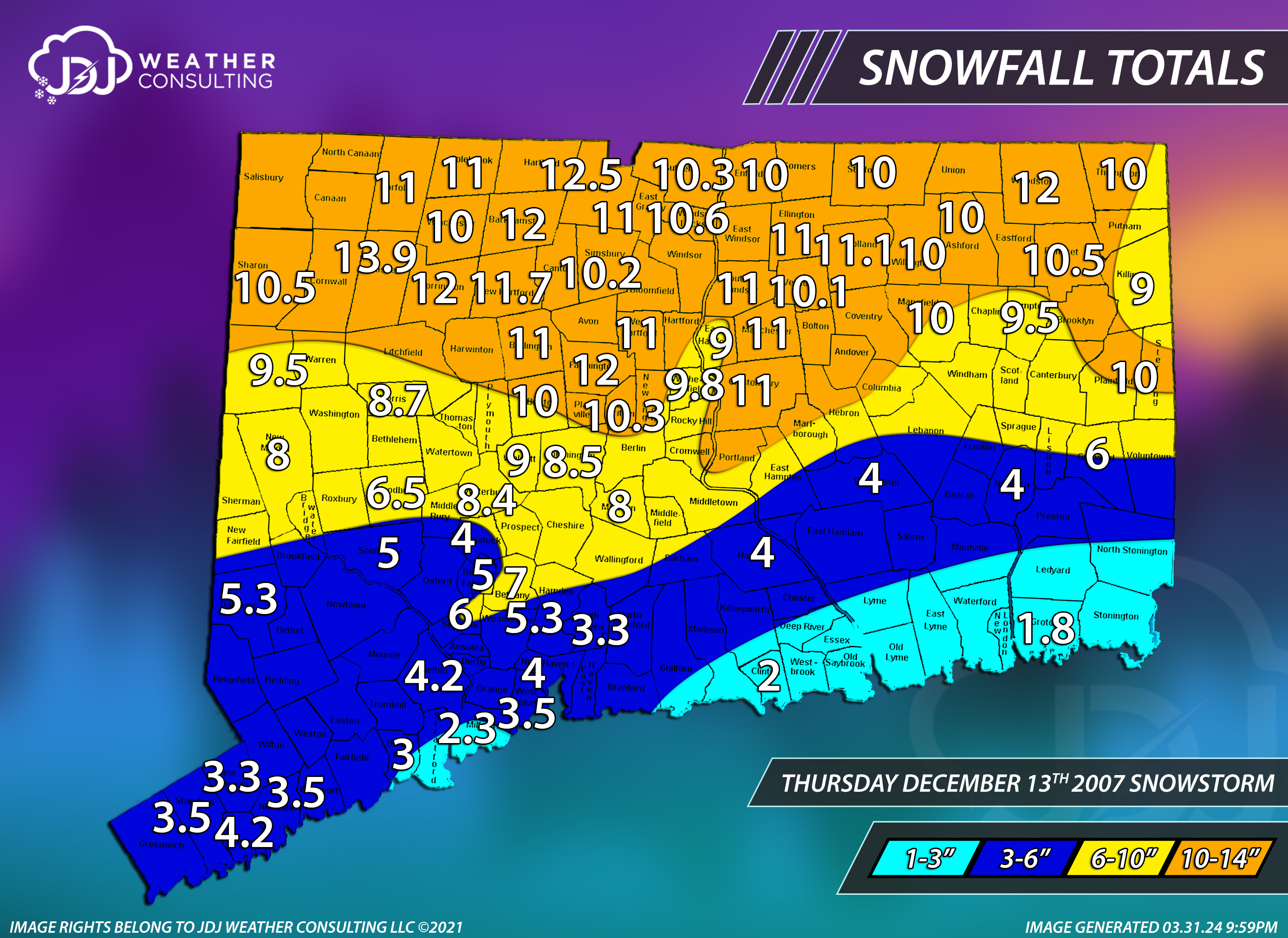
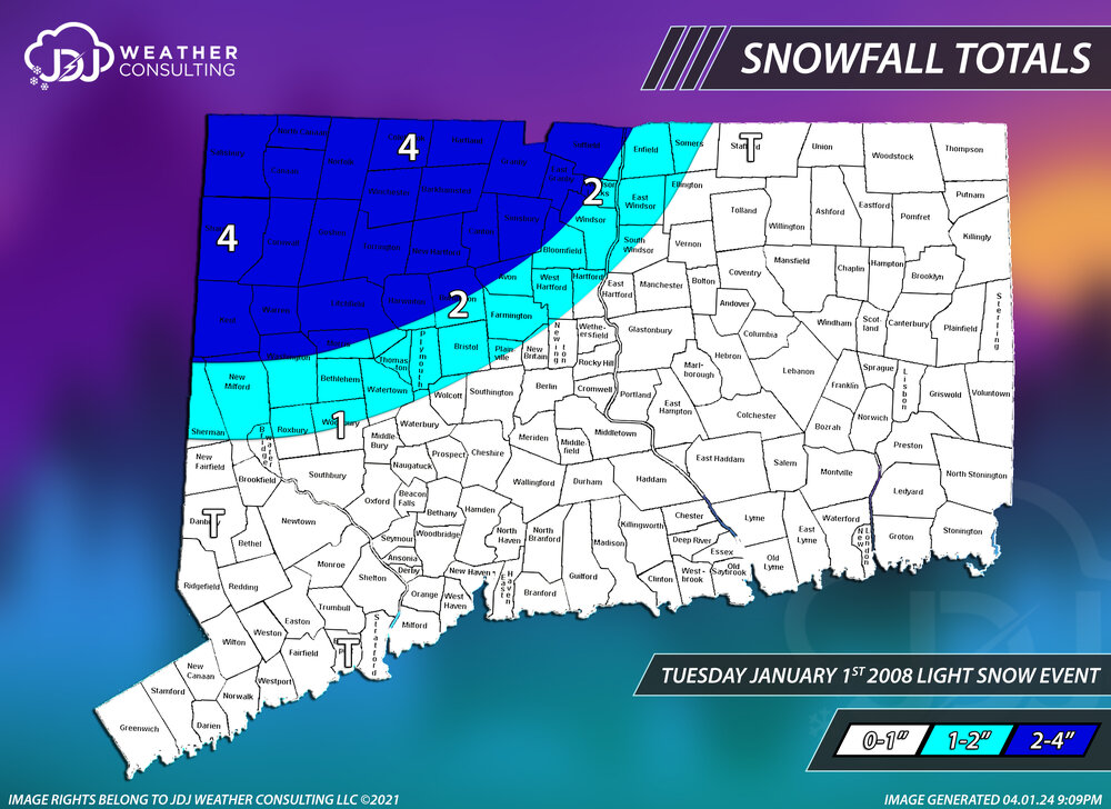
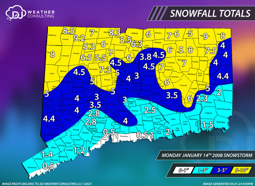
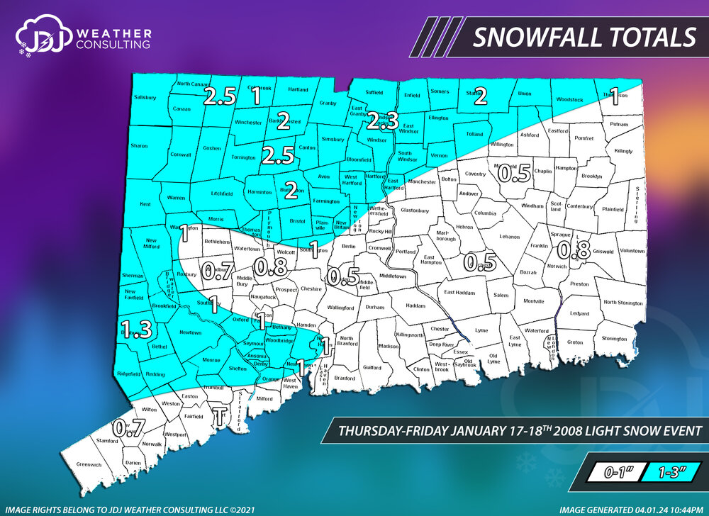
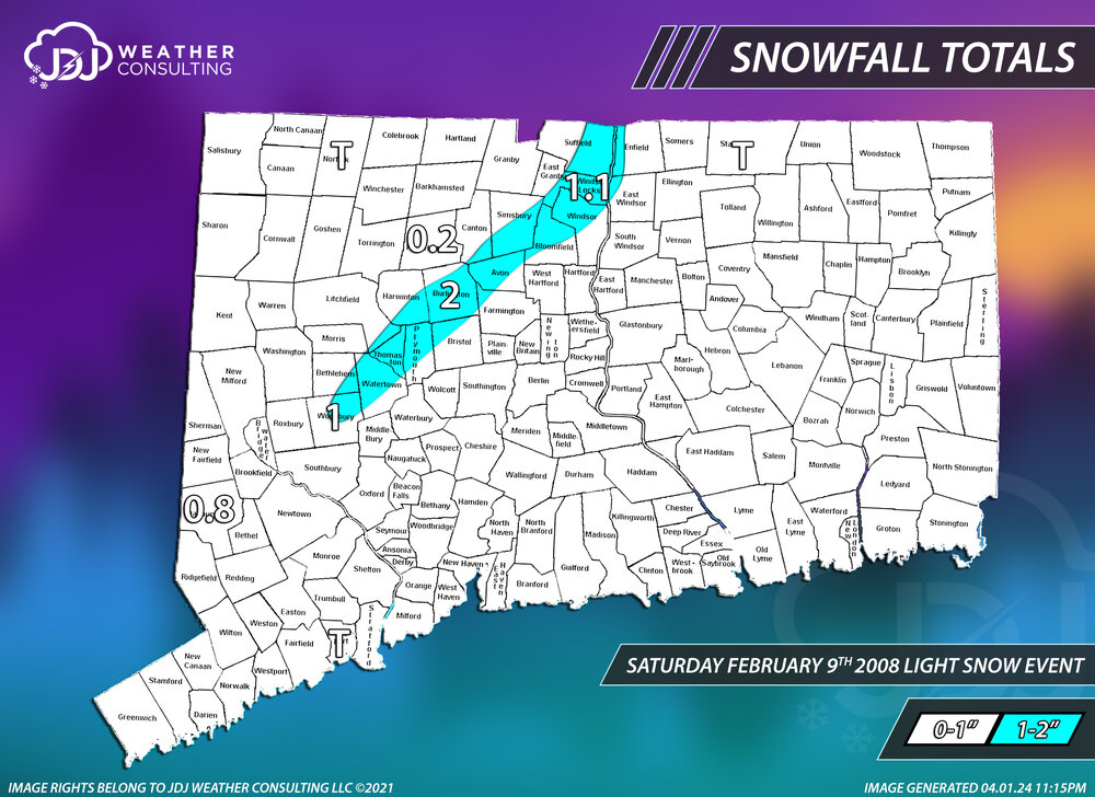
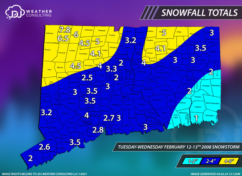
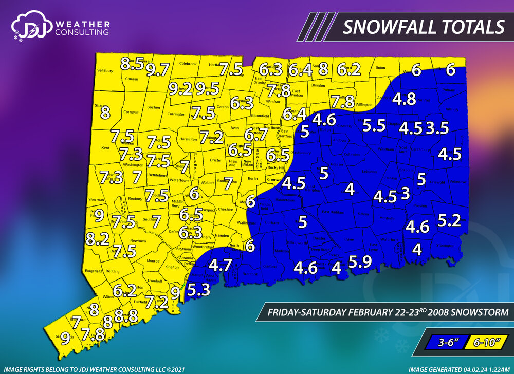
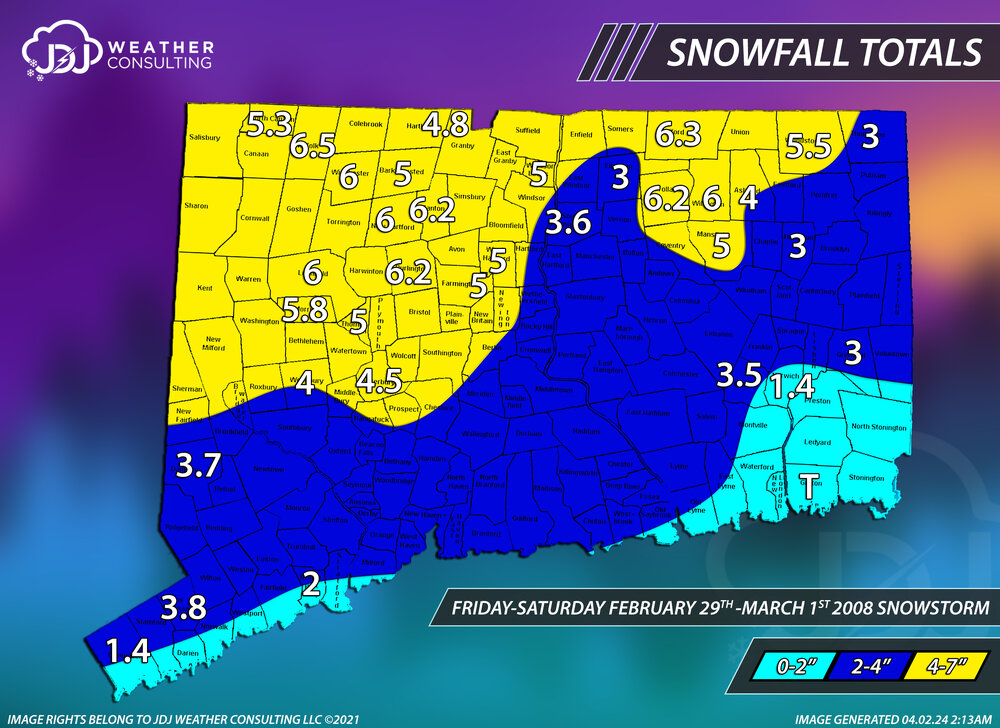
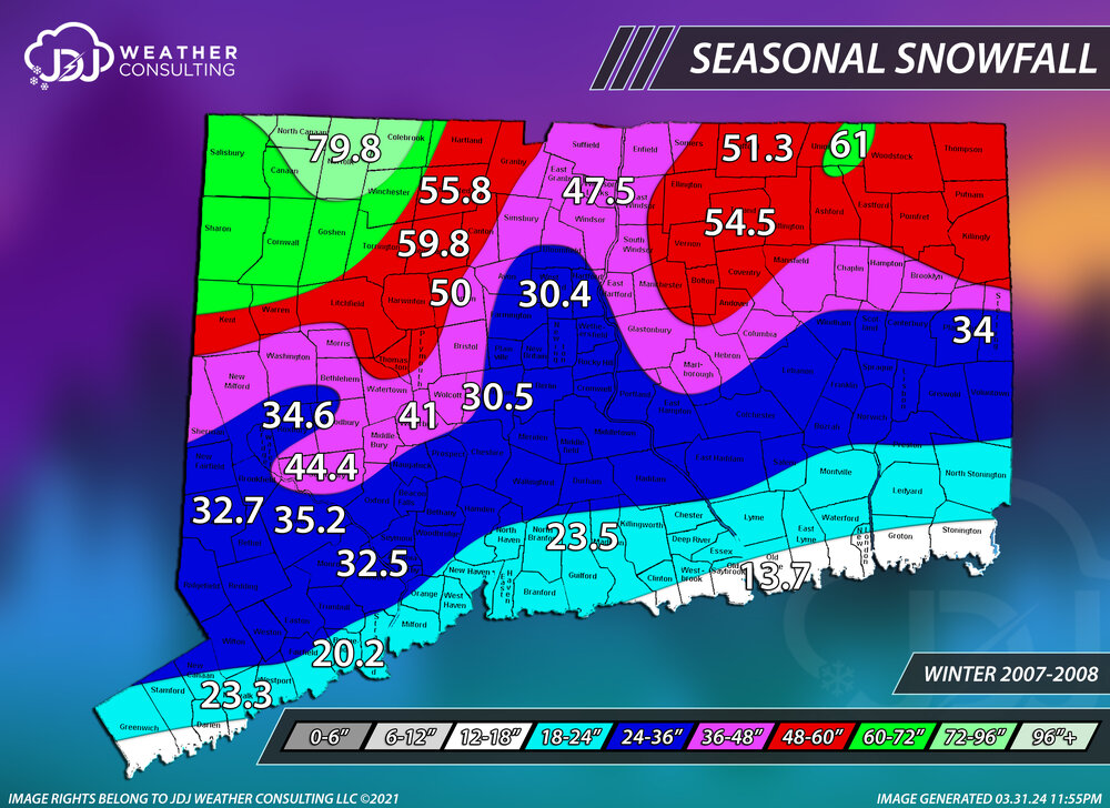
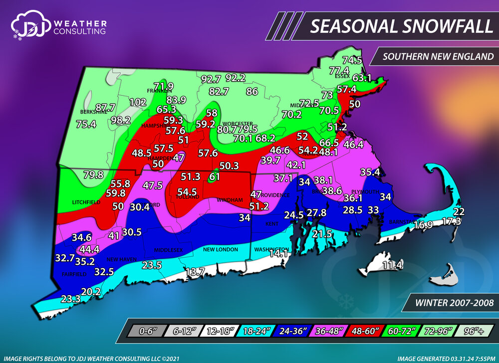
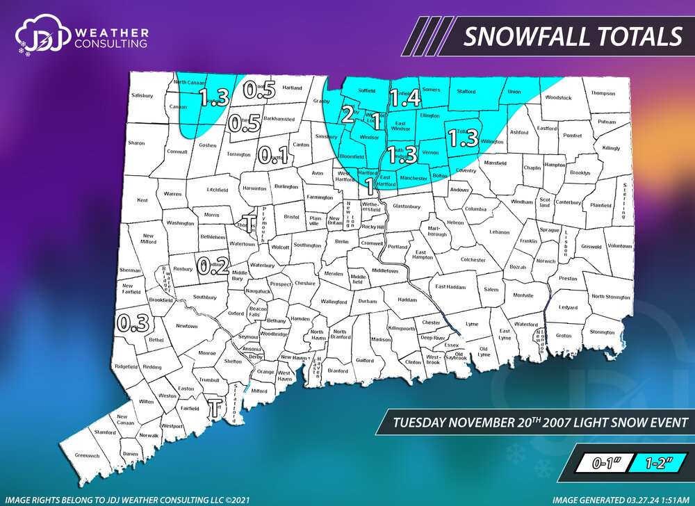
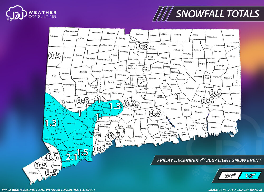
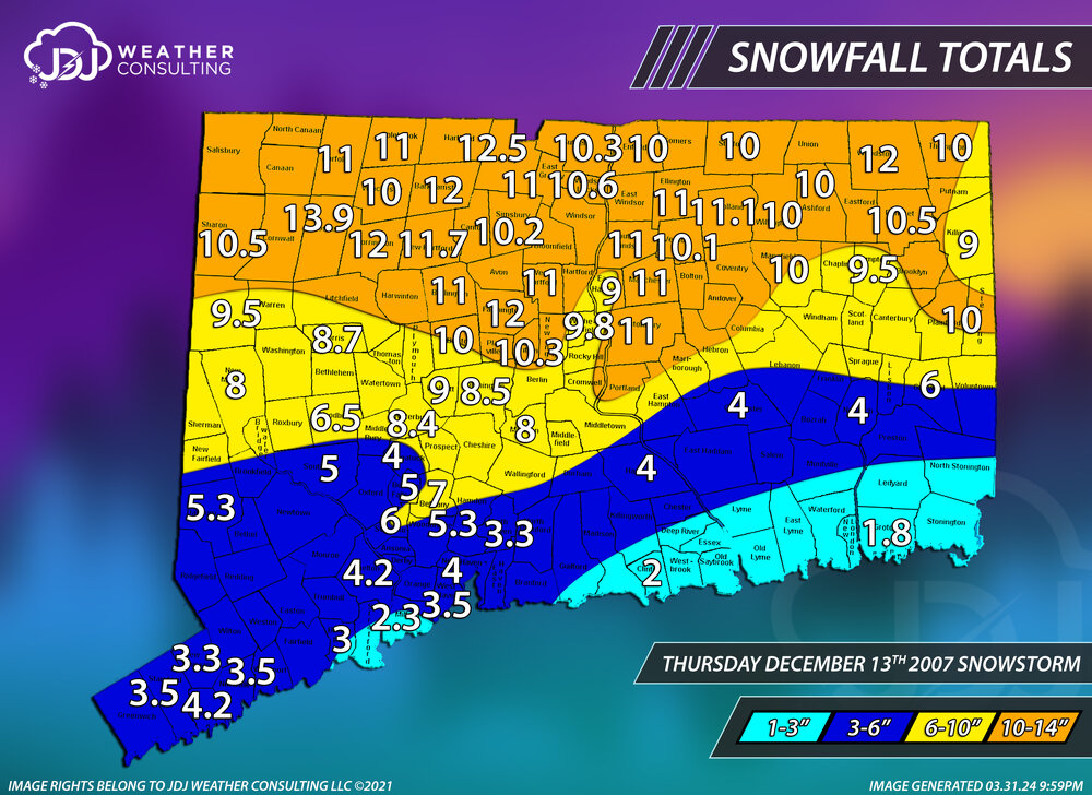
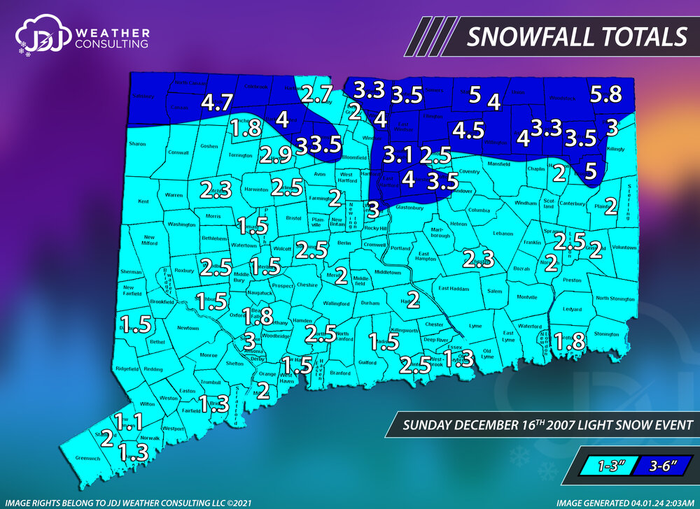
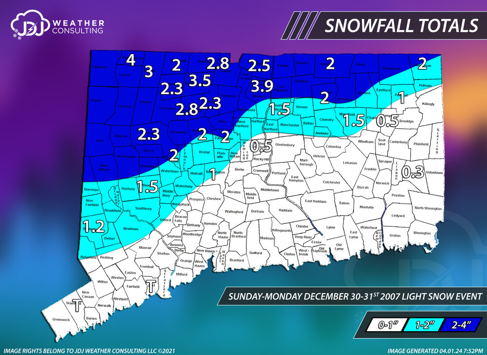
All accumulating storms in CT for 2007-2008 season and the seasonal snowfall for CT and SNE.
-
What do you mean it's totally correct
-
Congrats on today Paul
-
Shouldn’t the thread headline read “5-6-24” instead of “4-6-24”?
-
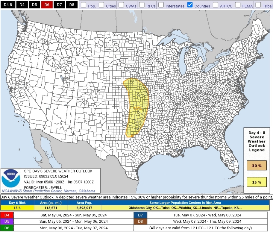
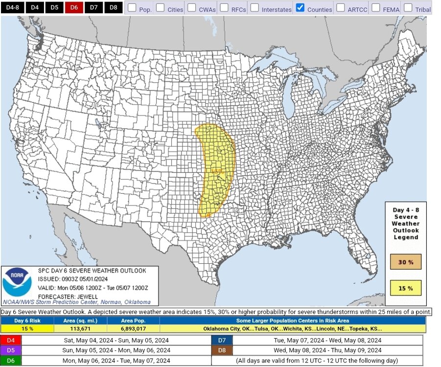
SPC has highlighted a swath of the plains from TX to NE for D6. May is in full swing! Day 4-8 Convective Outlook NWS Storm Prediction Center Norman OK 0403 AM CDT Wed May 01 2024 Valid 041200Z - 091200Z ...DISCUSSION... For Saturday/D4 to Sunday/D5, scattered to perhaps numerous thunderstorms are possible over a large section of the CONUS from the southern Plains into the Southeast. Mid 60s F to lower 70s F dewpoints will be common across the entire area, aided by southerly surface winds around an East Coast high. Aloft, generally weak flow will exist over the same areas, well east of a developing western upper trough. As such, the weak shear will likely minimize overall severe potential through Sunday/D5. For Monday/D6, models have shown increased run-to-run consistency in depicting a deep upper trough developing over the Great Basin and emerging into the Plains. Rich low-level moisture will be in place ahead of this system, which is forecast to enter the central Plains with a negative tilt and strong shear. While minor trough-geometry differences exist amongst the models, the combination of strengthening shear, a potentially deep surface low and ample moisture and instability necessitate introducing severe probabilities for parts of the Plains on Monday. All facets of severe appear possible with such a system, including supercells, squall lines, tornadoes, damaging winds and large hail. ..Jewell.. 05/01/2024
-
Had a super isolated cell roll through Biltmore yesterday afternoon. Literally was hailing on one side and sun out on the other.
-
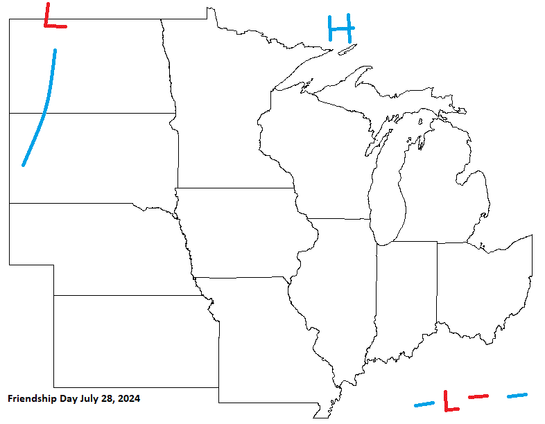
Friendship Day looking pretty decent with most of the sub under the influence of HP. Looks like a boundary may affect the southern most part of the sub. W areas could get a little on the hot side with a boundary in the Plains.
-
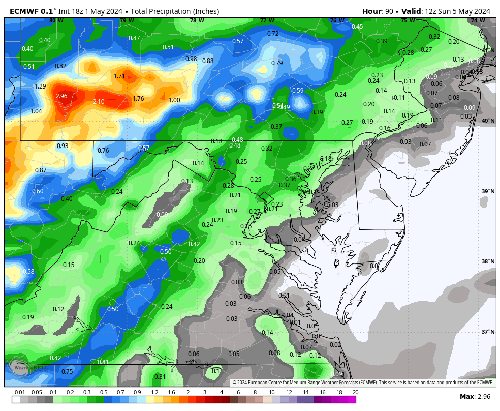
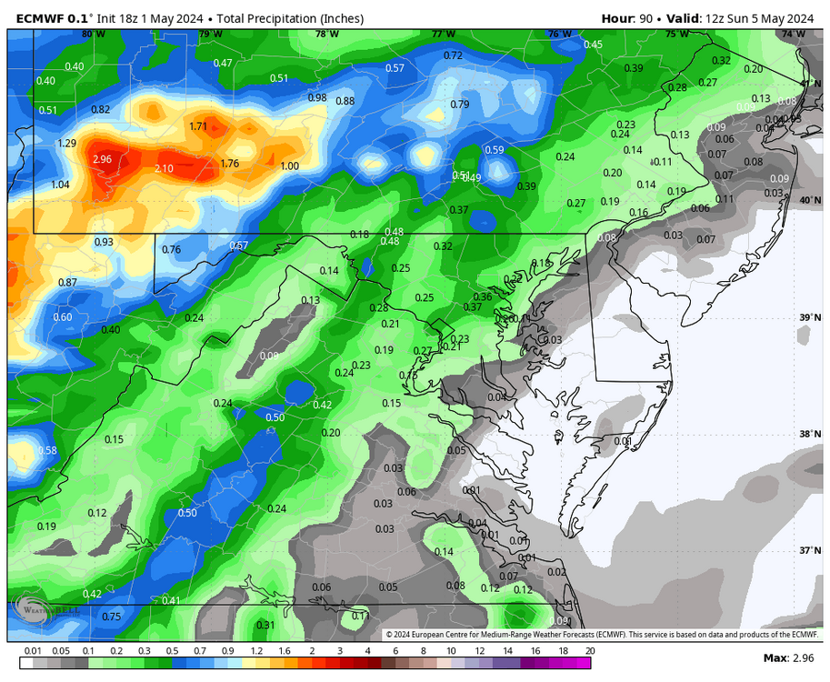
WB 18Z EURO is wetter for Saturday night compared to 12Z.
-

2024-2025 La Nina
Stormchaserchuck1 replied to George001's topic in Weather Forecasting and Discussion
Really nice -PDO pattern in the N. Pacific for the next 15 days (as per 18z GEFS). Fitting the La Nina evolution pretty well. -

May 2024 Discussion - Welcome to Severe Season!!!!
dendrite replied to weatherwiz's topic in New England
55/41 today. Finished with 1.32” of rain. -
Played a few halfcourt games after work and I’ll admit…it was toasty. I think part of it is just getting used to it. I needed this week..but the cooler weather might feel good this weekend lol
- Yesterday
-
July 4th is on a Thursday this year. Looks pretty nice to me. Could get real warm in the W sub on the backside of HP moving through, ahead of next system lurking to the W.

-
Modern is fantastic. Zuppardi's sausage pie in West Haven is outrageous as well.
-
Maybe a larger window of fantastic weather this spring. Usually get this from Memorial Day thru first few weeks of June before heat sets in.
-
Nevermind. I think I found the source:
-

Central Pa. Spring 2024
mahantango#1 replied to mahantango#1's topic in Upstate New York/Pennsylvania
84 for the high today. -
Hot and dry.
-
Seriously smoky conditions on the Upper East Side and Roosevelt Island. Wildfire-related or something else?
-
Isn't this the May MR/LR thread? December a hella long way off. What a start lol.
-
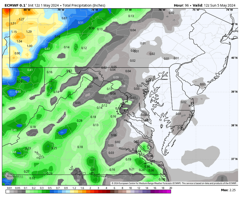
Tomorrow will bring a taste of June with readings rising into the 80s across the region. Hot spots could approach or reach 90°. Overall, the first week of May should wind up warmer than normal, even as there will be considerable variability in the daily temperatures. Showers and periods of rain could arrive during the weekend. Sunday into Monday could be the wettest period. The ENSO Region 1+2 anomaly was 0.0°C and the Region 3.4 anomaly was +0.8°C for the week centered around April 24. For the past six weeks, the ENSO Region 1+2 anomaly has averaged -0.23°C and the ENSO Region 3.4 anomaly has averaged +0.98°C. The ongoing basinwide El Niño event is fading. Neutral conditions could develop later in the spring. The SOI was +6.53 today. The preliminary Arctic Oscillation (AO) was -1.981 today.
-
18Z GFS is a rowboat run. Waiting to mow until Friday is risk for western areas then at least some rain every day going forward for 7 days.
-
The pollen dust in terrible. Just nasty.
- 43 replies
-
- 1
-

-
- spring
- dry weather
- (and 4 more)