All Activity
- Past hour
-

May 2024 Discussion - Welcome to Severe Season!!!!
CoastalWx replied to weatherwiz's topic in New England
Hrrr too. Signal was there at least. - Today
-

2024 Atlantic Hurricane Season
Windspeed replied to Stormchaserchuck1's topic in Tropical Headquarters
It's straight stupid how anomolous the current 28°C isotherm is across the MDR. I always pay more attention to that as it's really the harbringer of major hurricane potential. As soon as the upper atmosphere begins to settle into more of a late Summer / July pattern combined with La Niña and weakening trades, I fully expect an early onset of CV ASO+ and a hyperactive season. -
That said, although things do look ugly right now and I would lean warm, I’m not quite as pessimistic as I was last year at this time for New England. South of NYC yeah it looks really ugly, but New England has more room for error in stronger Nina’s. Latitude is a big deal in SE ridge patterns. Could it flex all the way up to Canada? Sure it can, and it likely will at times. But it can also lead to gradient patterns where those on the north side of the gradient get hammered like 2007-2008.
-
Yeah 95-96 is not a good analog at all, +PDO, weaker event, east based. I don’t think 14-15 and 10-11 are bad though. I like 14-15 for the atlantic (good solar match, strong consolidated PV), and 10-11 for the pacific (good ENSO match for both strength and structure, good PDO match). I’m not a fan of the way analog forecasting is done and interpreted. Using 14-15, 10-11 etc as analogs shouldn’t mean “Oh this means Boston is getting 80+ inches of snow”. It doesn’t work that way, just because there are some similarities in those years doesn’t mean the results will be the same. 14-15 is a decent analog for the Atlantic, but that was a strongly positive +PDO and a modoki Nino. A +NAO in a weak modoki Nino is a very snowy pattern, a +NAO in a moderate-strong modoki nina is a big warm signal. What Bastardi leaves out is that 2011-2012 and 2022-2023 are great ENSO analogs. AGW also needs to be considered. Bastardi fails to do this, which is a big reason why his forecast always bust cold.
-

May 2024 Discussion - Welcome to Severe Season!!!!
Ginx snewx replied to weatherwiz's topic in New England
I must have missed the 1 NAM run that had 3 to 6 -
After looking at the evening guidance, I still have little confidence in a Saturday forecast, although the trend for those of us east of the Potomac seems to be wetter.
-
i lived out there for a year and a half, girlfriends family lives out there so i go visit occasionally, and DEF moving back in the next few years. SD's weather is wild because that mediterranean climate is in such a pocket between the coast and mountains, in the winter you can drive 45 mins up to julian for snow, or mt laguna which is about an hour away. then the desert on the other side of the mountains offers some crazy summertime weather events like heat and the occasional monsoon. as boring as weather in sd proper can be, its got its little perks. main issue is as soon as one rain drop hits the ground driving becomes a nightmare. ive been on the 5 freeway in north county sd and i swear two rain drops hit my windshield and we slowed right down to a comfy 45mph...
-
Yeah I’m thinking it gets to around the strength of the 2007-2008 or 2010-2011 Ninas.
-

2024-2025 La Nina
Stormchaserchuck1 replied to George001's topic in Weather Forecasting and Discussion
We've held -4c in the central subsurface for some time, which implies at least a Moderate La Nina coming. Lower chance, but still possible that it goes Strong. -
The 00z NAM already has a potent setup for the day-4 forecast (72 hours, Sunday night)
-

May 2024 Discussion - Welcome to Severe Season!!!!
powderfreak replied to weatherwiz's topic in New England
Remember when that was a badge of honor on the forums? 20 years ago in the mid-2000s on WWBB it was a big win to have the lowest temps, especially during the warm season. My how we’ve all aged and grown up… . -
Texas 2024 Discussion/Observations
Stx_Thunder replied to Stx_Thunder's topic in Central/Western States
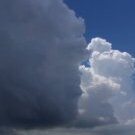
It’s MLB season. The Astros were just playing as scheduled tonight at Minute Maid park, and it looks like they’re gonna win also which is a nice finish to today’s powerful convective action in Houston. Nothing severe there lol 62 kts seems on spot around Houston as most people can definitely lose power at those sudden gust speeds (at least around this part of the country). But the TDS signature on radar and the broken windows on those 2 downtown skyscrapers that @cheese007 posted about suggests there may have been a very brief spinup right around there as the thunder line was moving in. -
By Wednesday we'll be bored by the sunny weather Sunday Partly sunny, with a high near 73. Monday Mostly sunny, with a high near 75. Tuesday Sunny, with a high near 77. Wednesday Mostly sunny, with a high near 78. Thursday Mostly sunny, with a high near 78.
-

Texas 2024 Discussion/Observations
Ed, snow and hurricane fan replied to Stx_Thunder's topic in Central/Western States
We're lucky, The CenterPoint grid is not robust in our neighborhood, but we have power. Light flickered while the storm was still well W of here, with near calm winds. I'm guessing the transmission towers out by Cypress going down. Then again when the line hit. But they came on before the rain was even over. Before the second round of severe t-storm winds (not as strong as the first, but impressive) that surprised me because it had almost stopped raining.- 222 replies
-
- 2
-

-
- flooding
- mcs season
- (and 3 more)
-
Whoever said it's hoodie weather lied...I'm sweating bullets Lol it's humid as hell
-
It's been a wonderful spring here in the Midwest. Sorry to hear it hasn't been as nice on the EC.
-

May 2024 Discussion - Welcome to Severe Season!!!!
kdxken replied to weatherwiz's topic in New England
-

May 2024 Discussion - Welcome to Severe Season!!!!
WxWatcher007 replied to weatherwiz's topic in New England
I’m guessing it’ll be mostly straight line winds. I think there was one TDS near Houston. Basically a cat 1 rolled through the region. Interesting how the actual obs sites had lower reported gusts. Phil ripping glass out of skyscrapers type stuff. Insane. -
Man oh man. Houston better pray they never get directly hit by cat 3+ Sent from my SM-G970U using Tapatalk
-

- 840 replies
-
- 4
-
-

-

-
- spring
- cool temps
- (and 3 more)
-

Central Pa. Spring 2024
Itstrainingtime replied to mahantango#1's topic in Upstate New York/Pennsylvania
Weekend forecast continues to slowly improve - precip chances for Saturday were 80% as of this morning, down to just 50% now. Sunday's forecast is Partly Sunny. -

Texas 2024 Discussion/Observations
canderson replied to Stx_Thunder's topic in Central/Western States
My family from Pearland to the woodlands is without power -
Hot weather sucks Cold weather sucks 50s and sheet drizzle sucks 75 and sunny is where it's at. Maybe I should live in San Diego. The problem with that is it gets boring pretty fast. I love the variety in regards to weather conditions we get in this area. I hate these stuck patterns.
- 840 replies
-
- 2
-
-
- spring
- cool temps
- (and 3 more)
-
This is measured by downtown-- 62 knots ( Houston Dunn Helistop airport?)
- 222 replies
-
- 1
-
-
- flooding
- mcs season
- (and 3 more)
-
Meanwhile in Houston