All Activity
- Past hour
-
These folks waaaaaaaaaaaaaaayyyyyyyyyy down south in the Andes are just getting demolished. You can actually see that snow on the ground, getting blown around, in REAL TIME!!!!! Take a really good look at this vid. Because you are seeing a representation of what DCA is gonna look like come mid Dec 2025 on into early April 2026. Believe it. When you got the Jebman talkin SNOW in early August, what you got here is a sign of an imminently very BAD winter here in the Mid Atlantic only about 18 weeks from now.
- Today
-
Looking at these 0Z models, except the GFS... That would be problematic to say the least.. A repeat of last September simply wouldn't be good.. Except for Debby in August ( some creeks were dry again 3 weeks later ) - the major drought kept widespread problems along the main rivers to a minimum although some local spots had significant smaller creek flood damage....
-
 Didn’t feel it, but was driving. Literally pulled into my job at 10:18 lol
 -

2025-2026 ENSO
Stormchaserchuck1 replied to 40/70 Benchmark's topic in Weather Forecasting and Discussion
I never got the ACE/Winter relationship. It seems a little dreamy. A caveat is there are probably macro factors that correlate the two variables. Last Winter we did have colder weather after a high Atlantic ACE, with some (although short timed) -NAO and -AO bouts. The top Winter analog years after high Atlantic ACE does have an unusually east-based -NAO Winter, but it could be because of not enough examples. I haven't heard of Winter cold coming after a low ACE season though, and I don't know that it will actually be a low ACE season.. the NAO/AO have been positive thus far, but long range models are trying to neutralize that going into mid-August. These positive AO periods the last 2 years have been complete shut down of Atlantic activity - but that's the macro variable, the +AO. It might be easier and a bit more accurate to run that variable forward. -
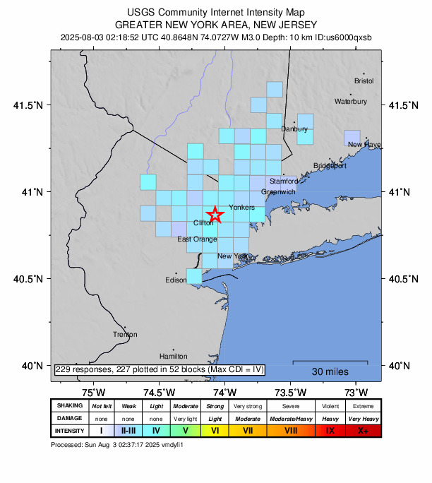
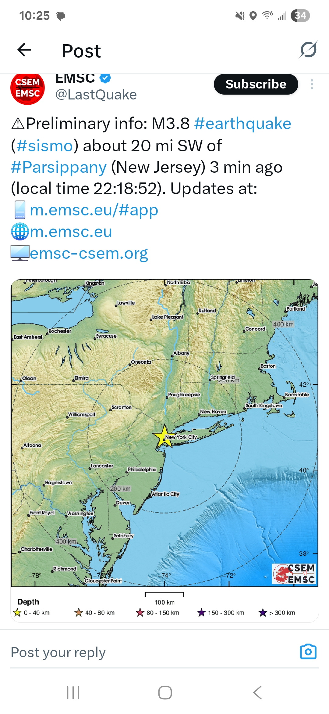
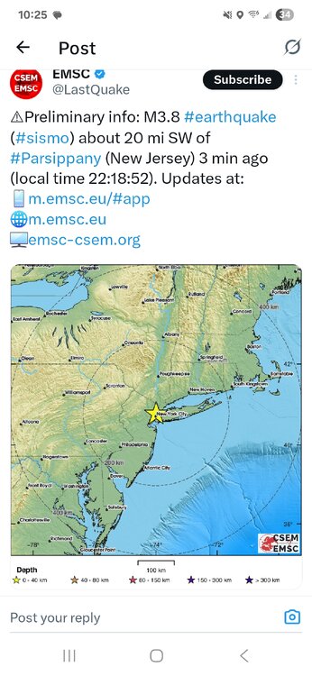
3.0 in northern NJ https://earthquake.usgs.gov/earthquakes/eventpage/us6000qxsb/executive
-
 Omg it was Hogan back from the dead dropping the leg one last time at Summerslam at Metlife!
 -
 Didn’t feel it in southern Westchester. https://earthquake.usgs.gov/earthquakes/eventpage/us6000qxsb/executive
 -
High of 81 today.dew point hovered around 70 most of the day and combined with a decent ne breeze, it actually felt good out there for a change. Looks like we will be dropping into the 60's tonight as it is currently 70 at 10:30 pm.
-
 My son reported feeling it HPN
 -
 Felt the earthquake in Queens.
 -
CooL felt it, lives right by there
-
 Didn't feel anything down here 3.0 magnitude earthquake 0 km from Hasbrouck Heights, New Jersey, United States 8 minutes ago UTC time: Sunday, August 03, 2025 02:18 AM Your time: Saturday, August 2, 2025 at 10:18 PM EDT
 -
Earthquake alert From Android Earthquake Alerts System There are reports of shaking in the Hasbrouck Heights area. Check back soon for more information from official sources.
-
 Did we just get an earthquake?
 -
Amazing for the first of August!
-
 Highs: PHL: 83 EWR: 83 TEB: 82 New Brnswck: 81 JFK: 81 ISP: 81 LGA: 81 TTN: 80 NYC: 80 ACY: 79 BLM: 74 *
 -
Nope! Got close though: 69.9 was the high.
-
The dew points have gotten down to the upper 40's for part of the time here, with an overnight low-temperature condition of temp: 55, dew point:50. It feels so nice, like the dew points I used to feel out West. It's a change from the seemingly endless 70-75 dew points. I probably should have walked down the street to try to take a better picture of the red sun tonight. I didn't get a good picture. It's the reddest sun since 2023.
-
 And no roads…
 -
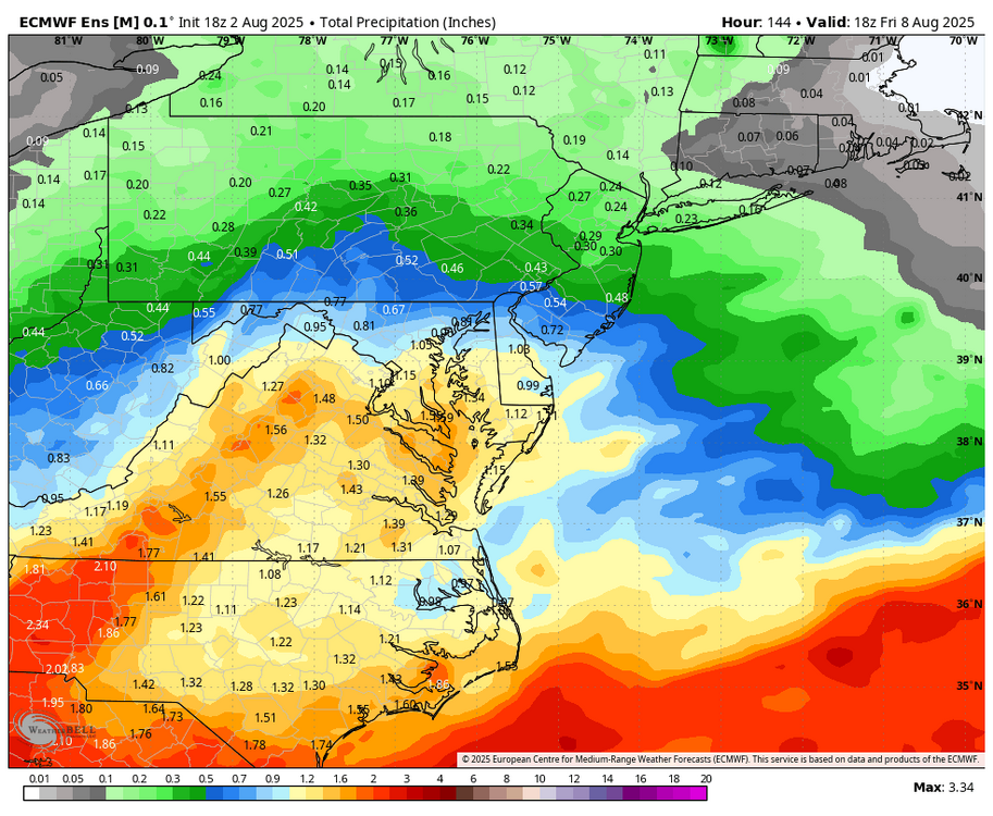
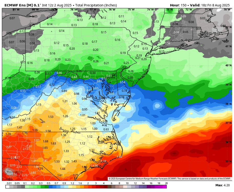
I do look at ensembles, and maybe you are correct, but I am still annoyed at how good the ensembles looked for a big February snowstorm and everything went poof. Guess that is the way it goes. WB 18Z Euro is wet again west of the bay, and still raining at end of the run on Friday. WB 18Z EURO ensembles are also wetter through Friday afternoon compared to 12Z.

-
 There's no managing the vast wilderness that are the Canadian boreal forests. They are not only massive but basically depopulated of people.
 -
 I had a cookout during the late afternoon and early evening. To me the mid to upper 70s here felt perfect for it.
 -
"Create its own environment", especially. caught up within a COL type regime
-
A steady light rain is falling. Temps are cool. It is so surreal. It is like someone flipped a switch. Very thankful for the blessing of cooler weather.