All Activity
- Past hour
-

2026 Mid-Atlantic Severe Storm General Discussion
southmdwatcher replied to Kmlwx's topic in Mid Atlantic
SPC update brings the slight risk down to the southside of DC Beltway and adds a 2% tornado risk for DC up through southeast PA/central NJ. -

E PA/NJ/DE Summer 2026 Obs/Discussion
Birds~69 replied to PhiEaglesfan712's topic in Philadelphia Region
Seem to be losing some intensity... -
I've dealth with that before, what a pain in the ass.
-

Central PA Summer 2026 Discussion/Obs Thread
Mount Joy Snowman replied to Voyager's topic in Upstate New York/Pennsylvania
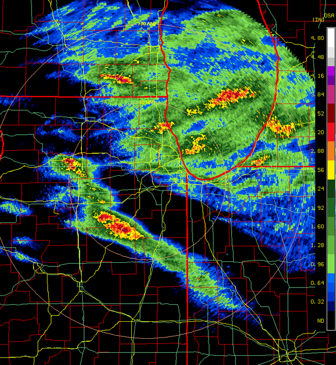
Low of 67. Sky has gone dark as an impressive looking line sits on the doorstep. -
was splotchy
-
Have fun!! Hopefully storms move thru quick for you
-
I was basing that on his odd maps..
-
Nice line of storms moving across southern PA. Can hear the thunder
-
I could see something like that happening. Super Nino patterns tend to be warm and wet with an active storm track. It looks like he is expecting a classing appalachian runner storm track that leads to big snows for the mountains and interior regions, while the coastal areas/1-95 corridor is on the wrong side of the storm track and gets rain instead. The interior regions, elevations and northern areas have a bit more room for error with the warm anomalies than the I-95 does in terms of the precip staying frozen.
-

Central PA Summer 2026 Discussion/Obs Thread
mitchnick replied to Voyager's topic in Upstate New York/Pennsylvania
Hail too. -
Central PA Summer 2026 Discussion/Obs Thread
mitchnick replied to Voyager's topic in Upstate New York/Pennsylvania
Sky is incredible. -

2026 Spring/Summer Mountain Thread
franklin NCwx replied to Buckethead's topic in Southeastern States
Alright, enough with the rain please -
First round yesterday afternoon was almost a complete miss. Everything disintegrated as it moved inland. Last night finally brought some rain. All told just over 2" between the two rounds. Something to keep the drought at bay for another week.
-
 https://trustpharmaindia.com/# india pharmacy mail order
 -

Augdewst 2026: Summer's Last Stand
weatherwiz replied to Prismshine Productions's topic in New England
Wanted to respond to this earlier since it's pretty important lightning safety but it is 100% true. People can be a great source as a connecting leader between the ground and the forming stepped leader with positive charges flowing up the connecting leader (which can be people) and when the stepped leader establishes a connection with a connecting leader...lightning! In fact, because of this the "flash" actually travels from the ground to the cloud but the whole process is so quick we see it was going from the ground to the cloud. -

E PA/NJ/DE Summer 2026 Obs/Discussion
Mikeymac5306 replied to PhiEaglesfan712's topic in Philadelphia Region
Pretty significant storm motoring through central PA near Harrisburg. Looks like we'll get something out of this in the next hour or two. -

Central PA Summer 2026 Discussion/Obs Thread
TheDreamTraveler replied to Voyager's topic in Upstate New York/Pennsylvania
Was just about to come in here and say that too -

Central PA Summer 2026 Discussion/Obs Thread
canderson replied to Voyager's topic in Upstate New York/Pennsylvania
This storm complex is louuuuuud -
Friday and Saturday were as intense rain as I have ever seen. Gravel driveway washed out yet again.
-
Central PA Summer 2026 Discussion/Obs Thread
TheDreamTraveler replied to Voyager's topic in Upstate New York/Pennsylvania
Wasn't expecting a severe thunderstorm warning at 8 am - Today
-
https://trustpharmaindia.com/# Trust Pharma India
-
Augdewst 2026: Summer's Last Stand
weatherwiz replied to Prismshine Productions's topic in New England
Was reading up about downtown Springfield/Forest Park area...pretty crazy. Forest Park closed until further notice due to storm damage. Was just at the Forest Park Zoo last weekend for Bew at the Zoo. When I parked at the T station, saw the watch was out, and those storms in east-central NY, I knew Springfield would get crushed. Don't think it was bad on my end though...a good 10-15 minutes northeast of that area. -

Central PA Summer 2026 Discussion/Obs Thread
WmsptWx replied to Voyager's topic in Upstate New York/Pennsylvania
Holy shit, the lightning storm I just encountered in southern Huntingdon county. One of the most prolific lightning producers I've seen in some time. -
we have returned to previous days pattern after a one day storm break yesterday - showers already moving this way from central PA - nothing severe YET. UPDATE : One just turned severe few minutes after I made this post SVR from KCTP