All Activity
- Past hour
-

Winter 2025-26 Medium/Long Range Discussion
michsnowfreak replied to michsnowfreak's topic in Lakes/Ohio Valley
March 15-17 timeframe is being picked up by all ensembles for a wintry threat. -
During the past 50 years those values have resulted in heavy snowfall winters............................
-
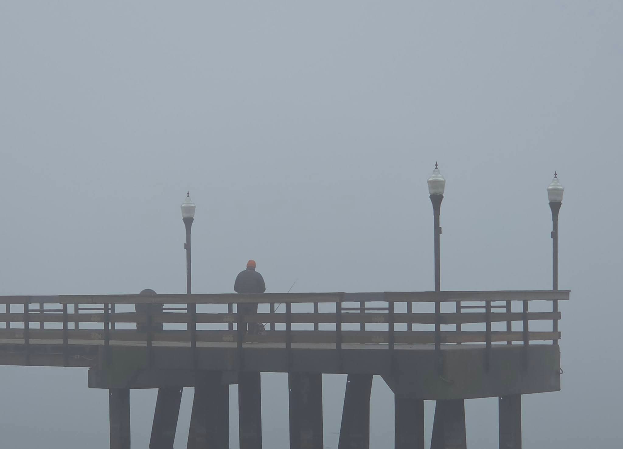
Murky fog here


-
https://x.com/StormCaptures/status/2030034387295719772/mediaViewer?currentTweet=2030034387295719772¤tTweetUser=StormCaptures
-
Seems could be interesting out west tomorrow afternoon into night? Afternoon discussion from LWX We`re expecting two rounds of storms tomorrow. The first round is expected to form within a surface trough just to the east of the Alleghenies during the mid-late afternoon hours. Model soundings show a fair amount of dry air in place aloft, and large scale forcing for ascent won`t be overly strong, so areal coverage with this first round of storms is only expected to be isolated to scattered in nature. If storms do become well established, the background environment will have enough instability (around 1000 J/kg of MLCAPE) and shear (around 40 knots in the 0-6 km layer) to promote updraft rotation. Isolated instances of damaging winds or hail may be possible with these storms as they move eastward from the Potomac Highlands toward the I-81 corridor and then the Blue Ridge/Catoctins during the mid-late afternoon hours. Conditions will likely remain dry to the east of US-15 during the daylight hours. A second round of pre-existing storms will approach from the Ohio Valley, reaching the Allegheny Front around sunset. This round of storms could be well organized into a squall line, and may potentially be quite intense. With the loss of daytime heating, the trend will likely be downward with the strength of this activity as it moves into our area, but damaging winds may still be possible, especially along and west of the Allegheny Front. Large scale forcing for ascent may enable these storms to hold together in a weakened form as they move eastward across the forecast area during the first half of the night. As of now, SPC has Garrett County in Slight Risk for severe thunderstorms, with locations further east to about US-15 in a Marginal Risk.
-
Fyp
-
Is that an ineedsnow ensemble map
-
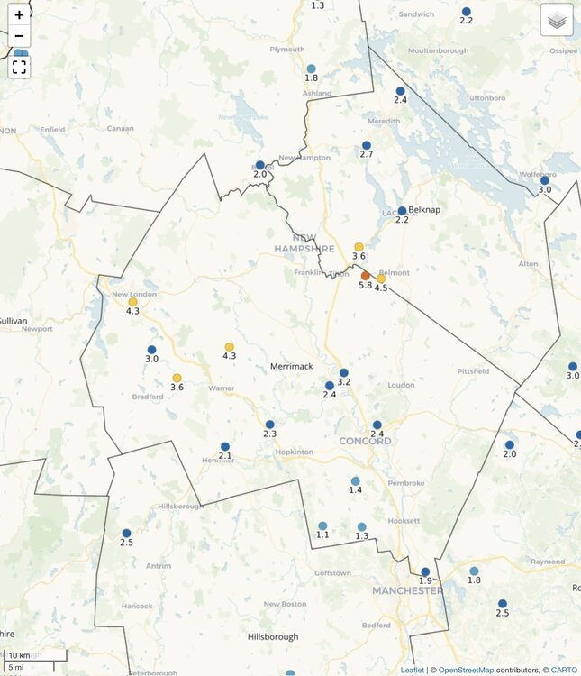
Mark was probably 1-2” less than here.

-
I wonder if we break the 14-15 streak then if we go till Monday?
-
He was away too…so he didn’t see it either.
-
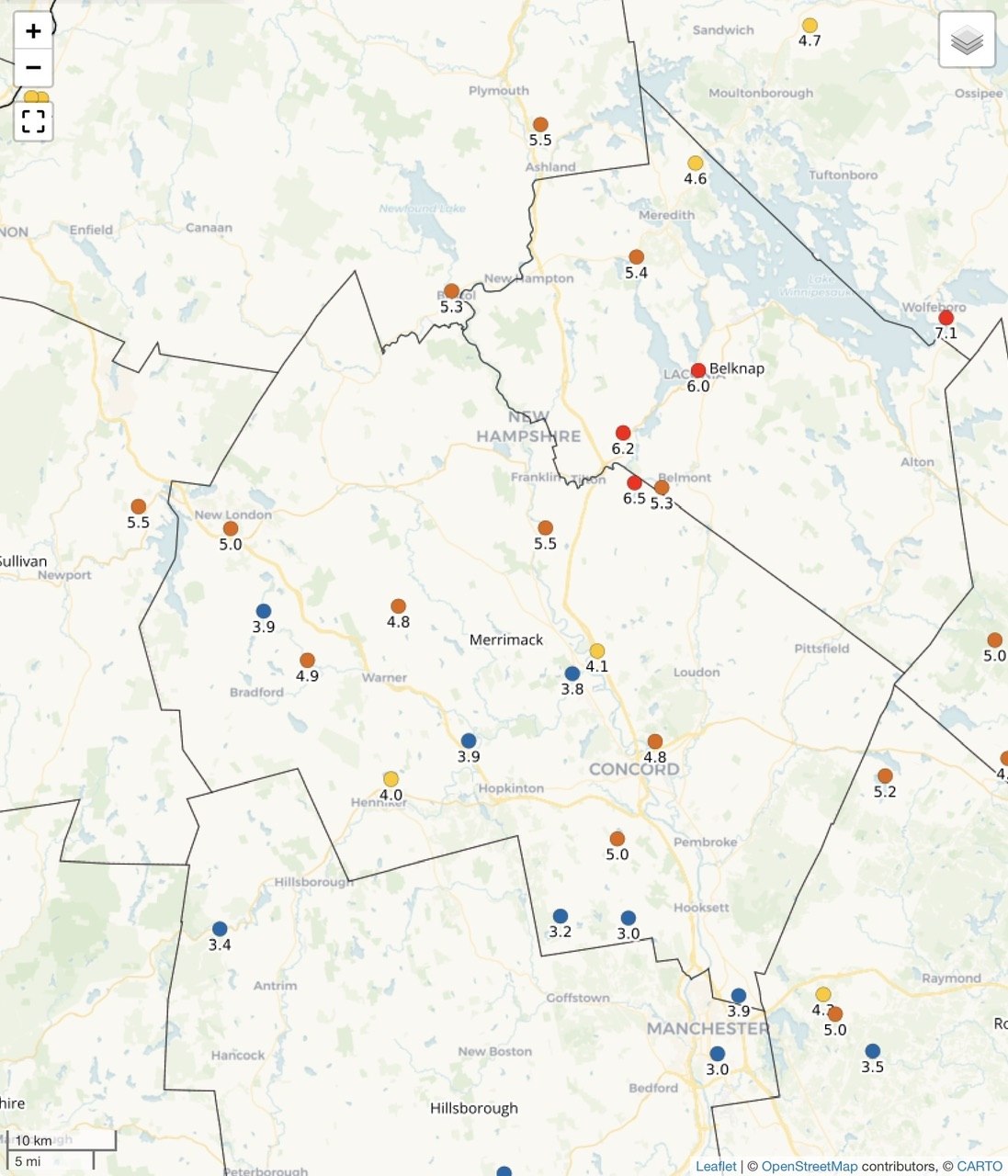
6.0” and 5.3” here.
-
It's turned wetter as of late-I Wouldn't rule out a big storm-question will be precip type this time of yr
-
60 with the sun poking out after the storms rolled out. Feels good fam.
-
Yep
-
I’ve been away for a week. what did you get in each event this week?
-
Had no idea our guy was torching like that
-

E PA/NJ/DE Spring 2026 Obs/Discussion
RedSky replied to PhiEaglesfan712's topic in Philadelphia Region
Forecast is two whole days to see the sun and feel the warmth before crappy weather returns -
There always something to challenge the status quo in meteorology.
-
Pretty crazy seeing a long-tracked tornado on the ground in Michigan with temperatures/dewpoints only into the 50's. That cell is a beast
-
It ain’t over yet…especially since it’s 3/6.
-

2026 Severe Wx - General Thread
TheClimateChanger replied to largetornado's topic in Lakes/Ohio Valley
Tornado Warning MIC023-149-062130- /O.NEW.KIWX.TO.W.0003.260306T2103Z-260306T2130Z/ BULLETIN - EAS ACTIVATION REQUESTED Tornado Warning National Weather Service Northern Indiana 403 PM EST Fri Mar 6 2026 The National Weather Service in Northern Indiana has issued a * Tornado Warning for... Northeastern St. Joseph County in southwestern Michigan... Northwestern Branch County in southwestern Michigan... * Until 430 PM EST. * At 403 PM EST, a confirmed large and extremely dangerous tornado was located near Centreville, or near Three Rivers, moving northeast at 40 mph. Reports of damage have been received in Three Rivers. This is a PARTICULARLY DANGEROUS SITUATION. TAKE COVER NOW! HAZARD...Damaging tornado. SOURCE...Emergency management confirmed tornado. IMPACT...You are in a life-threatening situation. Flying debris may be deadly to those caught without shelter. Mobile homes will be destroyed. Considerable damage to homes, businesses, and vehicles is likely and complete destruction is possible. * This tornadic thunderstorm will remain over mainly rural areas of northeastern St. Joseph and northwestern Branch Counties, including the following locations... Mendon, Leonidas, Fishers Lake, and Sherwood. PRECAUTIONARY/PREPAREDNESS ACTIONS... To repeat, a large, extremely dangerous and potentially deadly tornado is on the ground. To protect your life, TAKE COVER NOW! Move to a basement or an interior room on the lowest floor of a sturdy building. Avoid windows. If you are outdoors, in a mobile home, or in a vehicle, move to the closest substantial shelter and protect yourself from flying debris. && LAT...LON 4201 8522 4193 8556 4200 8561 4207 8551 4207 8527 TIME...MOT...LOC 2103Z 240DEG 34KT 4199 8554 TORNADO...OBSERVED TORNADO DAMAGE THREAT...CONSIDERABLE MAX HAIL SIZE...1.00 IN $$ FISHER -
CON was -1.6. Not sure what set of normals that is using.
-
What an all out ass day it was today. Little preview of April
-

2026 Severe Wx - General Thread
HillsdaleMIWeather replied to largetornado's topic in Lakes/Ohio Valley
It's bad in three rivers, multiple businesses downtown are completely destroyed -
Why do you keep asking people for clarification? It's definitely possible to see some snow with this upcoming pattern but a big storm is unlikely. There will be enough cold air.