All Activity
- Past hour
-
How did those 2 following winters turn out? Lol
-
Nice heavy downpour with some gusty wind. High was 93.
-
Ai models keep weekend shunted south which makes sense with that strong HP to the north. Bet we’ll see ops follow suit this week
-
My friend had a bottle of the Pepper X sauce. Surprisingly, not nearly as hot as I feared. I actually enjoyed it, in small amounts of course. It had a decent flavor to it too.
-
Typical screw job.
-
Wish every day could be like today
-

2026-2027 Strong/Super El Nino
Stormchaserchuck1 replied to Stormchaserchuck1's topic in Weather Forecasting and Discussion
^You were right about it shifting east, like other Strong Nino's. I have seen cold pools get stuck in the middle-west for the last few years, and kind of thought this year could follow the same trend with Nino 4 getting warm so early. -
Nice windy rain cooling things down to 70 degrees .10 in the bucket
-

2026-2027 Strong/Super El Nino
snowman19 replied to Stormchaserchuck1's topic in Weather Forecasting and Discussion
From a South American Met: ^ Translation: “This is the magnitude of how deep—and therefore how long-lasting—the warming of the ocean floor near our coasts is. We're talking about 100 meters or more in its most significant part and nearly 500 in its verifiable depth. All that warm anomaly is advancing toward the South American coastal edge. There's little the APS can do, as noted (APS=South Pacific Anticyclone) We haven't seen anything like this since 1997. This is one of the reasons, perhaps the most relevant one, why there's so much information about a major #ElNiño event on the horizon.” -

2026 Mid-Atlantic Severe Storm General Discussion
Ellinwood replied to Kmlwx's topic in Mid Atlantic
I'm losing count of the amount of times SPC has put upper MoCo in the Marginal only for 0 storms to appear this year (granted, I haven't expected anything from these setups yet except the one March system). That said, I do think we get a Slight with Wednesday's setup along/northwest of I-95... low-to-mid level shear is subpar but there's good CAPE and DCAPE for some gusty winds along the cold front. -
Currently 85, topped at 90. Strong breezes still.
-
Nino vs the dry pattern
-
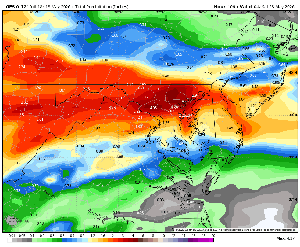
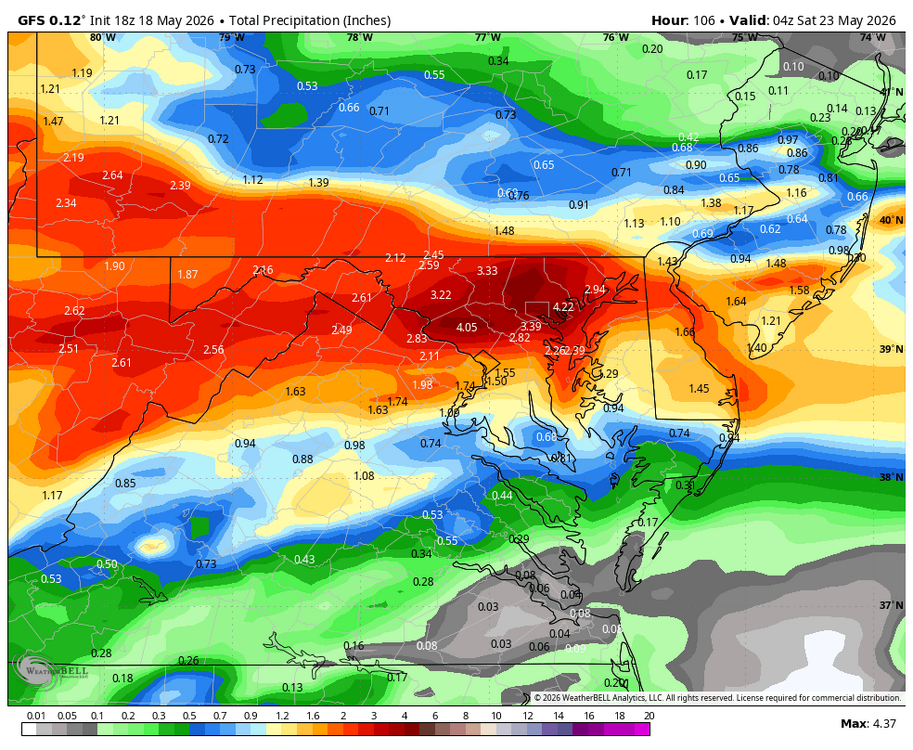
WB 18Z GFS precip. totals through Friday. If only...
-
81/67. Dews shoT up when winds turned SW. started from a S coast seabreeze and surging northeast as mentioned this morning.
-
Had a nice shelf cloud and wind from that line. Tomorrow looks to be far of a day from a severe standpoint. I wouldn’t sleep on the tornado threat in this area either tomorrow
-

E PA/NJ/DE Spring 2026 Obs/Discussion
The Iceman replied to PhiEaglesfan712's topic in Philadelphia Region
High of 95 IMBY… central AC decided to not kick on this morning so that’s cool. It’s 90 in my house this evening lol thank god I found an old window unit for my bedroom at least… I’m wondering if anyone hits triple digits in our region tomorrow? This is an impressive early season heat wave. -

Central PA Spring 2026 Discussion/Obs Thread
AccuChris replied to Voyager's topic in Upstate New York/Pennsylvania
Hit 96 before in Lebanon…back “down” to 95 lol . -
Isolated storm headed right for me.
-
Lets go! https://www.baltimoreravens.com/news/practice-report-day-1-ravens-organized-team-activities-jesse-minter
-
BDL 91° today
-
. We take. Let's get a drought going.
-
Stunner of a day. 43F to 85F so far for a 42 diurnal swing.
-
Would love to have one right now because it's roasting here in Eastern N.C. (Worse yet it will be four more days before we break below 90F for a high.) Sure hope this is not a sign of things to come for the next several months. SIGH.
-
It’s upper 60’s here today..tomorrow it will be higher. That guy doesn’t know what he’s talking about.
-
88.5 in Muttontown & 87.9 in Syosset today for the high.