Ellinwood
-
Posts
6,219 -
Joined
-
Last visited
About Ellinwood

- Birthday 06/19/1986
Recent Profile Visitors
8,925 profile views











-

2026 Mid-Atlantic Severe Storm General Discussion
Ellinwood replied to Kmlwx's topic in Mid Atlantic
Pretty good SPC verification yesterday... they were even under-done over some of the western areas. Storm coverage ended up being more than expected.- 2,562 replies
-
- 2
-

-
- severe
- thunderstorms
- (and 7 more)
-
2026 Mid-Atlantic Severe Storm General Discussion
Ellinwood replied to Kmlwx's topic in Mid Atlantic
Cap won yesterday. Less of an issue today despite the lower dews, but given the uncertainty with the placement and coverage of storms, I'm a little surprised to see the 45% from SPC today (though they kept me in a Slight at the 00z update last evening despite it being clear nothing was gonna happen after 00z). I do think whatever storms do form will likely overperform because we haven't had any turnover in the atmosphere since the start of the heatwave. Congrats to whoever gets the storms today (assuming it doesn't cancel your plans). I think we get scattered storm coverage with stuff that comes in off the mountains, but where those end up exactly is my biggest uncertainty.- 2,562 replies
-
- 2
-
-
- severe
- thunderstorms
- (and 7 more)
-
2026 Mid-Atlantic Severe Storm General Discussion
Ellinwood replied to Kmlwx's topic in Mid Atlantic
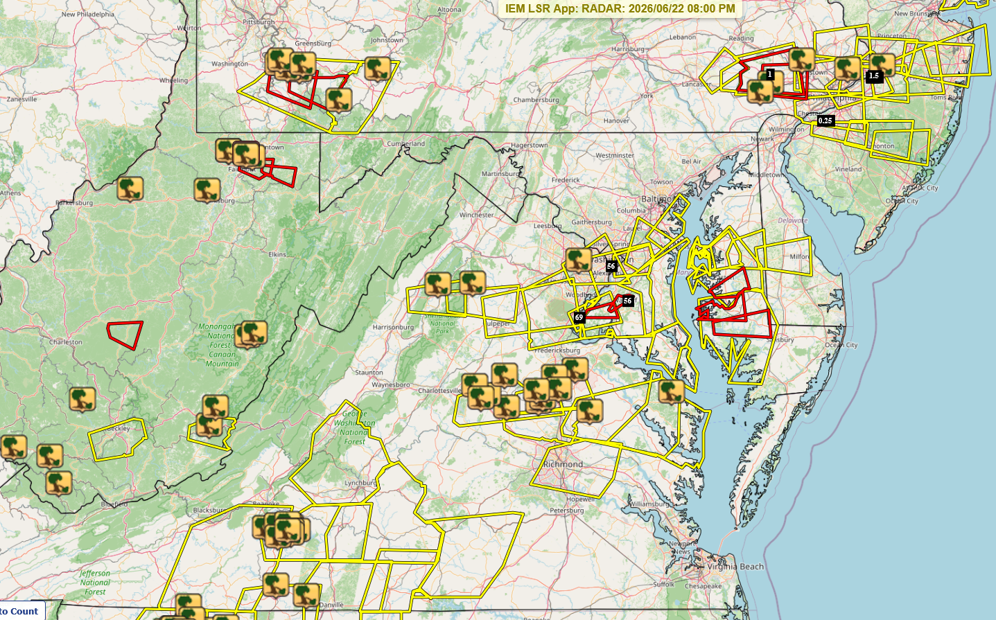
Got meh'd IMBY but I'll take the rain I did get. Interesting that we did manage to get several tor warns in MD today.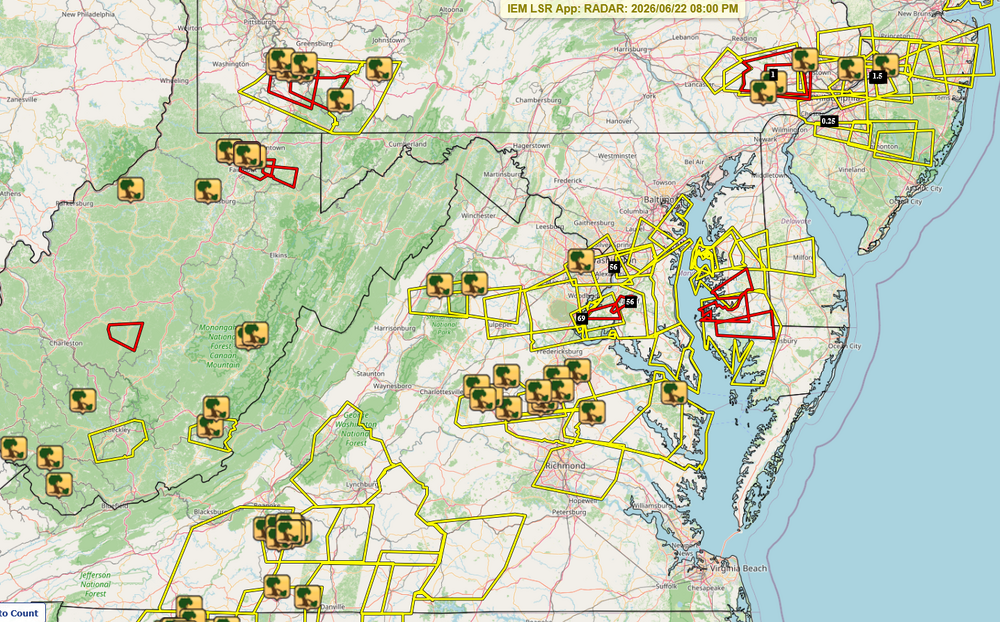
- 2,562 replies
-
- 1
-

-
- severe
- thunderstorms
- (and 7 more)
-
2026 Mid-Atlantic Severe Storm General Discussion
Ellinwood replied to Kmlwx's topic in Mid Atlantic
15/5/2 wind/hail/tor on the 06z Day 1... seems reasonable, but I could see a bump up to 30/5/5 this afternoon (no hatches) once we see how things are actually playing out coverage-wise. More confident with the wind coverage bump up than the tor. Shear's there, but the mid-to-high cloud cover loves messing up our setups.- 2,562 replies
-
- 3
-
-

-
- severe
- thunderstorms
- (and 7 more)
-
I may have already subscribed and ordered a shirt. Haven't messed around with the app much yet but liking it so far.
-
2026 Mid-Atlantic Severe Storm General Discussion
Ellinwood replied to Kmlwx's topic in Mid Atlantic
Missed the D.C. area but certainly verified northwest of I-95.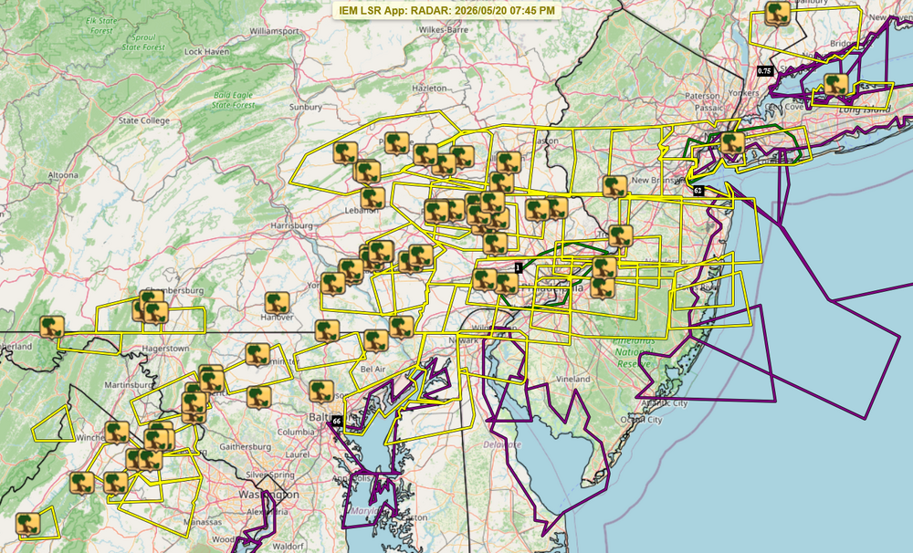
- 2,562 replies
-
- 1
-
-
- severe
- thunderstorms
- (and 7 more)
-
2026 Mid-Atlantic Severe Storm General Discussion
Ellinwood replied to Kmlwx's topic in Mid Atlantic
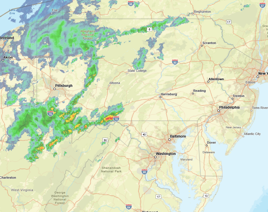
Not sure I'd be using the HRRR much today given it mixes out the low-levels too much and will be too low on dews by several degrees. Meanwhile, latest HRRR for 1pm vs radar: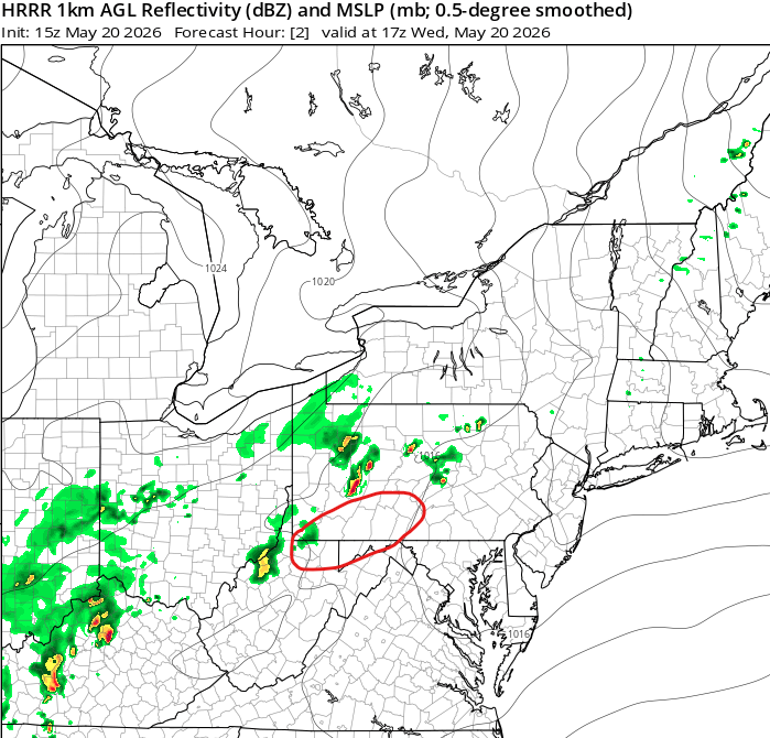
- 2,562 replies
-
- 4
-
-
- severe
- thunderstorms
- (and 7 more)
-
2026 Mid-Atlantic Severe Storm General Discussion
Ellinwood replied to Kmlwx's topic in Mid Atlantic
Haha yep. I still think we get Slight-level severe coverage along/NW of I-95 today (even if the SPC keeps it Marginal)... we've been baking since Monday with little to no turnover in the atmosphere and storm coverage looks pretty good today.- 2,562 replies
-
- 6
-
-
- severe
- thunderstorms
- (and 7 more)
-
2026 Mid-Atlantic Severe Storm General Discussion
Ellinwood replied to Kmlwx's topic in Mid Atlantic
I'm losing count of the amount of times SPC has put upper MoCo in the Marginal only for 0 storms to appear this year (granted, I haven't expected anything from these setups yet except the one March system). That said, I do think we get a Slight with Wednesday's setup along/northwest of I-95... low-to-mid level shear is subpar but there's good CAPE and DCAPE for some gusty winds along the cold front.- 2,562 replies
-
- 7
-
-
- severe
- thunderstorms
- (and 7 more)
-
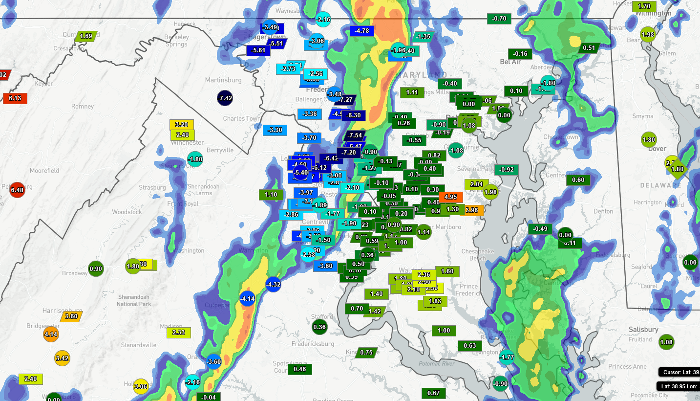
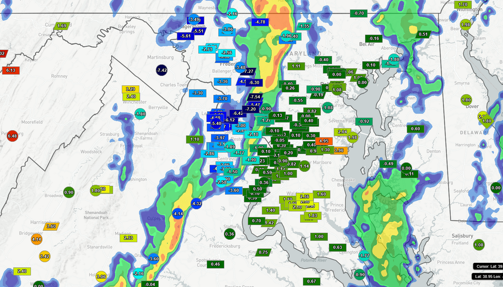
Temps got knocked down several degrees IMBY (to lower 60s)... 1-hour temperature change plotted. Some time to recover this afternoon but we'll see.
-
I live near there and got basically the same picture. Good wind-driven rain but no lightning. Clarksburg circulation went over my MIL's apartment but she's okay (nothing to report apparently).
- 1,093 replies
-
- 2
-
-
- severe
- thunderstorms
- (and 1 more)
-
Man I didn't realize so many Mid-Atlantic severe peeps are on the Doom-And-Gloom Express (based on last night's posts). Need to reprise my role of hype man for these events.
-
Highly dependent on the setup, but for tomorrow I'm looking for CAPE >500 (with closer to 1000 for the higher-end scenarios). I'd emphasize that this isn't a GO HIDE ALL AFTERNOON scenario so much as you don't want to be caught out and about if/when the storms roll through. The higher-end stuff will probably be pretty localized.
- 1,093 replies
-
- 5
-
-
- severe
- thunderstorms
- (and 1 more)
-
I was on the fence about messaging my kid's teacher saying I was gonna get my kid out early (we walk to/from school) so now I'm glad I don't have to make that decision myself
- 1,093 replies
-
- 5
-
-
- severe
- thunderstorms
- (and 1 more)
-
I need to post more. the tl;dr is I could care less about the tornado potential since the wind is the big story and I ain't chasing no storms going 50+ mph through this region. Doesn't seem like an "everyone gets hit" setup but the more potent stuff looks like it's gonna hit hard where it hits.
- 1,093 replies
-
- 13
-
-
-
- severe
- thunderstorms
- (and 1 more)