All Activity
- Past hour
-

2025-2026 Fall/Winter Mountain Thread
BlueRidgeFolklore replied to Buckethead's topic in Southeastern States
The UK looked improved and expanded the snow line southward into NC. It's interesting how strong of a wedge it showed for a model that always underestimated the strength of the CAD. Something to watch going forward. Baby steps. -
Drier. Less phasing? Doesn’t look north based on that.
-
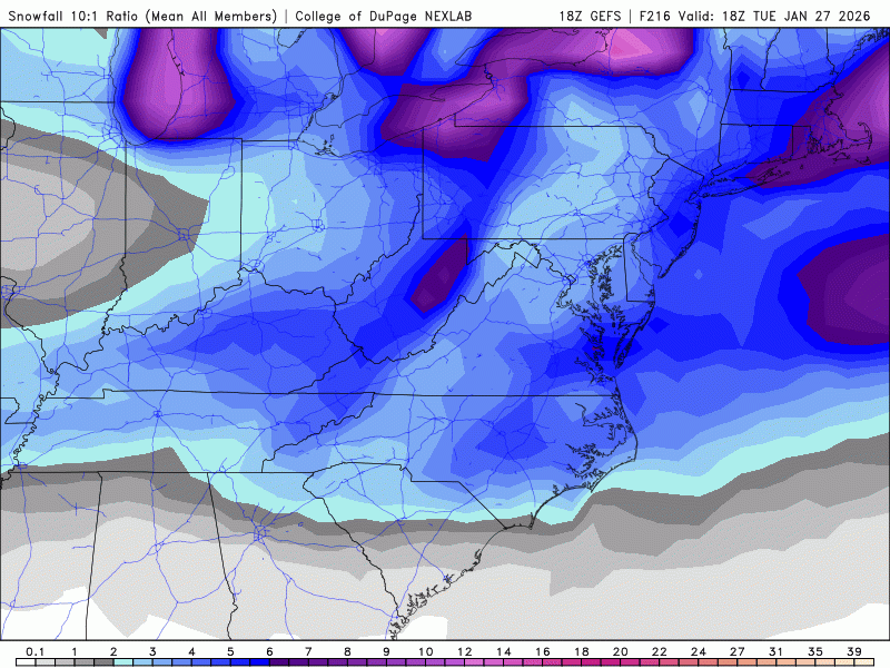
Mean got diluted between some suppressed members somehow getting added back into the mix and the continued amped camp. As it shows we still end up in the middle but a little less inspiring.
-
The airmass in front of this is quality and there will be quite a bit of CAD east of the Apps, so I think DC sees a cold/wintry storm even if Chicago cashes in, but ice/sleet are in play for them for sure.
-
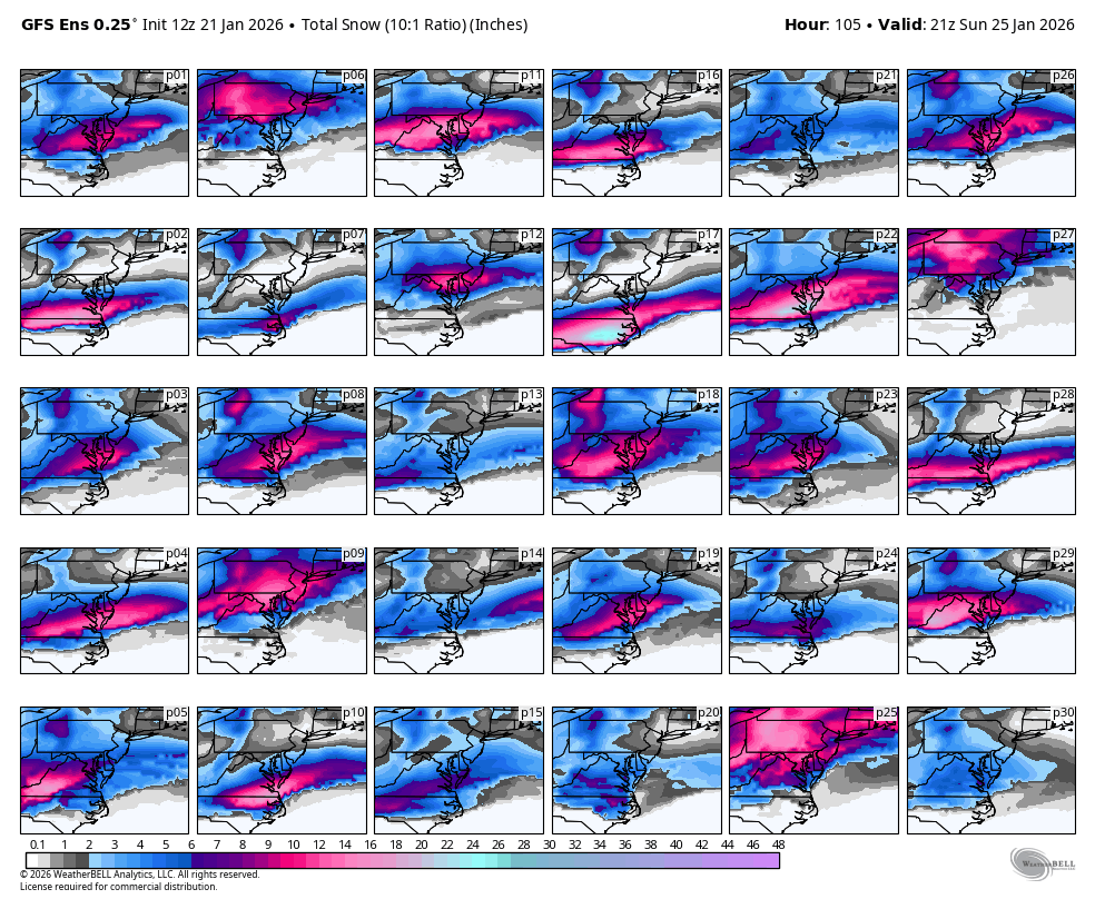
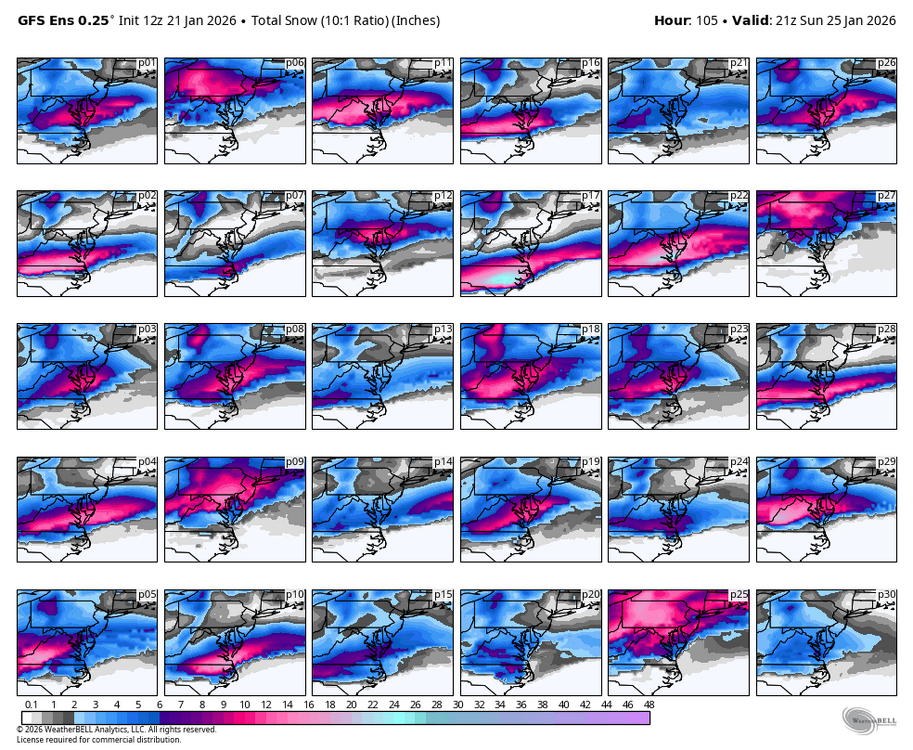
I'm good with 12z GEFS precip and snowfall picture.
-
Have a NWS briefing for work at 2pm... going to be interesting. Ukie dropping 3 inches of precipitation is crazy.
-

-
Literally one run of the UK and CMC and you're panicking? And it's also a pretty great solution themselves? Relax.
-
I told my daughter this morning who lives in Leesburg that i think 8-12" plus some sleet and cold temps are most likely. Feeling pretty good about that call right now. For my backyard i am thinking 6-10" no sleet to speak of but a really quick dryslot cutting off the moisture faster than others to my east
-
WB 12Z GEFS is not amped....
-

Pittsburgh/Western PA WINTER ‘25/‘26
colonel717 replied to Burghblizz's topic in Upstate New York/Pennsylvania
That ratcheted up quickly. Nice. 28 degrees so all should stick. Radar showing mix but all snow. -
It is going to be a long rest of the week!
-
Not quite as good
-
Read my synoptic post from yesterday. It literally was the consensus of all models excluding suppression worries.
-
If PSU says the worst case is a 6 inch front end thump followed by sleet, ice, back to snow, and cold. Thats a pretty good day. Maybe not a historical storm, but still something to be excited about.
-
The one thing that I find absolutely amazing. All the (supposed) modeling improvements seen in the recent past, combined with AI being utilized in its infancy............... and there were models that nailed the blizzard of 1993 from 5 days out. That was 33 years ago!
-
For shits and giggles this is the gfs for both storms

-
We better pray that doesn't verify.
-

1/23/26-1/25/26 Winter Storm Thread
WishingForWarmWeather replied to AMZ8990's topic in Tennessee Valley
Can anyone help me understand - I really use this forum to follow along with everything but most of yall are in different places than me. I’m in Clarksville, so pretty much right on the KY border, north of Nashville. Is it looking like sleet/freezing rain for me as well, or I’m still in snow currently? -
I find the h5 picture to be fascinating. Love me some vorticity.
-

Fall/Winter Banter - Football, Basketball, Snowball?
Holston_River_Rambler replied to John1122's topic in Tennessee Valley
I hurt myself today, to see if I still feel. I focus on the Euro, the only thing that's real What has snow become my dearest friends? Everything that I love goes away in the end -

January 25-26 Winter Storm Potential
coastal front replied to Ralph Wiggum's topic in Philadelphia Region
Let’s hope we are now seeing the northern most envelope of possible solutions and can shift H5 slightly south while just upping the precip when mesos are in range. I’m not worried about where we are at right now but more so if it keeps trending in the more amped direction. Todays gonna be a long day lol . -
At no time was this even close to the model consensus.
-

Possible Record Breaking Cold + Snow Sunday 1/25 - Tuesday 1/27
Snowlover11 replied to TriPol's topic in New York City Metro
For this storm and the one showing up a week later.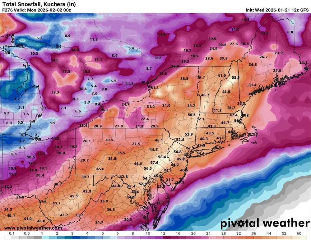
-
lol - MY kids - both now in their 20s - neither of them give a shit about weather. They are probably not even mine, now that I think about it...