All Activity
- Past hour
-
MRGL for most of the area which seems fair. Guidance is now in very good agreement that a strongly-forced, narrow line of heavy showers will race across the area during the evening: 9pm or so in the western burbs, 10pm in the DC-Baltimore area, and over the Bay by around 11. Wind fields are intense with some low-level shear, but instability will be negligible. Lightning therefore seems unlikely, and while winds will be gusty, severe gusts will be difficult to achieve. That said, I still can't completely rule out lightning or a few higher end gusts, and it's also possible that we end up with a tornado warning for someone for a brief couplet.
- 1,364 replies
-
- 1
-

-
- severe
- thunderstorms
- (and 2 more)
-
NWS OKX Updated AFD: SHORT TERM /6 PM THIS EVENING THROUGH TUESDAY/... Key Messages: * A fast moving frontal system will bring a quick hitting band of moderate to heavy rain, isolated thunderstorms, and gusty winds late tonight into the Monday AM commute. * Isolated thunderstorms and/or a fine line of low topped convection are possible, bringing a low and localized potential for strong to damaging wind gusts or even a brief tornado. * South to southeast peak winds gusts of 30 to 40 mph are likely, particularly along southern and eastern coastal areas, bringing potential for scattered downed tree limbs and power lines * A minor urban and poor drainage flood threat exits as well. Models in good agreement with negatively tilting vigorous closed low approaching the region late tonight, and then pivoting through the area on Monday. At the surface, strong low pressure should continue to track NNE up towards Hudson Bay tonight, with its trailing cold front approaching the eastern US coast late this evening. Notable model trend over the last 24 hours of a slower and further NW development of secondary low pressure along the cold front late tonight into Monday AM, in response to the approaching closed upper low. This should keep the developing low well NW of the region early Monday morning, with trailing cold front crossing the region between 5 and 9am. Ahead of this, increasing cloud cover this evening, with a shot of moderate to heavy rain and breezy conditions late tonight into Monday morning ahead of approaching cold front and developing low pressure. This is in response to deep lift ahead of negatively tilting upper low in conjunction with advection of +2 std PWAT, marginally unstable, Atlantic airmass on the nose of a 45-50kt llj. In terms of winds, 15-25g30-40mph, with isolated gusts to 45 mph possible ahead of the front. Highest winds along the southern and eastern coasts. With S/SE wind direction and 40mph gust potential, scattered downed tree limbs and power lines are possible. In terms of rainfall, ensemble probabilities of 1" in 24 hours continue to run fairly meager 10-30 percent across interior. Deterministic models have backed down a bit with footprint of 1"+ rainfall amounts, particularly for western portions of the area, as slower and farther NW surface low development, slows intensification of WCB. Still, potential for a widespread 1/2 to 1 1/2", low prob of up to 2", mainly in a 3 hr period, particularly for interior S CT. WPC URRD continuing to indicate potential for a brief period of 1/2- 3/4"/hr, low prob 1" hr rainfall rates. See hydrology sections for possible impacts. Potential for some isolated thunderstorms, including a low topped convective fine line ahead of cold front, in the weakly unstable and strongly forced environment. Although a very low probability, cant rule out an isolated tstm bringing strong to damaging wind gust or even a rotating storm causing a brief weak tornado with a high shear/helicity and moist adiabatic low level environment. After collab with SPC and neighboring offices, marginal risk has been expanded into the local area. Rain should come to an end fairly quickly from west to east in wake of cold front Monday AM, although scattered shower activity is possible Monday aft/eve as the upper low moves through, particularly interior. Breezy W/NW wind gusts Monday aft/early eve (15-25G30-40mph) in wake of closed low and secondary cold front. Winds subside with drying conds Monday Eve/Night.
-

2025-2026 Fall/Winter Mountain Thread
Buckethead replied to Buckethead's topic in Southeastern States
The petrichor smells great this morning! Currently 49° and rain in Wolf. I've had a few gusts to 30 in the last hour. Sent from my SM-S908U using Tapatalk -
Rainfall looking less than impressive for tomorrow. It blows up well east of the area
.thumb.png.03f7527b6db2a870fc49f1358e9d01a0.png)
-
Yeah, 80-90 percent of my snow comes from NW flow lately. If we actually had an average amount of synoptic snow we could really rack up the seasonal total.
-

Monday, October 20, 2025 Squall Line Potential
CoastalWx replied to weatherwiz's topic in New England
Fine lines typically don’t produce damage. You’ll need a rogue strong cell either within the line or just ahead of it to cause it. Too bad it wasn’t 6 hrs later. -
Your timing is off. The image you showed is for 9pm. Guidance has the line reaching the Bay by 11pm.
-

Spooky Season (October Disco Thread)
Henry's Weather replied to Prismshine Productions's topic in New England
31-3 at the half -

Spooky Season (October Disco Thread)
HoarfrostHubb replied to Prismshine Productions's topic in New England
Beware the trap game -

Occasional Thoughts on Climate Change
donsutherland1 replied to donsutherland1's topic in Climate Change
As I provided the SSTA data yesterday, I won't repeat that part of the post. I note that he asked GEMINI (AI) a question. The question he asked does not directly address the issue. The issue concerns whether volcanoes are driving the warming, not whether there is hydrothermal activity and/or what drives that hydrothermal activity. Since he used GEMINI, let's see how it would respond to a direct question (note: I never provided "leading" information to generate a desired outcome): Its response: So, while he tried to create the impression that AI, or at least one AI, backs his thinking, when asked directly about the warming, the AI does not. It focuses on what the literature describes as the causes of the warming. Submarine volcanoes are not even mentioned its response. Of course, he didn't ask the direct question. It doesn't fit his preferred outcome. The exercise was about confirming his view, not gaining objective information. Although the AI performed quite well with the direct question, I still think it is better practice to go to the literature itself, as bad practices such as prompt injection can lead to skewed results from AIs. A good paper on the subject can be found at: https://agupubs.onlinelibrary.wiley.com/doi/full/10.1029/2020GL090956
-
Spooky Season (October Disco Thread)
Henry's Weather replied to Prismshine Productions's topic in New England
Muted sun, orange leaves, a Pats routing… nothing like these weekends -

Spooky Season (October Disco Thread)
kdxken replied to Prismshine Productions's topic in New England
Good day to go out and grab yourself some firewood.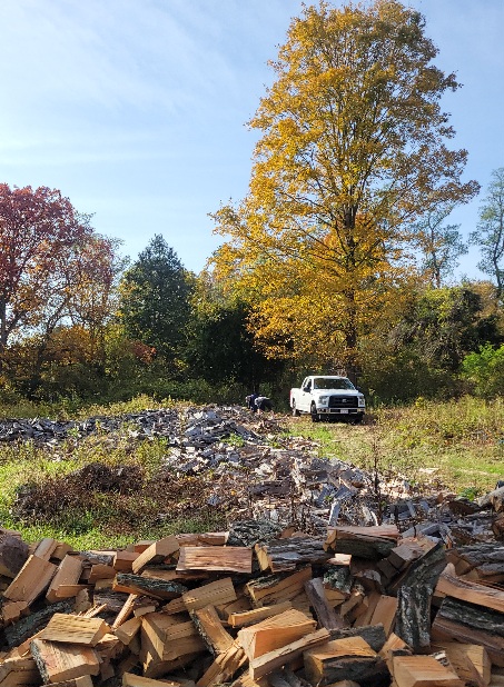
-
Don and others, This was posted by JB 2 hours ago at WxBell: “Continued Climate Community Denial Dr Viterito writes: This is the latest ‘buzz’ in the climate community. The BBC just ran an article on it, and the conclusion of the Berkeley Research Group is that the warming can be partially explained by a reduction in cloud cover due to reductions in sulfur dioxide, a reflective aerosol. Improved Chinese air quality is also listed as a possible cause. Of course, the fallback position is ALWAYS what's happening above our heads and NEVER what is beneath our feet. So, it's business as usual as there is no mention of geothermal inputs into the system. First and foremost, the East China Sea is the locus of the warming. As Google Gemini posits: Hydrothermal activity is widespread in the East China Sea, particularly in the Okinawa Trough, a back-arc spreading basin. Here, seawater circulates through the oceanic crust, becoming superheated and carrying unique chemical and biological properties to the seafloor. This activity is concentrated in the central and southern parts of the trough and is often associated with volcanic and tectonic activity. Notable sites include the Yokosuka vent field, which is the deepest and hottest known in the area. And a huge rise in seismic activity has been recorded this past year. According to All Quakes (East China Sea Earthquakes Archive: Past Quakes in 2025 | AllQuakes.com), there has been a large amount of volcanic/seismic activity in 2025. Here are the summary statistics for the East China Sea: In 2025, East China Sea has had 14,770 quakes of magnitudes up to 5.9: 50 quakes above magnitude 5 271 quakes between magnitude 4 and 5 1,375 quakes between magnitude 3 and 4 3,197 quakes between magnitude 2 and 3 9,877 quakes below magnitude 2 that people normally don't feel. Keep in mind, we still have 10 weeks left in 2025. If we compare this with the FULL YEAR statistics for 2024, we see the following: In 2024, East China Sea has had 12,143 quakes of magnitudes up to 6.4: 1 quake above magnitude 6 23 quakes between magnitude 5 and 6 382 quakes between magnitude 4 and 5 655 quakes between magnitude 3 and 4 2,365 quakes between magnitude 2 and 3 8,717 quakes below magnitude 2 that people normally don't feel. That is, we have a 21% increase year over year, and if we adjust for the remaining time left this year (i.e., extrapolate out to the end of 2025), we would see a 53% increase, or an extrapolated total of roughly 18,500 seismic events for the year. More importantly, according to AllQuakes.com, the average yearlystatistics for the East China Sea are as follows: East China Sea has a high level of seismic activity. On average, there are about 6,600 quakes every year. That is, the extrapolated value for 2025 will be nearly three times higher than an average year for the East China Sea! And we aren't even factoring in the extraordinarily high vales for the fore-arc basins east of Kamchatka I discussed in the PSI article a few weeks ago. That activity will impact the temperatures of the Kuroshio Current as it makes its way into the north central Pacific. We have to keep plugging away at this!! Art You cant make this stuff up”
-
The Catoctin Cloud Magnet (CCM) has been a force this morning...and very visible on satellite. Looks like some thinning in progress, though. Hoping to get another round of sun today before the line of showers and stuff arrives after sunset.
-
Spooky Season (October Disco Thread)
CoastalWx replied to Prismshine Productions's topic in New England
That might be the greatest invention ever made. I love those. - Today
-
All good points. For clarity, I'm okay with cold and dry. I just cannot tolerate a warm winter. There is something so very unwholesome about 70s in the dead of winter in these parts.
-
Quickly up to 67 here.
-
Yeah I’d take 21-22 again for sure as Ninas go. The odds of dead ratter are just baked in with a Nina. And outside the eastern shore, the ceiling is like 80% of climo.
-

Spooky Season (October Disco Thread)
SJonesWX replied to Prismshine Productions's topic in New England
I nuked about a dozen of those fuckers with the electric tennis racquet yesterday. very satisfying. -
Beer?
-
Tbh I don’t actually consider 21-22 a dud, some places cashed in nicely and those who didn’t had just plain bad luck. However, the chance for another dud is very real and unfortunately that’s how the data is presenting itself currently. But I think that would be too easy. I believe there will be a surprise X factor (maybe the NE pac warm blob?) that throws a wrench into the standard nina/-pna climo progression to keep us in the game.
-
In Selbyville DE visiting my sister. Was a beautiful day yesterday, today shaping up to be just as lovely ahead of whatever rain comes
-
What's the problem with a 7.69% accuracy rate??
-
Occasional Thoughts on Climate Change
donsutherland1 replied to donsutherland1's topic in Climate Change
The following seems to describe their M.O.: 1) If presented by counterarguments, they largely ignore the counterarguments or, in infrequent cases of response, make broad claims that the arguments are incorrect, they shift goal posts, etc. 2) If presented with data and links to the data or scientific literature that anyone can access, that crosses a "red line." They seem to have a mortal fear about others having the ability to access the data or literature, perhaps because they know that their own view is hollow unsupported conjecture. Access to data is far more dangerous to their view than simple counterarguments. -
Finished with a much appreciated 2.07", a significant overperformer to be sure. Northwest winds gusting over 35mph with that deform in Chicagoland. Definitely would be pretty wild if were the white stuff.


.png.ff1ec81ec7bb4794bcb30bd80b52dc53.png)


