All Activity
- Past hour
-
Topped off at 90 here today.
-
 http://mencarevirtual.com/# MenCare Virtual buy Viagra online
 -
Good holy hell here in Charlottesville right now
-
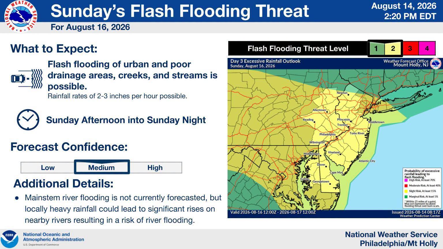
The clouds are too sloppy today. Need to get a return of those puffy cumulus. Maybe Sunday brings the goods.
-

2026 Mid-Atlantic Severe Storm General Discussion
SnowenOutThere replied to Kmlwx's topic in Mid Atlantic
That storm in cvill is tor warned and seemingly has a debris ball on radar.- 1,895 replies
-
- 1
-

-
- severe
- thunderstorms
- (and 7 more)
-
Finally got in the thick of a good one. Got just under an inch.
-

Central PA Summer 2026 Discussion/Obs Thread
canderson replied to Voyager's topic in Upstate New York/Pennsylvania
My plan is to start black tar heroin the day before. -
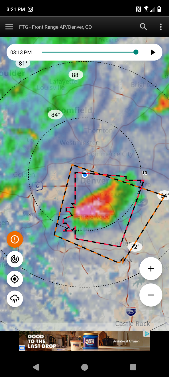
Helluva storm over Englewood, moving north right towards downtown.
-

2026-2027 Record-breaking El Nino
michsnowfreak replied to Stormchaserchuck1's topic in Weather Forecasting and Discussion
Ive said it before and ill say it again. I do not agree with alot of the stuff you post, but you always remain respectful so I have no problem agreeing to disagree on some things. This is the huge difference between you and snowman. -
It’s going to snow or I’m coming over to your house and putting up it is all your fault signs in the yard
-

2026-2027 Record-breaking El Nino
EasternLI replied to Stormchaserchuck1's topic in Weather Forecasting and Discussion
Does the AAO signal anything to us (NH)? I don't remember. I want to say no, but I feel like I've heard that it did somewhere. Just wondering because it's been very positive through most of our summer. Which is the SH winter. Even getting above 4SD for a bit at the tail end of June. -

2026 C and E Pacific tropical activity
WxWatcher007 replied to GaWx's topic in Tropical Headquarters
Doesn't look like much of a core on that first recon pass today. We'll see what they find on the north side though. The IR looks relatively disheveled. New cone likely brings an official landfall. -
Viagra generic over the counter [url=https://mencarevirtual.com/#]Cheap Sildenafil 100mg[/url] Cheap Viagra 100mg
-
https://mencarevirtual.shop/# MenCare
-
Something tells me weather weenies don't make for good gamblers in Vegas.
-
sildenafil 50 mg price: MenCare - Sildenafil 100mg price
-
They needed it out there.
- Today
-
People laugh off the wdi but climate isn't a poisson process. The odds of getting a big snow event should presumably go up after going through years that dont structurally support big snow events assuming that those structural patterns must relax.
-
It's hell week for moths. 3hrs a day out in this weather changing out sleeves. Another 2-3 more.days of this nightmare and I'm on the other side of the bell curve.

-

Augdewst 2026: Summer's Last Stand
CoastalWx replied to Prismshine Productions's topic in New England
Meh -

Augdewst 2026: Summer's Last Stand
CT Valley Snowman replied to Prismshine Productions's topic in New England
It's nice having a consistent berkshires poster. Looking forward to your reports during the winter. -
.thumb.png.3513c28619bf91f0fa8e4004956c33df.png)
2026-2027 Record-breaking El Nino
annunciated replied to Stormchaserchuck1's topic in Weather Forecasting and Discussion
I hope Athens can get some of that magic too, lol. -

Augdewst 2026: Summer's Last Stand
vortex95 replied to Prismshine Productions's topic in New England
And it was only a MRGL day! 8/12 and 8/13 were excellent examples of how "only" has gen tstm and MRGL out can be deceptive or promote the @CoastalWx MEH! MRGL say nothing about how intense any given tstm will be. And you can having honkin' supercells no problem. I recall in April 2024, MRGL for NC/SC and one storm produced 4" stones in SC! The HVN MB?, in a general tstm area, yet we get a high-end wind gust. And the PWM area ydy as noted. But the actual svr reports are isolated/sct as shown on the SPC plot from 8/12 and 8/13. https://www.spc.noaa.gov/climo/reports/260812_rpts.gif https://www.spc.noaa.gov/climo/reports/260813_rpts.gif And now for today, suddenly a narrow gen tstms area gets upgraded to MRGL at 1630z. Decent 500 s/w and temps drops to -17 C at 500 (that quite good for August - and ydy they were -14 to -15 C). When it's good, it's good (NW flow and cold temps aloft RULZ!!!) I don't want to hear any IMBY "I didn't get anything!" whining either! -
-
My guess is no, as their lowest is 21.4" in 1954-55. However, 1997-98 is missing and might've been a candidate for lowest.