All Activity
- Past hour
-
Welcome to mby Not the cliffs, but in the area and yes, it is pretty here
-
A cooler regime is in place and will remain in place for an extended period of time. Highs will generally reach the upper 70s and lower 80s through the week and into the start of the weekend. Showers and thunderstorms are likely tomorrow into Wednesday. Some areas could pick up heavy downpours with flooding a possibility. Daily rainfall records for July 21 include: Atlantic City: 4.60", 1969 Bridgeport: 2.16", 1961 Islip: 2.69", 1984 New York City-Central Park: 2.26", 1983 New York City-JFK Airport: 2.45", 1948 New York City-LaGuardia Airport: 2.06", 2006 Newark: 3.23", 2006 Philadelphia: 3.45", 1988 Wilmington, DE: 3.80"m, 1988 The long-term outlook for the remainder of July has swung to near normal or even somewhat cooler than normal on the guidance. The ENSO Region 1+2 anomaly was +3.6°C and the Region 3.4 anomaly was +2.1°C for the week centered around July 15. For the past six weeks, the ENSO Region 1+2 anomaly has averaged +3.20°C and the ENSO Region 3.4 anomaly has averaged +1.82°C. The ongoing strong El Niño will continue to strengthen through the summer. The SOI was -21.79 today. The preliminary Arctic Oscillation (AO) was -0.825 today. Based on sensitivity analysis applied to the latest guidance, there is an implied near 64% probability that New York City will have a cooler than normal July (1991-2020 normal). July will likely finish with a mean temperature near 76.8° (0.7° below normal). Supplemental Information: The projected mean would be 0.3° above the 1981-2010 normal monthly value.
-

2026 Mid-Atlantic Severe Storm General Discussion
dailylurker replied to Kmlwx's topic in Mid Atlantic
We don't do widespread severe around here. In my 47 years of life in this area I've seen widespread severe once or twice. It's normally very localized like what happened in Pasadena a couple days ago. Even the day La Plata was hit with the EF 5 was pretty lame. That Southern MD super cell was the only game in town that day. I remember thinking it was a bust until I heard about the GOAT tornado. The derechio was the the most widespread severe I've seen. -
 can you buy generic clomid tablets: HormonePath - best online pharmacy no prescription
 -

2026-2027 Super El Nino
Stormchaserchuck1 replied to Stormchaserchuck1's topic in Weather Forecasting and Discussion
+2.03c on this date is greater than +1.7c in 1997 and 2015 at this time for highest since 1950 (+16%!) -
0.17" of anvil rain earlier.
-

2026-2027 Super El Nino
snowman19 replied to Stormchaserchuck1's topic in Weather Forecasting and Discussion
All one has to do is look at this….the last 2 super El Niños (1997, 2015) at this point in time compared to this one. It’s not even close…it’s blatantly obvious we have a historic, monster event coming….. -
This is a case where the shear is not from a trough, but the E side of a strong upper-level ridge. In these cases, the TC can be forced to the S, which is a motion that TCs most often do not respond to well. Convection gets sheared away in short order and you are left w/ an exposed LLCC the moves more w/ the low-level flow.
-
Touched 101 in my backyard.
-
2026-2027 Super El Nino
Stormchaserchuck1 replied to Stormchaserchuck1's topic in Weather Forecasting and Discussion
2 good signs for the Winter: 1) SSTA south of New Foundland is cold. This is up to 65% correlated to DJFM -NAO 2)-PDO is cooling off a bit -
-
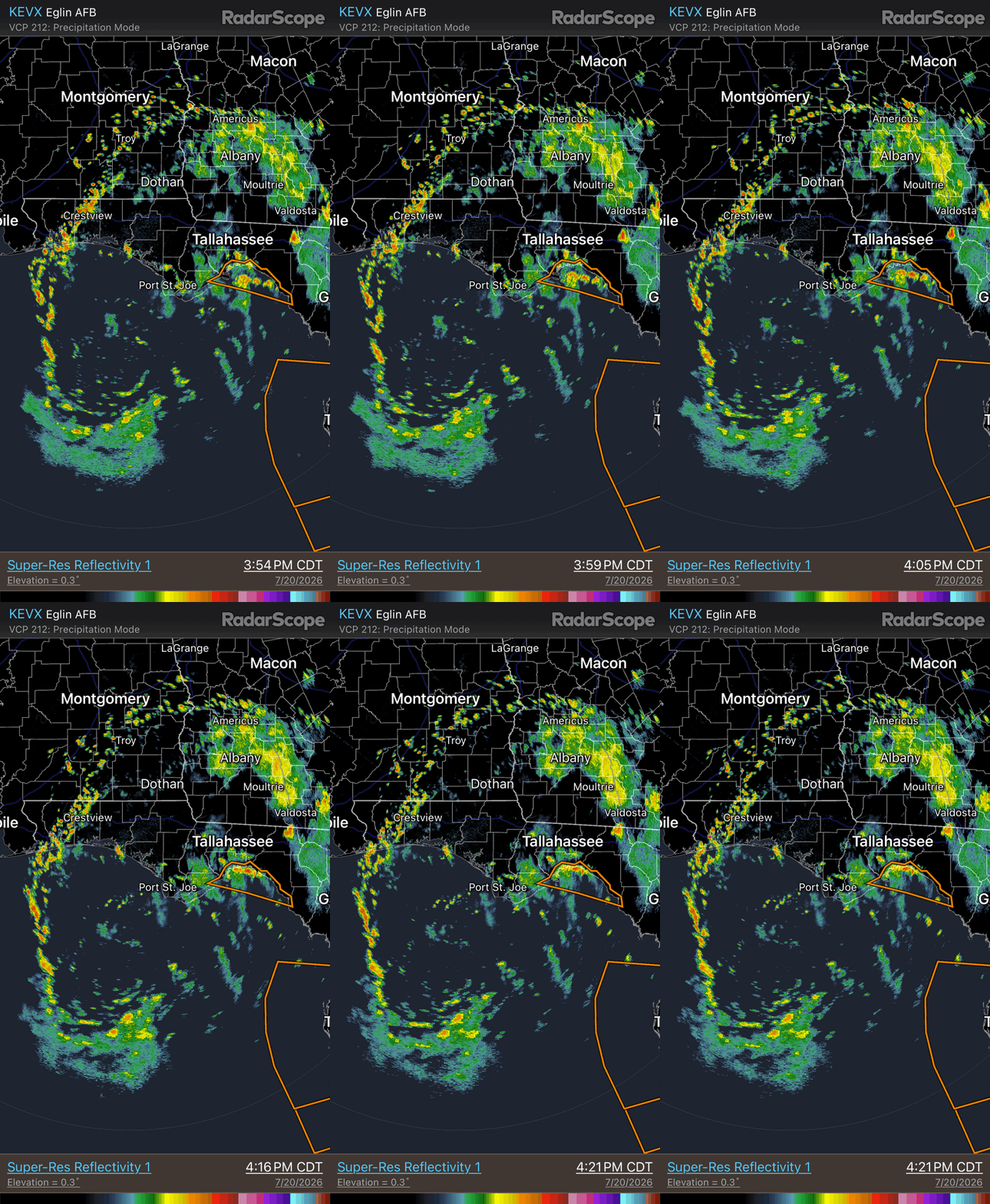
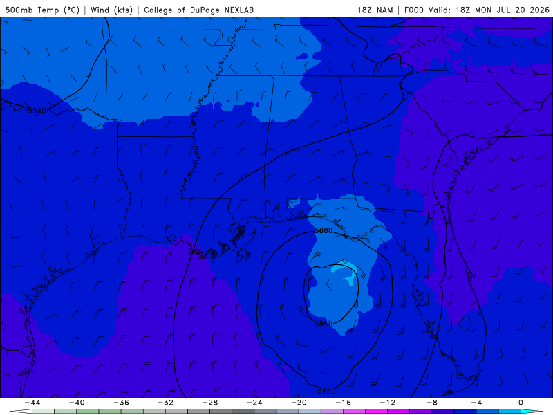
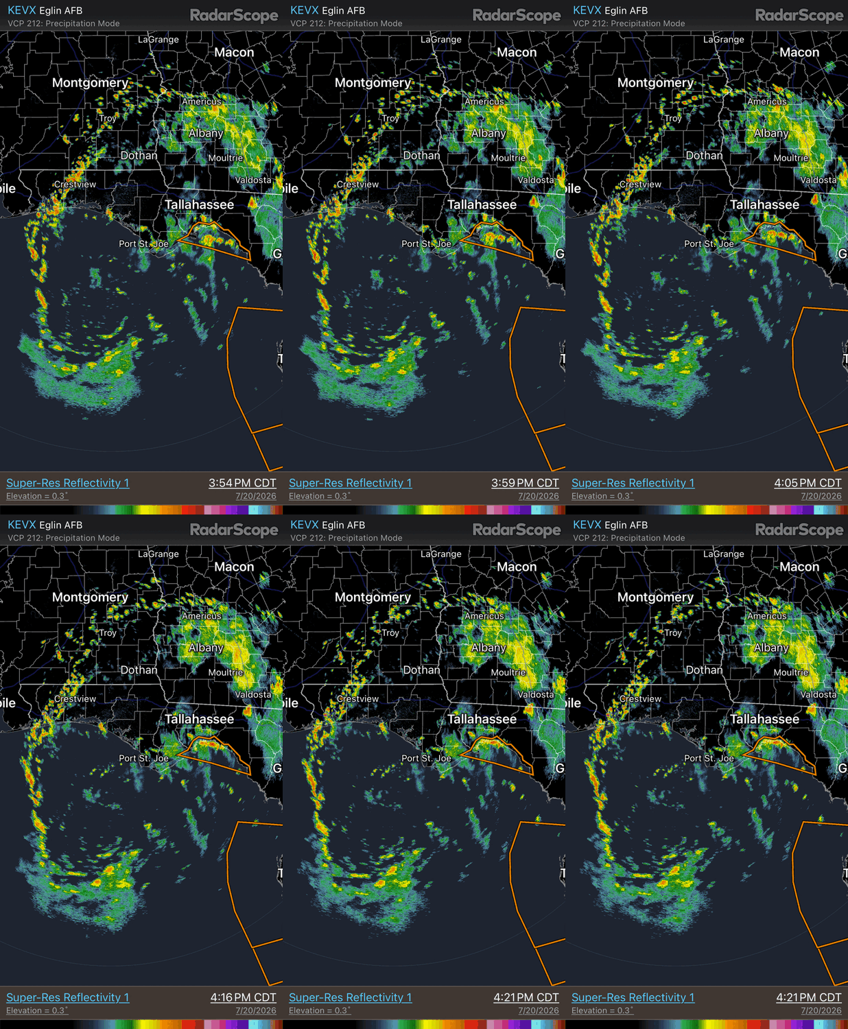
It became more warm core faster than expected. 500 analysis 18z NAM shows warm core at 500 w/ temps to -2 C (attached). HRRR the other day showed the gradual organization well and the broad skeletal structure w/ the banding. See radar loop attached. Being so broad and dry air issues, it likely going to have problem tightening up, and by 36 hr, the ECWMF shows the 500 low getting sheared apart from deformation. GFS does not show this nearly as much, but I trust the ECMWF more there. Also the GDPS is similar to the ECMWF. The LLCC looks to eventually accelerates W after its gets to the LA cost, which is generally not good (too much shear) for a weak system in in tropical easterly flow. Sharp asymmetry fcst w/ all the heavy rain sheared to the S of the LLCC. Just an empirical observation over time, NHC seems to intensity too quickly nascent systems that are broad and not in the best overall environment In the first advisory ydy at 15z, they had it a 35 kt TS by 12z today. Second advisory 35 kt TS by 18z today.
-
Seeing real blue again
-
This had a reported tornado near Webster City, Iowa (continuing tornado warning)
-
1.22" from this afternoon. Forecast highs in the 70's on Thursday? I'll believe it when I see it ...
-
temp/dew point of 100/50 at Fort Collins/Loveland (KFNL) so that's a 50% relative humidity, right Nope. 200% relative humidity?? 103 at Greeley right now. Be glad you don't have dew points like Nebraska today, which has a heat index of 110 a few 101s yesterday near Loveland and Denver
-
2026-2027 Super El Nino
Stormchaserchuck1 replied to Stormchaserchuck1's topic in Weather Forecasting and Discussion
IRI model consensus of +3.05c would make it the Strongest El Nino on record since 1950 by +0.25c (NDJ 15-16, +2.8c) [ONI]. Number 2 is +2.4c (ONDJ 97-98), which it would beat by more than 20%! Since 1950, there has never been a La Nina <-2.0c. -
That MCS just took the smoke away.
-
1.41” at my house between 3 separate periods of rainfall brings the MTD total to 7.98”
-
Just under 2 inches IMBY in Garner this afternoon
-
Oh I bet! That spot is always horrible. Here is the roll cloud I caught: https://www.facebook.com/share/v/1CwggxCZbM/ - Video
- Today
-

Central PA Summer 2026 Discussion/Obs Thread
canderson replied to Voyager's topic in Upstate New York/Pennsylvania
I used to not be but am growing more the same - especially since storms are more severe now than before. -
I’m going to be in the theater watching odyssey tomorrow evening when my roof gets torn off in the derecho
-
This is my moment
-

Central PA Summer 2026 Discussion/Obs Thread
Voyager replied to Voyager's topic in Upstate New York/Pennsylvania
Sure is quiet in here (and in the Pittsburgh sub) considering the severe threat tomorrow.